In brief: Heavy rain is causing widespread instances of flash flooding in the Southwest. This is likely to expand into Colorado, the southern Plains, and west or central Texas tomorrow and Thursday into Friday. The Atlantic tropics remain uneventful. We may see that change in a week or so, but it’s too soon to say what that could mean.
Good evening to everyone except the Atlanta Braves and Chicago White Sox. (Your author is a Phillies and Astros fan)
Let’s see where we are with the ongoing rainstorm in the Southwest and Texas, and we can talk tropics as well.
Polo Remnant Rain
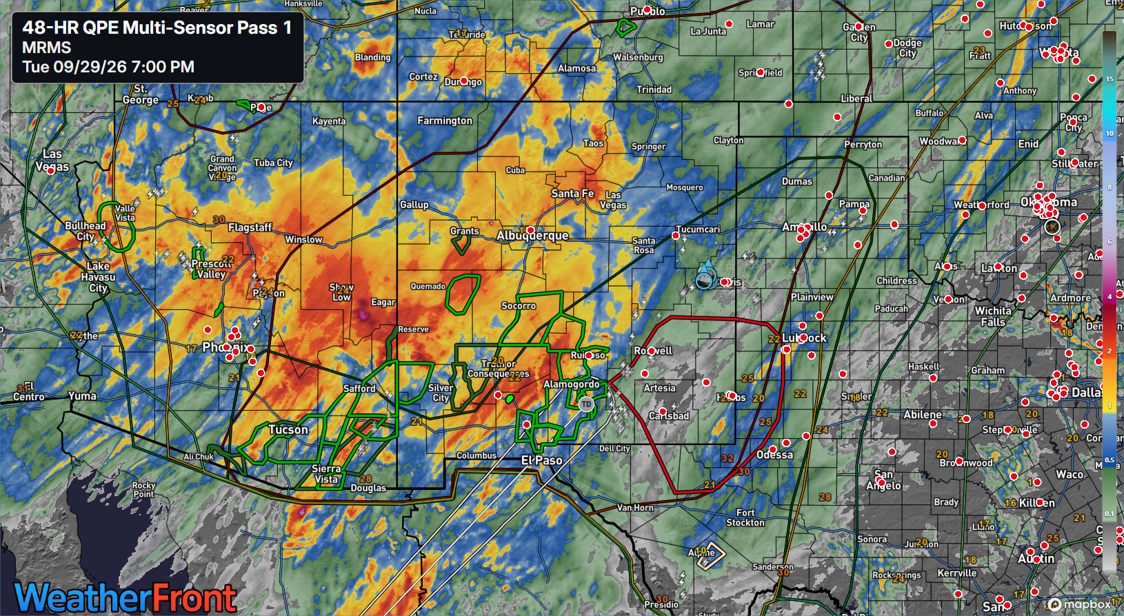
A lot of rain has fallen over the last day and a half or so in the Southwest and parts of Texas. We’ve seen as much as nearly 5 inches of rain southwest of Tucson.
We have our first “emergency” of the event, as a small portion of Doña Ana County in New Mexico near Rincon is at risk of severe flooding due to a levee breach.
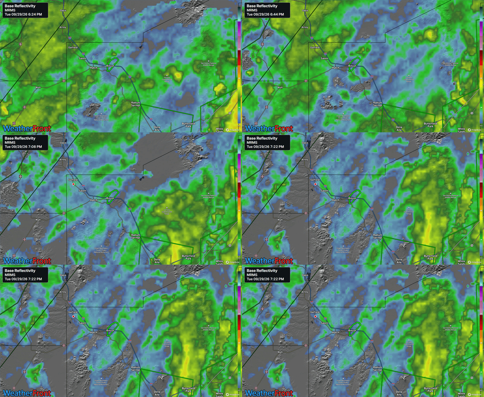
Rincon has seen nearly 6 inches of rain this month, almost half of which has fallen in the last 48 hours.
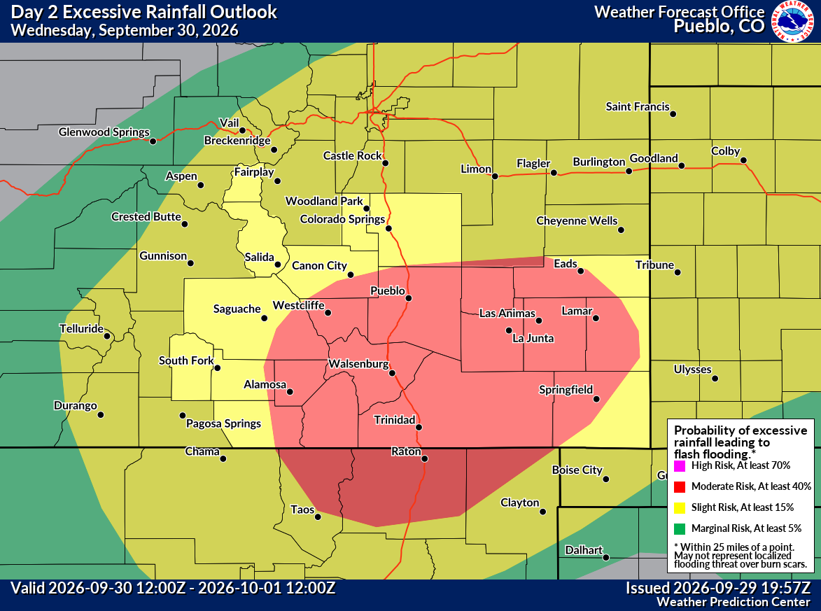
The entire region remains under a moderate risk (level 3 of 4) for excessive rain tonight. That shifts north and east some tomorrow, but still, portions of eastern New Mexico could see some heavier rainfall, as model forecasts are on the order of 2 to 6 inches or more, depending on which model you look at. The tropical and convective (thunderstorm) nature of this rain is such that localized areas can easily receive 1 to 3 inches of rain in a couple hours, which is when the risk of severe flooding increases.
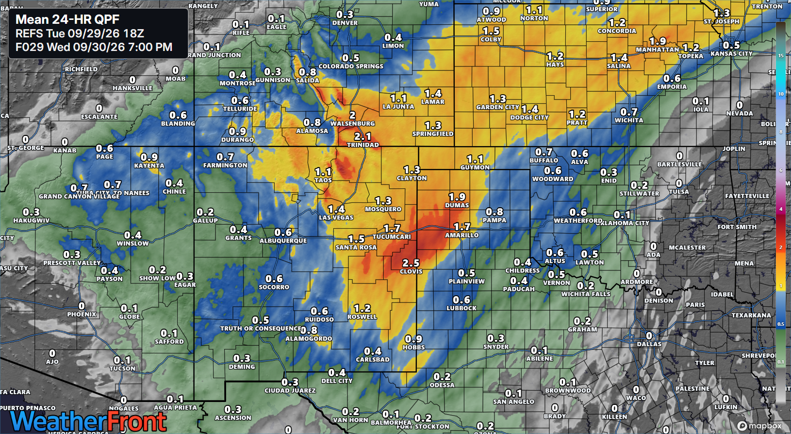
The highest risk of those more squirrely amounts would be in southeast Colorado or northern New Mexico. You can see those pockets of oranges showing up on the map above in those areas.
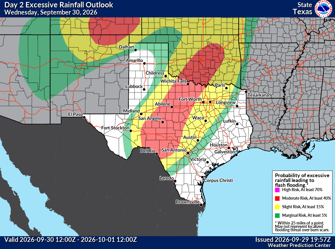
For Texas, the situation is a little trickier. A slow-moving line of storms is going to move from West Texas into Central Texas tomorrow night, and as it does, locally torrential rain will occur. The good news is that it’s been relatively dry here late this summer. The bad news is that anytime you add 3 to 6 inches or more of rainfall in a short time, flooding can occur. This is the challenge tomorrow night and Thursday morning in parts of Hill Country.
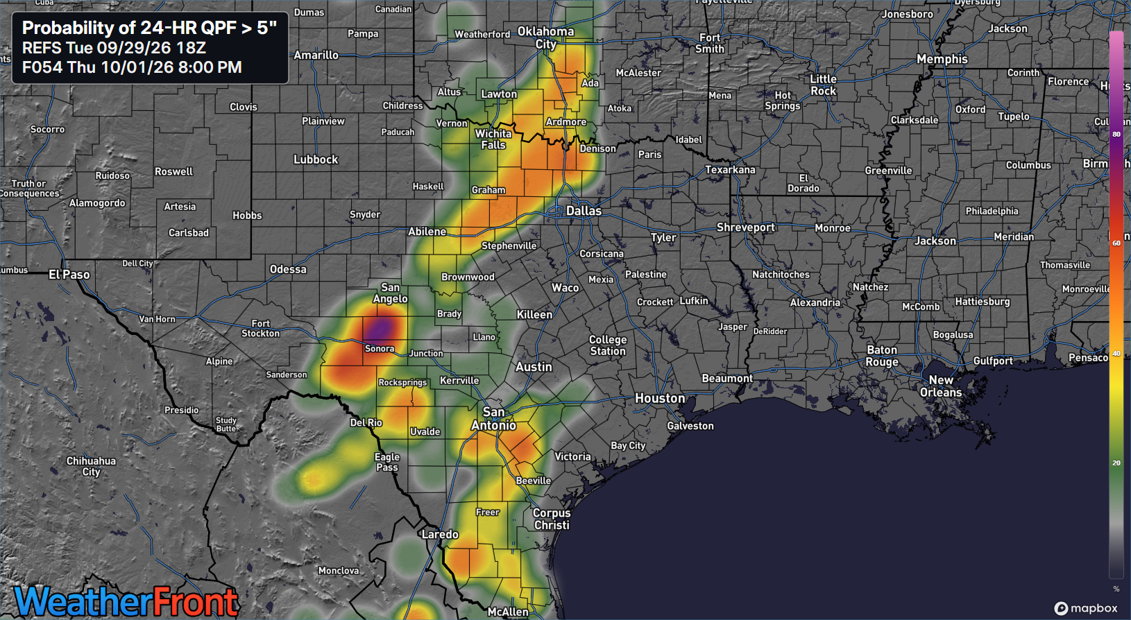
If we look at the probability of any location seeing 5 inches or more of rainfall, what I would deem to be a more serious flash flooding threat, you can see a bullseye showing up near or south of San Angelo. Don’t zero in too closely on the exact location of this bullseye, as it’s going to be a fluid situation. But you can see those odds creeping up to 80 percent or higher. This mean that somebody, likely between Del Rio and San Angelo and west of Kerrville is going to see 5 to 10 inches of rain tomorrow night, likely to trigger some flash flooding and, locally, some serious flash flooding. The same holds true north and west of Fort Worth.
On Thursday night and Friday, this risk will shift east into the I-35 corridor to include DFW, Waco, Austin, and San Antonio. I think the risk is a little more isolated on Friday than it looks tomorrow night, but there is at least the potential for some locally torrential rainfall. And, indeed, a moderate risk for flooding exists on Thursday night/Friday AM too.
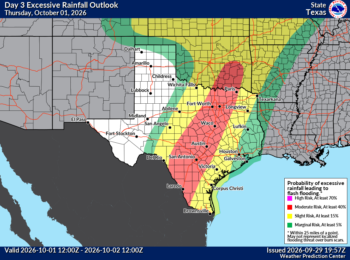
Bottom line: Folks in Texas, Colorado, New Mexico, and Oklahoma should be prepared for locally significant flash flooding tomorrow through Friday.
For the Houston area, check out Space City Weather for the latest on how this weather will impact that area, as we don’t expect quite the significance of flooding risk there that we see to the west.
Atlantic tropics remain futile
The eighth named storm of the docile 2026 Atlantic hurricane season formed yesterday, with Tropical Storm Hanna forming east of Bermuda. It heads out to sea and will weaken. Tropical Storm Fay’s on again/off again relationship with tropical storm intensity blossomed again yesterday only to end today. Now, Fay is officially a post-tropical cyclone, with the final advisory issued this evening.
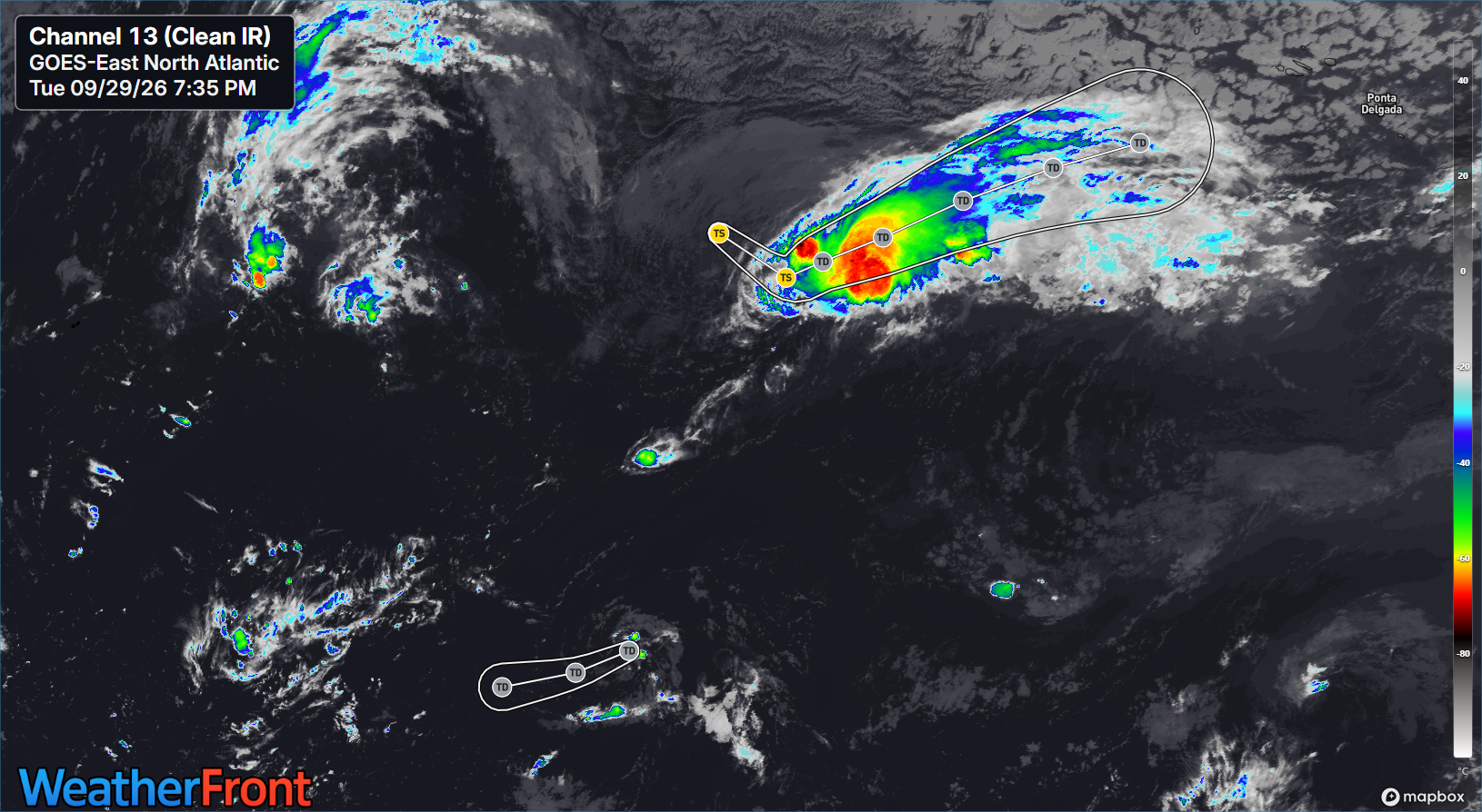
Fay managed to rack up only 3.8 units of ACE, despite 39 advisories, which has to be close to a record for futility. That represents 40 percent of the Atlantic’s ACE to date, which should finally breach 10 units tonight. Compare that to a normal value of 95 ACE units by October 1st.
Over the next week, things should remain quiet. It continues to appear like the southern or eastern Gulf will get a little more active in about 7 to 10 days, but we continue to have no real specific read on what disturbance it would be, where it would come from, etc. It’s basically an uncorroborated threat that we will continue to monitor for now and update on by Friday if it becomes more material. At the least, I would expect to see a potential uptick in heavy rain risk in Florida in a week or so.