Happy Sunday! The National Hurricane Center introduced a lemon on the map for potential tropical development over the next week earlier. It is now an orange, indicating a 40 percent chance of tropical development.
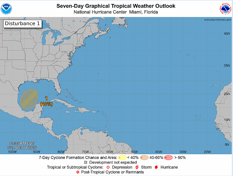
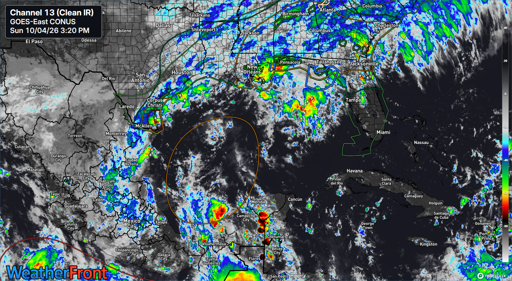
This one happens to be in the southwest Gulf and Bay of Campeche, a typical launching point for tropical systems this time of year, and occasionally a place where some bigger storms can still emerge. It’s not much today, but over the next 2 or 3 days, we are likely to see a more coherent disturbance try to organize in the area of the Bay.
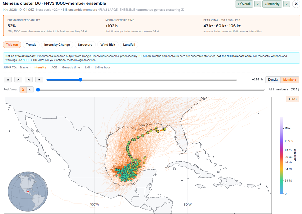
Models have been on again/off again in terms of how they see this playing out. Google Deep Mind’s 1,000 member ensemble had actually had pretty strong odds earlier this past week before fading them the last 2 or 3 days. However, just in the last 24 hours, we’ve seen a shift back to a higher likelihood of development, with about half of the members doing something here.
So there are three things here: First, does this even develop at all? Second, how strong could it get? And third, where does it go?
The first question is the only one that has a reasonable answer right now, and that is that there is a reasonable chance, probably better than 50 percent that this does develop into at least a tropical depression. The tail end of a cold front that has delivered a bunch of rain to the Central U.S., especially Texas over the last few days is going to establish in the Gulf as the week goes on. As thunderstorms develop and fester down there, this is where we expect some organization to occur.
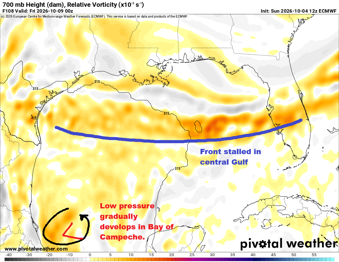
This setup seems to suggest a bit of a mess. A stalled front, a loosely developed tropical system, exceptionally warm water. Gulf of Mexico sea surface temperatures are at record levels for this time of year.
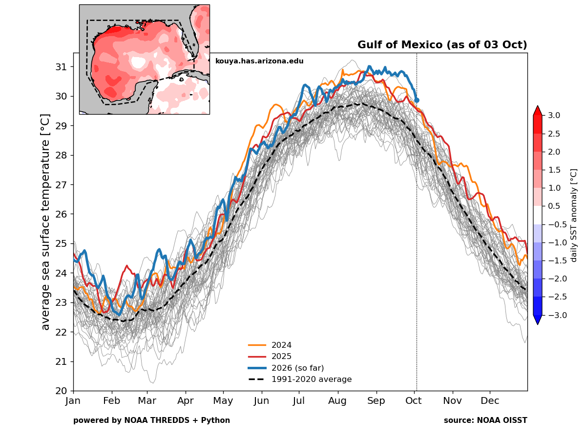
But warm temperatures can only carry a tropical system so far. For further development, you need moist air, unstable air, and generally low shear. It would appear that the moisture and shear will be cooperative for tropical development. Will the instability? Good question. So sitting here about a week out from whatever it may be that threatens, we can say a couple things.
First, tropical development is plausible, but we cannot really speculate on how far it will go. The potential ranges from sloppy tropical depression or storm (the story of 2026) to something fiercer. The 90th percentile intensity outcome on the 50% of Google ensemble members that develop this system is a major hurricane. Given the record warm temperatures there, I would not rule anything out. A track generally north or northeast seems reasonable as well, putting Louisiana through Florida on some notice (not likely Texas). But I think what we are most confident in at this point is a heavy rain event for the Gulf Coast and Florida.
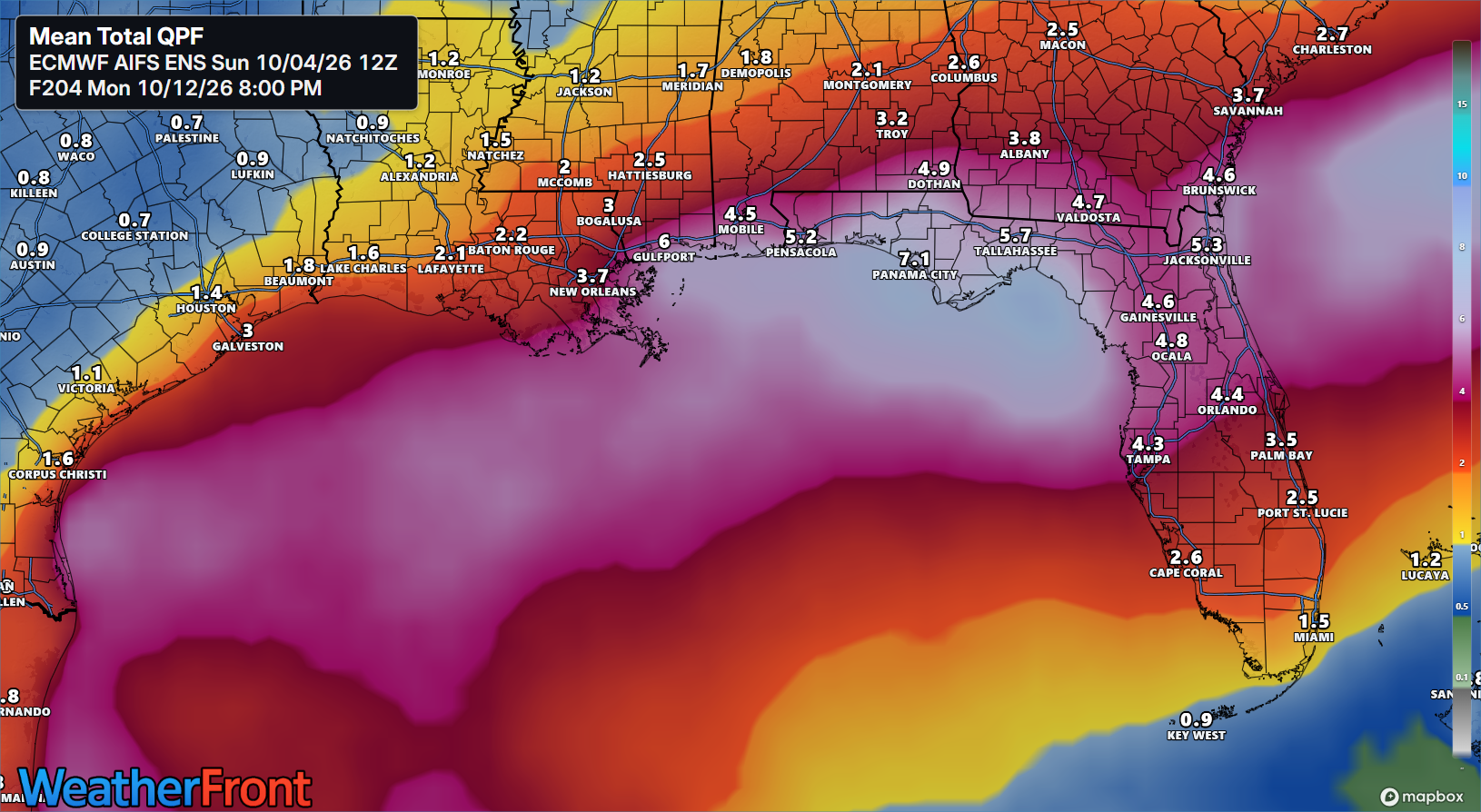
Rain totals could approach double digits near the Florida Panhandle. Substantial rainfall is expected on the Gulf Coast, as well as in North Florida, mainly above I-4. Flood watches are already posted near Tallahassee and in southwest Georgia
So what’s the play here? Stay tuned, as it will be an interesting week. This hurricane season has been absolutely dead quiet, but it’s those types of seasons that can occasionally produce unpleasant one-off surprises. We don’t expect that here, but it is something we’ll watch.