In brief: Tropical development chances are trending up over the southwest Gulf this week. While we don’t have a fully coherent picture of what will occur, we can begin to speculate a bit on how dry air, wind shear, and the track will play out. Folks on the central and eastern Gulf Coast from just west of New Orleans through the Big Bend region of Florida will want to monitor the progress of Invest 92L.
Our disturbance to watch has been classified today as Invest 92L, and it’s an area of thunderstorms in the Bay of Campeche.
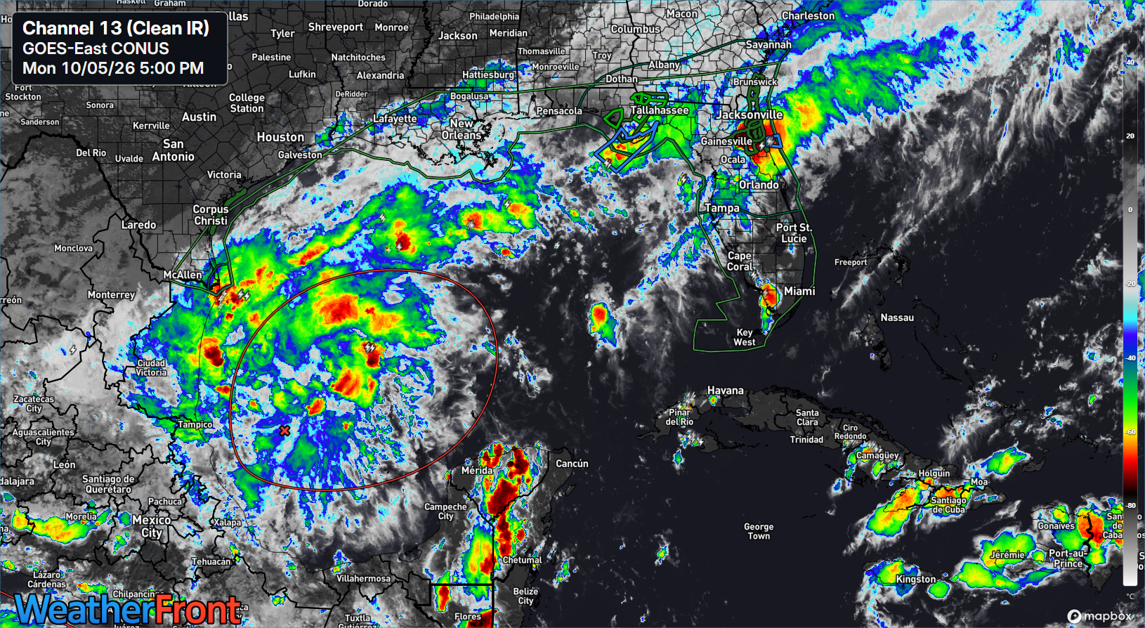
Nothing yet. Just some unsettled weather. Over the next couple days, this is expected to gradually become better organized and a bit stronger. As of this afternoon, the NHC has pushed up the potential for development to 80 percent.
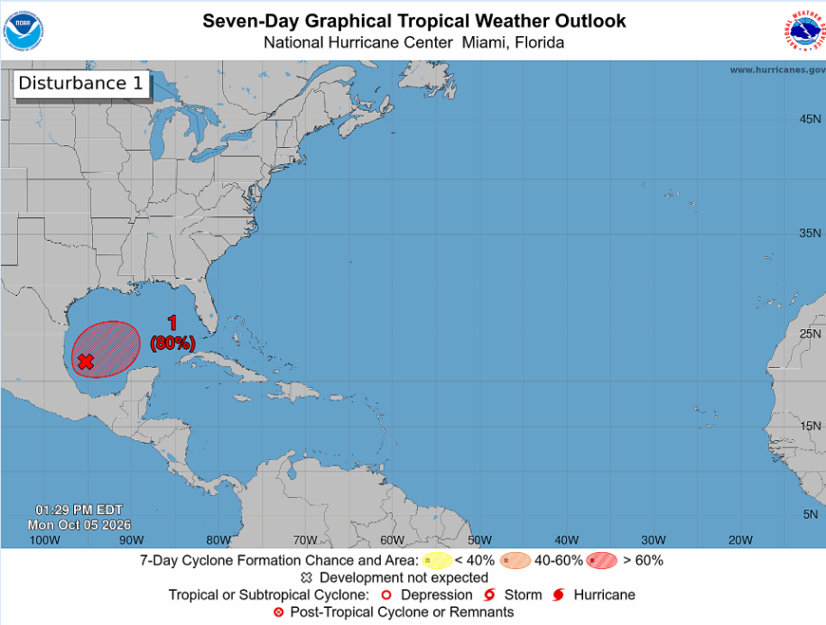
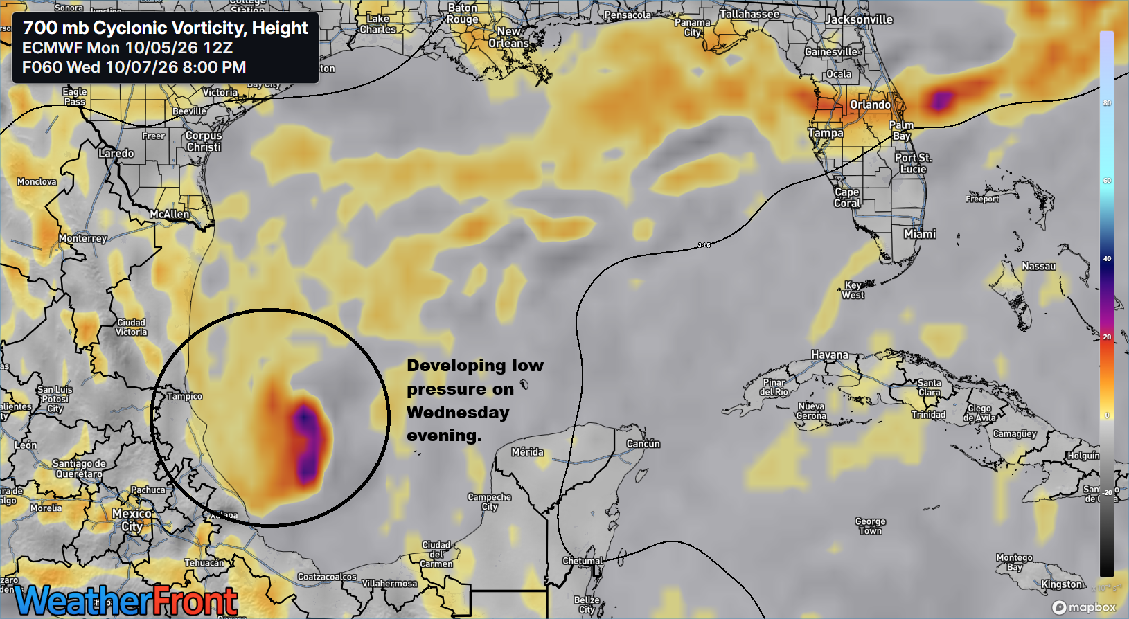
So what’s going to go on here. Like I said, we expect this whole area to become a bit better organized through the week in the Bay of Campeche, and by Wednesday afternoon or so, we should have a fairly coherent area of low pressure there.
It’s at this point that the models begin to diverge wildly. The GFS goes ballistic. The Google AI model begins to gradually develop it, as does Google’s 1,000-member ensemble. The AIFS model seems to follow Google’s solution, albeit weaker (though the AIFS is known for poor intensity forecasting). The European operational model peaks it as a tropical storm and weakens it on approach to the Gulf Coast, and the Euro ensemble is a mixed bag of all of the above, though with a lean toward an AIFS type outcome. So the number of solutions on the proverbial board are plentiful.
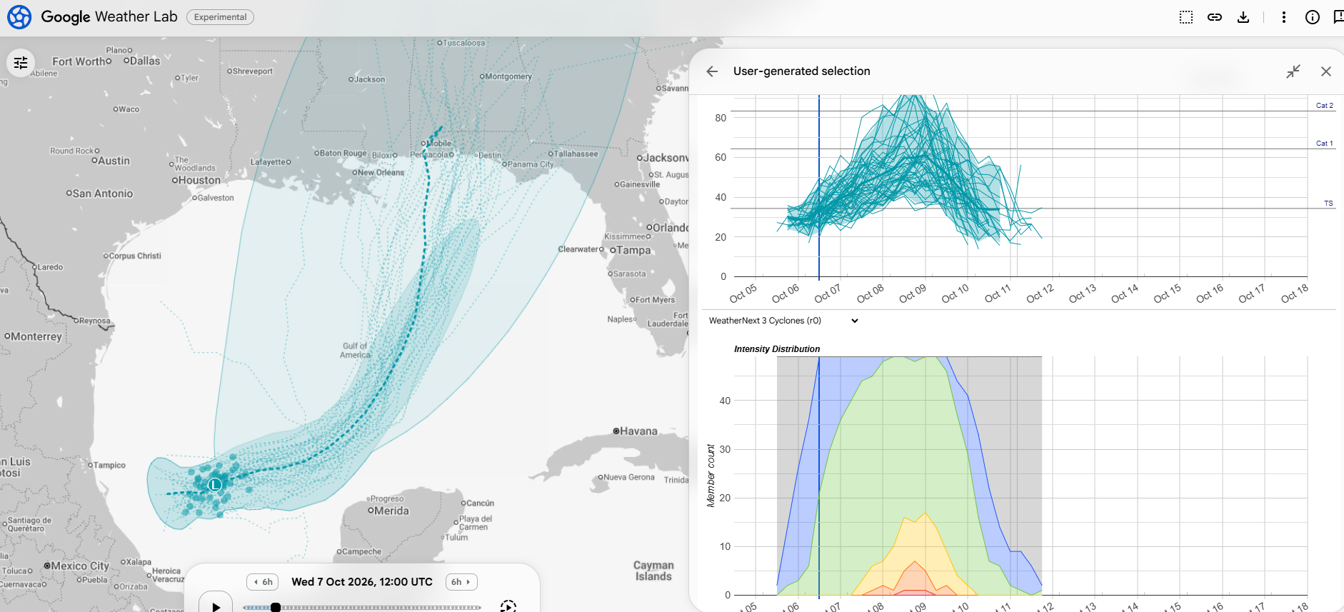
I feel like the operational version of Google right now feels like a healthy compromise. Still a chance nothing comes of this, but also a 30 percent chance of a hurricane, or perhaps a 5 percent chance of a major hurricane. We’ve seen model guidance come into better agreement today, and we will want to study trends tonight for any sort of signals we can pull.
In the meantime, it seems like a significant rainstorm will precede a potential tropical storm or hurricane impact this weekend on the Gulf Coast, somewhere east of central Louisiana.
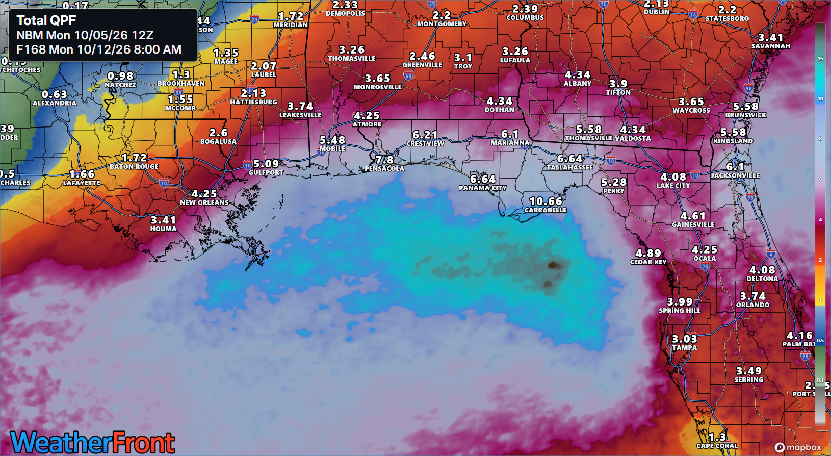
I don’t want to overlook the heavy rain impact of this system because that’s going to happen whether this is a tropical storm, hurricane, or nothing at all. So, from that point of view, we’re looking at a potential for some areas of flash flooding on parts of the Gulf Coast this week.
But whether or not this organizes still matters from a wind, surge, and honing of the heavy rain forecast. It appears the system will fester in the Bay of Campeche for a couple days before beginning to turn eastward or northward by later Wednesday or Thursday. There will be a lot of things influencing and dictating the outcome here. For one, wind shear, which is expected to be plentiful in the northwest Gulf but less so in the central Gulf.
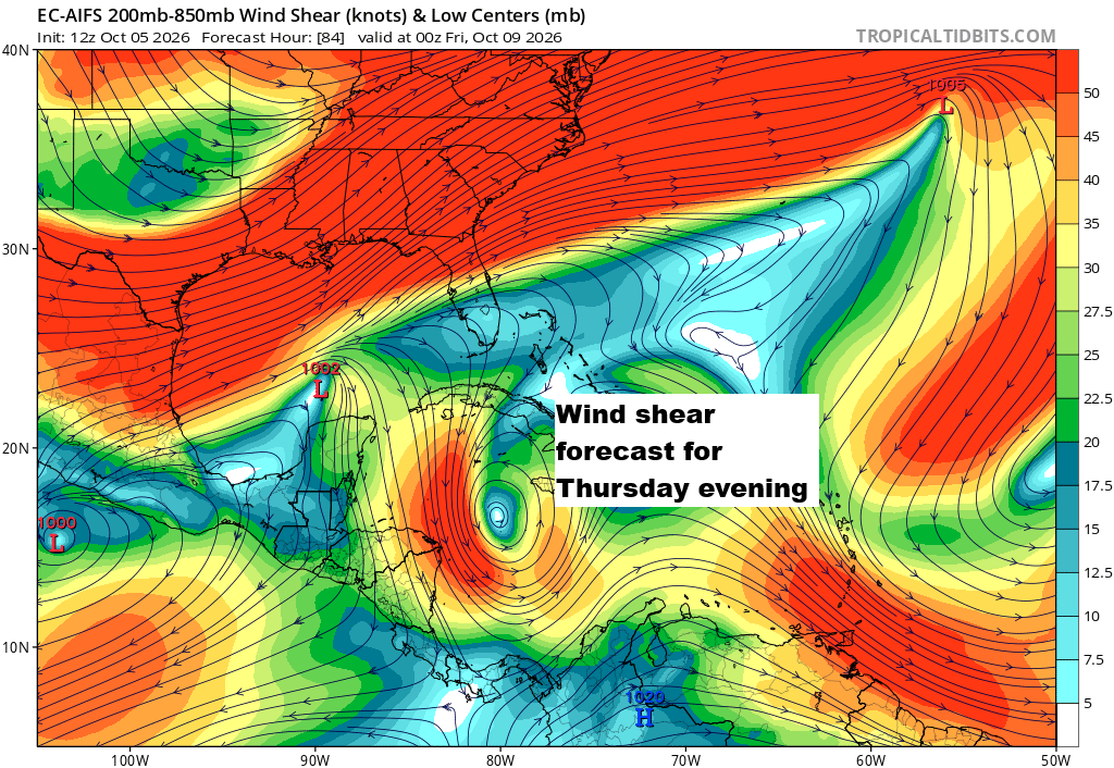
Keep in mind that wind shear has not always acted as destructively on tropical system intensity as expected, especially along the Gulf Coast and in recent years. While shear is generally going to act against development and strengthening, there have been cases where northward moving storms toward the Gulf Coast have had their outflow aided by wind shear leading to maintained intensity or even strengthening. We can also get weird behaviors when storms are transitioning more toward extratropical cyclones than classic hurricanes. In other words, while wind shear is going to be a topic with this system, if it can organize in the next few days, I would not be fully convinced that is necessarily a negative. That said, this does look rather strong, and it may be a bit tough to fully overcome.
In addition to the wind shear as a result of the pattern over the Gulf and Southeast, there’s also the situation regarding the next Pacific storm, which will likely be named Simon. If that can outdevelop Invest 92L, it could impart more destructive shear on 92L, leading to weaker development. This seems be a low likelihood (but not an impossibility) right now.
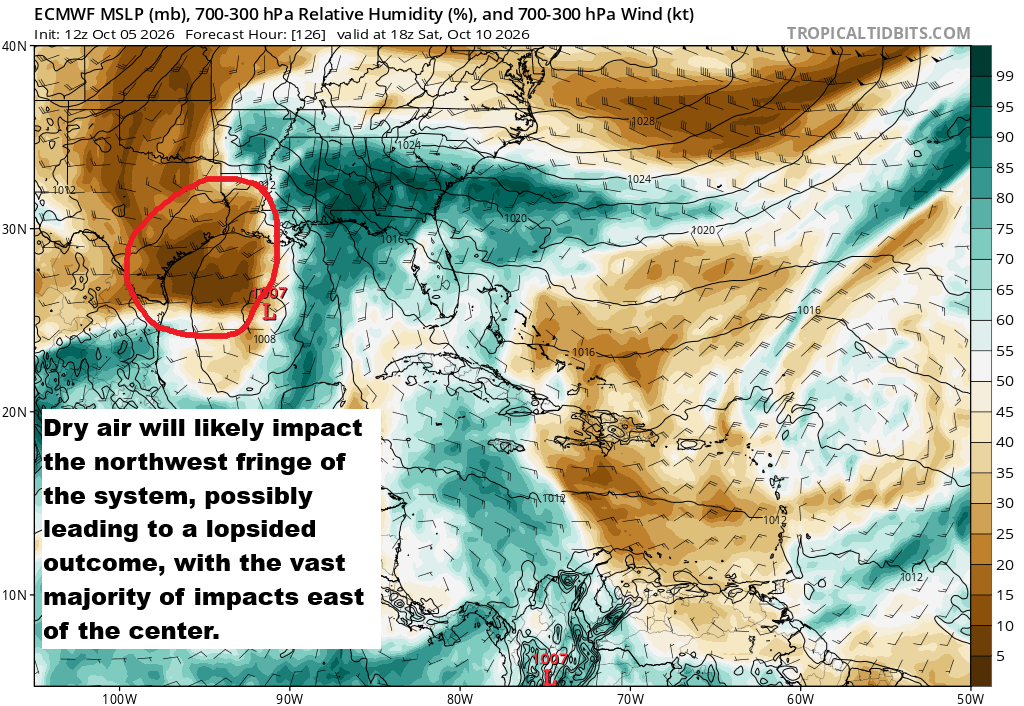
Last, we always need to watch to see if dry air is going to be an issue. Much of Texas and the Gulf Coast has or will see rain, but some notably drier air pushing offshore of Texas is likely to get drawn into the storm in the Gulf. This will probably yield at least a somewhat lopsided system, with much greater impacts east of the center than west.
So, we have a long way to go here. At this point it looks like whatever it is will sweep north over the weekend. That leaves us a couple days to watch developments here before folks would need to prepare in earnest anywhere, if at all.
Bottom line:
- Gulf development risk is increasing.
- Potential ranges anywhere from a sloppy, disorganized system to a major hurricane.
- A “worst case” type outcome is unlikely here because of the hurdles related to dry air and wind shear.
- Likely track aims to between southeast Louisiana and the Florida Panhandle.
- Regardless of development, heavy rainfall is likely on the Gulf Coast this week and weekend.
Stay tuned here and to your other favorite sources of weather information for updates in the coming days.