In brief: Tropical Storm Bertha may be nearing its peak before it begins a steady, if not quick weakening trend on approach to Louisiana. Bertha is expected to dissipate before reaching Texas. Impacts from Bertha will include high tides and some minor tidal flooding perhaps on the Mississippi and southeast Louisiana coasts, as well as locally heavy rain.
Big Bertha
Ok, Bertha isn’t exactly big. But it’s a tropical storm. It’s more like a blob. Or a couple blobs. Or a creepy thing staring at you.
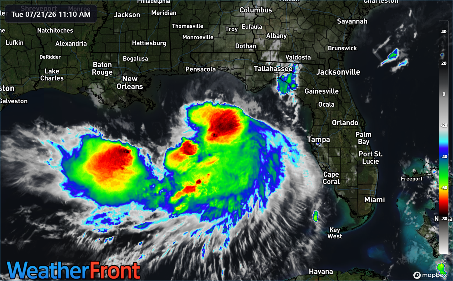
Bertha is extremely reminiscent of another “B” storm in the Gulf from a few years back, Barry. Barry became a hurricane, or more like a halficane.
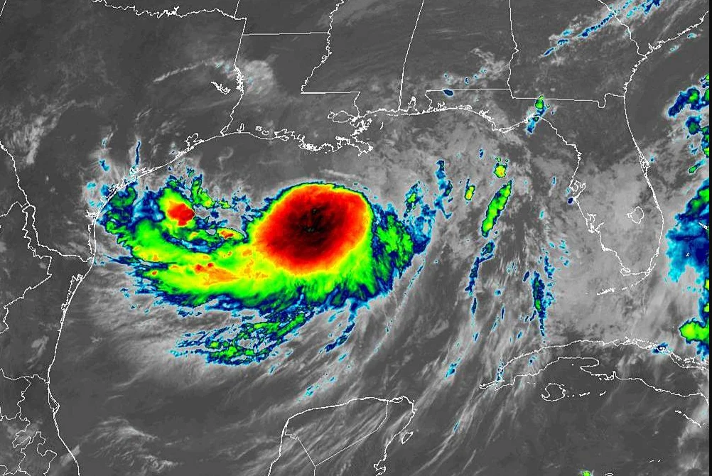
Barry’s center was constantly north of all the thunderstorms. In Bertha’s case, it’s similar. Where’s the center?
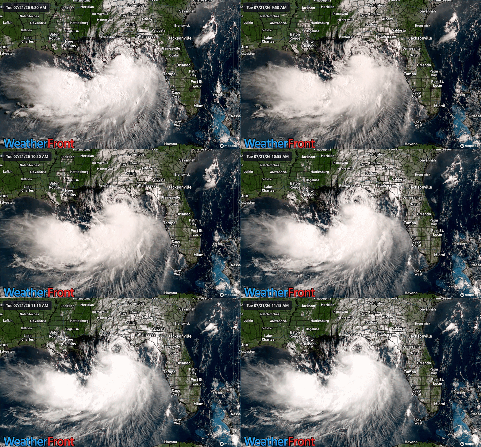
The center is visibly exposed north of the thunderstorms and located just south of Destin. The bulk of the wind with Bertha is located under the storms, especially south and east of the center. We are seeing 40 mph wind gusts near Cape San Blas east of Panama City and a 43 mph gust near St. Teresa and Bald Point State Park (which is a beautiful place to visit). So, Bertha’s doing the thing. Maximum sustained winds are around 60 mph, again offshore under the thunderstorms. Bertha is probably near its peak intensity this morning.
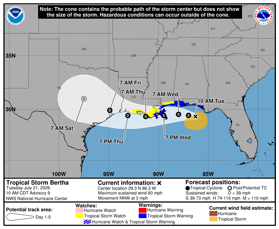
Bertha is expected to track west northwest for a little while before shifting west and perhaps even west southwest over the immediate coast of Louisiana.
Bertha should be near peak intensity today, and we’re fairly confident of this for two reasons: Wind shear and dry air. Bertha’s going to get attacked on both sides in about 12 to 24 hours. On the eastern flank, northeasterly wind shear. On the western flank, dry air.
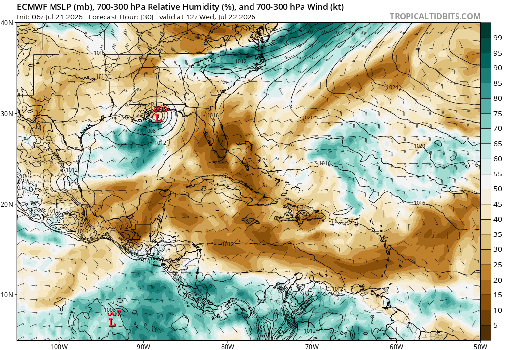
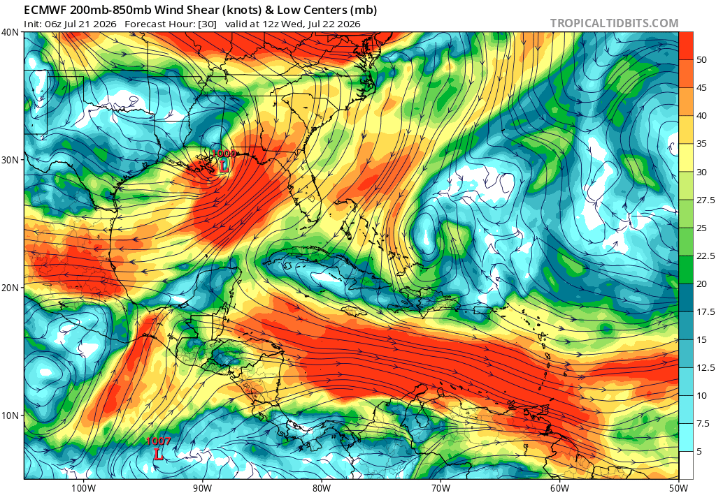
The combination of these factors in conjunction with a storm that is already just barely holding it together coherently historically leads to rapid weakening. We hear a lot about rapid intensification during hurricane season, something we’ve seen happen more and more often in recent years. But rapid de-intensification may be the story here. Bertha should weaken to a depression by the time it gets west of New Orleans, and frankly, it may be lucky to even have an identity anymore by the time it gets to Lake Charles. There may some additional thunderstorms into western Louisiana or far southeast Texas on Thursday or Friday as the remnants pass through, but even that may be asking a lot.
The main impacts from Bertha to land will be in the form of rain and squally weather. The squalls will produce gusts to tropical storm intensity at times, primarily along the coast east of Vermilion Bay, Louisiana. The heaviest rain should fall in southeast Plaquemines Parish.
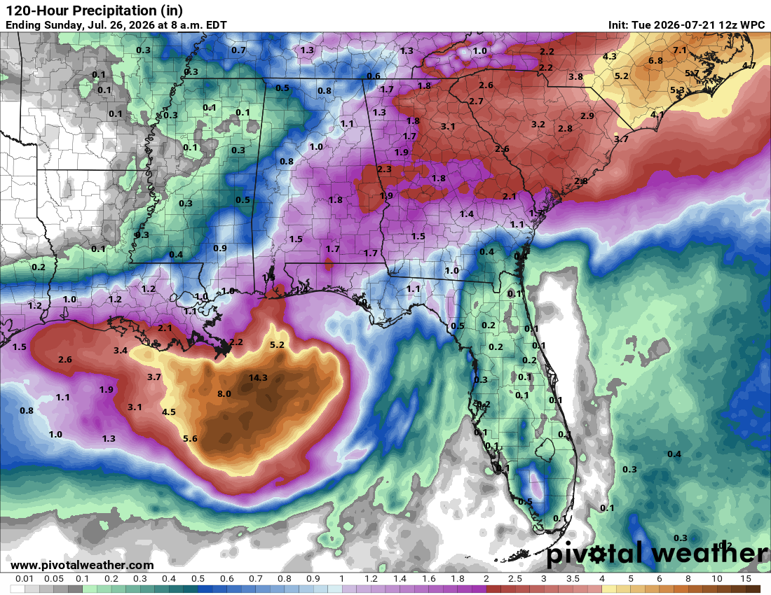
Additionally locally heavy rain may fall from Grand Isle west as well as near Mobile Bay. Additionally, waves and tides will increase some across the Gulf Coast, leading to perhaps a 2 to 4 foot peak storm surge in eastern Louisiana, as well as on the Mississippi coast.
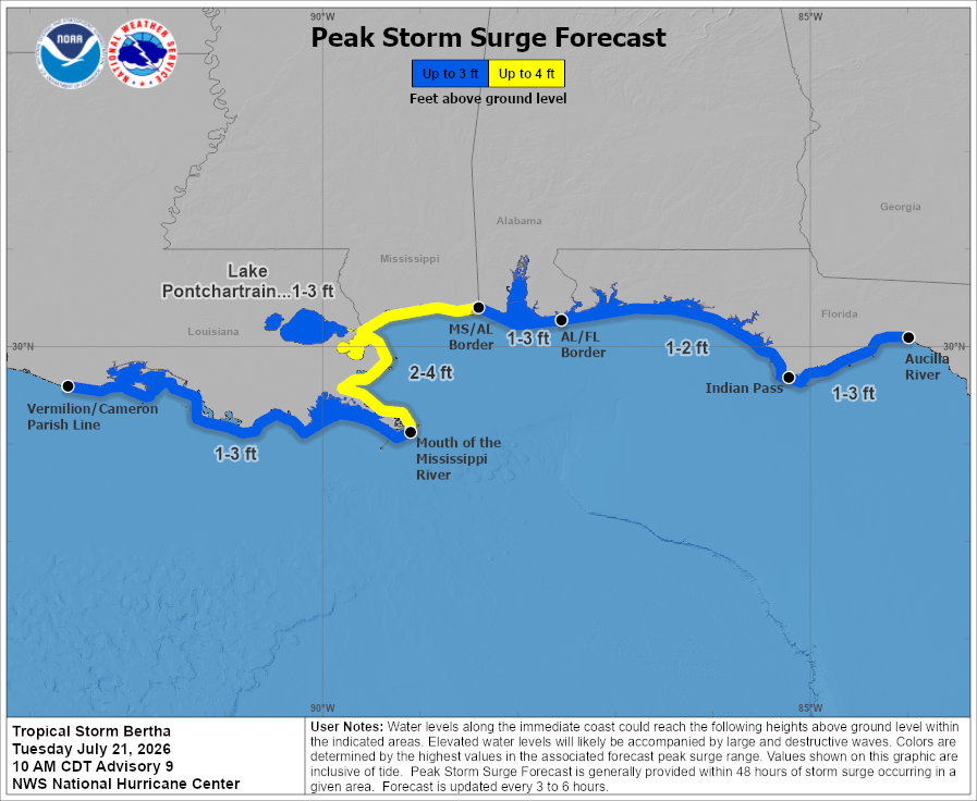
Bottom line: Mostly nuisance impacts from Bertha are expected along the Gulf Coast, particularly in southeastern Louisiana.
No other tropical concerns in the Atlantic at this time.