In brief: While the Atlantic looks mostly quiet, some low-end development is possible next week. The Pacific looks active, and we’ll see how any remnant moisture from developments maneuvers into the Southwest. Meanwhile, the region between New Mexico and Mississippi will be at risk for flooding today and this weekend.
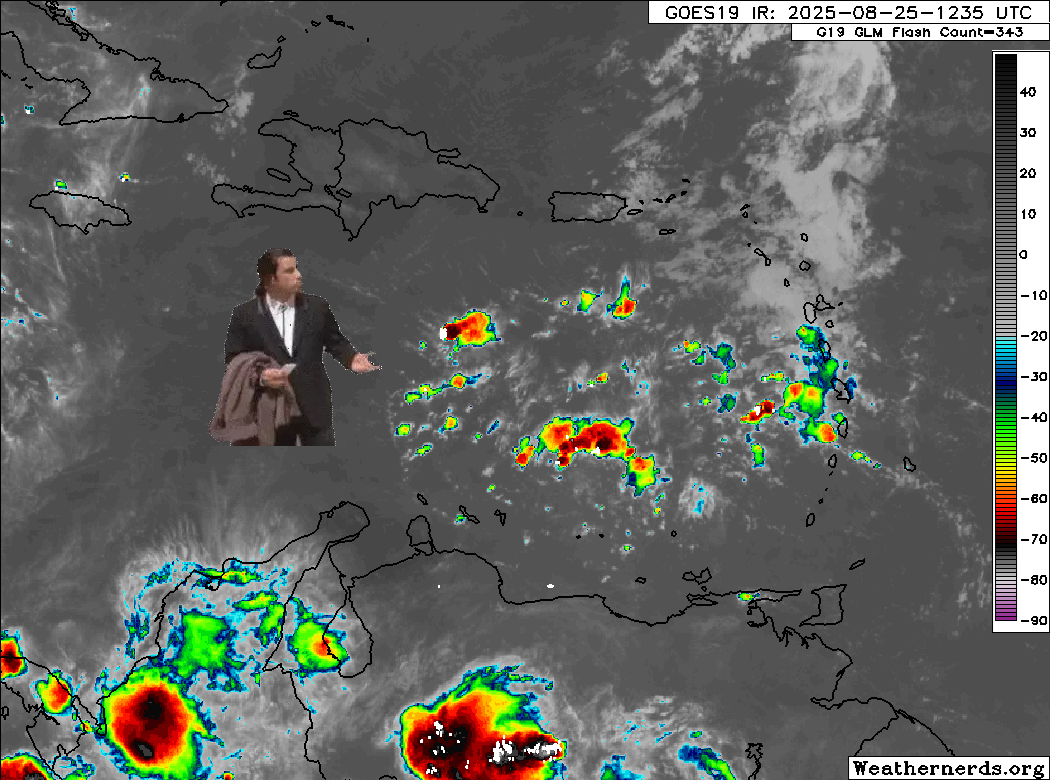
Tropical Atlantic embracing a slow go
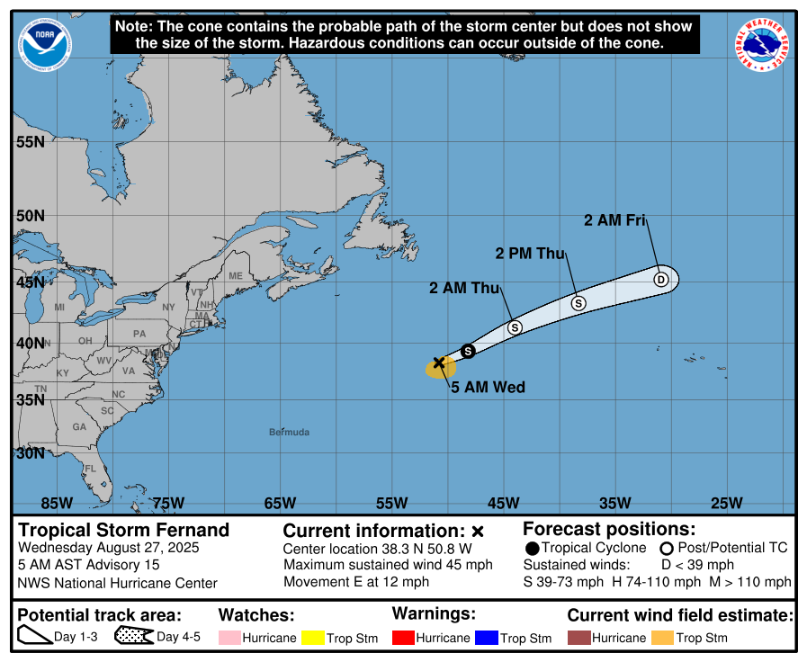
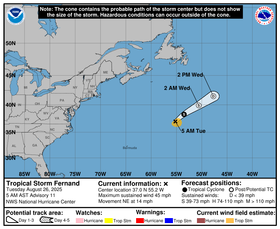
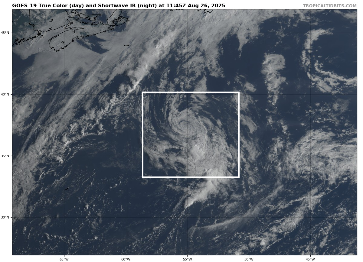
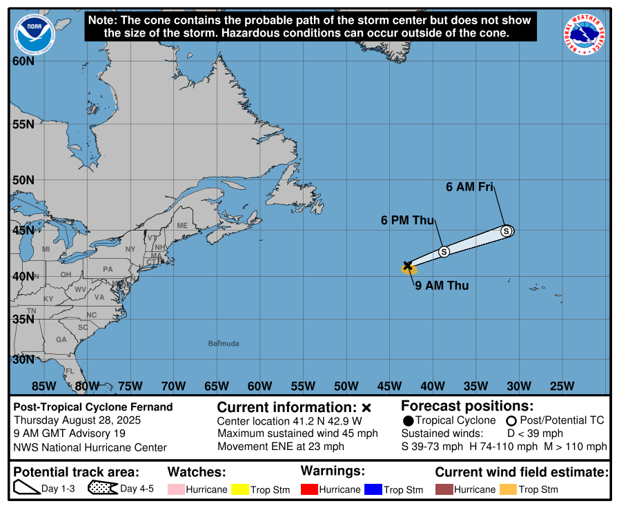
Fernand is now post-tropical and exiting. We appreciate its service.
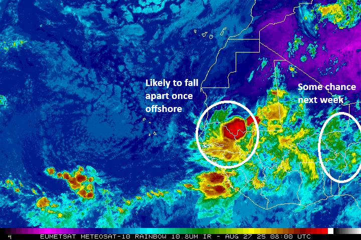
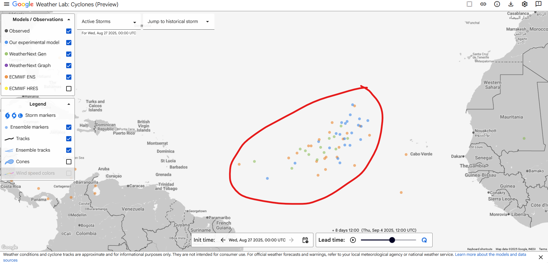
Meanwhile, the National Hurricane Center tagged a new area today off the coast of Africa. This is the tropical wave we discussed a bit yesterday that seems to have some model support for development. It’s expected to emerge off Africa this weekend, and slow development could allow it to become a tropical entity sometime later next week. Modeling remains modestly supportive of this. By no means is this a slam dunk development case. But enough European ensemble members and AI ensemble members and operational modeling shows this somewhere in the central Atlantic and at least trying to develop next week.
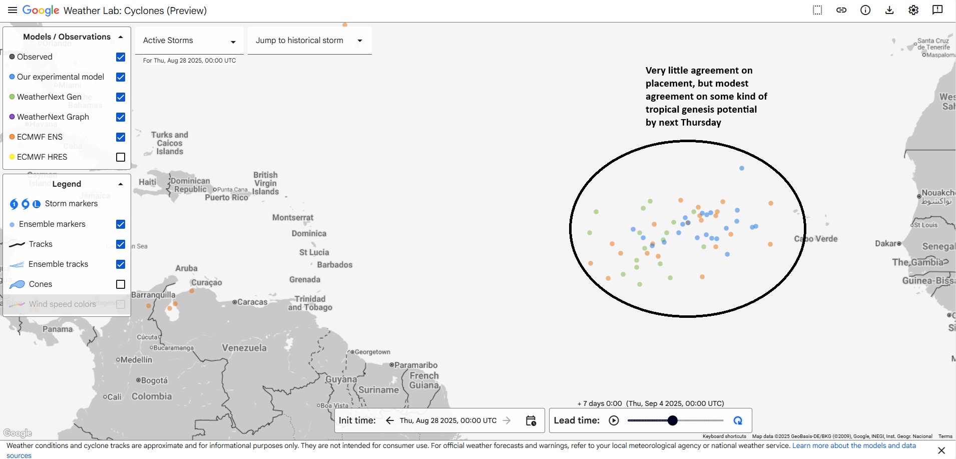
Where it goes from here is hard to say, but a general west-northwest track seems likely at this point. One thing models seem to agree on strongly for now is that this system may have a very low ceiling. In other words, there’s a slight chance it develops, but there’s a higher than usual chance that if it does develop, it would not be a particularly large or strong storm. We’ll keep tabs on it of course, but for now this is not something we feel anyone needs to worry much about.
An additional wave or two may follow off Africa next week, but none of them look particularly menacing at this time.
Terrific Pacific
Meanwhile, there aren’t any imminent land threats on the Pacific side of the tropics, but that’s where the action is.
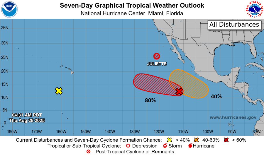
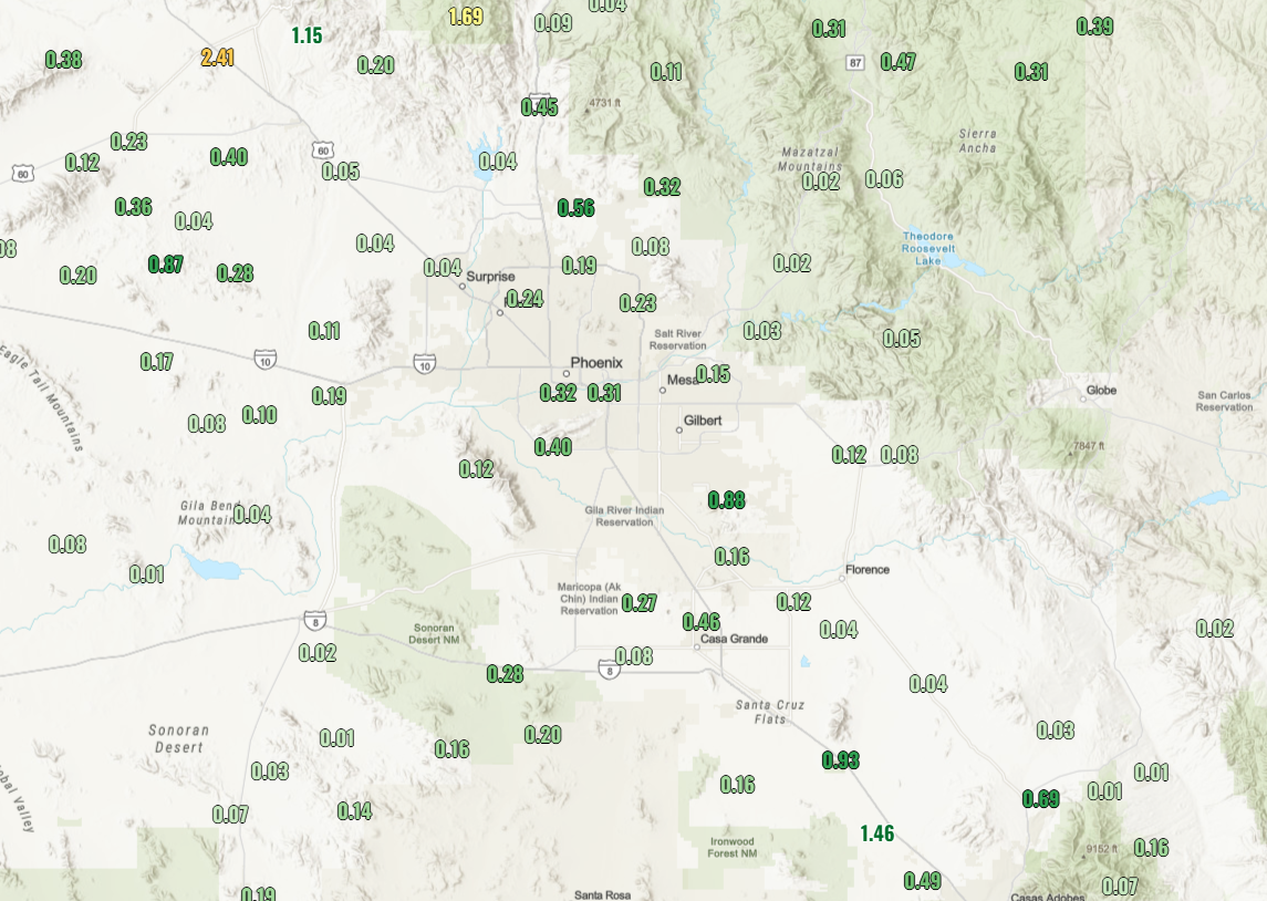
Juliette will be responsible for rain showers in the Southwest today as some of its remnant moisture arrives. Rain totals won’t be high, but any moisture is welcome in the desert.
Beyond Juliette, there is both a medium and high-risk area to watch for development in the Eastern Pacific. Neither of those look to threaten land ultimately, but we may get some interesting satellite imagery or even another Juliette-type situation where remnant moisture finds the deserts of northwest Mexico and the Southwest U.S.
Wet Southern Tier
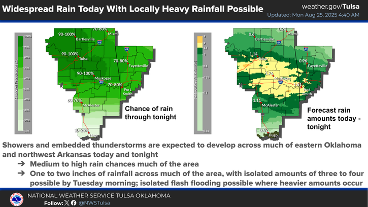
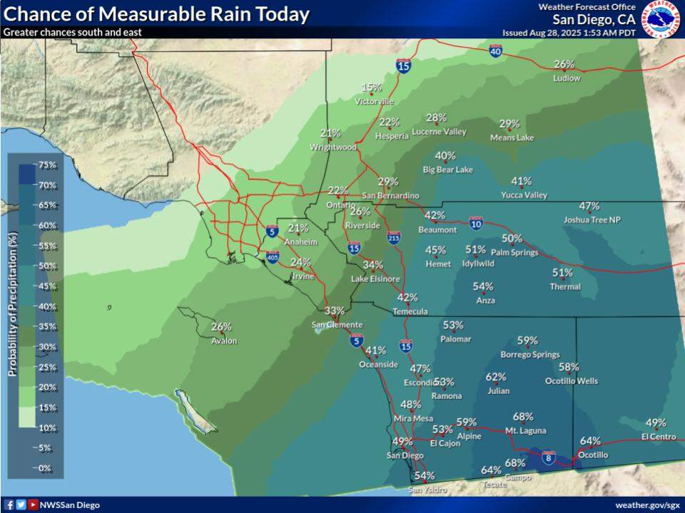
We’ve already got heavy rain happening in southeast Kansas and northeast Oklahoma this morning, where some flooding risk will live today. That heavier rainfall will cruise southeast across Arkansas and into extreme northeast Texas and Louisiana today.
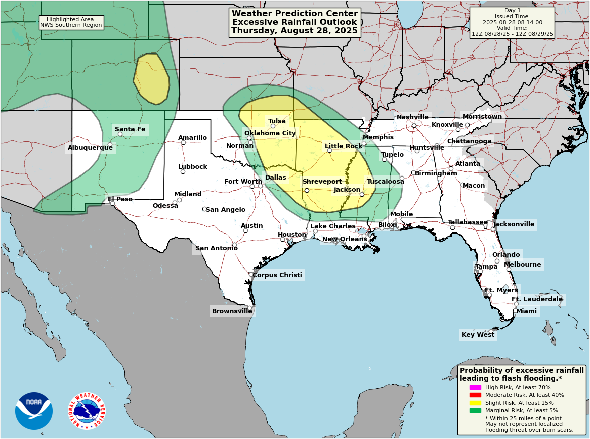
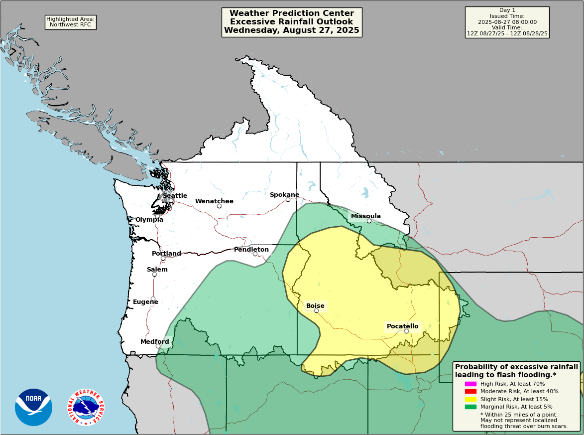
Rain totals of 1 to 3 inches with isolated pockets of 4 to 5 inches are possible along the trajectory of the storms through the slight risk area highlighted above today and tonight.
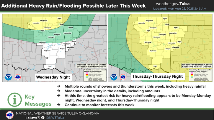
Over the next couple days, the flooding risk will maneuver around the South, tomorrow including Mississippi and Louisiana again but also West Texas and New Mexico. Heavy rain chances will linger at times in Texas and New Mexico from Sunday into early next week. In fact, a widespread 1 to 3 inches seems possible when all is said and done. There will almost certainly be higher amounts in spots. Burn scars in New Mexico (including Ruidoso) will probably be at higher risk of flash flooding.
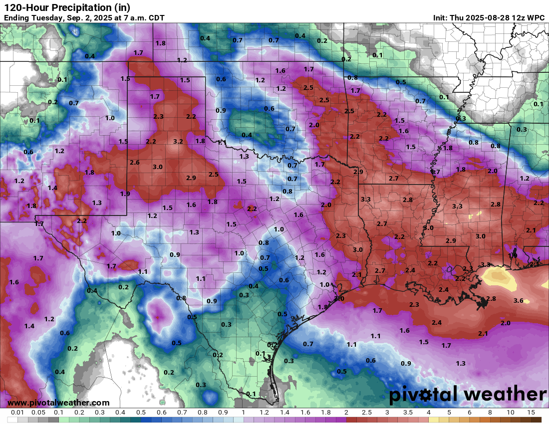
We will probably see flash flood watches in spots over the next day or two for that rain.