In brief: Today we take a look at the stats from the East Coast blizzard so far. We also introduce a hopefully new weekly feature that outlooks Texas-wide weather. And a look at how at an atmospheric river event will evolve into our next Eastern U.S. storm this week.
Blizzard update
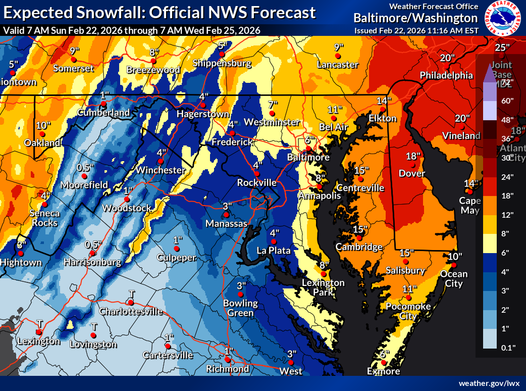
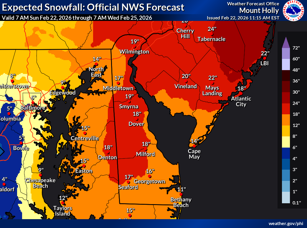
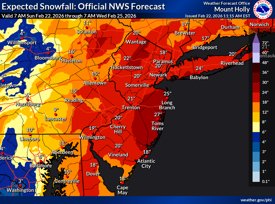
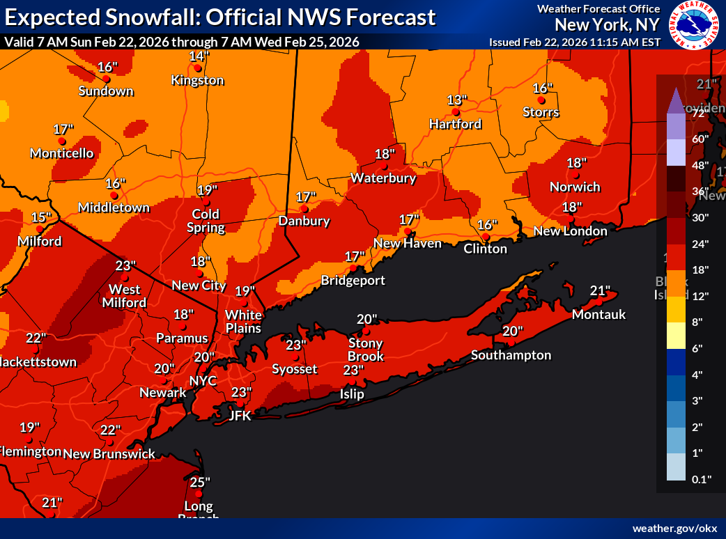
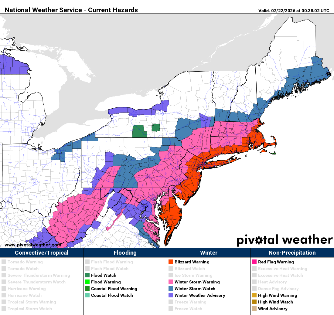
The East Coast blizzard will exit today, but as of this morning, we’ve got numerous reports.
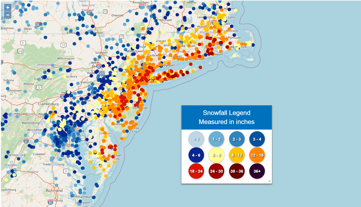
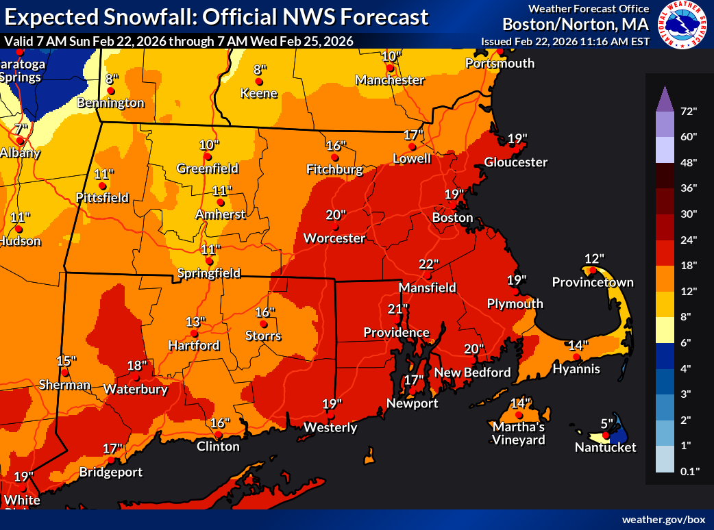
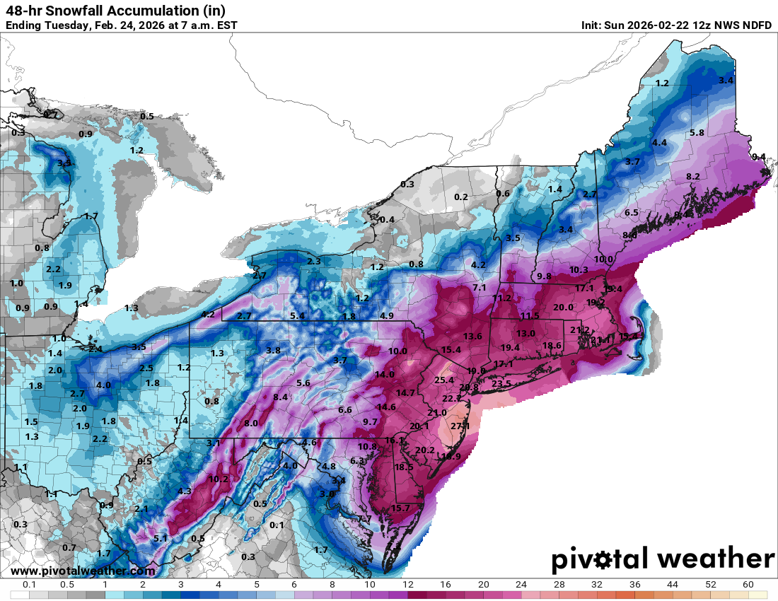
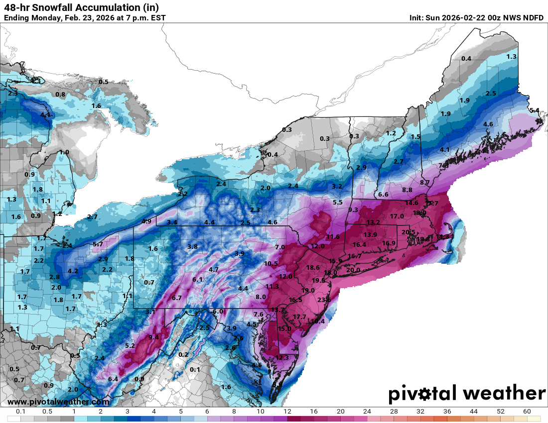
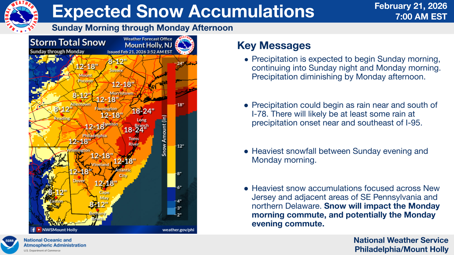
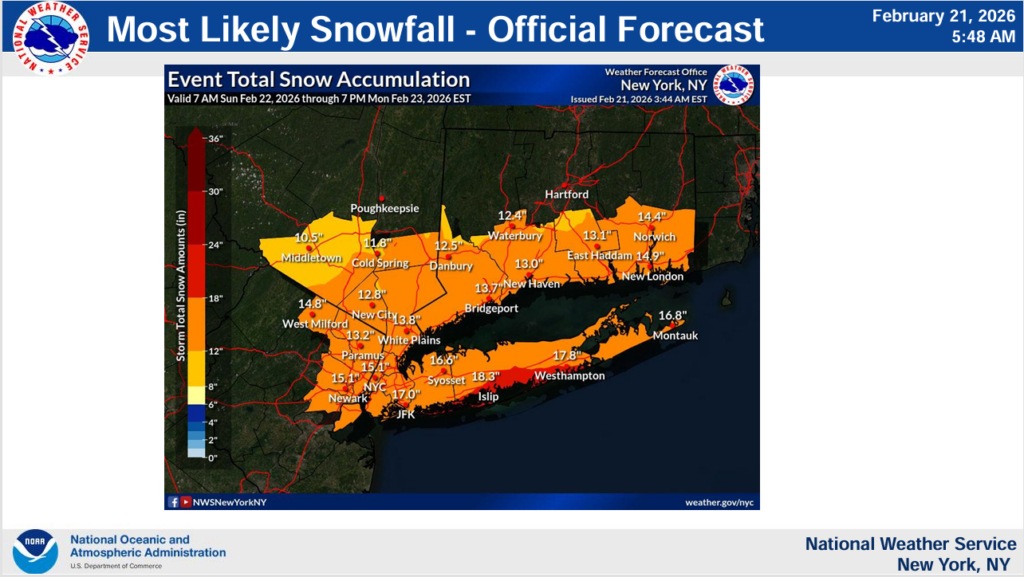
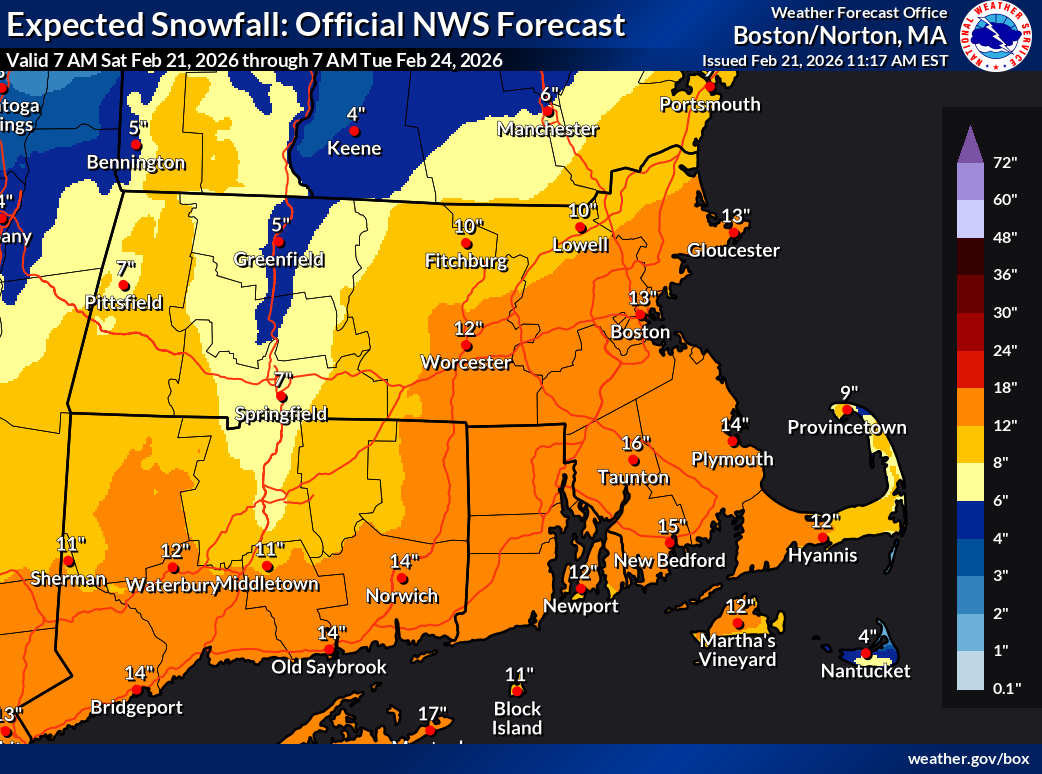
The highest reported snow total so far comes from Brookhaven on Long Island, which has reported 26 inches. That total is also now being reported near Richmond, RI, Narragansett, RI, and Quogue on Long Island on the south shore just east of Brookhaven. It is still snowing in all these locations. Some other notable totals in 24.2 inches in Freehold, NJ, 24 inches near New Bedford, MA, 19.3 inches in Bethel, DE, and 22 inches in Langhorne, PA and Chester, CT.
Officially, Central Park is at 15.1 inches so far, putting this storm in 19th place for New York City back to 1869. The 14.5 inches at Atlantic City Airport so far means the storm cracks the top 10 list there back to 1945. Just for the record, I would like to point out that the Atlantic City area saw a total of 4 top 20 storms in the 18 years I spent growing up there. Since I left, they’ve now had 9 of them.

You’re welcome.
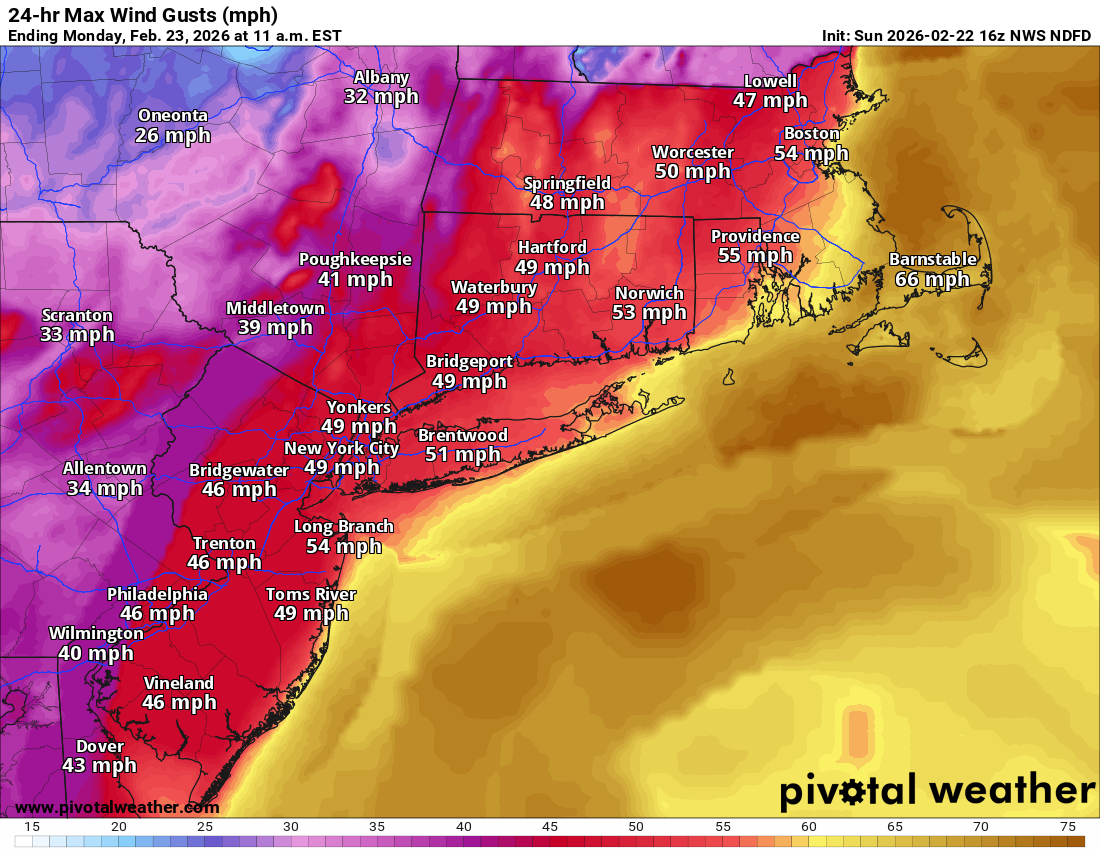
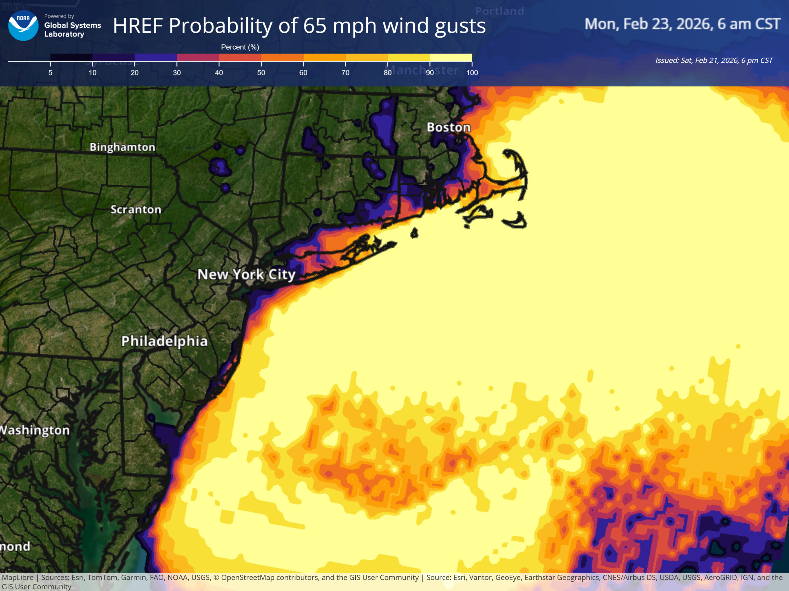
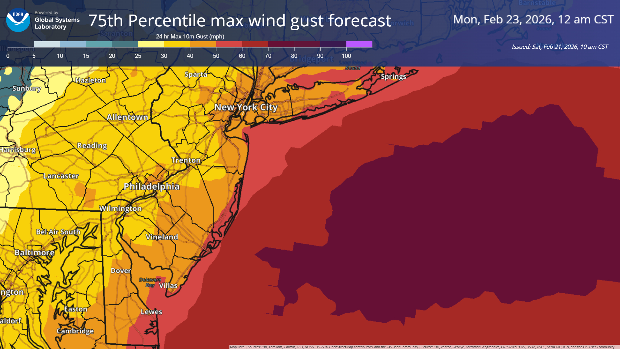
More to come on the snow, but what about the wind? We have seen several gusts up over 65 mph. Atlantic City hit 60 mph, Barnegat Light 70 mph, and Stony Brook and Nantucket both hit basically hurricane equivalent at 74 mph. Marthas Vineyard hit 71 mph.
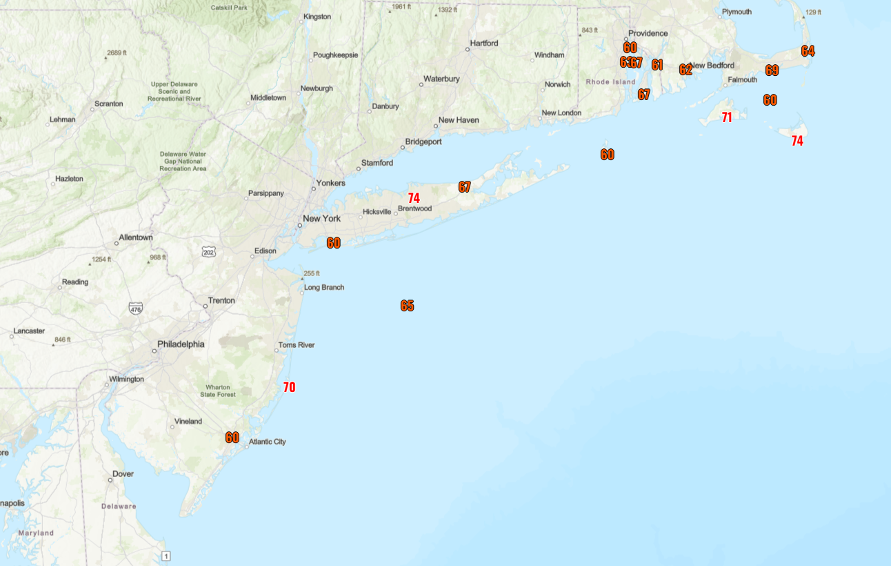
Obviously, these kind of winds are knocking out power. As of this writing over 250,000 customers in Massachusetts are without power, 130,000 in New Jersey, and 76,000 in Delaware. In total, we’re around 600,000 customers from Virginia into New England without power right now. We’ve had worse storms to be sure in that regard. But obviously, this is quite a powerful storm.
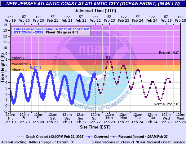
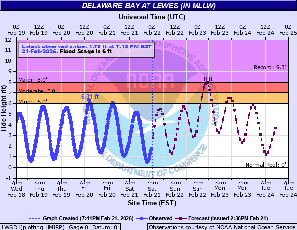
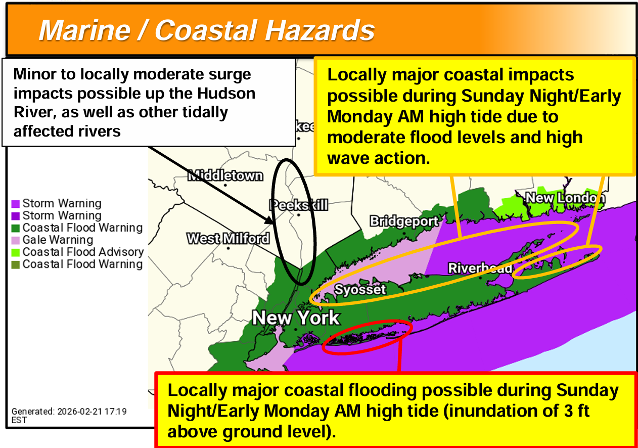
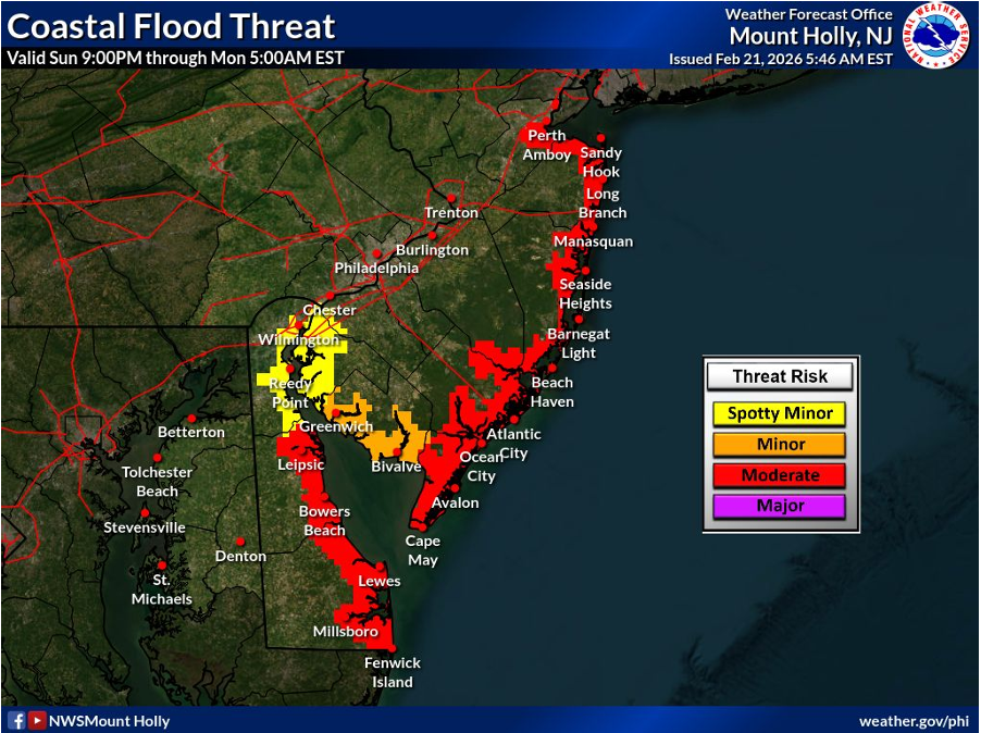
One area where the storm has tended to underperform was with tidal flooding. Most tide gauges that were predicted to approach major flooding came nowhere near it overnight, so some good news there, although there is certainly some coastal flooding and beach erosion ongoing with this storm.
More to come on the final totals!
Texas weather this week
Trying something new this week. Texas is big, and as a part of Space City Weather, we’re often asked about weather elsewhere in Texas. Well, I’m going to try to commit to a Monday 50,000 foot overview of what to watch for in Texas and generally the southern Plains and Louisiana for the upcoming week, as a number of our readers hail from there.
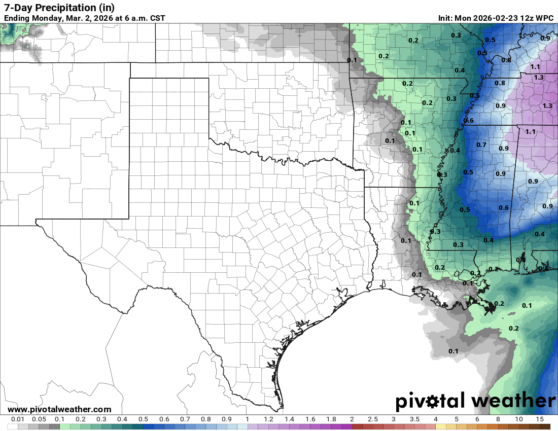
First off, the weather word for Texas is dry. Most of the state should be absent any rain at all this week, with a midweek storm cranking up well off to the east. This will mean periodic fire danger, particularly as winds kick up through the week. Conditions may be at their most considerable on Tuesday, particularly in West Texas.
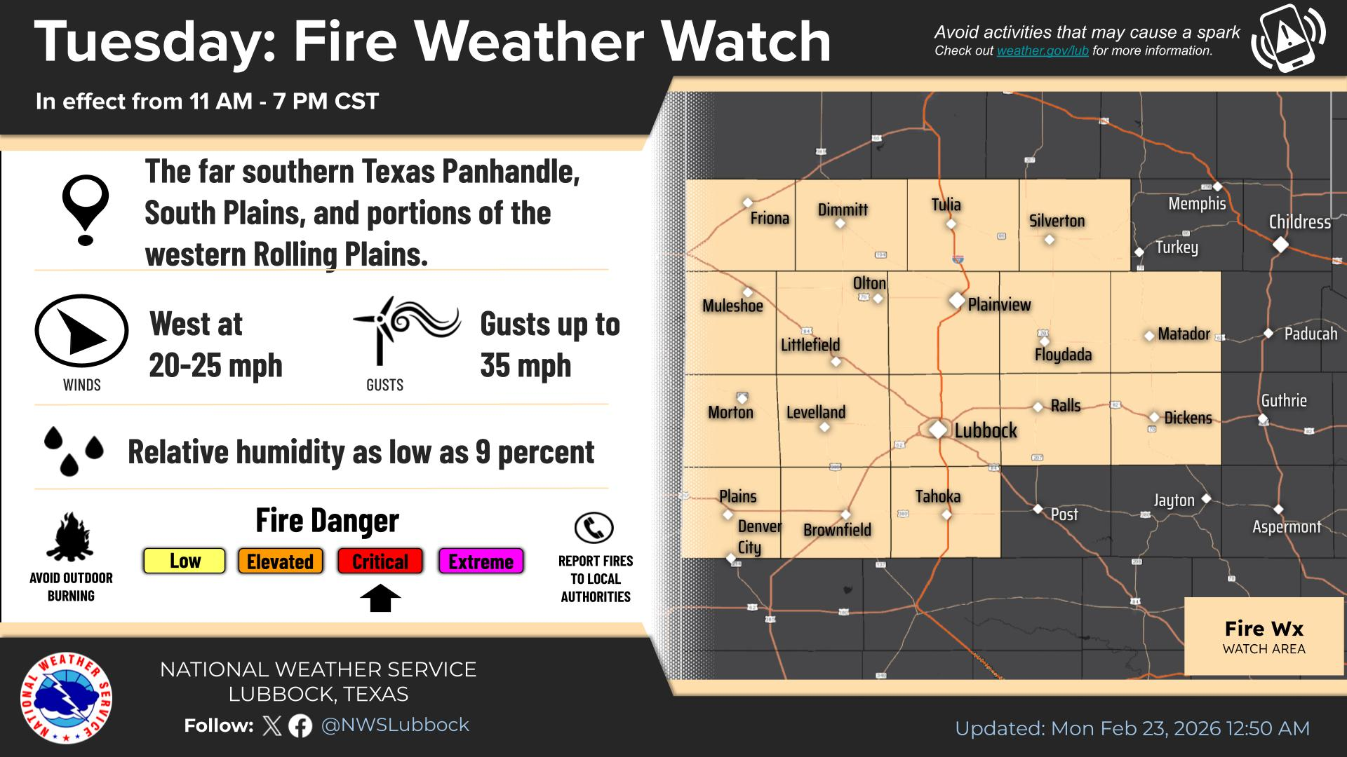
Red flag warnings are likely tomorrow. Winds don’t look insanely strong, but given the dryness and relatively low humidity, it will be enough to create meaningful fire weather conditions.
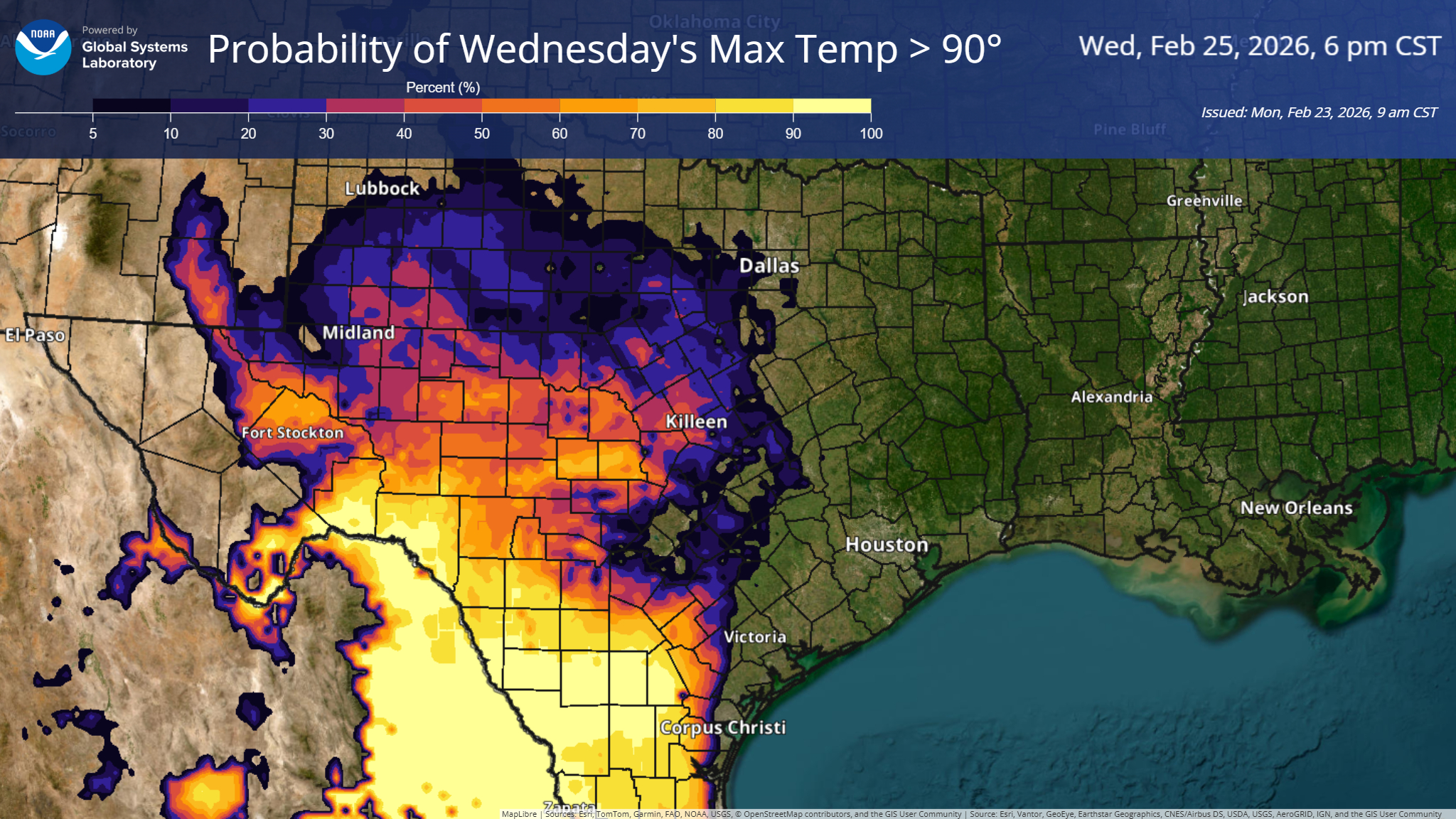
Meanwhile, the biggest question may be if one of the Texas triangle cities (Dallas, Austin, San Antonio, Houston) can hit 90 degrees first and if so, who might it be? The leader in the clubhouse right now is Austin (Bergstrom) which hit 89 degrees on January 2nd. Forecast highs this week are expected to top off in the mid 80s in most of the larger cities. Corpus Christi has a shot to do so on Thursday, and much of the Rio Grande Valley will hit 90+ on Wednesday.
But the main story will continue to be the dryness across the state.
Storminess
It will be a moderately active week across the country in terms of storminess. A pretty healthy atmospheric river event is bearing down on the Northwest early this week, tipping AR4 on the 5-level scale for portions of southern Oregon and northern California.
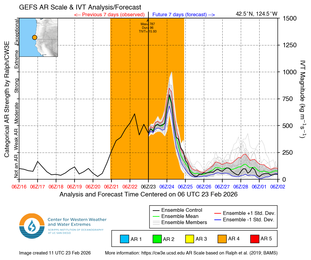
Rain totals are expected to be on the order of 1 to 3 inches from Tacoma south through Redding, CA. This will be a warm AR event, with snow levels up above 6,000 feet even into Oregon. Although the risk of severe flooding is not high with this event, there are numerous flood watches up across the West and a slight risk (2/4) for excessive rainfall on Tuesday in parts of the northern Sierra.
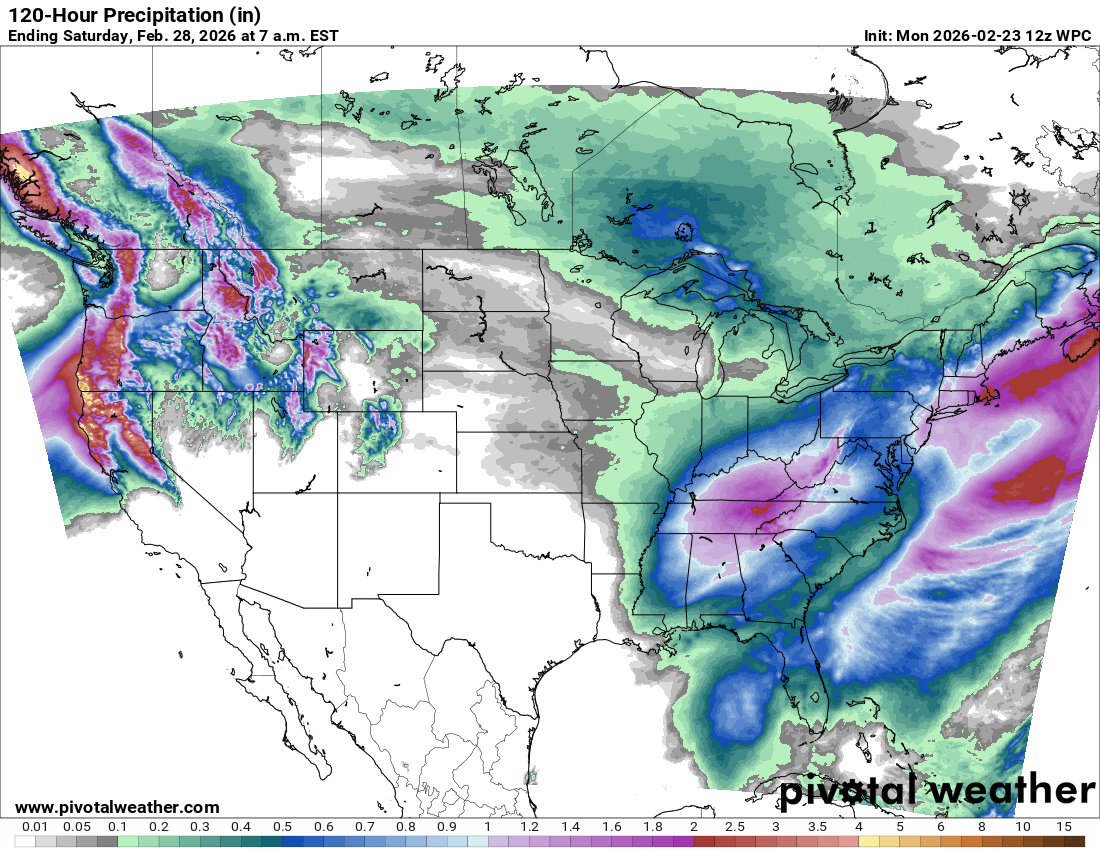
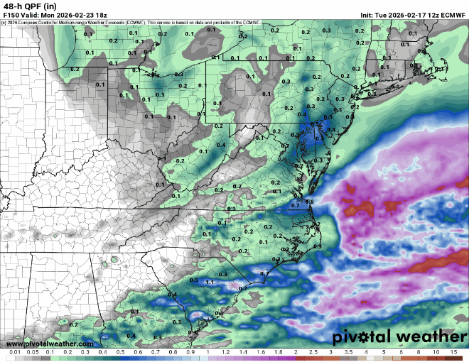
Meanwhile, the tail end of that storm is going to become the next Eastern U.S. storm by later in the week. Right now, it appears this will primarily be a locally heavy rainmaker in the Southeast, but there has been some back and forth in model guidance as to whether or not the storm could carry a wintry component on the northern fringe. This was aiming along I-90 on Sunday morning, but model guidance has mostly lost it at this point. Some of that uncertainty is likely due to the typical issues in predicting exact trajectories and intensities of West Coast storm systems. This tends to happen at times, and it’s one reason why we don’t usually get super excited more than 3 days out ahead of a winter event.
Still, as we saw with the East Coast blizzard, this can change quickly, so we’ve got another 36 hours or so before we can feel particularly confident one way or another on the future outcome here. Stay tuned.