In brief: Erin enters the record books as one of the quickest intensifying Atlantic hurricanes on record, now flirting with category 5 intensity. It remains unlikely to directly threaten any land, but fringe impacts will continue to impact the northeast Caribbean, possibly the Bahamas, and perhaps Bermuda. No threat to the U.S. or Canada.
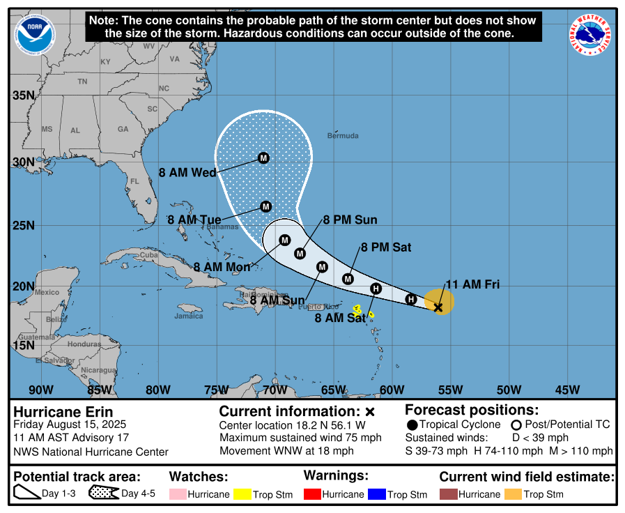
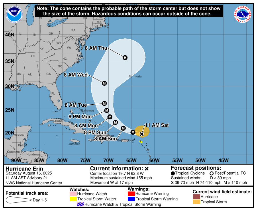
Erin exploded overnight into a category 4 hurricane. As of the 11 AM AST advisory it has 155 mph maximum sustained winds, just a sneeze away from category 5 intensity.
Why? Well, it always was expected to strengthen quickly. But Erin was able to close itself off from external dry air and shear and basically insulate itself, contract in size, and explode.

Erin’s small size works to its benefit, as hurricane-force winds extend out a mere 30 miles from the center. This is good news for the islands, as they’ll be a comfortable distance from the powerful winds. Erin should intensify a little further today. After today, the storm will likely become prone to fluctuations and internal processes that impact intensity (things like eyewall replacement cycles, etc.). So it may wax and wane a bit after today or tonight.

Let’s talk real quick about Erin’s intensification rate. Erin is the quickest intensifying Atlantic hurricane by a significant margin (before Sept 1) that we have data on, according to Sam Lillo. A 70 mb drop in 24 hours is incredible. The warming oceans are certainly one factor playing a role in this. By every metric, Erin will go down as a historic Atlantic hurricane.
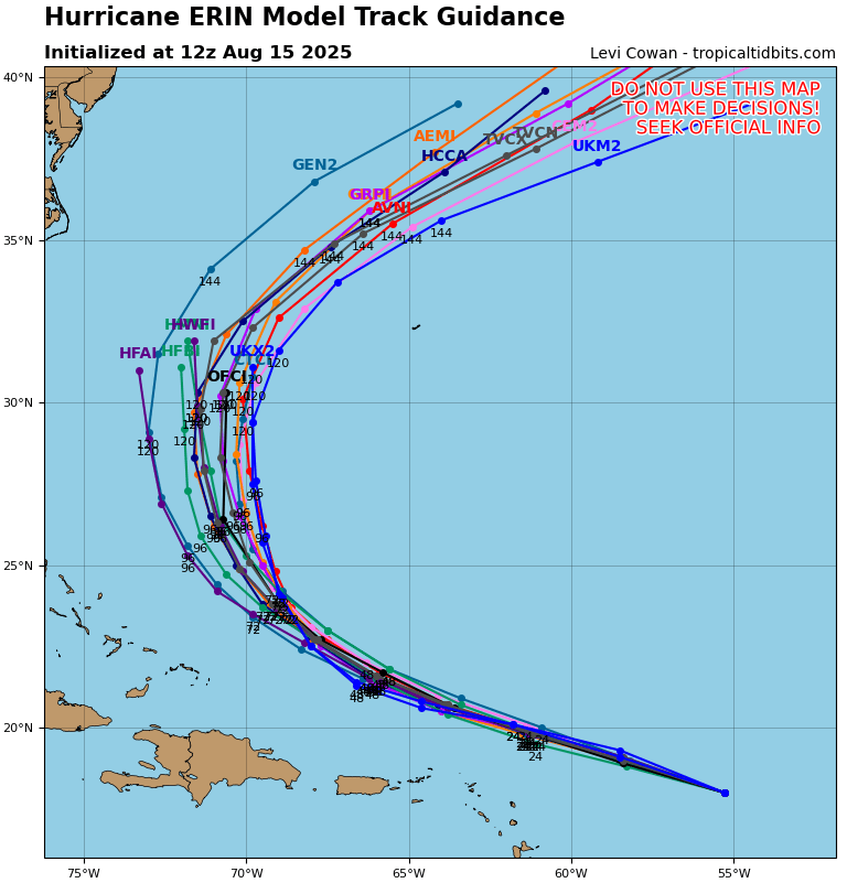
Heading into next week, Erin will begin to feel some wind shear and start advancing toward cooler water, so we’ll see a slow decline in intensity for Erin, with most modeling bringing it back below major hurricane intensity by Tuesday or Wednesday.
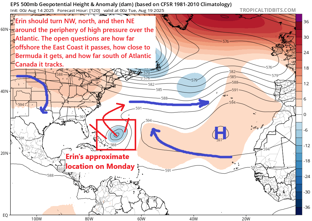
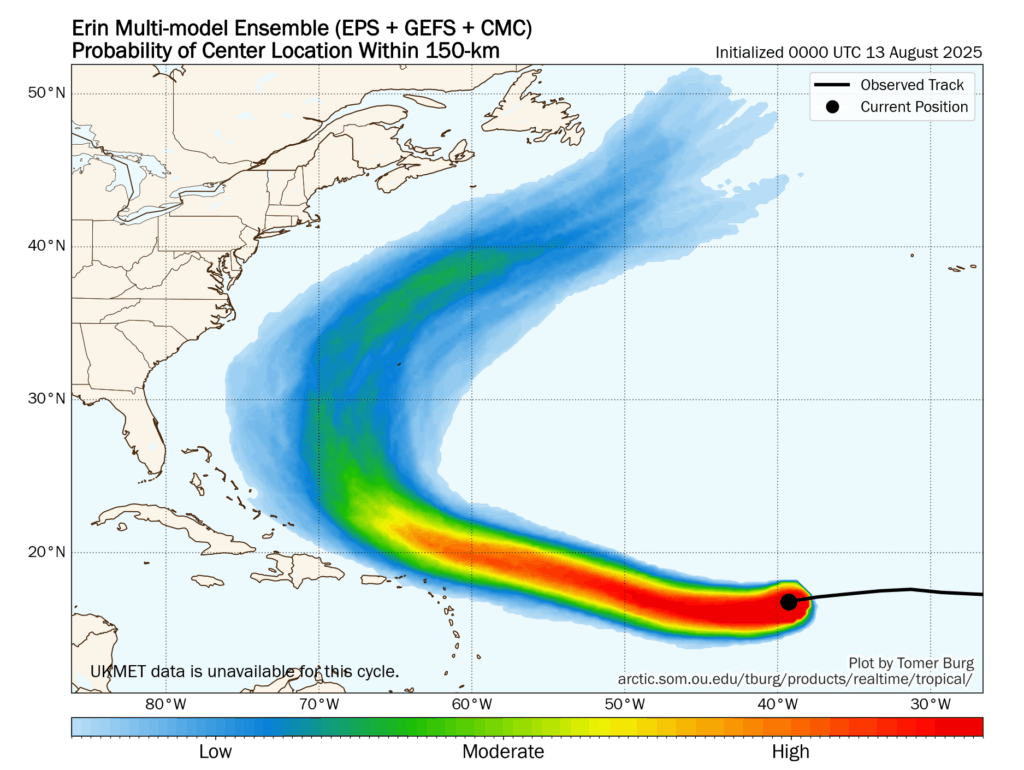
How about track? Well, we’ve got good agreement today. At present, we’re seeing some wobbles and subtle shifts southward, so there could be some additional adjustments to the track forecast above, but in general, modeling agrees that this will slow down and turn northward by early next week, pass well off the East Coast and west of Bermuda and south of Atlantic Canada while heading out to sea.
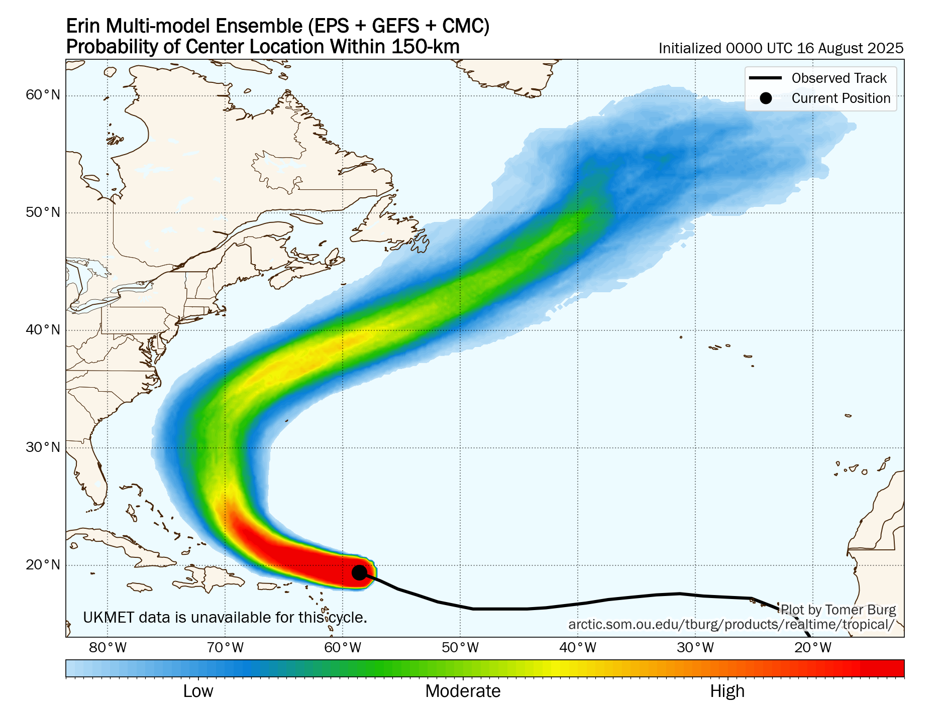
Erin is going to grow in size, so for folks in Bermuda, it will be important to recognize that even though Erin is likely to weaken on its way out, it will be larger in size, which means a close pass, even west of Bermuda could bring some direct or fringe impacts. The biggest questions right now are on the exact timing of various turns.
I don’t want folks to pay too much attention to the wobbling or even track shifting we see north of the islands right now. I see this with every strong storm that occurs. While that stuff does matter in the near term, it should not have a major impact on things in the long term. Powerful storms like Erin tend to wobble and meander a little on the general heading they’re moving in, and it’s not at all uncommon for a storm to deviate from the forecast track by a good bit in the short term before correcting back in time.
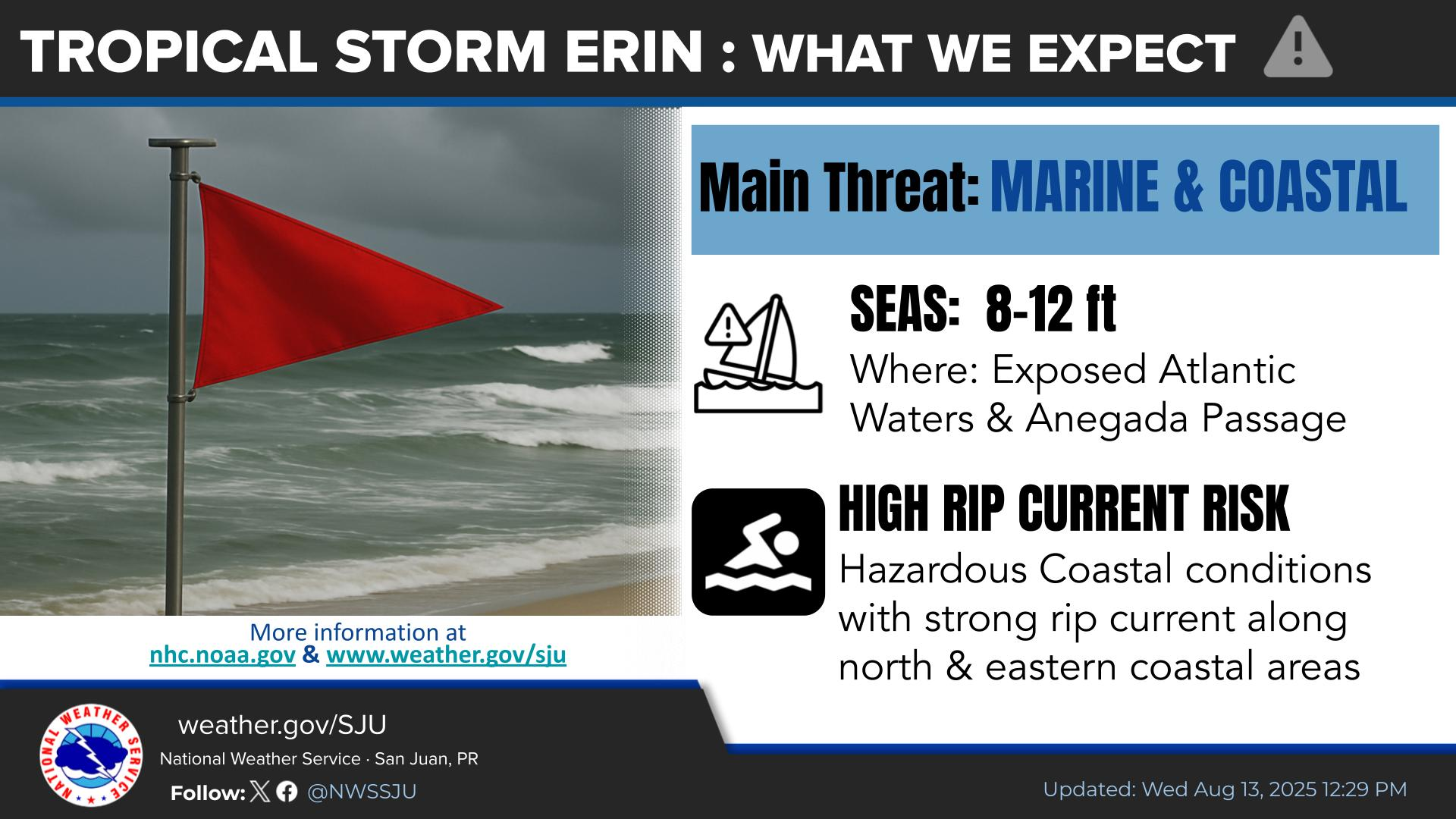
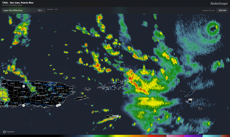
For folks in the islands right now, experiencing heavy rain and gusty winds, yes, continue to monitor Erin, but again, the worst of this will stay north of those islands.
On the East Coast of the U.S. and in Atlantic Canada, get ready for rough surf and strong rip currents. That will be increasing in the days ahead. Folks planning a late summer vacation next week to the Jersey Shore or Outer Banks or wherever just want to keep in mind that swimming conditions may be suboptimal or even unsafe at times.
So, bottom line on Erin:
- Should become a category 5 storm, as it is one of the fastest intensifying Atlantic storms known in the historical record.
- Track will wobble and meander off course at times; this is normal for elite hurricanes and it doesn’t portend a significant forecast track change.
- Currently not expected to directly impact any land.
- Locally heavy rain and gusty winds in the northeast Caribbean today and tomorrow from outer bands and squalls.
- Rough surf and rip currents likely to become an issue on the East Coast next week.
- Bermuda should continue to monitor Erin’s progress closely.