In brief: Tonight’s late post serves as a table setter for the upcoming week, with no tropics concerns thankfully. However, a major heat wave is going to overspread much of the country. We check on details there, as well as some talk of other challenges of note.
Editor’s note: This week begins the relocation process for me from the Houston area back to the Northeast. Nothing will change with my work here with The Eyewall or at Space City Weather. That said, the next week or two will be quite frenetic so please bear with us, as posts will be fairly infrequent.
While I do have time this Sunday evening, I wanted to step through some major weather news for the upcoming week. I encourage you to read my friend and colleague’s Alan Gerard’s post from earlier today, particularly with some additional details on recent severe weather and Western U.S. fire weather.
Tropics
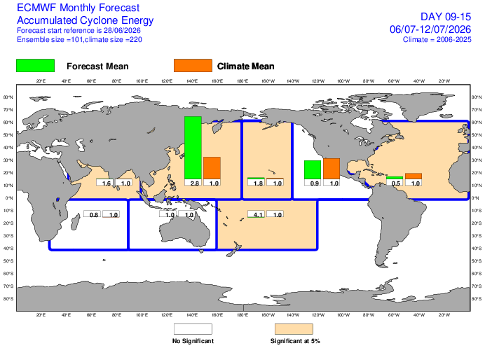
Let’s start with the easy stuff. There do not appear to be any realistic tropical concerns over the next 7 to 10 days. Nothing is forecast this week, and looking at the subseasonal European model’s outlook, there appears to be no real risk of much of anything next week.
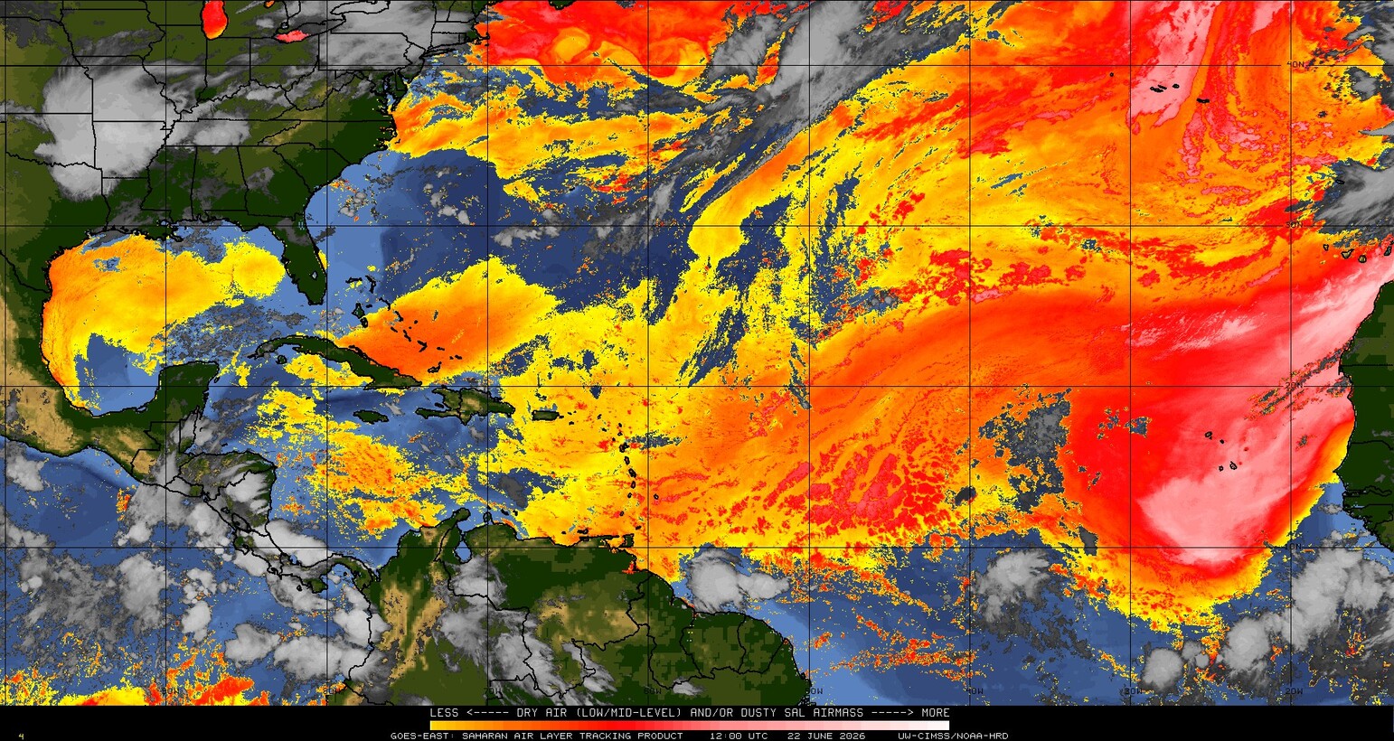
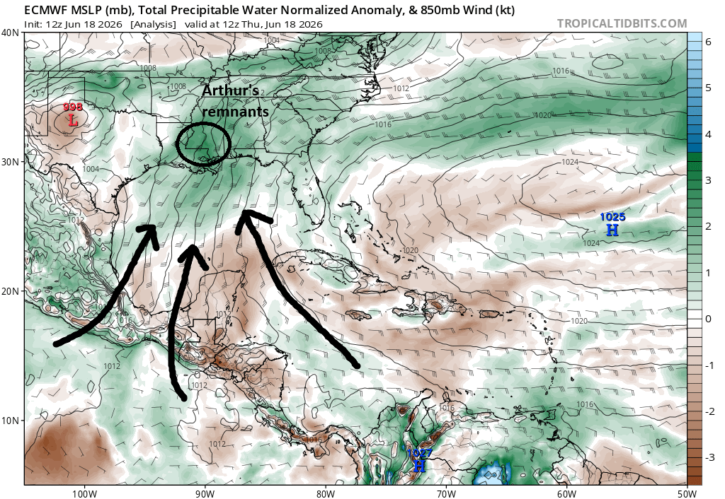
It’s actually somewhat fortunate, as the overall pattern over the U.S. this week would favor some broad flow toward the Southeast or Gulf. But with plenty of dust and not many disturbances, we should be in good shape.
Heat Wave
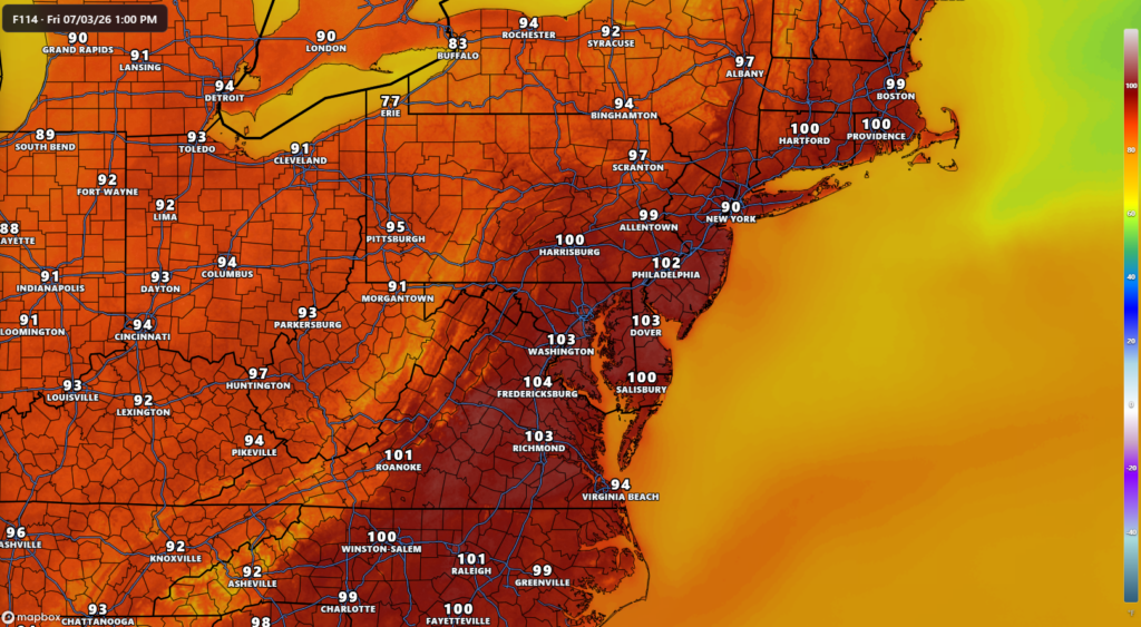
We have an absolute roaster coming to the Eastern U.S. over the next week. This is not your average heat wave. The forecast high temperature for Washington, DC on Friday is 103°. This level of heat has been hit only 21 times since decent records for the Reagan National Airport site began in 1871. DC last did this in 2024, when it hit 104 degrees. Some modeling does indicate that temperatures could even pass 103 and head toward 104 or 105 degrees. Unlike in many parts of the country, the all-time DC record of 106° has resiliently stood since 1930. This is also the case for places like Philadelphia and Baltimore, that have held some of these heat records for over 100 years. Urbanization and climate change have helped along nighttime lows and daytime highs significantly in recent years overall, but it’s a little tougher on some of these individual days. Though as we saw recently in Europe, it’s not out of the question we do it this week.
While the heat may not be quite to the max levels as we see in the East, the Midwest will be dealing with multiple days of excessive heat as well. The forecast for Chicago over the next week is painful.
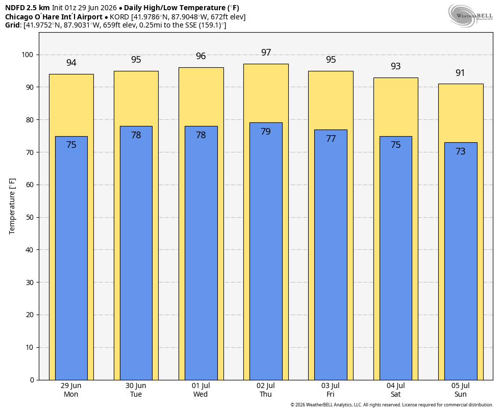
The next five days will also see substantial humidity, pushing virtually every heat metric we use into “extreme” categories, meaning outdoor conditions will be unsafe, not just for vulnerable individuals, but also for some normal people too. Particularly with nighttime lows never cooling off much below 80 degrees at night, this sets up a health concern for folks without access to air conditioning.
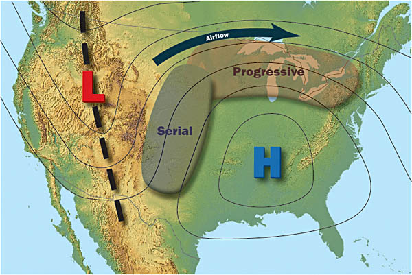
The simple explanation for this heatwave is just a really, really strong area of upper atmospheric high pressure, what we often hear referred to as a “heat dome” or “death ridge.” Cheeky nicknames though they are, these types of high-pressure systems are notorious for some of the hottest weather we see in a summer. And at this intensity, you’re talking record risks.
By the end of the model loop above, you can see that ridge of high pressure begin to break down and retreat. This will lead to a gradual relaxation of the heat heading through the holiday weekend.
Another element of this setup we’ll have to watch are thunderstorms.
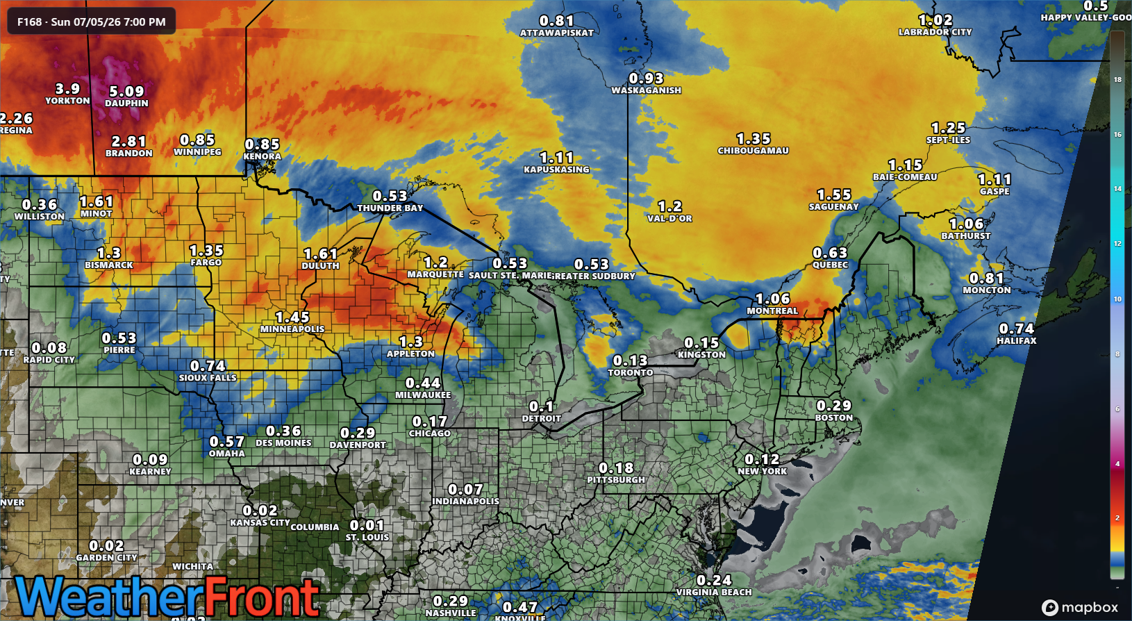
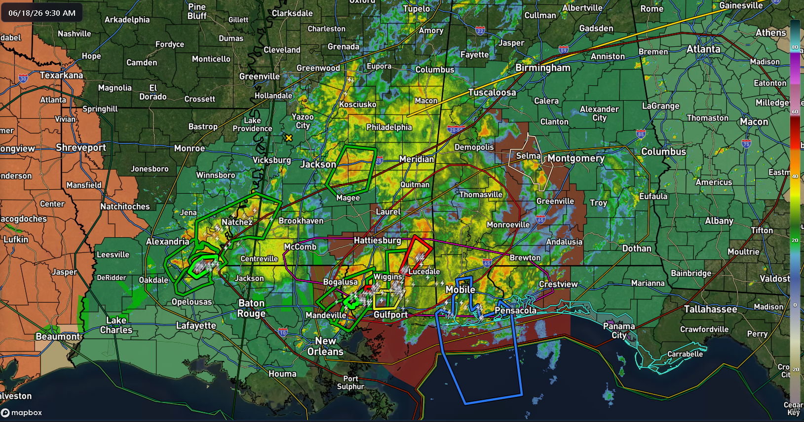
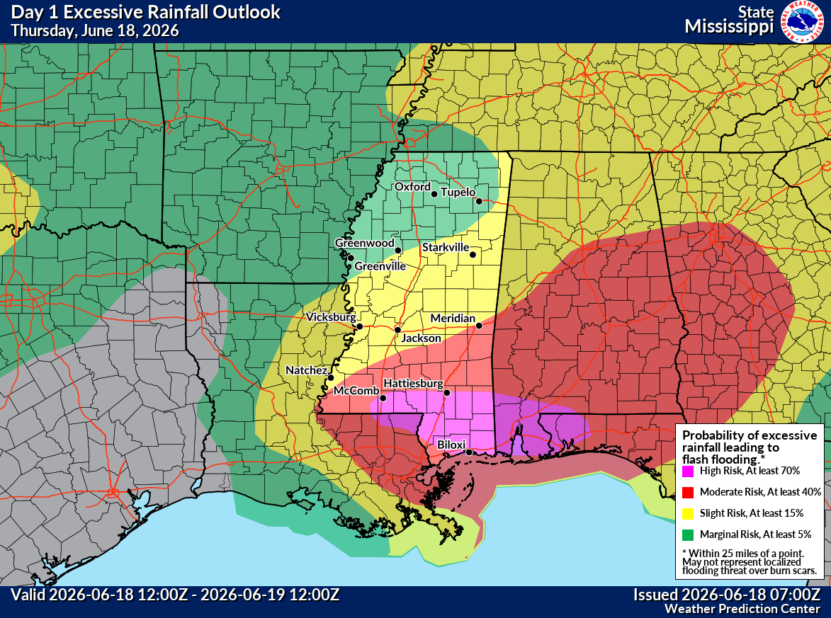
You can see the evidence for the ridge over the Midwest, and what happens (as we discussed last week) is you get thunderstorms riding the ridge periphery. In this case, the most likely areas to see thunderstorms will probably be across Ontario, Quebec, and perhaps Maine. We could see a couple complexes of storms come closer to Upstate New York, New Hampshire, Vermont, Michigan, Wisconsin, or Minnesota. Rain amounts will vary based on how well organized these storms are and exactly where they track. Additional scattered thunderstorms are likely on the south side of the ridge from Florida across the Gulf Coast and into perhaps Louisiana and Texas.
Other items of note
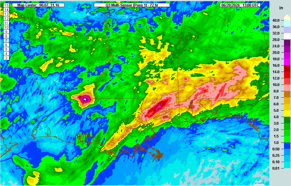
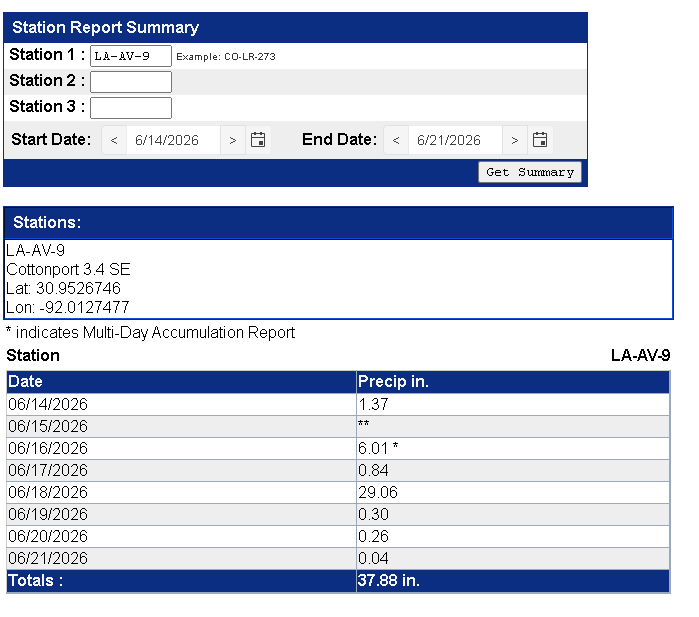
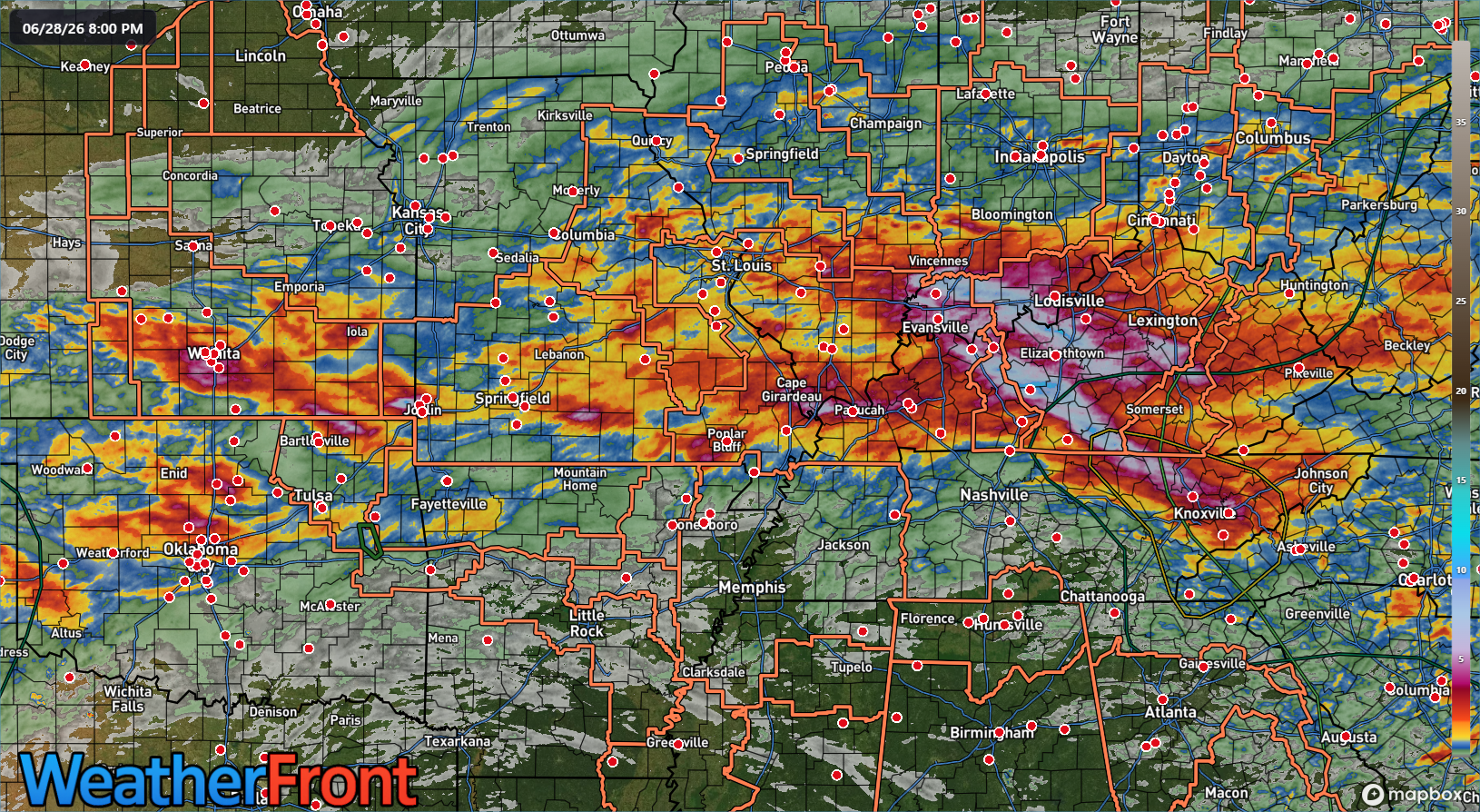
We had some severe flash flooding this weekend in Kentucky and Indiana that has left several people dead. Rainfall estimates over the last 72 hours top 10 to 12 inches in spots.
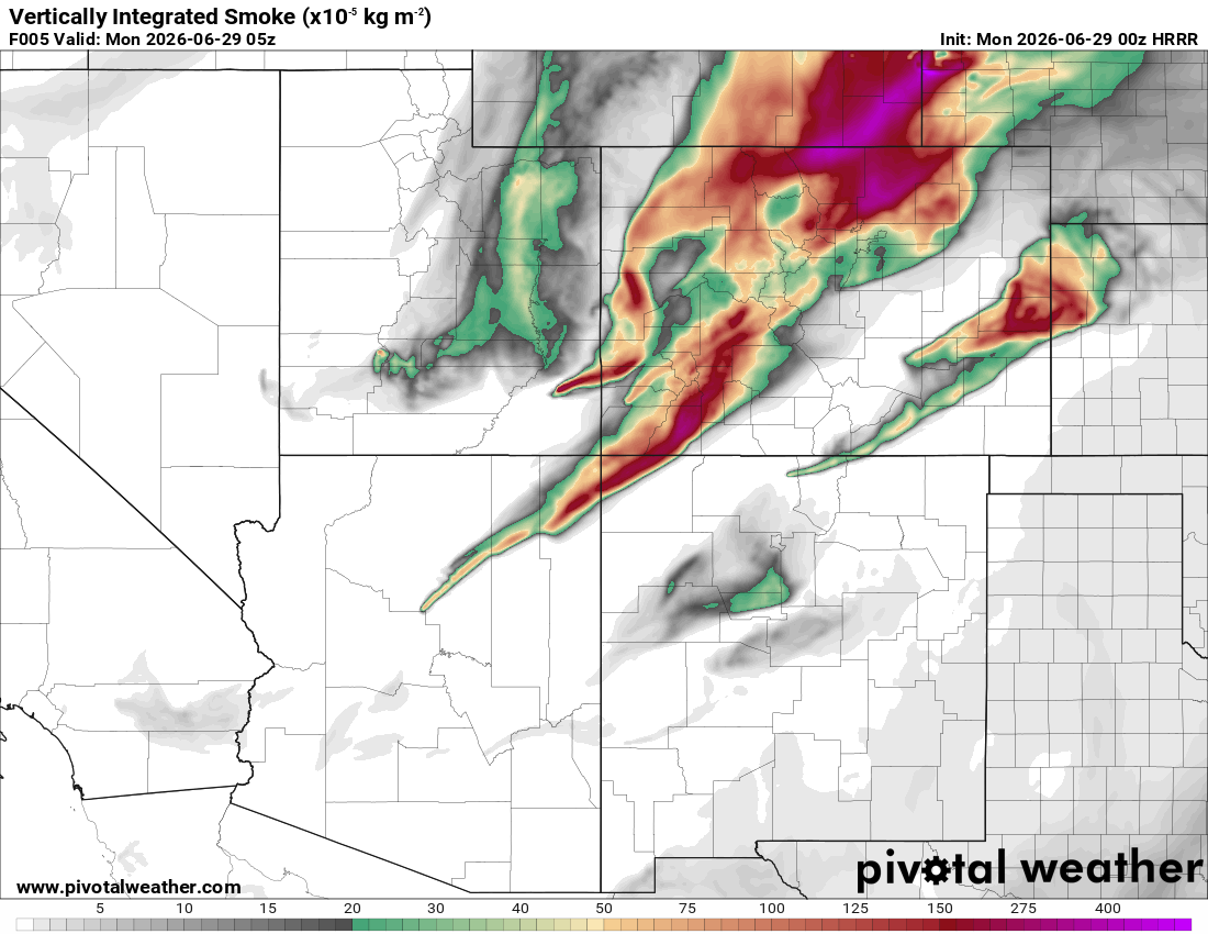
On the opposite end of the spectrum, we’re seeing some pretty severe wildfire activity in the West now. Aside from the numerous threats to life and property ongoing from those fires, we are also likely going to see an enormous amount of wildfire smoke spreading across parts of the country, starting in the Rockies and Plains over the next few days. We’ve already seen it happening at times. This problem is likely to continue. Hopefully cooler weather in the West will help with suppression efforts.
Air quality issues are likely at times, especially around the periphery of the high pressure ridge this week in the Midwest and East. This may impact the Upper Midwest, Great Lakes, Canada, and parts of New England.
Whatever the case, the weather is quite busy right now, and the focus turns to heat this week.
More when we are able. Thank you for everyone’s patience!