In brief: A developing storm in the Eastern Pacific may combine with an unlikely to develop disturbance in the Bay of Campeche to deliver a significant rainfall to Mexico or parts of far South Texas later this week. Otherwise, the tropics appear quiet.
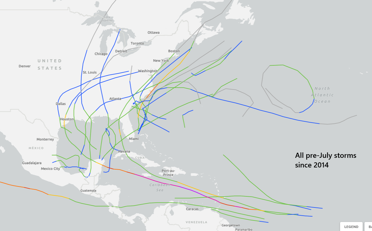
We do not expect any tropical development in the Atlantic this week. But there is still a disturbance to discuss in the Bay of Campeche later this week, as well as continued Pacific activity.
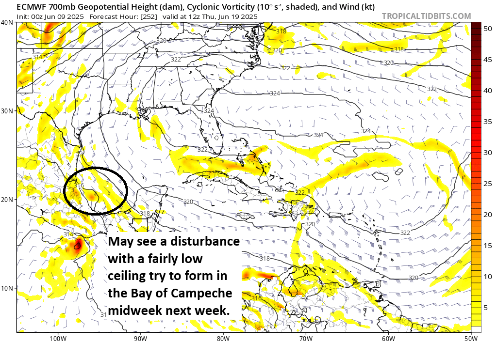
Bay of Campeche disturbance
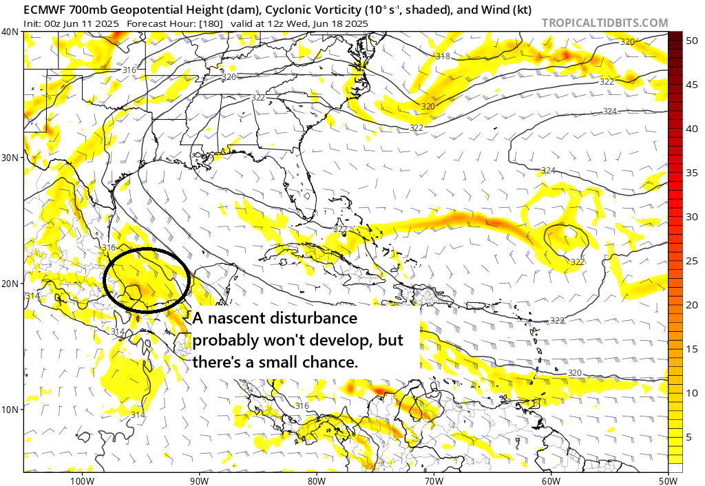
While we do not expect any organized development in the Gulf or Caribbean this week, a disturbance we’ve been discussing for about 7 to 10 days now is going to arrive in the Bay of Campeche around midweek. Because of how close it is to the coast and the steering currents aloft, it should quickly move ashore before it has any time to develop.
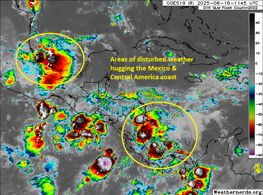
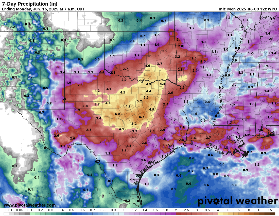
The overall upper pattern once it gets inland, however, will feature a slowing system, as well as assistance from what should become Tropical Storm or Hurricane Erick (currently Invest 94E) in the Pacific. With Erick coming ashore likely in Oaxaca or Guerrero, and the Bay of Campeche disturbance coming ashore between Tampico and Veracruz, we are likely to see a substantial amount of moisture plow into that part of Mexico.
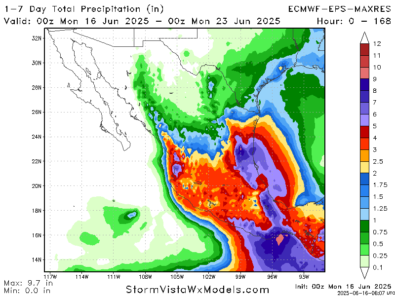
Models are currently hinting that 4 to 8 inches (100-200 mm) could fall in eastern Mexico from this scenario (and in southern Mexico). It is possible that some of that moisture makes it as far north as the Rio Grande Valley, which could also lead to heavy rainfall in parts of South Texas. We’ll keep tabs on this through the week to see how the rainfall forecast evolves across Mexico and Texas.
Eastern Pacific
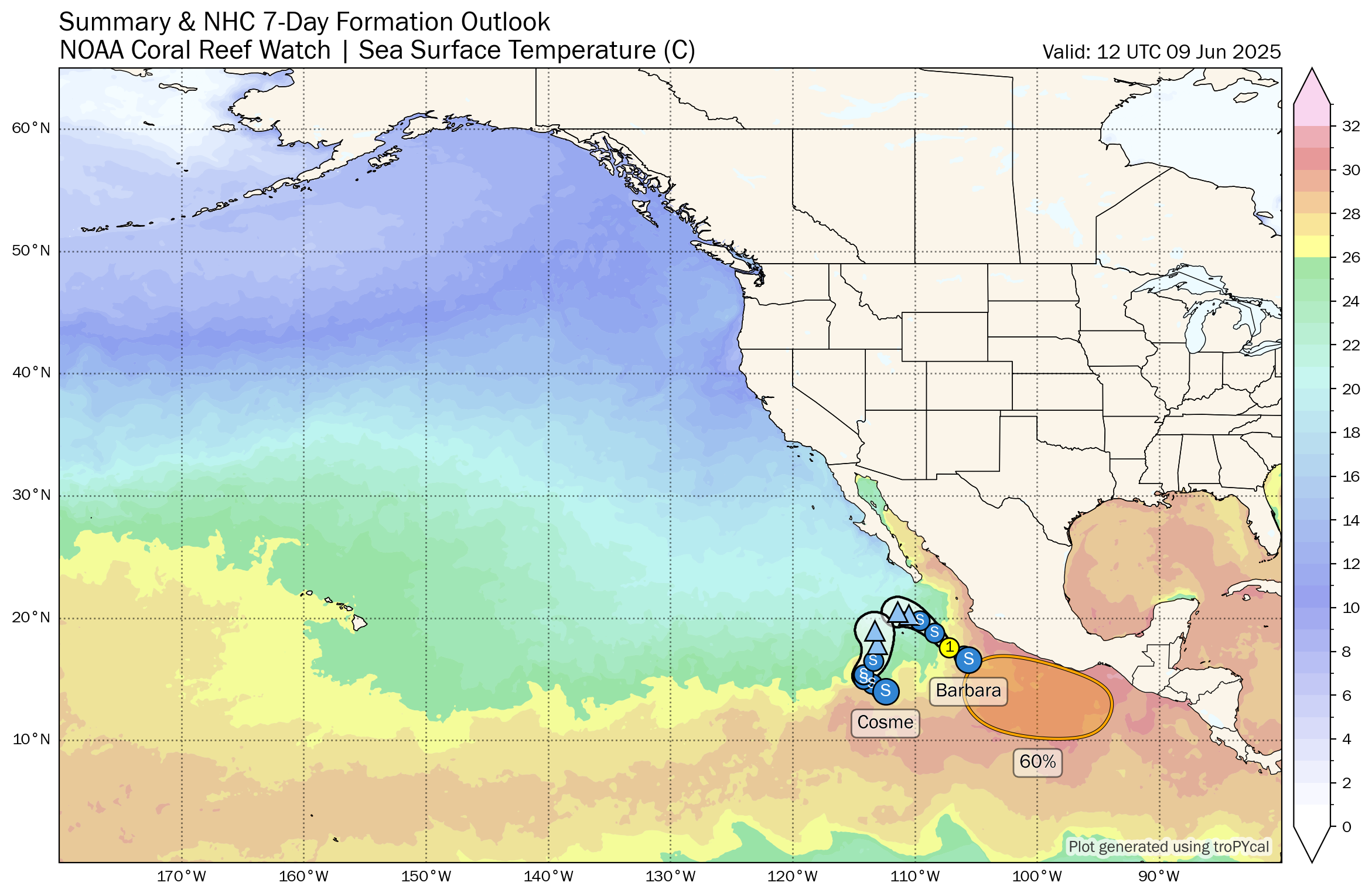
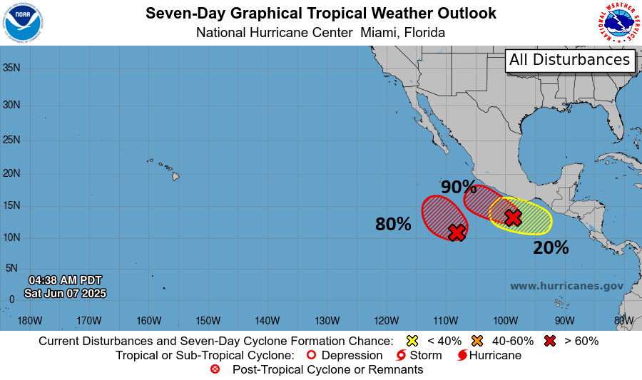
Invest 94E in the eastern Pacific, as noted above, is likely to become a tropical storm or (perhaps) hurricane named Erick this week. The ultimate destination is probably somewhere in Oaxaca or Guerrero in southern Mexico. Models have been somewhat polarizing on how strong this one gets, but in general,
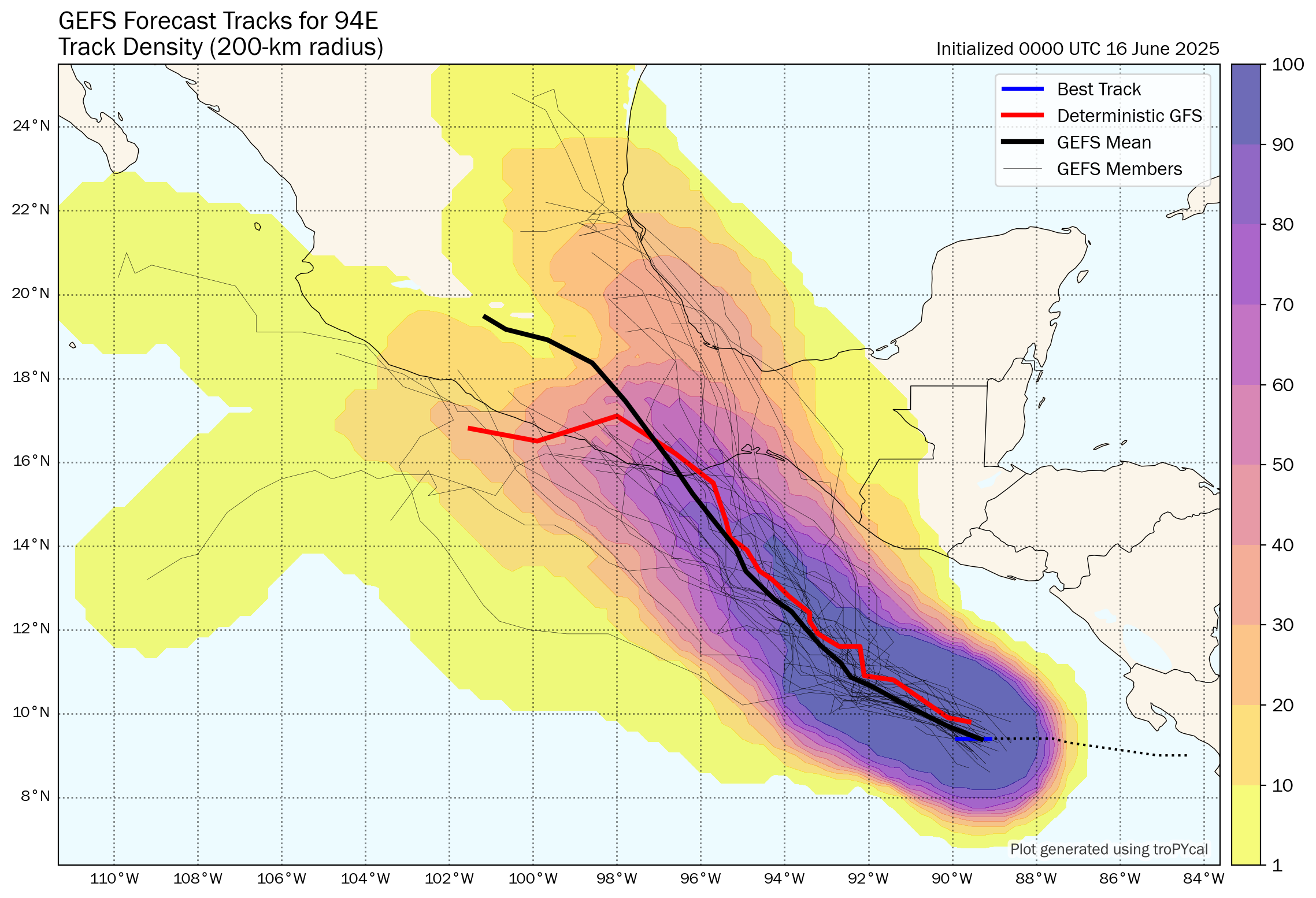
Right now the disturbance sits off the Mexican coast, rather disorganized. But over the next 24 to 48 hours, we should see 94E slowly get together. From there it should track northwest toward the coast of southern Mexico, arriving by Thursday. There’s a pretty wide berth of options with this one as you can see above. While the track density seems to point it toward Playa Zipolite or Puerto Escondido, I would not focus too much on the direct track of this one, as the moisture from it is likely to cause widespread flooding issues in Mexico later this week.
Looking ahead
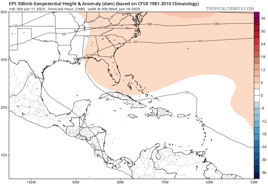
The somewhat favorable pattern that established over Central America and has helped fuel a lot of the Pacific activity this month looks to break down over the next week or two. We may start to see a few tropical waves emerge off Africa with a little more robustness before June is out, but I don’t currently believe the pattern looks especially favorable for any meaningful tropical development in the Atlantic over the next 2 weeks. We’ll see if that changes at all.