Headlines
- Tropical development, while not likely in the Gulf cannot be entirely ruled out as heavy rain will continue to pile up for portions of coastal Texas and Louisiana.
- The next wave in the Atlantic remains unlikely to develop til it gets to the Caribbean.
- From there, we have a lot of questions and very few answers, but it bears watching, particularly for the Gulf and Caribbean.
- Farther out in the Atlantic, we have some waves to watch, but none looks to be a concern at this time.
Gulf of Mexico: Low development odds, coastal soaking underway
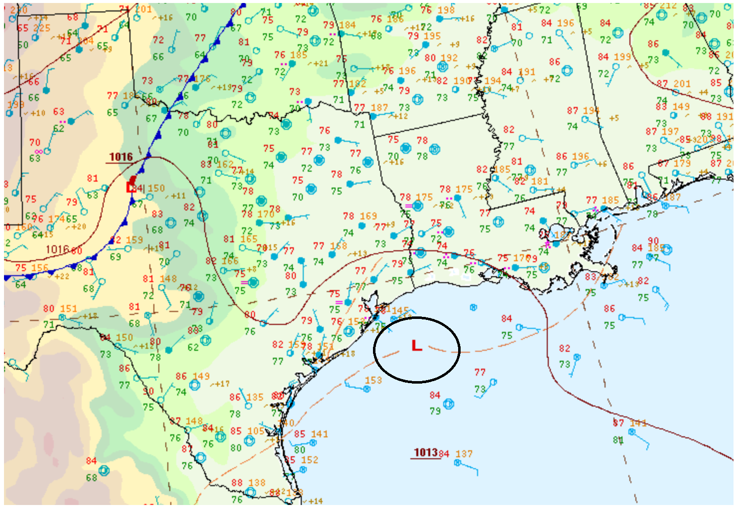
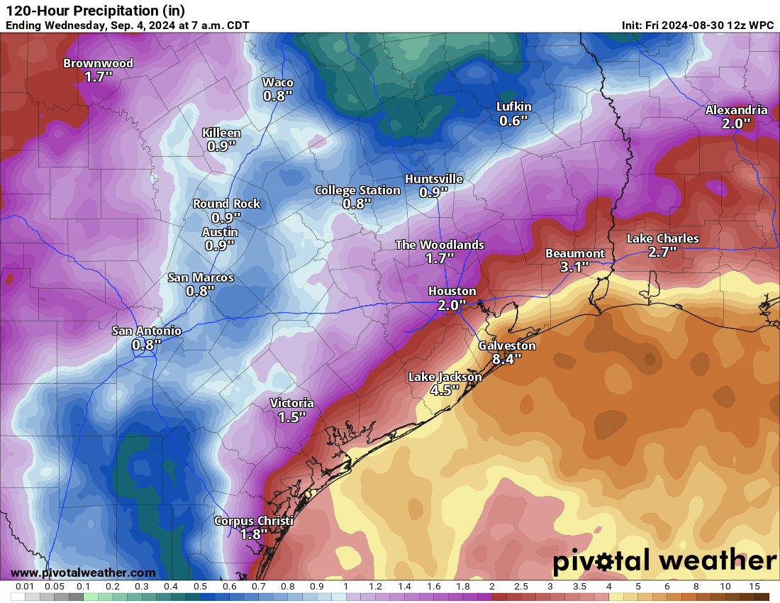
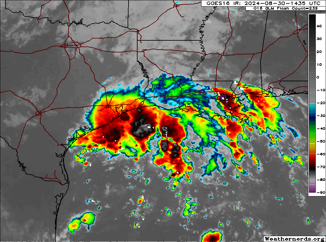
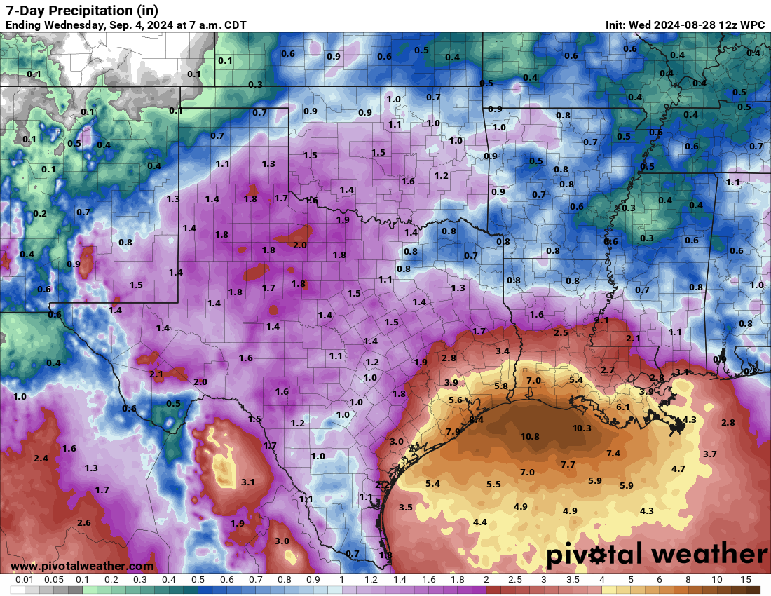
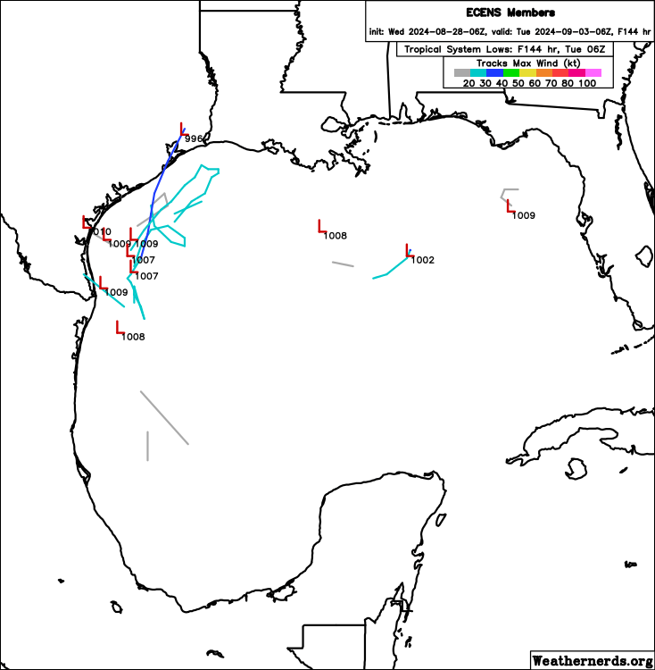
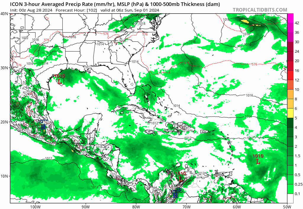
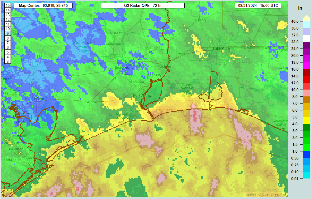
We continue to see low pressure meandering around the northwest Gulf today. As of this morning, it was centered right along the coast near High Island, TX. Heavy rain was funneling in through Sabine Pass and Port Arthur. So far this week, portions of coastal Jefferson County, TX have seen about 7 inches of rain or more. And there are even hints on radar of 8 to 10 inches just east of Sabine Pass and across coastal Cameron Parish in Louisiana.
Over the next few days, we’ll continue to see this low mosey about in the Gulf or along the coast. The proximity to land is one reason significant development is unlikely from this over the weekend. This will probably continue to trek back and forth between Matagorda Bay and Cameron Parish through Wednesday or Thursday before eventually kicking off to the east or northeast with an approaching cool front.
With tropical development possible but not especially likely, the main issue with this will continue to be locally heavy rainfall. Through Tuesday morning, we could easily see another 2 to 5 inches of rain, with higher amounts possible in coastal areas.
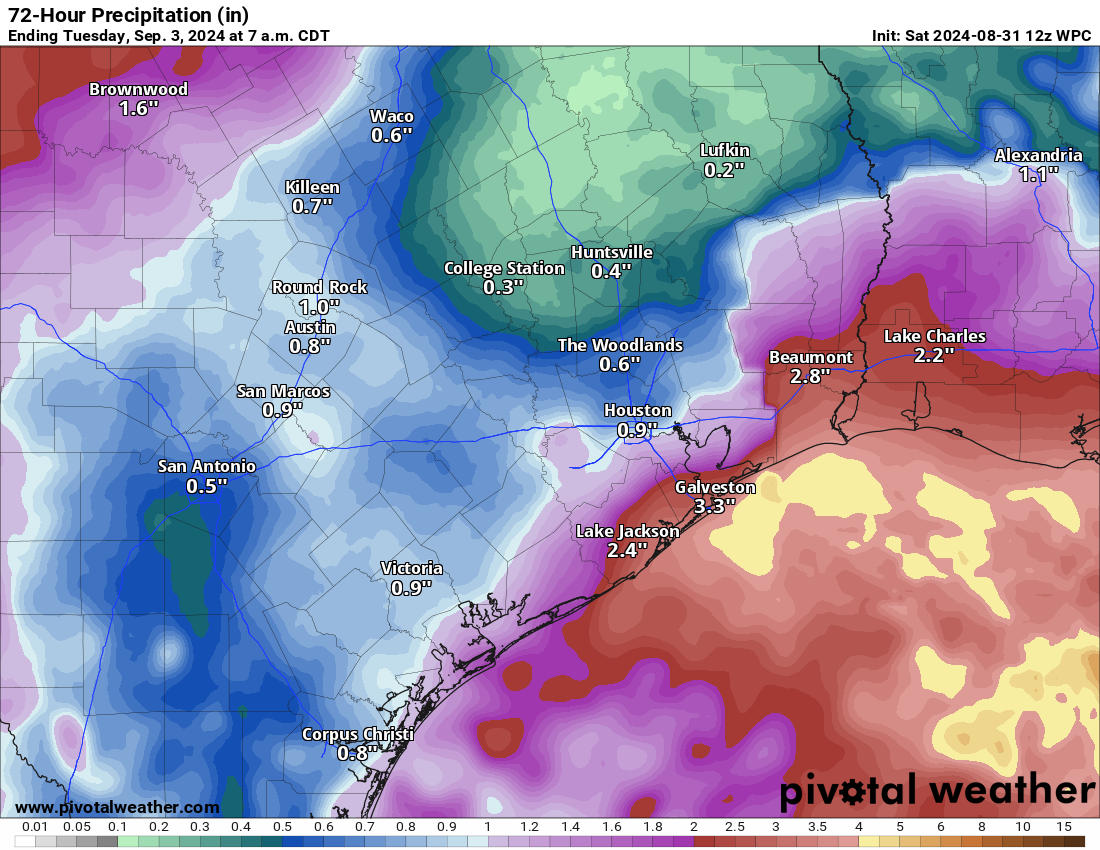
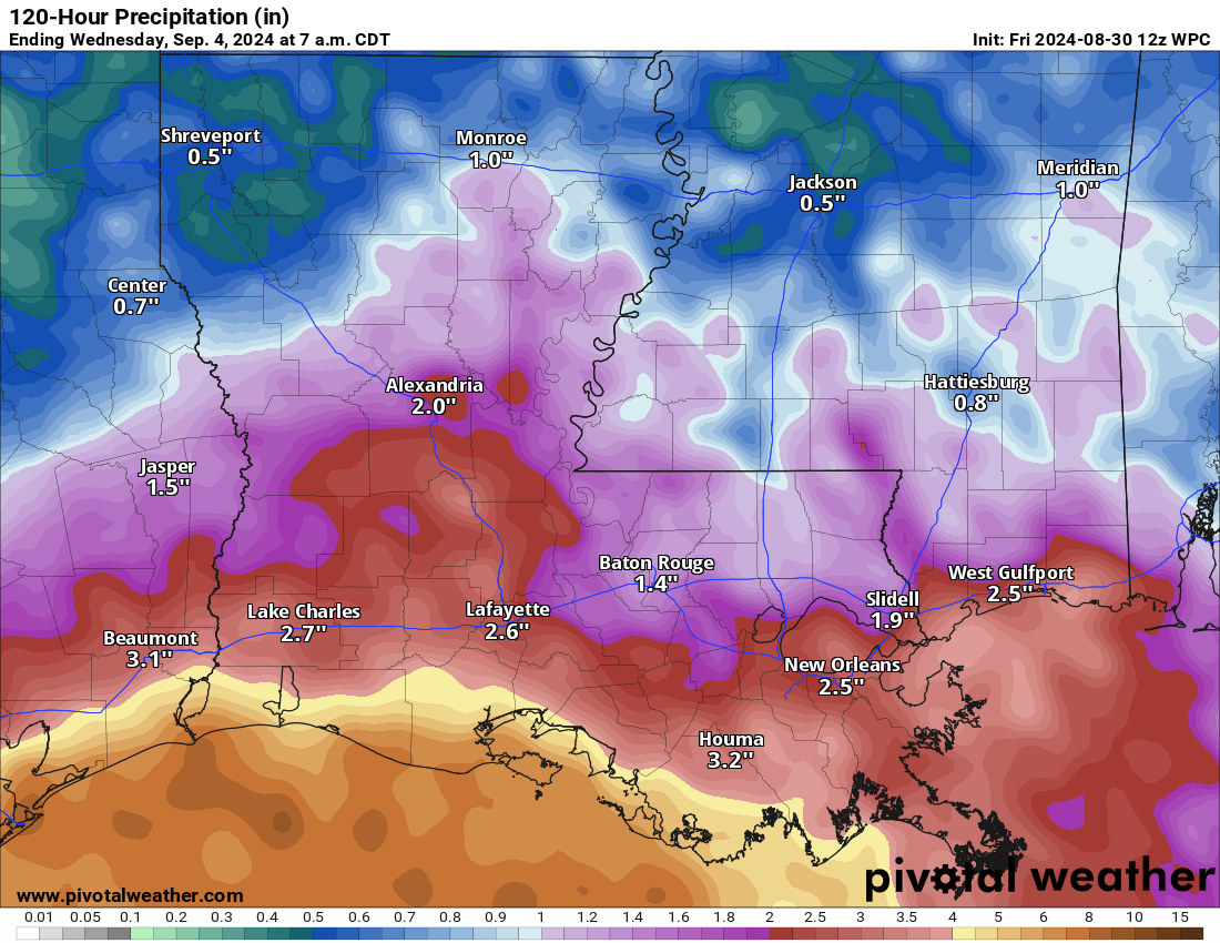
Inland areas, such as in Houston are likely to see some showers, drizzle, or rain but nothing serious. Flash flooding and street flooding are growing possibilities between Galveston and Cameron, with the Sabine Pass through Port Arthur areas probably the most susceptible at the moment. Flood watches remain hoisted east of this area for New Orleans and Baton Rouge as well. But the heaviest rains will fall closer to the Texas/Louisiana state line.
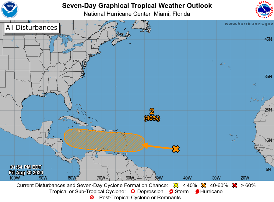
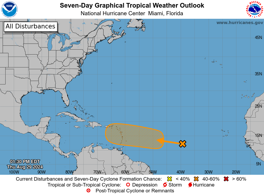
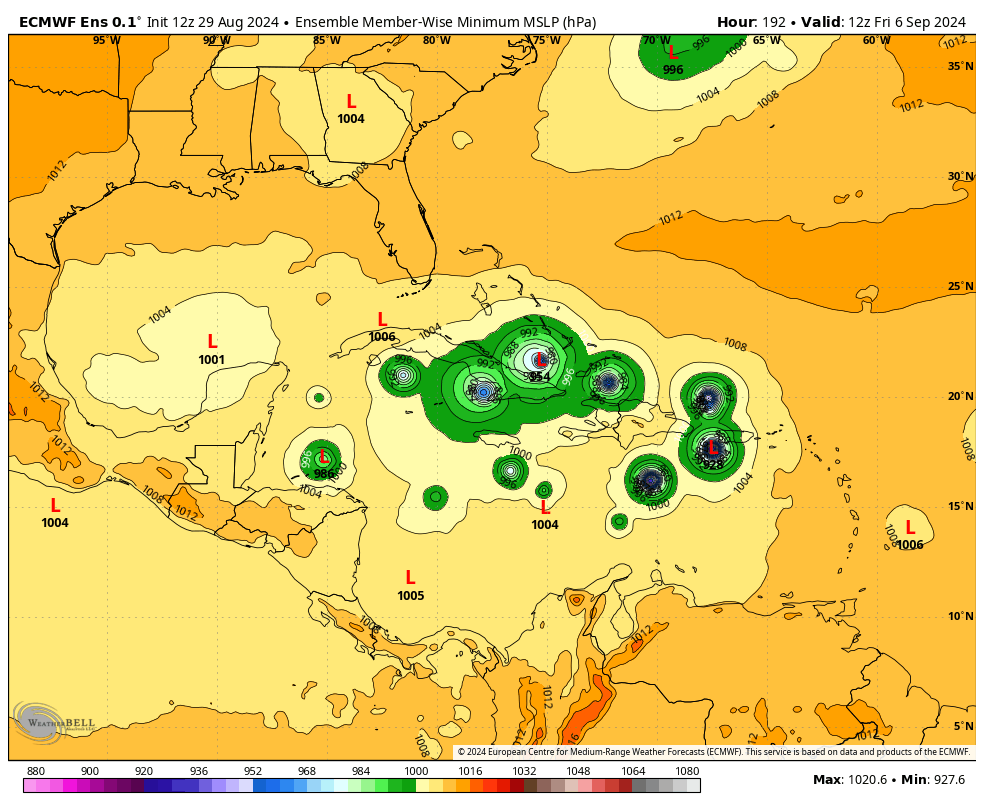
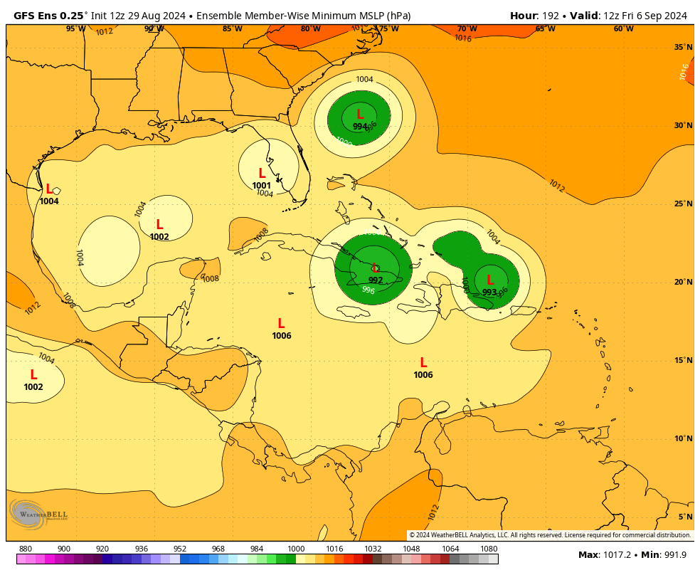
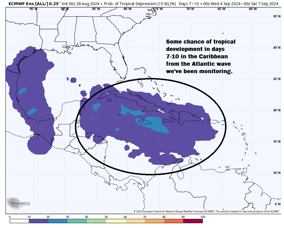
Caribbean system: Far too early to do much other than watch
The wave that we’re going to watch in the Caribbean remains east of the islands this morning, a bit strung out and very poorly organized.
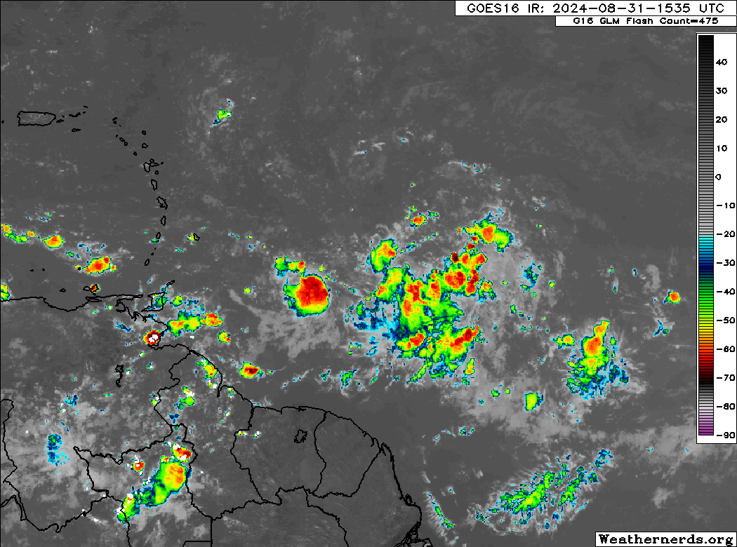
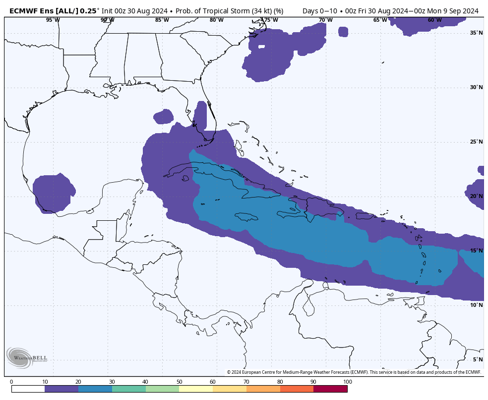
This one is in no hurry to develop. In fact, I would not be shocked to see this struggle over the next four to five days. The latest NHC outlook has bumped odds to 50 percent over the next week. A look at last night’s European model shows the system south of Hispaniola by Wednesday morning. It would be unlikely to be developed much at this point. Conditions in the eastern Caribbean are far from ideal for tropical development, so it seems as if this is going to struggle for a bit.
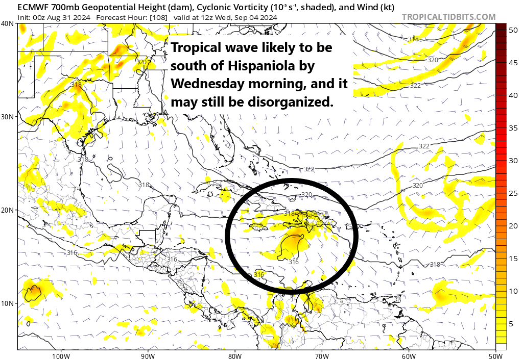
Once it gets past about this point, conditions for development will steadily improve, likely leading to strengthening and organization. To what extent and how far it gets in that process remains to be seen. By about next Saturday this system would probably be somewhere between Belize or western Cuba. A weaker system would be more apt to stay south and track into Mexico or Central America, whereas a more rapidly developing system would start to turn more northwest. But for the sake of simplicity this far out, let’s assume it’s somewhere in that bubble. If we look at a weather map next weekend, we can see a cold front rather far off the Gulf Coast. This is associated with a pretty deep trough over the East Coast.
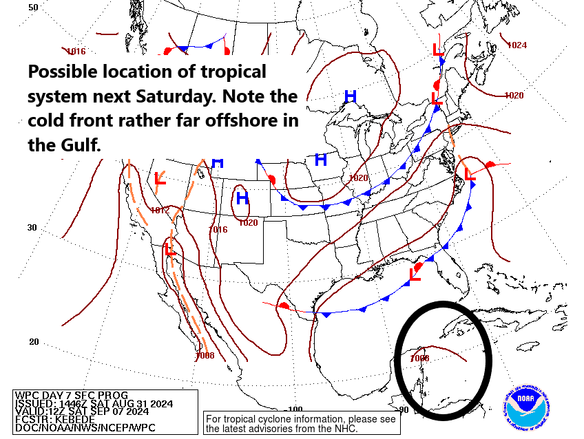
Meteorologically, I would think that any sort of meaningfully strong tropical system would be captured by this trough and forced northward at some point. A system that doesn’t develop would probably keep tracking west. When I looked at the European ensemble this morning, I noticed this sort of bifurcated outcome, with one cluster going west and one turning north at varying points. It’s way too early to speculate on anything specific here, so I’ll leave it at that. Anything in the western Caribbean is of concern.
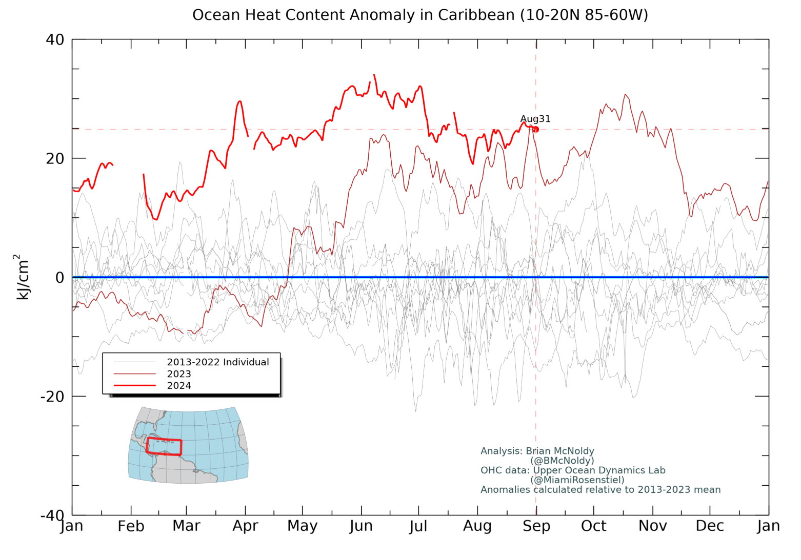
The ocean heat content in the Caribbean is as strong as we’ve ever seen this time of year and prior to last year, the strongest we’ve ever seen. This is an indicator that there is a large reservoir of deep, warm water available for a tropical system to feast on. I often joke that the Caribbean is always supportive of big storms. This year, it’s supportive of big storms for longer.
We’ll continue to watch the positioning of the cold front. We’ll continue to watch the intensity of the trough. And hopefully we have a little bit more news to share on Monday or Tuesday. For now, continue monitoring this one, particularly in the Gulf and western Caribbean.
Next waves up
The next item on the docket is a tropical wave in the eastern Atlantic. This one has a low chance to develop over the next few days and would likely remain out to sea. The next wave emerging off Africa this weekend has perhaps a better shot to develop later next week in the eastern Atlantic. That too looks like it may remain out at sea.
Neither of these are a concern at the moment. Beyond that, we don’t have anything else of note to watch, which is good news.