In brief: We have an update on Melissa’s damage and some other news stories that have emerged in the wake of the storm. We also take a quasi-deep dive into flooding that hit New York City on Thursday. It wasn’t necessarily unexpected, but its impact was probably worse than expected. Also, a look at the upcoming week and an atmospheric river event in the West.
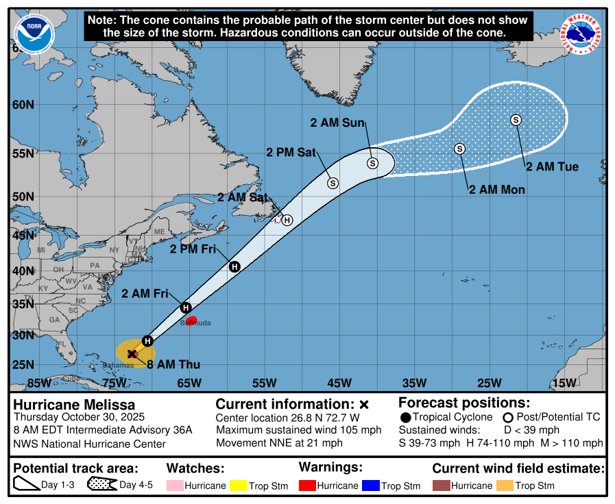
Melissa’s latest
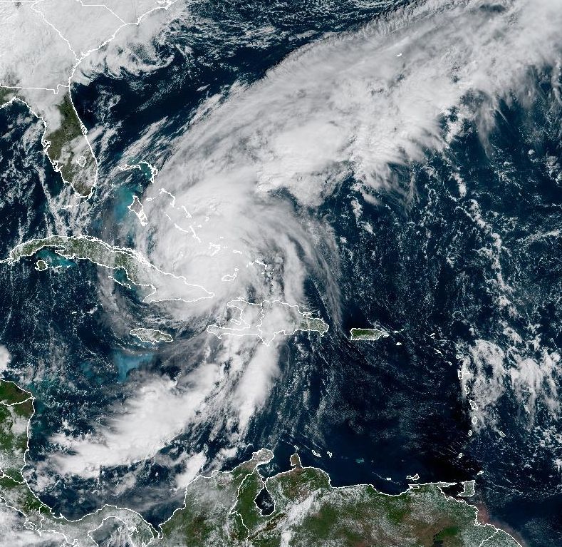
The death toll has surpassed 60 in the Caribbean, including 28 in Jamaica and 31 in Haiti from Melissa. Relief is slowly trickling in, but the logistics of getting to a place like Black River is exceedingly difficult at the moment. The tangential effects of a storm like this are starting to come to light as well, as the farming and fishing sector of Jamica, broadly, not just in the hardest hit areas will be greatly impacted in the months ahead. Other perspectives, such as from Canada where seasonal workers contribute a great deal to their agriculture sector have provided some additional context on how this has and will impact the country.
We’ll repost our list of links here that point to organizations directly helping affected areas.
United Way of Jamaica will donate directly to Jamaicans in the affected areas.
The American Friends of Jamaica is a fund that has been active for decades helping Jamaica.
Give Directly will provide cash relief directly to those impacted by the storm.
Samaritan’s Purse has set up a field hospital in Jamaica and is sending aid as quickly as possible.
The Center for Disaster Philanthropy which is focused on medium and long-term recovery. When the media and volunteers all leave, there will still be enormous amounts of work to do to recover from a storm of this magnitude. CDP works to help fill that gap.
New York City flooding
Lost in the headlines around Melissa and probably Halloween was a pretty terribly flooding event that hit New York City on Thursday.
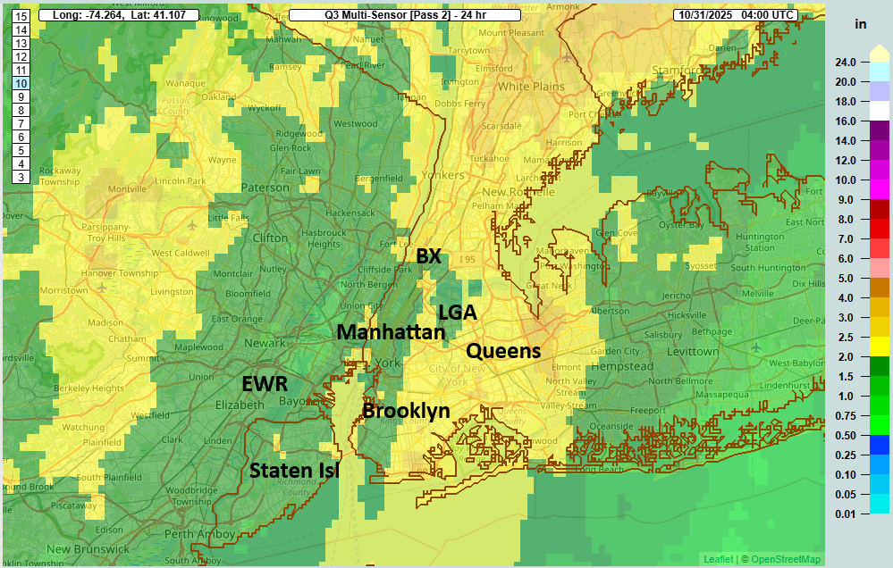
Two people died, one in Manhattan and one in Flatbush, Brooklyn after being trapped in flooded basements. This has some echoes from Hurricane Ida’s remnants in 2021, which killed over 12 in Queens, many in basements. Radar estimated rain totals above show only about 1 to 2 inches in most of the city, with some isolated pockets of 2 to 3 on the east side of Queens and in Nassau County and north of the city. That may not seem like much, but torrential rains passed through the area between about 2:30 and 4 PM, dumping anywhere from 1 to 1.5 inches in an hour.
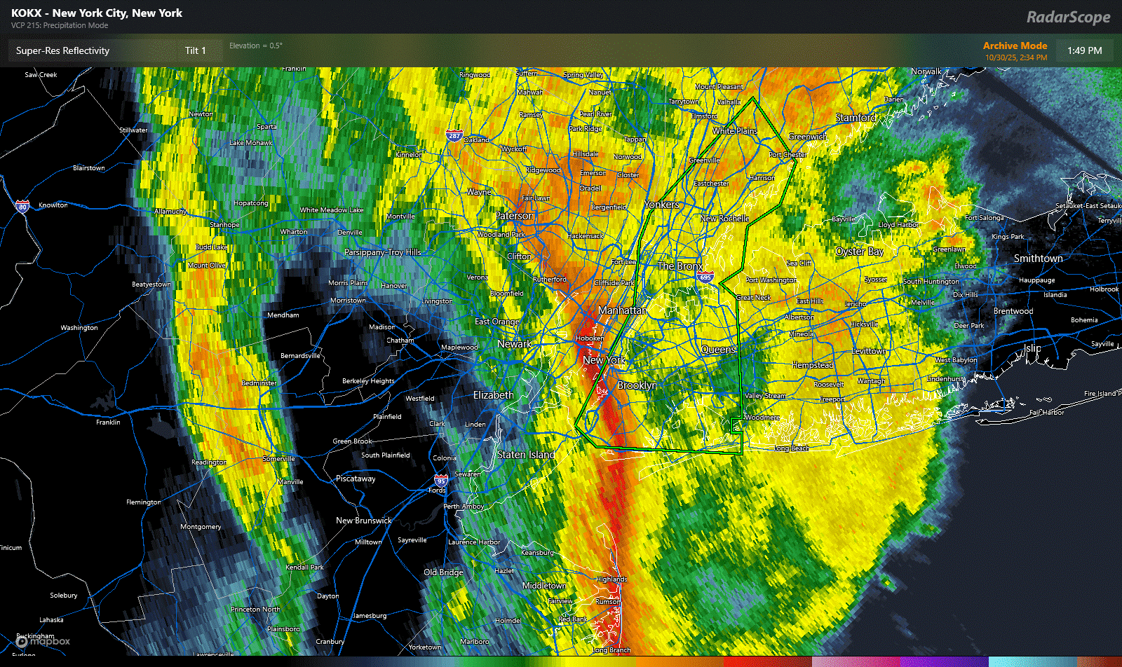
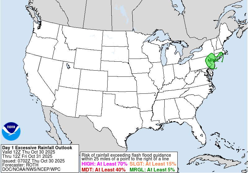
Those intense rates, coupled with New York City’s less than perfect drainage system led to very rapid onset flash flooding, exacerbated by about a month and change of below normal rainfall, which likely left lots of debris blocking drainage. The New York City area had been placed in a marginal risk (1/4) for flash flooding on Thursday.
The morning forecast discussion from the New York City NWS office described the situation that day:
The heaviest falls late Thursday afternoon and early evening as the core of LLJ (low level jet) passes, and localized rates could briefly approach or exceed 1 in/hr. Based on the 00Z HREF, the most likely location for this for be in NJ, west of NYC. This presents the possibility of mainly nuisance flooding, mainly for urbanized and/or poor drainage areas. Otherwise, the threat for flash flooding is low and localized.
The timing was spot on. The idea of urbanized and poor drainage flooding was spot on, though in this case “nuisance” probably feels the wrong word choice in hindsight, but it’s likely what had been expected. And, frankly it just underscores how serious flooding can be. This was really a nuisance flooding event brought on by the type of rain that occur in NYC more than once a year. It ended up being damaging and sadly fatal. While work on improving New York’s resilience to extreme weather continues, I think it’s fair to say that they have a long way yet to go. It also highlights the challenges of pinpointing the areas at most risk to a flash flood event. While model guidance had favored New Jersey, a slight deviation placed it over New York City. Both newer and older cities have their fair share of flooding challenges.
The week ahead
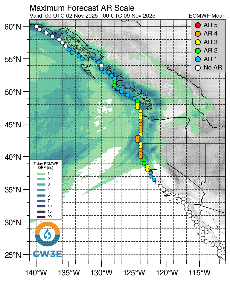
Looking at the forecast precipitation for this week, it’s pretty clear where the headlines will be: The West Coast. An atmospheric river will crash into the West Coast with a couple storms that look set to dump heavy rain and some mountain snow in the Cascades south into northern California, mainly north of the Bay Area.
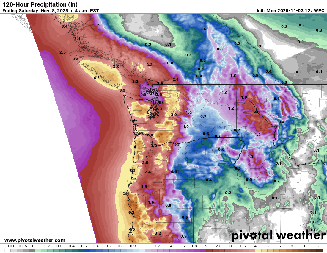
Additional heavy precipitation will fall inland across northern Idaho and the Bitterroots. This will be a fairly warm storm overall, so snow levels will be up around 5,000 to 6,000 feet in the northern Rockies and into Washington, possibly even a bit higher to the west and mostly out of reach to the south (over 8,000 feet).
The temperature maps look quite warm, especially in the Rockies, Southwest, and Plains through Upper Midwest. The fall preview we’ve been enjoying in the South will ebb away through the week.