Today’s headlines
- Cold front off the West Coast about to kick off Sierra snow blitz.
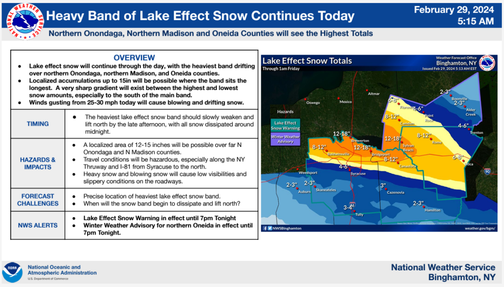
- Heavy lake effect snow just north of Syracuse today.
- Multiple days of strong winds move from the West into the Plains bringing elevated fire danger once again.
- More record warmth possible this weekend in the Midwest, Lakes, and Canada.
Sierra snow blitz
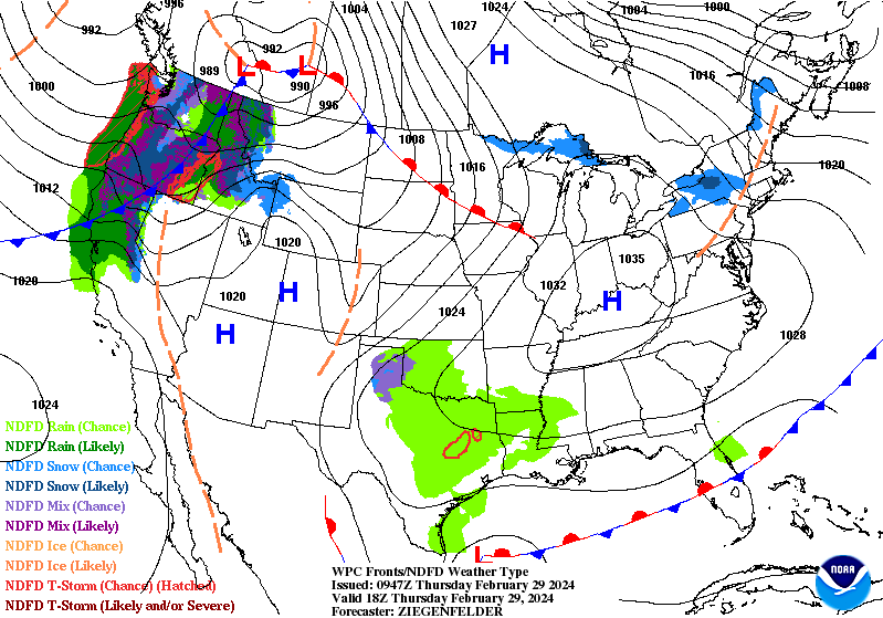
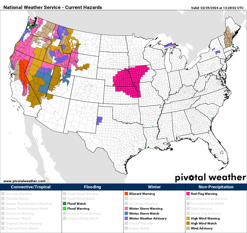
As noted yesterday, blizzard warnings are in place now in California from near Mt. Shasta south to about Sequoia National Park, encompassing most of the Sierra.
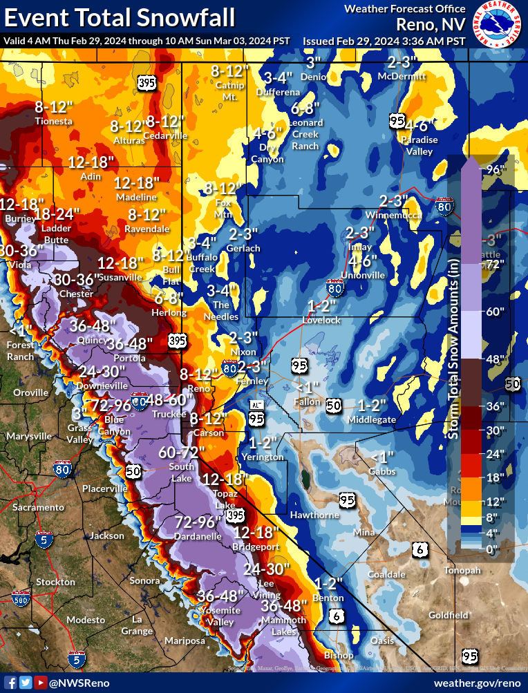
Upwards of 4 to 8 or 5 to 10 feet of snow are expected in the highest elevations, with snow levels down to about 4,500 feet today, 2,000 feet tomorrow, and perhaps as low as 1,000 feet on Saturday. While a lot of the worst of the weather will occur in the backcountry, there will be plenty of folks impacted by this long-duration storm. Travel looks to be severely impacted heading over the Sierra between Sacramento and Reno. In addition, winter storm warnings are posted in Nevada, with perhaps as much as a foot of snow in Reno. Lake Tahoe will be hammered by this one, with 5 to 6 feet expected.
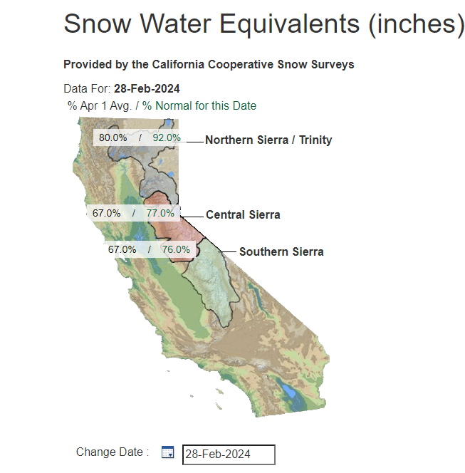
This is both good and bad. Obviously, an extreme winter storm, even in a winter-durable place like the Sierra is capable of causing severe problems. On the flip side, the Sierra snowpack needs a boost. Snow water equivalents, or how much liquid is in the snowpack have been running a deficit for most of winter. Still, 75 to 90 percent of normal isn’t the worst we’ve seen in California in the last 5 to 10 years. This time last year, these values were 150 to 200 percent of normal.
What will this storm do to the snowpack? Probably send it sharply above average. Liquid totals of 4 to 8 inches are expected within all this snow. We’ll check in on this again next week.
Elsewhere on the winter weather front, a burst of lake effect snow will impact Upstate New York today, with some heavy snow north of Syracuse, perhaps over a foot.
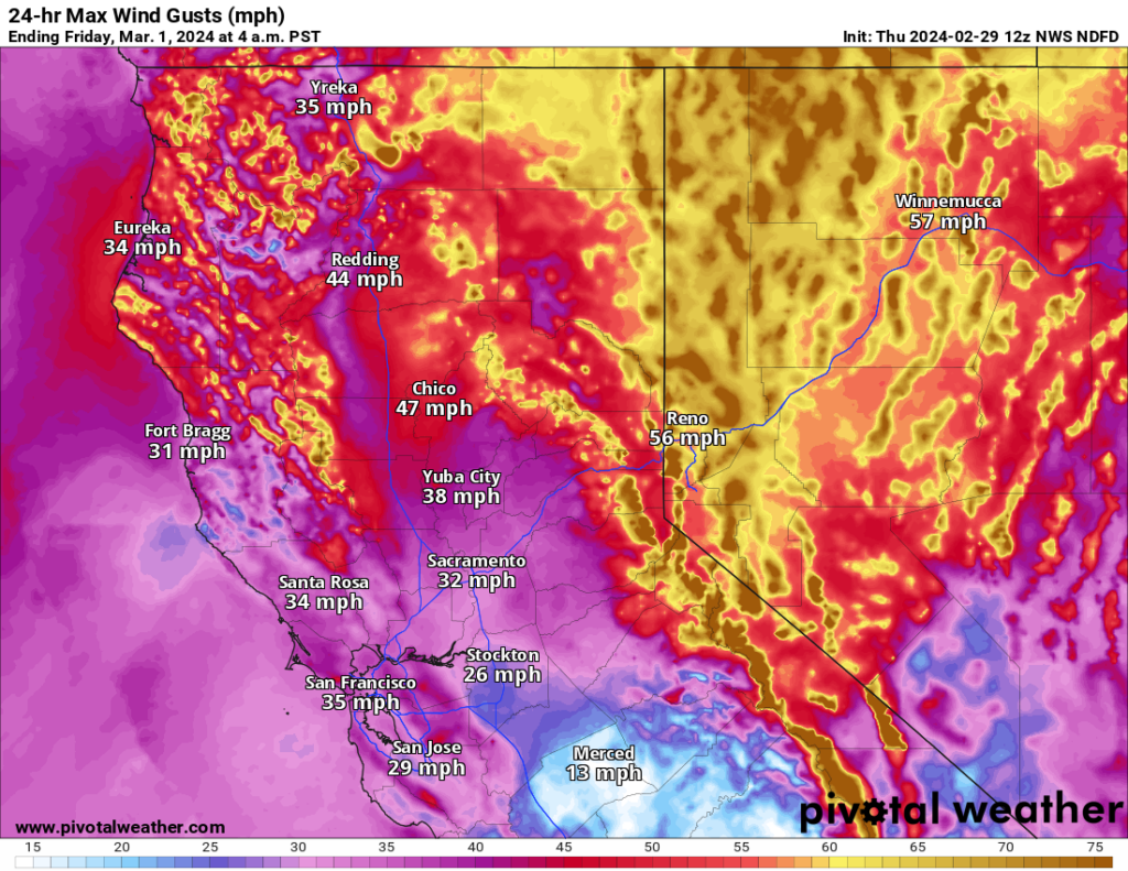
Winds to expand across the West; fire weather risks in the Plains
On the map farther above, you can see a lot of wind advisories and warnings in place for the Western United States. Not only will this storm bring heavy snow to parts of the West, it will also bring strong winds (hence the blizzard warnings in California). You can see the forecast for today has 50 mph or stronger winds in a good swath of Nevada (as well as southeast Oregon and southwest Idaho).
The strong winds have also prompted red flag warnings for fire danger in Nebraska, Kansas, and Iowa today. By Saturday and Sunday, higher fire danger returns to the Texas Panhandle, which is still dealing with active fires in the wake of Tuesday. The snow and rain in that area will certainly help today and may help allow for Sunday to be less of a critical fire weather day than Tuesday was. Still, it’s not quite enough to dramatically reduce the risk by the time we get to Sunday.
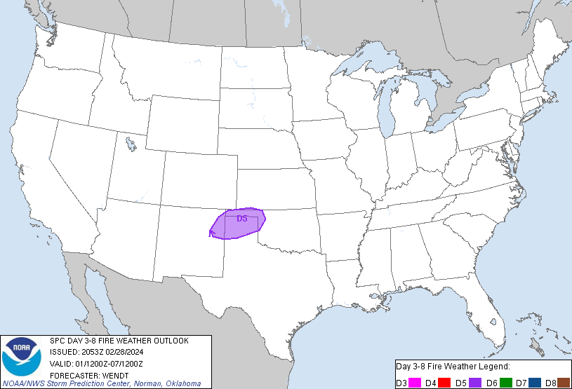
We’ll keep an eye on this, as that part of Texas really took a hit on Tuesday.
More serious warmth for the Lakes and Midwest into Canada
Warm weather will continue to absolutely dominate the story across the Great Lakes and Midwest. It will actually be warmest relative to normal in Canada, with portions of Quebec averaging 12 to 16 degrees above normal for days 3 to 7.
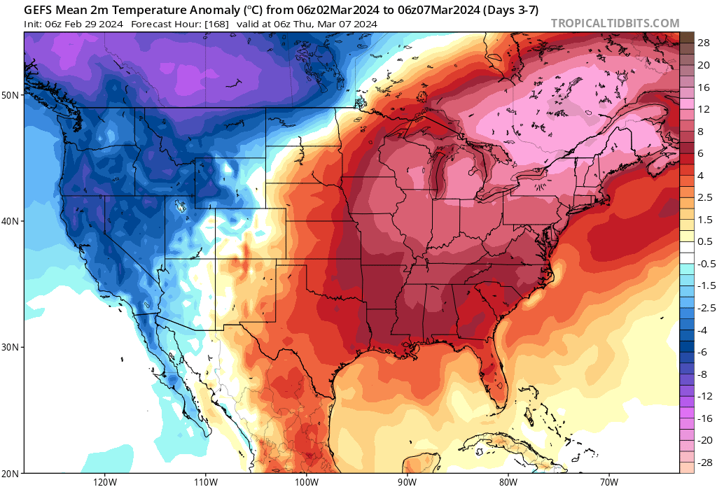
Record temperatures will be in jeopardy. La Crosse, WI for example is forecast to be 73° on Sunday. The record high is 66°, set back in 1894. Some other Midwest and Lakes locations will threaten some pretty old records by later in the weekend.