In brief: Today’s post reviews the seasonal activity we have seen so far in the Atlantic Ocean. Then we turn our attention to the next wave on deck, and potential mischief in the Caribbean Sea.
Wednesday marked not just hump day for this week, but also the statistical midpoint of the Atlantic hurricane season. It’s been an odd season so far. There has been one very powerful hurricane, Erin, which formed in August, and five modest tropical storms. Additionally, although Erin was by far the most intense and long-lasting system, arguably the season’s most impactful storm was Barry, which made landfall in Mexico as a weakening tropical depression. It was moisture from these remnants that contributed to devastating flooding in Central Texas over the Fourth of July holiday, causing more than 135 deaths and causing widespread damage.
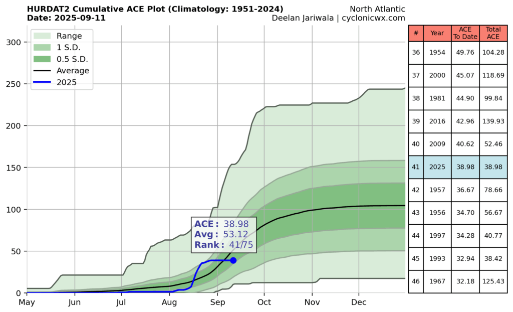
Going by raw statistics, the tally of six named storms to date is probably a little behind where we would expect to be during a season in which, on average, 15 named storms were predicted to form. In terms of Accumulated Cyclone Energy, which factors in the the duration and intensity of tropical systems, this season is running about 25 percent below normal. Without Erin, it is worth noting this season would be pushing historic lows in terms of overall activity.
So, overall, we are seeing less activity than is normal. Will that last?
Next wave up
Yesterday the National Hurricane Center started to flag a tropical wave that has not yet even emerged off the coast of Africa, into the Atlantic Ocean. (As a quick reminder, because it can be a little confusing, when forecasters refer to ‘tropical waves’ they don’t mean large waves in the ocean, but rather perturbations in the atmosphere). Anyway, when it reaches the Atlantic, this wave should find favorable conditions for further development.
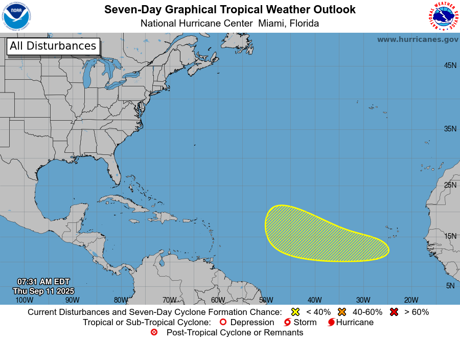
Most of the various models we look at, including traditional physics-based models as well as AI models, have become fairly bullish on development of this system about a week from now. There is surprisingly good agreement among several of these models, and their ensembles, about where the disturbance will be by the middle of next week.
After that point there’s not a whole lot of agreement, and at six or seven days we are entering the realm of speculation. Some solutions never really develop the system beyond a tropical storm while others bring a stronger storm close to Puerto Rico or north of the islands. Other models predict dissipation, and are a lot more excited about another wave that is several days behind this one. All of this to say: This is something we are going to have to pay attention to for awhile, since the second half of September can see storms get pretty strong, pretty quickly. It could be something. It could be nothing. We’ll see!
Home brews?
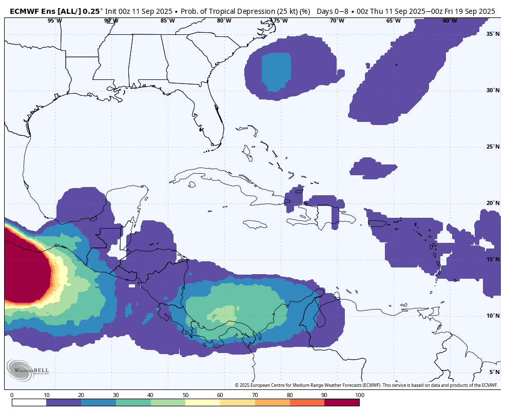
The other thing we’re watching for is development of a tropical system closer to home, possibly in the southern Gulf of Mexico or more likely related to the Central American Gyre, an area of low pressure over the eastern Pacific Ocean and western Caribbean Sea. There is nothing imminent here, but it is the time of year when this thing happens, and some of the models (such as the ECMWF, shown below) are splashing low-end chances for formation. Given the overall pattern in the Atlantic right now, the best odds for a storm getting into the Gulf of Mexico in September will probably come from this kind of home-brewed system. But that does not mean the overall odds are particularly high.
Given that we are presently right at the peak of the Atlantic season, this is pretty good place to be in with just a few nebulous threats. We’ll keep a close eye on things in the days ahead to see what, if anything, comes from all of this.