In brief: The Mid-Atlantic coastal storm is winding down, so we debate whether it was subtropical or non-tropical. Tropical Depression 7 has formed in the Atlantic, which is not currently a land threat but should be monitored in Bermuda. Meanwhile, the forecast in California is a little wetter, which is good news mostly.
Mid-Atlantic coastal storm
The coastal storm in the Mid-Atlantic is now inland and winding itself down. Rain totals were impressive, with 36-hour values up to nearly 8 inches around Virginia Beach.
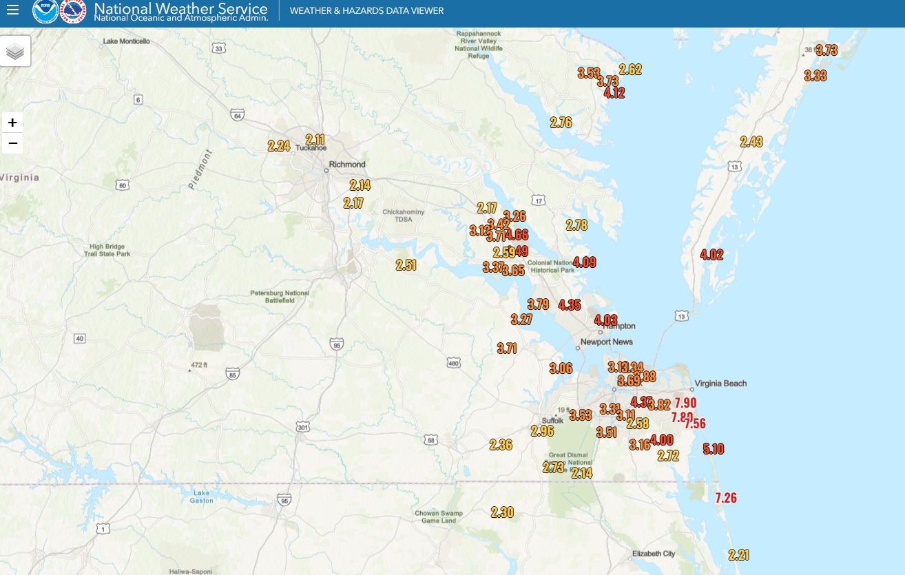
Additional rain today should be manageable, but a couple pockets of heavier rain can’t be entirely ruled out.
The question about this system will persist into the offseason. Was this a subtropical storm? Did it have characteristics of both a nor’easter-type storm (extratropical) and a tropical storm? The answer is very much “yes, it’s plausible.” If you look at what is known as a cyclone phase diagram, constructed by Dr. Robert Hart at Florida State University, you can see on the map inset how (based on yesterday’s European model guidance), the disturbance originated in the tropics (A) and lifted north to the Mid-Atlantic coast (C) where it will basically dissipate.
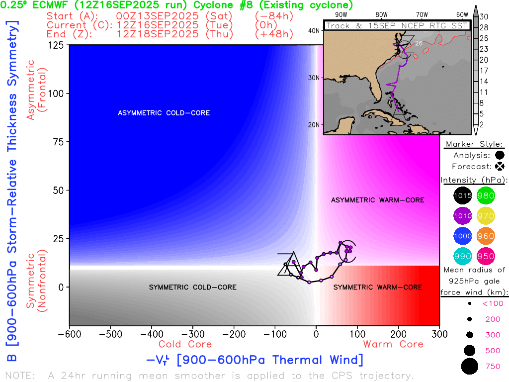
But then if you look at the “phase” part of the diagram, notice how it went from cold core (extratropical) to warm core (tropical). This is where the “sub” comes in with subtropical. It began as a frontal low pressure system, basically just a disturbance organizing on a cold front, something we see many times each year across the country. Since it was over warm water, the disturbance gradually took on *some* (not full) tropical characteristics as it came north, and now it will retreat back to non-tropical phase. This feels like the type of system that will get an extra look in the offseason, and it may turn out that this was our first September storm.
More notably, I think this really underscores that the technicalities don’t much matter in terms of impacts. Did the system produce heavy rain? Yes. Did it produce significant tidal flooding? Yes. Did it produce winds of 45 to 55 mph? Yes. Did it have a name? No. Should we have written more about this before yesterday? Probably. I think this is a good example of a storm where impacts are more clear-cut than the “what” it is. The “what” is all too often an academic exercise that means nothing to the vast majority of people. Remember, focus on impacts.
Tropical Depression 7
Overnight, we saw Invest 92L get an upgrade to Tropical Depression 7!
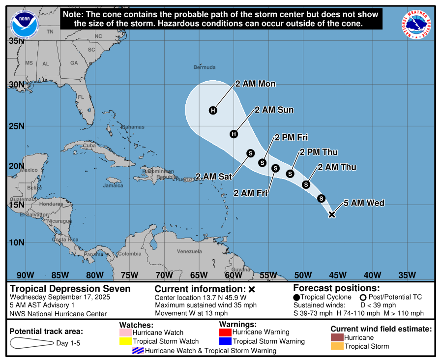
Tropical Depression 7 will head northwest over the next few days, likely passing comfortably north of the Caribbean islands. This morning, TD 7 looks…well, it looks.
The thunderstorm activity is plentiful around the depression, so that signals that it’s got some good underlying bones. However, it’s not particularly clear that this has a closed circulation right now. Regardless, we’re again debating technicalities. This is a system that is ready to intensify once the bones become better organized.
The only land we’re focused on right now for a potential threat is Bermuda. Models seem split right now on whether it tracks toward Bermuda or curves back into the Atlantic east of the island. We’re about 6 days out from that happening, either way. Interests in Bermuda, be it for travel or otherwise should monitor Tropical Depression 7 over the coming days.
Other news and notes
Next wave up
Beyond Tropical Depression 7, there remains another wave with about a 20 percent chance of development. For now, this seems unlikely to be a big deal.
Mario & West Coast risks
The remnant moisture from Tropical Storm Mario will move north today and tomorrow, bringing the risk of heavy rain to California. The overall track of the moisture seems to have shifted a little west, which means much of California will see scattered showers and thunderstorms, especially west of the deserts. The good news is that it appears most of these thunderstorms in this setup look wet, with lesser dry lightning risk than initially feared. This should keep fire risk relatively low.
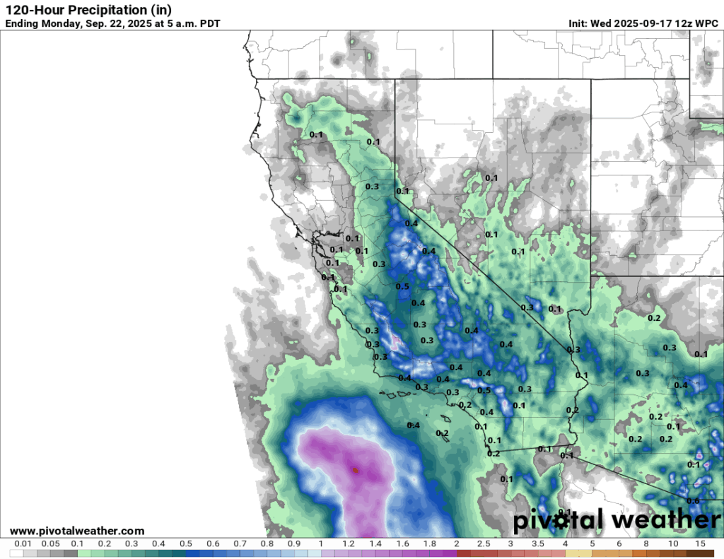
Rain totals will be very erratic in nature, as some places may only see a couple tenths of an inch or less, while others may see flash flooding concerns and 1 to 2 inches of rainfall. Follow your local NWS office for the latest here.