In brief: Tropical Storm Erin formed this morning from Invest 97L. It’s expected to make its way north of the islands by the weekend. From there, it’s likely heading out to sea, but we explain why the chance isn’t quite 100 percent. Plus, a quick update on the Gulf, which won’t see development but could see locally heavy rain this week.
Tropical Storm Erin
With our first real significant Atlantic storm of the season now likely getting underway, we’re doing a quick evening post here to just set the landscape up, as I know some people may be a little confused or wondering if things have changed since this morning’s update. In short, they haven’t changed a whole lot.
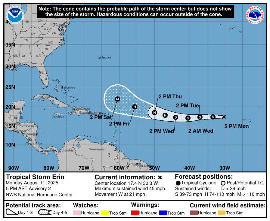
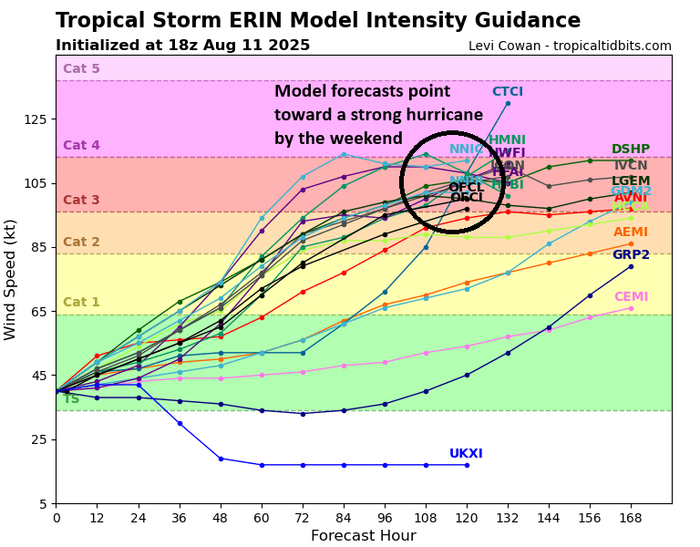
Erin has been identified with 45 mph maximum sustained winds just west of the Cabo Verde Islands. It’s hauling westward at over 20 mph. This quick forward speed probably won’t do it many favors over the next day or two, allowing for only gradual intensification, but it should be a slow, steady intensification over the next several days with probably a burst of rapid intensification at some point later this week or weekend. In fact, the intensity forecast for Erin is pretty dang aggressive over the next several days, showing the storm becoming a category 2 to 4 hurricane by the time we get to Friday or Saturday.
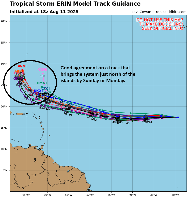
The track forecast is in equally decent model agreement, showing a good, tight track consensus through Sunday or Monday, bringing the storm north of the Caribbean islands.
Thus, the confidence in the NHC forecast shown above should be moderate to higher than usual.
For the Caribbean islands, this is unlikely to impact directly, but folks in Puerto Rico or the Virgin Islands through Anguilla or Barbuda should probably keep tabs on the size of Erin in case fringe impacts are felt in those areas.
After the weekend, Erin’s forecast confidence drops off significantly, as you’d expect from any tropical system in the day 8 to 10 timeframe. But here are a couple thoughts. First, Erin’s quick intensification will likely help it turn more northerly in time. In fact, you can see on the model track forecast spread above a very sharp northwest or even due north turn showing up on days 6 or 7. A stronger Erin would be more apt to feel the weakness in ridging that develops over the western Atlantic late this weekend and early next week. This will more than likely allow it to begin gaining latitude.
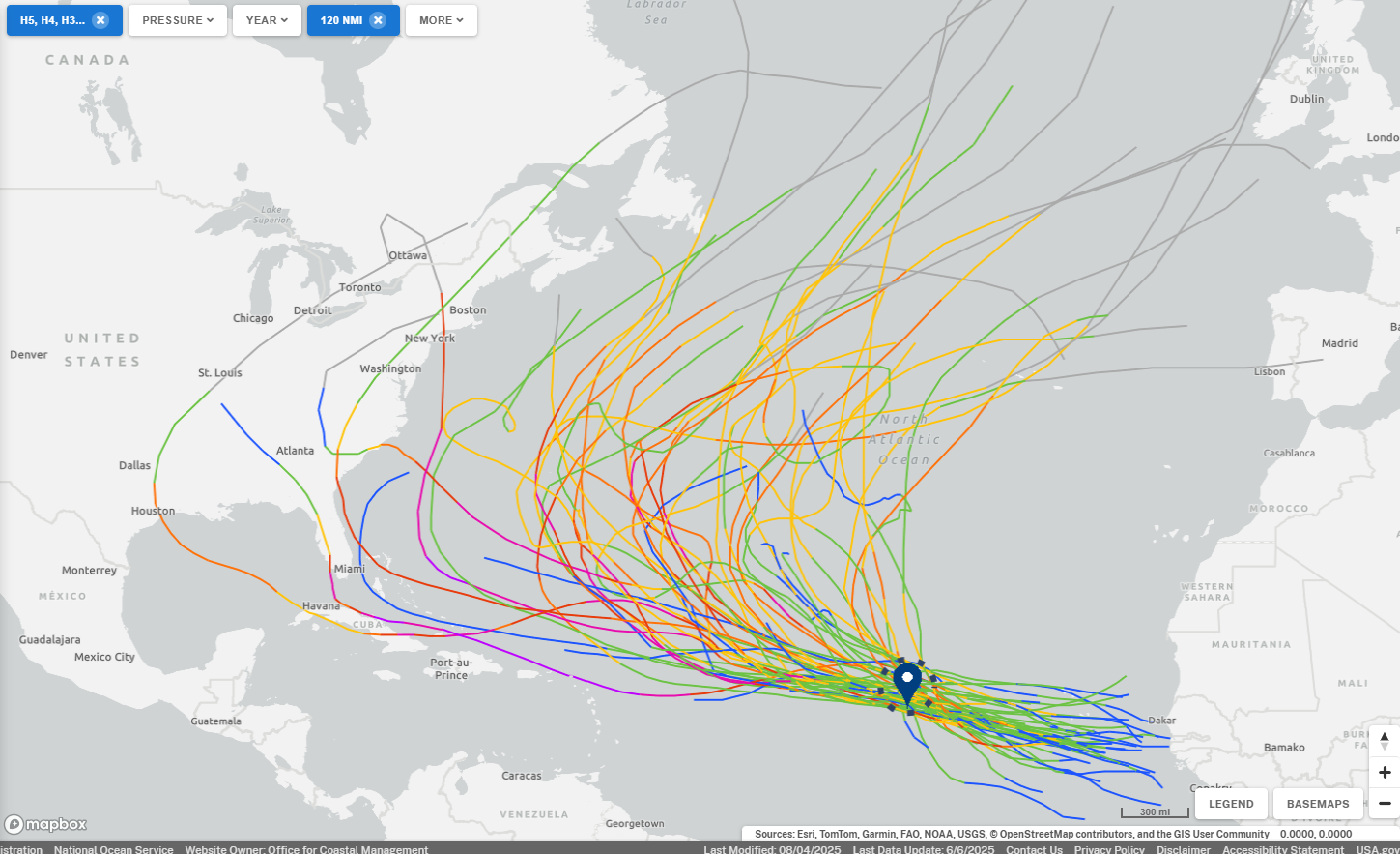
The second thing we can say is that history favors an out to sea track, though not at 100 percent. Of the 56 known named storms track within 120 nautical miles of Erin’s forecast position in 24 hours, 51 of them have gone out to sea, a U.S. hit rate of about 9 percent. Of course, Bermuda is on the way out to sea, and that was at least threatened by 7 of these storms as well.
So currently modeling, history, and the overall setup we see favors Erin turning out to sea eventually. That said, anytime the storm is 7 to 10 days away from somewhere, you keep an eye on things. But hopefully this allows some folks to breathe a little easier in the meantime.
Gulf blob
Alright, I neglected to really touch on this earlier today, but the Gulf is looking pretty revved up right now. Usually, when you see this, you worry a bit in August. But!

There’s a mountain of wind shear in the western Gulf right now, and the eastern Gulf isn’t exactly hospitable right now either. This is just your basic, run of the mill surface trough interacting with warm water and hot, humid Gulf weather, producing lots of thunderstorms, mostly over open water right now.
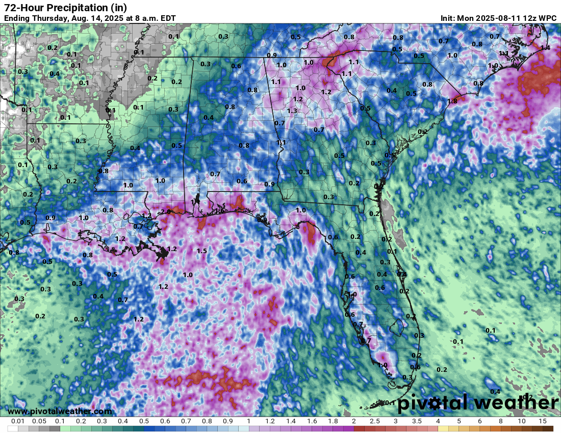
We could see 1 to 3 inches of rain in spots, with isolated higher amounts in excess of 5 inches possible through Wednesday or Thursday as this system lifts into and across the Southeast. More tomorrow!