Headlines
- 94L in the Central Atlantic Ocean continues to putter along
- Significant development is less likely as the system nears the Caribbean Sea
- Parts of Central America could see heavy rainfall over the next week from tropical moisture
- Overall there appear to be no threats to the United States over the forecast period
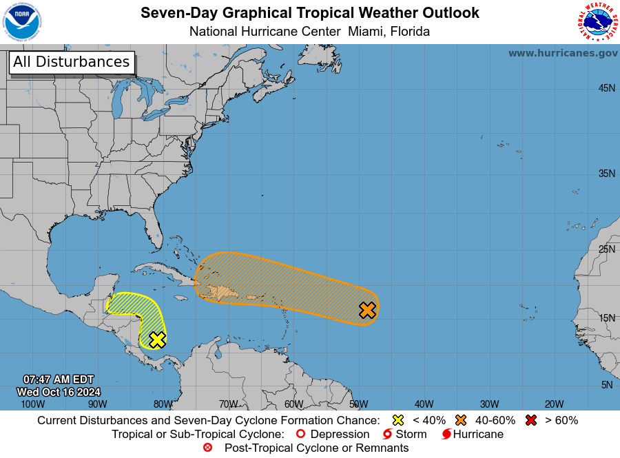
Invest 94L
We’re continuing to track an area of low pressure that is moving across the central Atlantic Ocean. Overall, this system is expected to continue moving more or less westward, or just north of due west, this week. This would put it in the vicinity of Puerto Rico or Hispaniola by this weekend. We can be fairly confident in this general track. What I’m less certain of this morning is whether anything actually develops.
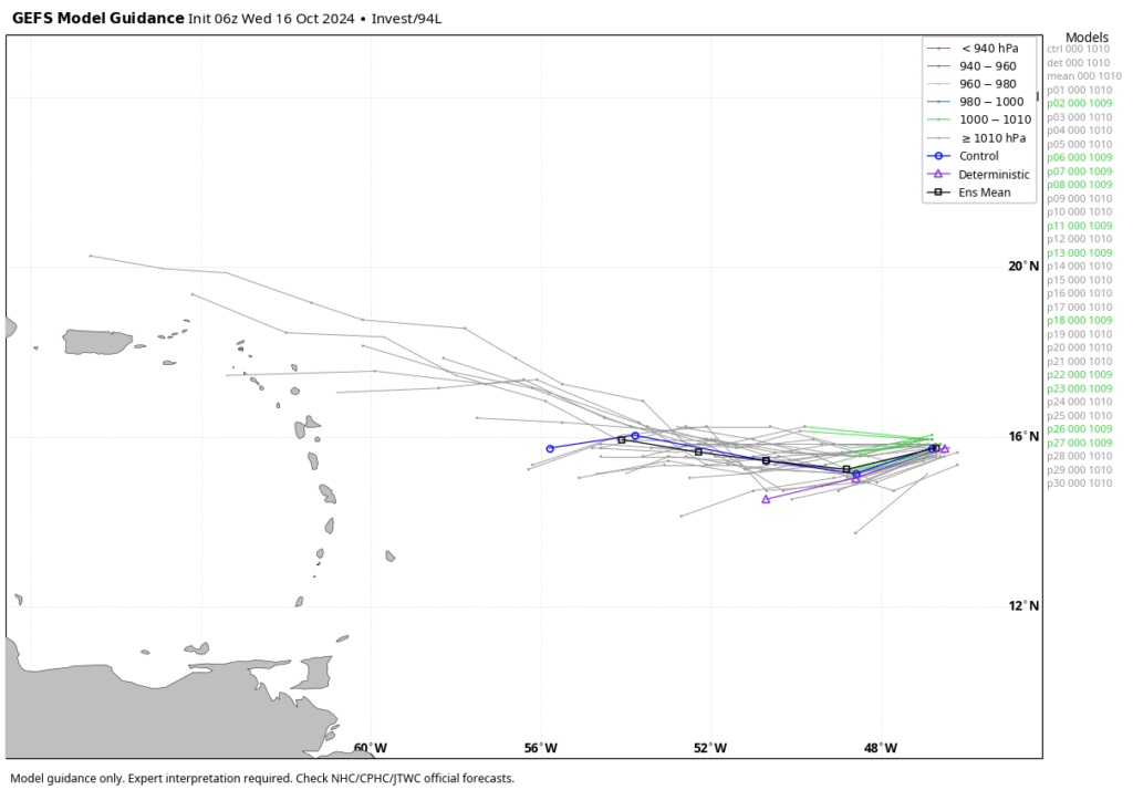
The National Hurricane Center gives Invest 94L a 40 percent chance of becoming a tropical depression or storm during the next seven days, and frankly this feels a little generous. Most of the major models that we look at no longer develop 94L into a tropical system (a few still do). In any case, this is something for the Caribbean islands and possibly the Bahamas to continue to watch, but our overall concerns for significant impacts from 94L remain fairly low. If our thinking on this changes, we’ll of course provide a timely update.
Caribbean Sea blob
The National Hurricane Center has also begun highlighting an area that Matt has been talking about for awhile in the western Caribbean Sea. This mass of showers and thunderstorms is not particularly organized, nor do I think it probably will become a depression or named storm. However, this part of the Caribbean Sea remains very warm, so there is at least the potential for something.
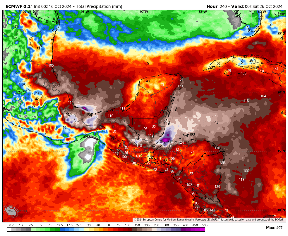
Regardless of development, however, this system could prove a rainmaker for southern Belize, Guatemala, and Honduras over the next week or 10 days. Depending on whether the heaviest rains remain offshore or push further inland, rainfall from this tropical blob could potentially lead to some mudslides in the region.
Elsewhere
As we get deeper into October, the tropics are starting to wind down. The Atlantic season doesn’t officially end until November 30, of course, but at this point we don’t see any near-term threats to the United States. That’s a good thing as areas hard hit by hurricanes Helene and Milton continue to recover, and start to rebuild.
Good job. Valuable information.
History: early on October 16 1989 (35 years ago today), Hurricane Jerry made landfall on Galveston.
and thank you for the way info is givenI survived a direct hit from
and thank you for the way info is given! survived a direct hit from Hurricane Andrew