Headlines
- Flood watches now in Florida with 5 to 15 inches of additional rain on the way to the south through Saturday.
- Some slightly potential that a disturbance can form into an organized system as it moves out into the open Atlantic.
- Moisture shifts into the central and western Gulf next week with locally heavy rain possible.
- Continuing to watch the western Gulf next week for potential development next week, but recent GFS “scareicane” runs are likely illegitimate.
Florida focus
The main near-term concern remains the rain in Florida. A flood watch is now posted for South Florida through at least tomorrow evening.
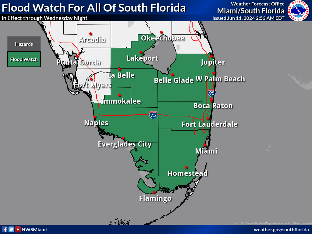
Mostly minor amounts fell yesterday, with the heaviest right near Titusville to the east of Orlando, where radar estimates around 5 inches of rain occurred. Heavy rain also occurred between Bradenton and Fort Myers as well. Heavy rain is pushing into the Southwest coast this morning, and additional rounds of rain are likely through the day. Some localized flooding issues may crop up today. It’s the piling up of rain totals that will eventually shift this from a localized flood risk to a slightly more widespread one.
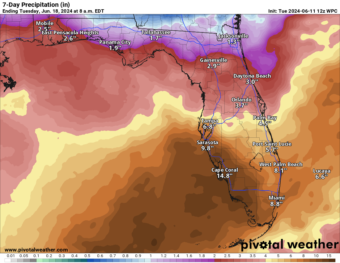
Additional rains of 5 to 15 inches are expected across South Florida from this morning into probably Saturday before things settle down. Locally higher amounts cannot be ruled out.
What’s next for the moisture plume?
We’ve got two aspects of this thing to watch. The first, and perhaps the best chance of tropical development over the next week is this disturbance crashing into southwest Florida this morning. It is expected to cross the Peninsula, emerge north of the Bahamas and may have a window of opportunity to develop into something in the Atlantic as it exits out to sea. This isn’t an especially uncommon early season mode of tropical formation, so this makes sense.
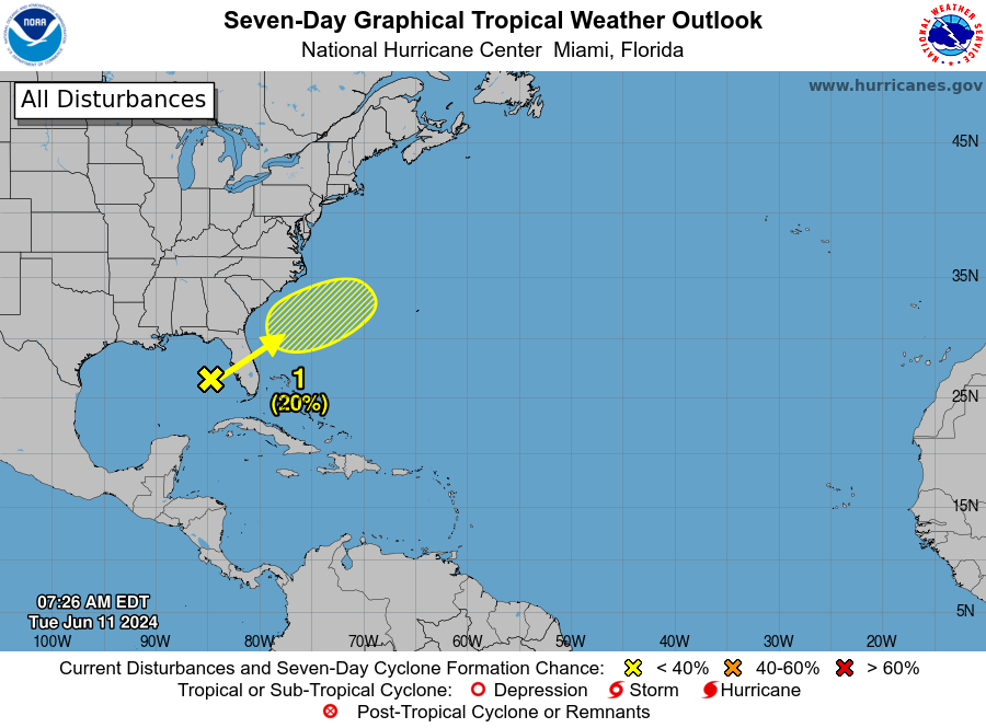
The NHC is offering up only 20 percent odds of development today with this as it scoots out to sea. This seems to be as good of odds as are necessary at this point, but it is our best development opportunity through the weekend.
The second aspect of the moisture plume is where it actually ends up next. It abruptly shifts off Florida beginning Saturday as high pressure begins to build in from the west. This should help dry Florida out a bit after Saturday.
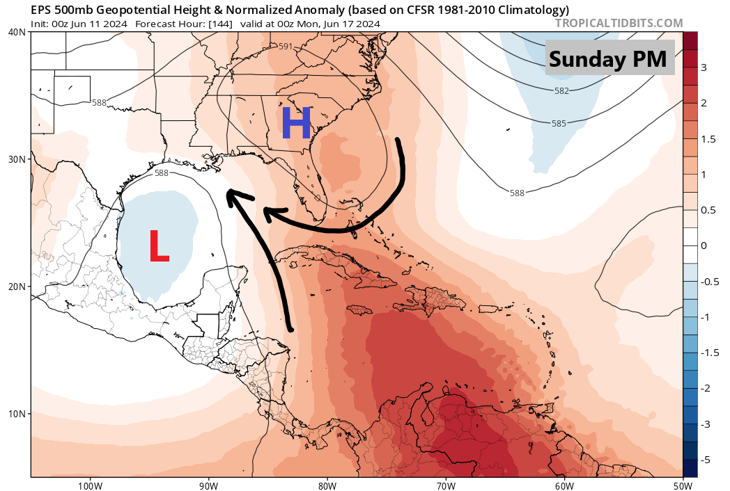
This shift will allow the “firehose” to move west and focus on the central Gulf Coast by later Sunday or Monday. This should allow for locally heavy rainfall between Pensacola and New Orleans and at least some localized flash flooding potential.
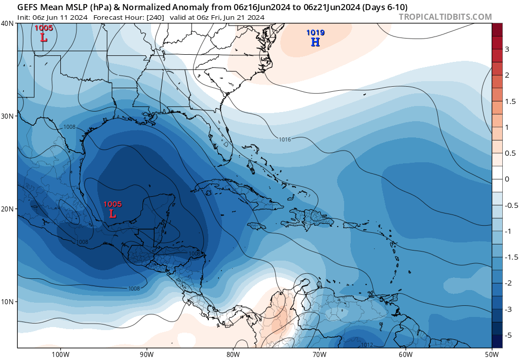
From here, things get tricky. The European suite of modeling focuses in Texas next week, with its AI model aimed near Houston and the traditional operational model aimed at the Corpus Christi area south into the Rio Grande Valley. It’s tough to get a good signal in the ensemble modeling with a focus on the Louisiana coast within the GFS ensemble and a focus somewhere broadly in Texas or even Mexico on the European. Much, if not everything will depend on exactly how the weather pattern over the U.S. evolves next week. Stay tuned on this.
What of the late period GFS “Scareicane?”
Avid model watchers will note the sub-960 mb low that emerged in the Gulf of Mexico on a couple GFS operational model runs yesterday. Suffice to say there is little to no support for that particular outcome from any other weather model. And, in fact, the last two GFS model runs did not contain that feature. As a reminder, that is a normal GFS June bias to explode tropical systems unnecessarily strong in the Gulf. Bottom line: We offer it little to no credibility.
That being said, there does continue to be support for broad low pressure somewhere in the western Gulf of Mexico next week.
But whether or not we’re able to pull a specific system out of this general unsettled soupy mess of moisture remains to be seen. I think that potential next week is legitimate, but I think the ceiling on intensity is capped. We’ll keep watching this. In the meantime:
- The GFS operational scare runs from yesterday are likely illegitimate.
- There is broad support for something potentially in the western Gulf next week.
- If something does develop, most likely it’s a strung out, sloppy storm and whether it goes toward Mexico, Texas, or to the north remains to be seen.
Stick with us as we watch!
Thanks for this run-down! As someone recently relocated down to the Gulf coast, this detailed run-down is both informative and helpful for planning.
Is it true only a small minority of model scenarios spare Houston from over a foot of rain next week? Getting impression that even with model spread, that Houston is locked in for a dangerous flood. Message seems consistent: high press building to our East, low press in western Gulf, and “firehose” of moisture.
“Dangerous flood” is extreme given the current forecast. As of now, we will likely see an increase in showers and storms, but there is some chance most of this ends up confined to the coast. Or focuses more to our east (or south). Nothing is locked in yet.
Go to “WeatherNerds”. Here you can run the different models in “precipitation” mode and see how the different models diverge.
I’m SO glad you addressed that scareicane.
Ty Matt⚘
Possibly a stupid question not being at all familiar with how all of these models work. However, if it known that there is GFS June bias to explode tropical systems unnecessarily strong in the Gulf, can they not fix the model?
I was about to ask that exact same question. If there is a known bias year after year, why not fix it?
It’s a great question. But it’s one of those things that’s easier said than done. One problem we had earlier in the 2010s was an issue with poor temperature performance in major cities. Well, they corrected the model to account more for an urban heat island effect in major cities, and inadvertently made the model obscenely overforecast temperatures at times in city centers. A lot of times these problems lead to a game of whack a mole, where you correct one thing but as a result, you have unintended new consequences. I think that’s at play here: We can sacrifice poor performance in the model in June, something we as humans can account for and accept better performance as a result later in the hurricane season when bigger storms are more likely. It’s not that neat and tidy, but I think that is part of things.
Hello. I made plans to travel to Kalahari Resorts in Round Rock,TX on Sunday morning 6/16-6/18. I’m wondering how bad the weather may get in traveling back home on the 18th and if i should reschedule. I live in La Porte. I don’t want to run into flooding. That’s my worry. What’s your opinion on the weather for Tuesday 18th? Thanks
Given that it’s a week out, I wouldn’t change any plans at this point, as it’s unlikely that on one specific day you have to contend with flooding. So I wouldn’t be too worried right now. Most model data continues to keep things manageable into next week here at this point.
The 7-day cumulative rainfall shows a lot of rain falling in the Gulf water west of Florida. Does this cool the sea surface temps in a meaningful way?