One-sentence summary
The near-term remains quiet, while the Atlantic looks to pick up the pace next week but no serious land threats are seen at this point.
Happening now: Bahamas wave remains the only thing on the board this weekend & remains unlikely to develop
We head into the second weekend of August with a clean plate! We’ll take it. It’s quiet for the next few days. We continue to mic check the wave in the Bahamas that’s heading toward Florida now. It remains very disheveled this morning.
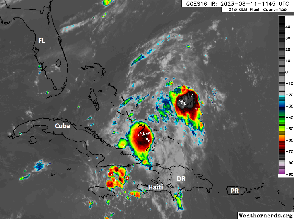
Over the next 5 to 7 days, what’s left of this wave is actually likely to traverse the southern Gulf but seems likely to fall apart before bringing some needed moisture to drought plagued Texas and northern Mexico.
With development not expected from that, we could look out into the deep Atlantic, but there are no signs of development there over the next 4 or 5 days either.
The medium range (days 6 to 10): Atlantic action Jackson!
Well, let’s see how this goes. Modeling continues to insist that one or several waves off Africa next week will develop as they come west. As best I can tell, the Euro is picking up on potentially three waves, none of which are expected to rapidly organize.
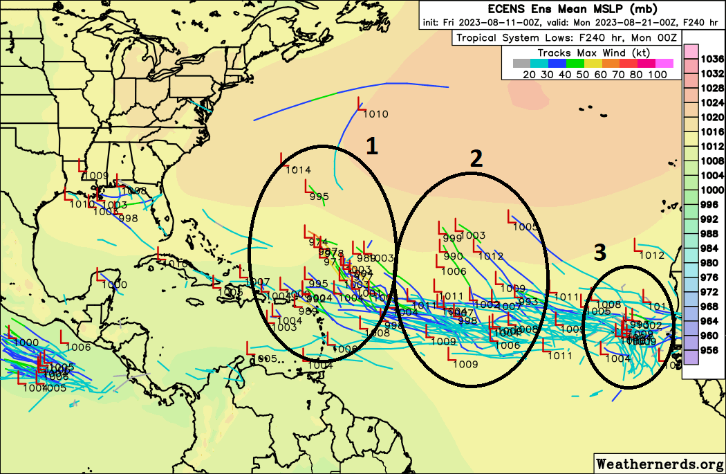
Let’s keep in mind that the European ensemble (the 50+ runs of the Euro model with various tweaks) has been rather aggressive in developing tropical waves in the main development region of the Atlantic this year. So this may be a bit overconfident. But I just want to give you an idea of what we’re watching next week.
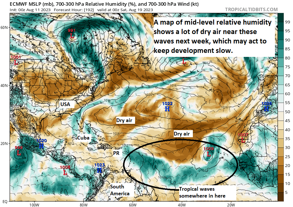
Alright, so let’s say the Euro is correct here and we have, call it 2 or 3 tropical waves that could develop. What does this model think of the pattern and conditions of the Atlantic next week? We’ll start with a look at humidity. Dry air acts to inhibit tropical development. Tropical systems like moisture, not dry air. Looking at the mid-levels of the atmosphere, we can actually see the Atlantic has a fair bit of dry air present. That’s a caution flag to me.
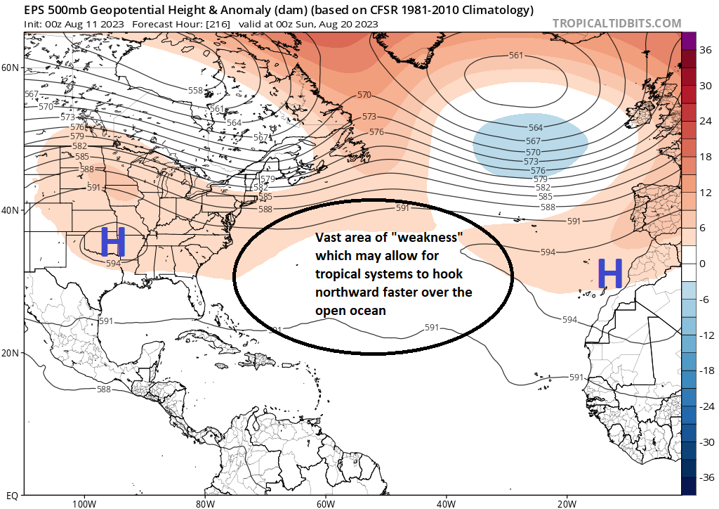
If we look up around 20,000 feet, which we refer to as the 500 millibar (mb) level, we can get a good sense of what will be “guiding” any tropical systems next week. It would seem that high pressure over the open Atlantic will establish between Bermuda and the Azores. This may mean two things. First, it’s entirely possible that at some point that’s enough to force any quicker developing tropical systems to turn north quicker.
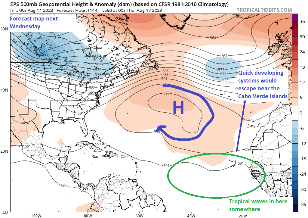
Over time next week, that high may actually nudge farther east, as high pressure reasserts itself over the United States. What this could do is open the exit door for escape of any tropical waves, ideally before they get to the Caribbean islands.
So, yes, we expect that tropical waves have a chance at developing next week, but we also think that the upper level steering pattern and mid-level dry air will help keep intensity in check and hopefully leave the door open for an early exit out to sea. Keep in mind that we’re talking about a 7 to 10 day forecast here, and a lot can change! But sitting here today, those are our thoughts.
Fantasyland (beyond day 10): Punt
Much like yesterday, I am intentionally punting on the extended range part of the forecast today because there’s too much volatility in the medium-range to even try to make sense of anything beyond day 10. So let’s how next week shakes out first, and then go from there.
NOAA Outlook
Just to cap this post, the National Oceanic and Atmospheric Administration (NOAA) issued their seasonal forecast update yesterday. It did increase the odds of an active season, but I don’t believe it particularly sheds any new light on things. We knew this season would be a battle between an El Niño event emerging that has historically led to quieter activity and Atlantic and Gulf and Caribbean sea-surface temperatures that are extremely warm, if not record warm. So far, the home team has won, and we hope that continues the rest of the season. But there are some notable things in the background that give seasonal forecasters reasons to be wary, and I think that explains their boosted outlooks this year. Remember to prepare each season as if it will be the one that delivers you a storm, regardless of seasonal outlooks.
Matt your last line is the best advice of all. Thanks for starting this website it has been wonderful to learn all the in’s and out’s of the Atlantic hurricane season so far.
Absolutely…thank you for your support!
Love how you describe air portals – hook entrances, it helps me see the atmosphere as a giant moving lava lamp with blobs moving around each other, horizontally & vertically.
Ty for the explanations and unique approach to weather – it sure makes a difference ⚘
Y’all are the best. That’s why I’m an avid reader of your posts!
GRAMMAR POLICE POST: none is a contraction of no one, so “none are” is grammatically incorrect — it should be “none is”. Yes, I know it sounds awkward, but there are plenty of Americanisms that sound correct but aren’t (e.g., “yes, it was me” should be “yes, it was I”).
Enjoying this new website. It doesn’t look very exciting from your viewpoint, but thanks for soldiering through it!
Didn’t expect this to be a public post — sorry for any embarrassment!
According to Thesaurus.com it is the proper form because it is referring to a plural within one sentence. As in three waves not one. However either way could be acceptable. We are not speaking in Olde English. Even though I think that would be hilarious on this site.🤣
This is a zombie grammar rule and is completely, as in 100%, false.
Source: the Merriam-Webster Dictionary of English Usage, which spends 1.5 pages discussing this issue. Their final words:
“Clearly, none has been both singular and plural since Old English and still is. The notion that it is singular only is a myth of unknown origin that appears to have arisen late in the 19th century. If in context it seems like a singular to you, use a singular verb; if it seems like a plural, use a plural verb. Both are acceptable beyond serious criticism.”
anyway, back to the weather
Great stuff as per usual!
Can y’all address the possible effects of the Hunga Tonga eruption on our weather, particularly as it may apply to the heat? Such an incredibly interesting event yet so little reporting.