May the 1st be with you. Today, we just want to briefly acquaint folks with some of the changes to expect in the upcoming hurricane season. Every year, lessons are learned, data is collected, and changes are implemented. Forecasters and those that communicate the risks and impacts are always attempting to improve, even if just a little.
The cone: New graphics available
The biggest and most important change this year from the National Hurricane Center will come via the cone graphic you often see.
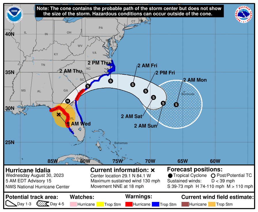
In the older maps, the watches and warnings covered the coastal regions, and that was that. As we’ve learned, impacts extend far from the track of the center and far from the coast very often. Thus, to capture this more, the NHC will now be including a different map, with the inland watches and warnings included.
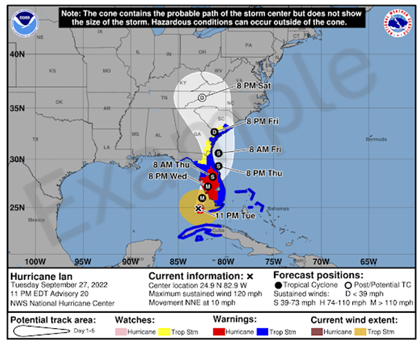
These watches and warnings have been issued for a number of years, but they’ve never been combined with the forecast cone on the NHC maps. These maps are considered “experimental,” which in NWS parlance means they may not always be available quickly. But they will be there, likely beginning in August. People will be able to provide feedback to the NHC about these images. We plan to include them when available in our posts.
The rainfall forecast: Going global, sort of
One thing I actually made mention of last year either here or on social media was the lack of rainfall forecasts for international locations. That will be partially corrected this season. Experimental rainfall graphics will now be issued by the NHC and Weather Prediction Center for the Caribbean and Central America. This is very good news, as rainfall is sometimes the biggest threat from these storms.
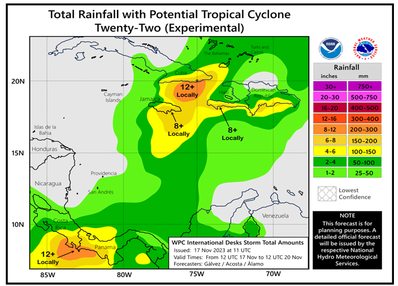
This will give us another useful communication tool for individual storms.
U.S. watches and warnings: More frequent updates
In the past, NHC advisories could generally be broken into two groups: Primary advisories issued at 5 & 11 AM/PM EDT, and then intermediate advisories issued every three hours in between the two primary advisories. Very little would change in the intermediate advisories, other than position and intensity. Well, now the NHC will have the option to expand or trim back watches and warnings in these advisories for the U.S. So, if the forecast looks to change or the storm speeds up or something, there will be the option to give an additional 3 hours of lead time on watches or warnings. Every hour counts ahead of these storms, so this is a welcome change.
Other notes: Spanish, size, names
In addition to the big changes noted above, the NHC will implement some other tweaks this year. There will be additional products available this year in Spanish which should allow almost all key information to be accessed from the NHC in both English and Spanish. This is thanks in part to AI, which is really helping improve how much and how quickly information can be translated. I assume additional languages will be on the board in the future too.
Size forecasts for wind radii will extend out to days 4 and 5, previously only available through day three. The size of the cone is adjusted each year based on average track error. As the NHC states, “the size of each circle is set so that two-thirds of historical official forecast errors over the previous five years (2019-2023) fall within the circle.” It’s a little complicated, but it’s built to account for as much potential error as possible. This year’s cone size will actually increase a little in the Atlantic basin, particularly in days 3 through 5, though not by a huge amount.
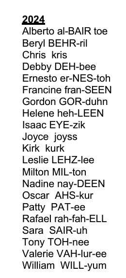
The storm list for 2024 is above and can also be found here, going out to 2029.
Hurricane season outlooks continue to populate, and according to the Barcelona Supercomputing Center site that tracks these things, the current consensus forecast for the 2024 season is 23 named storms, 11 hurricanes, and 5 major hurricanes, compared to an average of 14, 7, and 3 respectively. So, yes, this season is highly likely to be very active. We’ll have more for you soon, and we’ll start pushing daily outlooks out sometime later this month. Spread the word on our site, and follow us on the socials.
Another great job.
I live in Louisiana known as hurricane alley. I am from the mountains of N.C. Hate this weather here. Wish I lived high in the mountains.
When can we get a name like,
Henrietta or Rhetta?
They are planning for 23 named storms but only have 21 names on the list?🤪
oh yeah, we’ll be heading into the greek alphabet like we did in 2020.
I think the Greek Names were abandoned after 2020. Now there are a new list of supplemental names that get used: https://www.nhc.noaa.gov/pdf/aboutnames_pronounce_atlc_alt.pdf
That’s when we move either to the 2025 list early, or go into the already developed but they don’t want to scare us 2024 part 2 list. I’ve heard it both ways. Either way, I don’t want to go there!
OOOHH Joy…storm name Milton…
Love what you do! Keep up the awesome work!
thanks for the update. I think the new maps with the inland warnings will help people understand the impacts better.
Imagine if Hurricane Rafael “Ted” Cruz hits Houston.
Stick to your day job.
Will there ever be a hurricaine Kim? 😒
Will there ever be a hurricane name Doritha(ole school)name..