One-sentence summary
Invest 95L had a moment where it looked like it might become an interesting feature, but that has since faded so our attention will focus to the next wave to emerge off Africa.
Happening now: Invest 95L struggles & Don finally exits
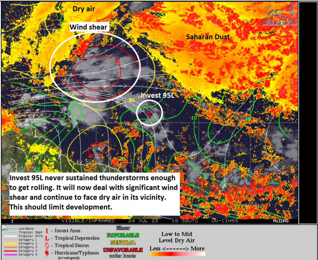
At one point by Friday evening, the 7-day odds of Invest 95L developing had bumped up to as high as I think 70 percent? The odds were considered “high.” That is down to 20 percent this morning. Why? Invest 95L was unable to hold thunderstorms together enough to stay shielded from the dry air and shear that surround it. Back in Friday’s post, we mentioned that 95L would basically have to insulate itself from dry air to have a chance. The 30 knots of shear around it aren’t helping either.

Modeling has pulled back a ton on development chances with 95L since last week, and given the hurdles noted above, it will be tough for 95L to get its act together. That said, it will still deliver areas of heavy rain and thunderstorms to the Lesser Antilles, especially south of about Dominica and Martinique. But as far as organized tropical activity is concerned, it does not appear that 95L will be the one to make it so.
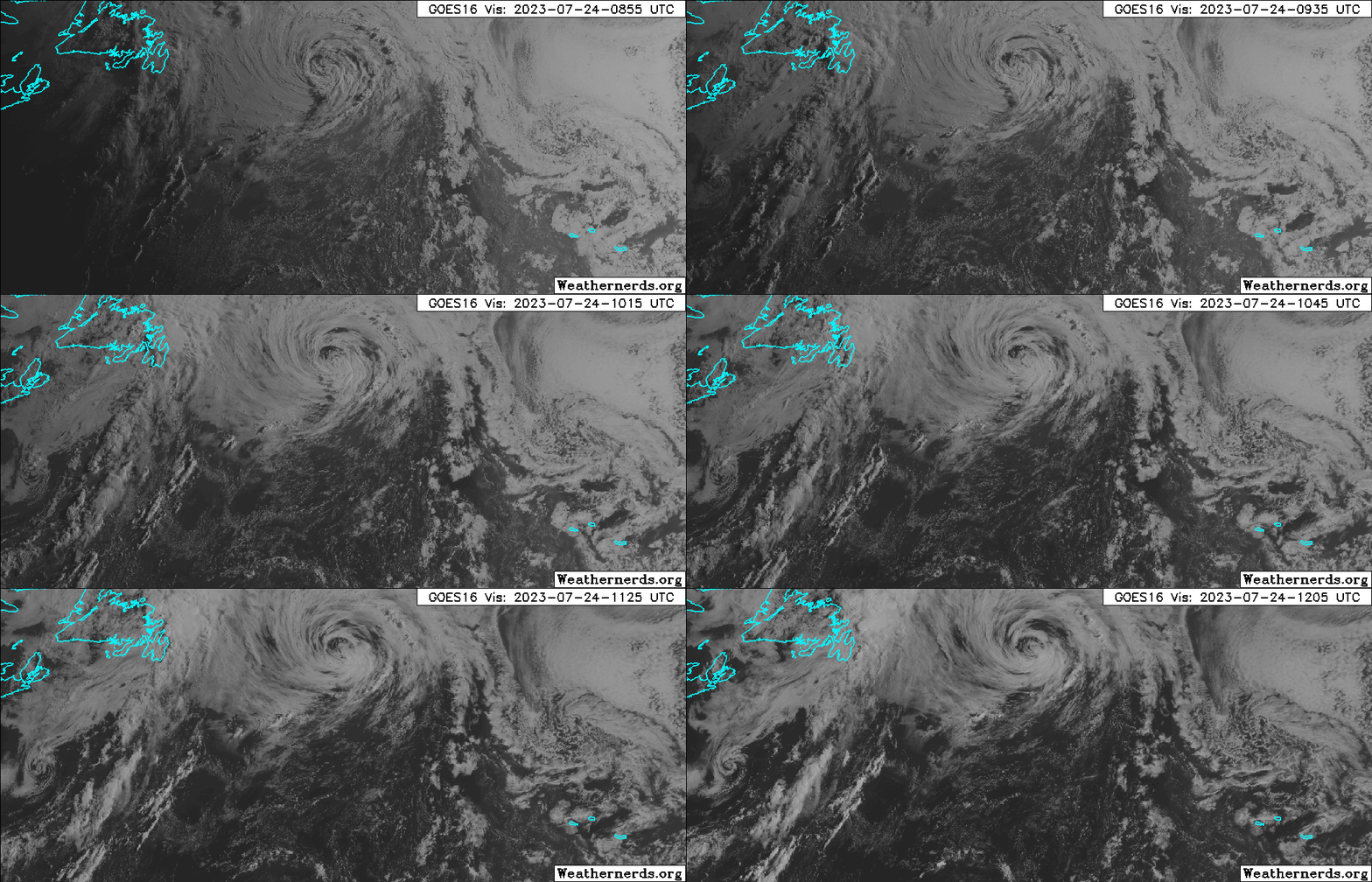
Meanwhile, to the north, Tropical Storm Don briefly became the season’s first hurricane over the weekend. It has since fizzled, and it will become an “extratropical” storm later today. Basically, it’s driven by cooler weather processes and looks more like a nor’easter than a tropical storm.
Don is the type of storm we hope we see much of this season: Out at sea, mostly harmless to any land, and working to cool ocean waters a bit. Fare thee well, Don.
The medium range (days 6 to 10): More action off Africa to come
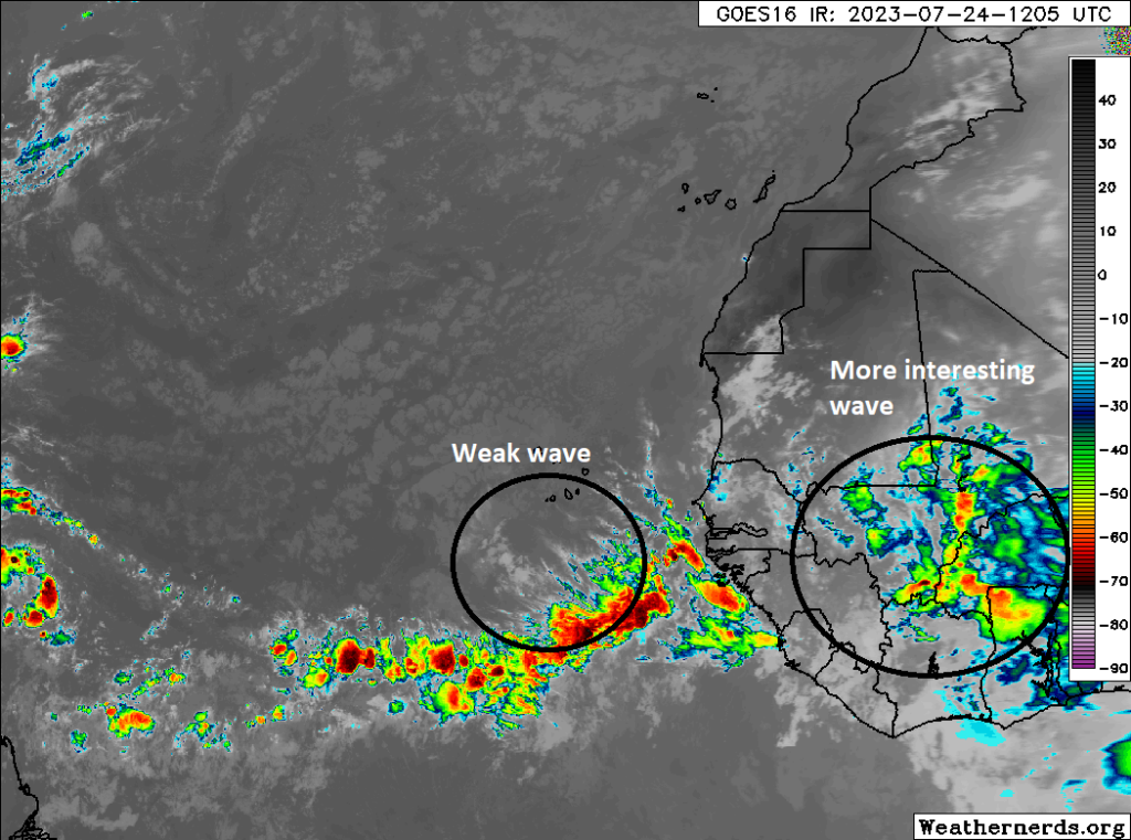
So what’s next? For that, let us again look at Africa.

Right now, the next wave up does not appear to have much to it, and model support is also lacking as it comes west. But the wave over Africa this morning will emerge into the Atlantic by midweek. Both the GFS and European models suggest this one has a chance to develop, with the GFS being extremely bullish and the Euro being extremely modest, a trend the Euro has won more often than not this season thus far. Ensemble support is moderate for this as well, with the European ensemble actually a little more excited about development odds than the GFS ensemble, a trend that the GFS ensemble seems to have won more often than not so far this season. Remember, ensembles differ from operational models because they are run 30 to 50 different times with small tweaks in their initial snapshots to help produce more “spread” to give us a better view on possible outcomes.
Regardless of what the models specifically say, it appears this will be the next area to watch heading into the weekend and next week. It seems that steering currents would suggest that anything developing would stay out at sea, but it’s far too early to say so with any conviction. For now, we will watch and wait.
Fantasyland (beyond day 10): Babysitter’s club
We currently don’t see any real specific concerns in the long range, with the exception of this wave emerging off Africa, as discussed above. The main theme heading into early August will likely just be to keep babysitting this stuff. We aren’t overly impressed with anything right now, but given the time of year and water temperatures out there, it makes a lot of sense to keep tabs on everything.

Good strategy Master Lanza.
Watch n wait. We should watch for the low riding innocent looking waves that don’t pop until it makes it into the western Caribbean or the Gulf and blows up, Harvey style for example.
Laura was a hollow point bullet that almost had our name on it.