One-sentence summary
Strong winds will bring some risk of localized power outages across the Central U.S. and increased fire danger in the Southern Plains as a fall storm winds up today.
Tropical update: Nada
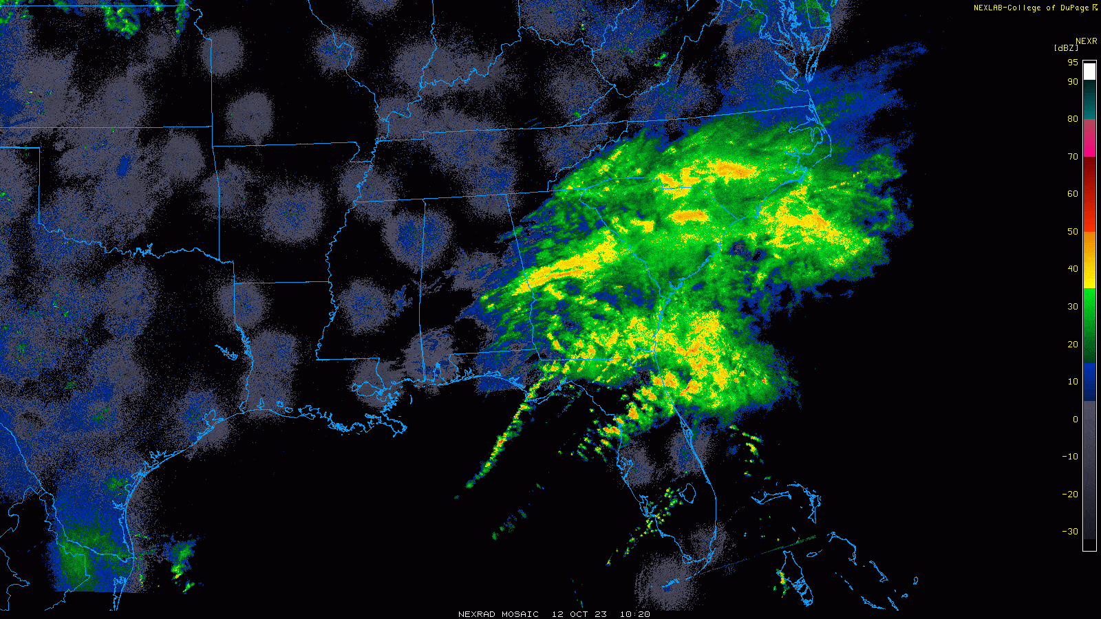
With Sean back down to tropical depression status, there’s not a whole lot else to discuss for the next few days. I would not be shocked to see the low pressure system develop that’s presently bringing rain and locally gusty winds to the coastal Southeast. A couple tornadoes were reported earlier this morning near Tampa, and there are a couple tornado warnings ongoing as of this writing. All this will race east across the Atlantic, however, and poses no further risk to land as it exits.
There is some potential for another lower-end Cabo Verde type system in 5 to 7 days, but at this point between that and a likely quiet Caribbean for a bit, there’s no reason to sweat anything out on land.
A wind-ripped Thursday in the Central U.S. brings some fire danger and severe weather
Wind is the story today for the U.S., with a deepening low pressure system over the center of the country driving a pretty healthy wind event. Wind gusts of 40 to 50 mph or higher are likely from about South Dakota into western Nebraska, northeast Colorado, much of Kansas, northeast New Mexico, and the Texas and Oklahoma Panhandles.
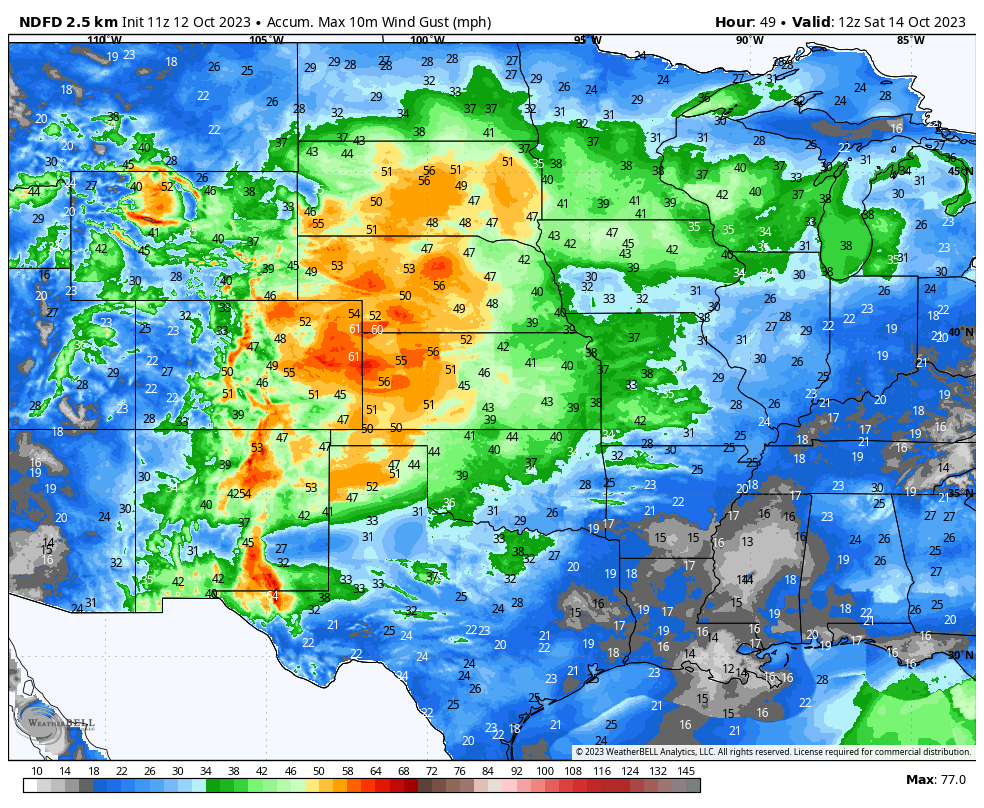
We get a handful of these events per fall, winter, or spring so it’s not too unusual. But it may have impacts ranging from localized power outages to tree damage to wildfire risk. The “critical” area of fire danger risk today is from southwest Kansas, across the Panhandles into northeast New Mexico. The combination of drought, low humidity, and winds will combine to enhance that risk.

Wind advisories, high wind warnings, and red flag warnings are posted in many of these regions for today.
With a storm like this, you usually get some severe weather, and this may be the case today in Nebraska and Kansas in particular. There’s a modest tornado risk today but more likely, we’ll see hail or damaging winds take prime billing later today as the low pressure area works east. Tornado risks are highest in Nebraska.
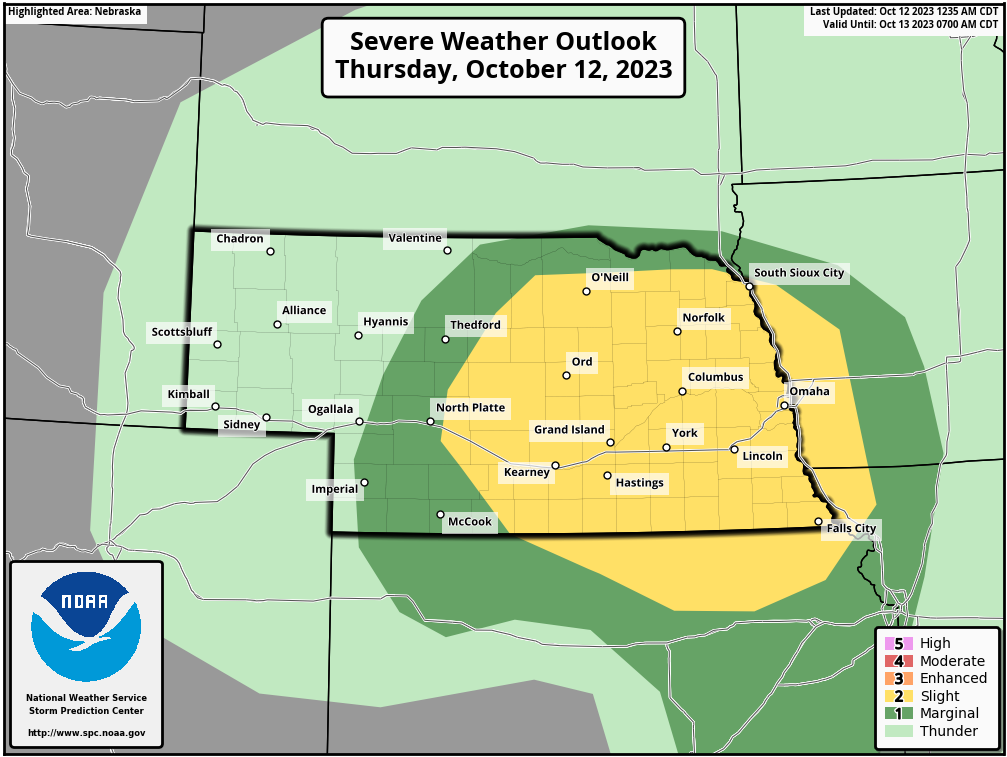
A slight (level 2 of 5) risk of severe weather is posted today. Heavy rain will also be possible, especially across South Dakota, where as much as 3 or 4 inches of rain may fall between Pierre and Sioux Falls. Enhanced precip may also occur in the Rapid City area and Black Hills, though a chunk of that will fall as snow.
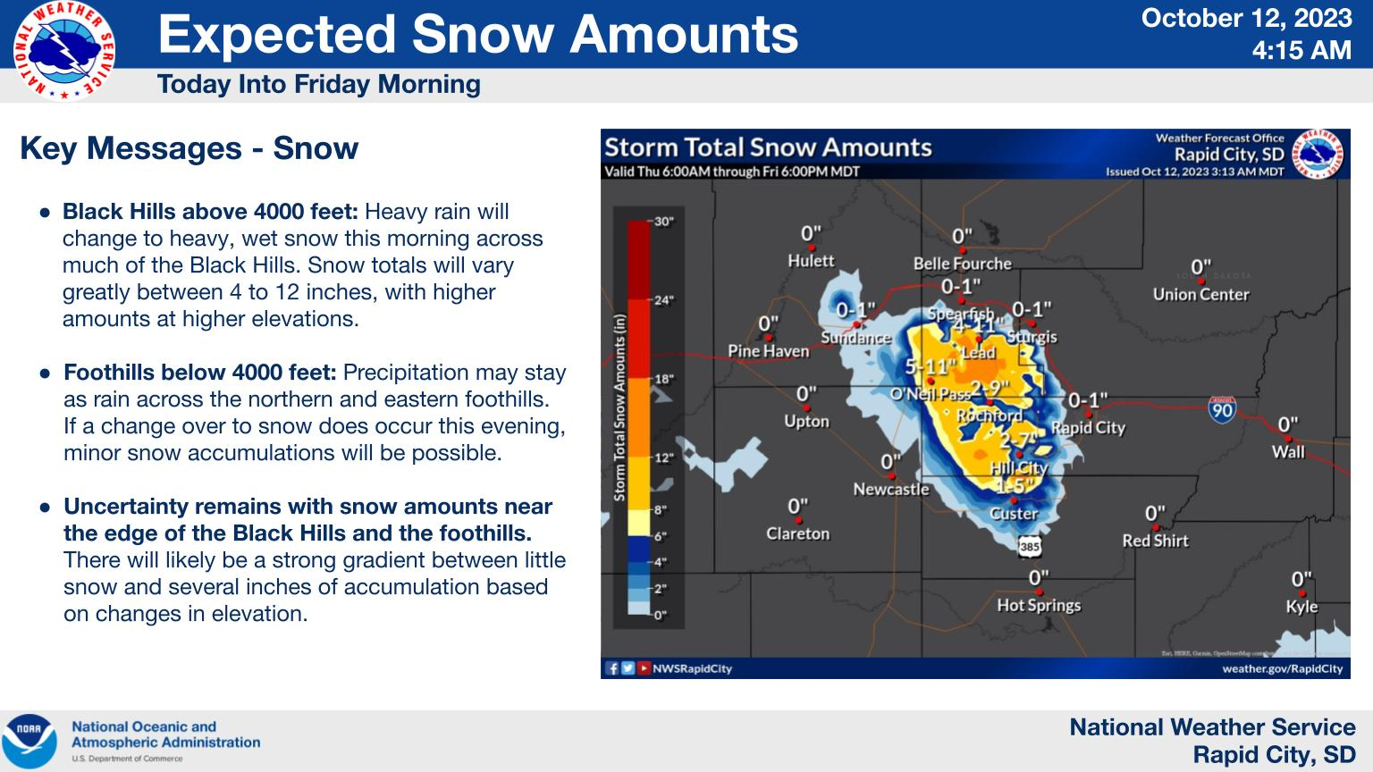
Maximum snow is expected northwest of Mt. Rushmore in the Black Hills, where as much as a foot or so is possible. Snow will also occur in the mountains of Colorado and Wyoming and in parts of northwest Nebraska.
The flood risk will shift east tomorrow, when Chicago, Milwaukee, and Madison all fall into a slight risk of excessive rainfall (level 2 of 4), as 1 to 3 inches of rain are expected. More on that tomorrow.