One-sentence summary
Tropical Storm Lidia dissipated this morning over Mexico, but will bring rainfall and mudslides to part of the country; and its remains will merge with other moisture in the Gulf to bring rains later this week in the southern United States.
Tropics now: Goodbye Lidia, and hello Sean
After rapidly intensifying on Tuesday and slamming into the Pacific Coast of Mexico, Lidia has been shredded by the mountainous terrain of Central Mexico. The big concern with Lidia, accordingly, is now rainfall. The remnants of the system could cause urban flooding and mudslides in Western Mexico today.
After today, those remnants will be drawn into the Gulf of Mexico along with the remains of another Pacific storm, Max, as well as a warm front lifting north. This mess will eventually move to the northeast, toward Florida. We have zero expectations for these lows to congeal into something threatening from a tropical storm standpoint, but it should heighten rain chances for areas from Louisiana through Florida.
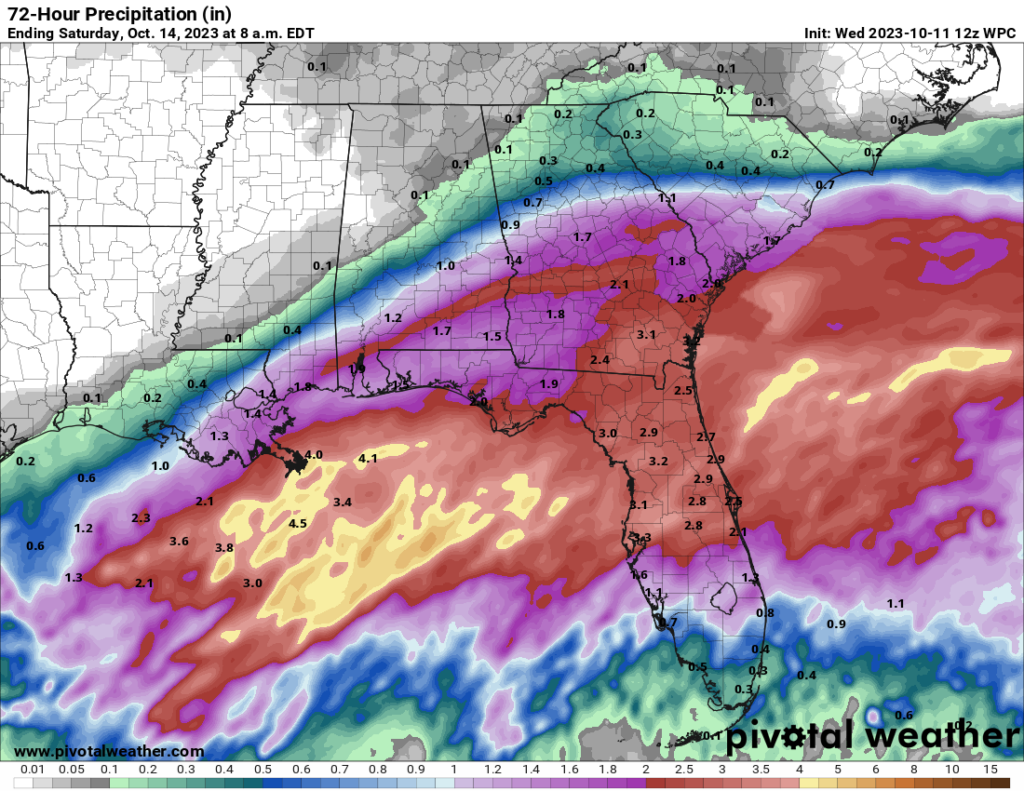
Overall rainfall totals look fine, with 1 to 3 inches from Southern Louisiana along the Gulf coast all the way to the Tampa area of Florida. Some locations may see higher amounts, but this system will be pushed out of the region by Friday and Saturday as a broad front brings drier air into the southern United States. So, not a huge concern.
Hi Sean, Goodbye Sean
Tropical Storm Sean has formed in the Atlantic tropics, about halfway between Africa and the Caribbean Sea. This system is expected to piddle along for a few days before it gets swamped by wind shear this weekend most likely. It will not threaten land. That’s probably about all we need to say about Sean.
Tropics later
Beyond Sean there are some mildly interesting features that we are watching.
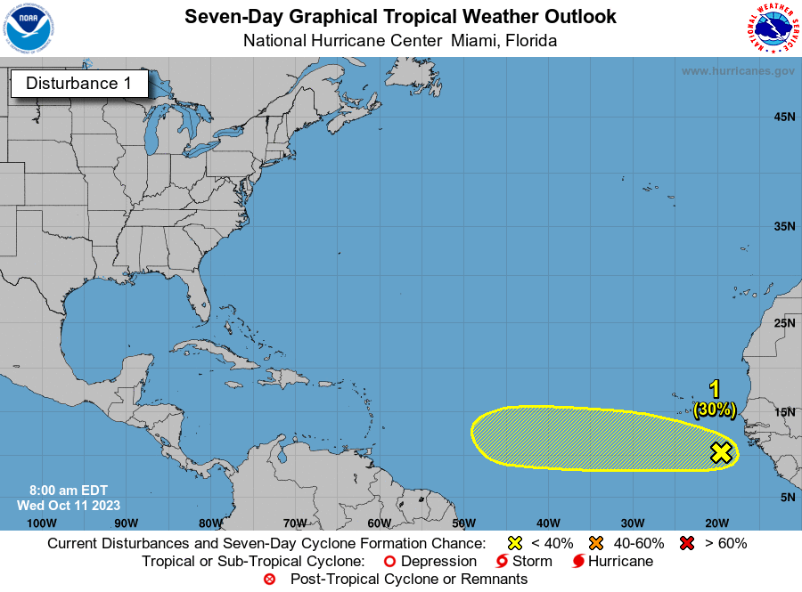
The first of these is a tropical wave that just moved off of Africa, and should continue to move due westward through the weekend. The atmosphere isn’t overly favorable for development, so the National Hurricane System only gives this system a 30 percent chance of becoming a tropical storm over the next week. But eventually, and we’re talking at least a week to 10 days from now, this system might be something that eventually approaches the Leeward Islands. It’s not something I am really concerned about at all right now, but we will continue to watch it for you.
Beyond this, we probably need to be wary of some late-season development in the Caribbean Sea. Waters remain very warm in those sun-bathed seas, and there are some hints of potential storminess during the last 10 days of October. There’s not much of a threat to point to, just the potential for something to eventually spin up.
I’ll take *mildly interesting* 💜
And rain for NOLA ☔ 👻 ☔
Do the 30% wave off Africa, or the potential late-season Caribbean development mean anything to Houston?
Nope