One-sentence summary
Decent viewing is expected for this weekend’s solar eclipse, with a few exceptions, while we have a few days to check on Invest 94L before it develops and potentially becomes a troublemaker in the Atlantic.
Tropics: Invest 94L emerges as a potential troublesome late season pest in the Atlantic
Tropical Storm Sean regrouped yesterday, but it is expected to gradually fade away as it turns northwest over the next few days.
Behind Sean, however, lurks our next system. I was hoping we might have a couple days to chill out before we started really following this one, but here we are. Invest 94L is nothing to look at right now, and it only has a very low chance to develop into anything over the weekend. But as we go into next week, the odds are beginning to increase that something will come of this.
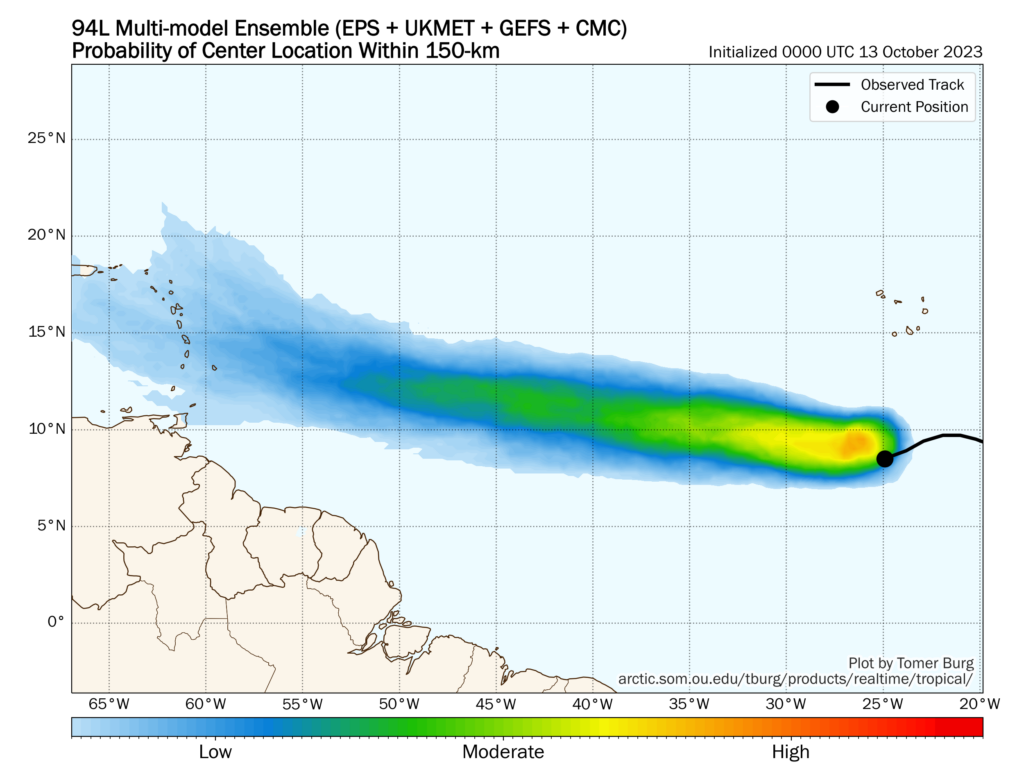
While we’re a long way from having to actually worry about this, there’s enough potential there to say this is going to be worth watching. As Sean exits, the central Atlantic is going to fill up with a pretty beefy ridge of high pressure. Winds turn clockwise around high pressure, which means, 94L will be generally directed due west with minimal latitude gain over the next several days. Wind shear may or may not begin to lighten up a bit on its track as well, and that will help determine what upside there is to this system.
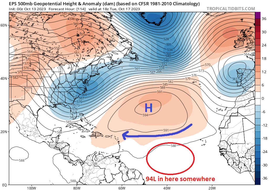
What is troublesome is that the odd lack of latitude gain and the oddly far south for October placement makes this a candidate to potentially run into the Caribbean islands. And if it can find a hospitable environment to strengthen in before that point, well we may actually have a storm to watch in the Caribbean in 8 to 10 days or so. For now, any talk of 94L’s end game is speculative at best, but this will merit watching in the days ahead.
Eclipse Outlook
Alright, tomorrow around midday central time is the big event! Our annular eclipse will occur, with totality from Oregon into northern Nevada, southern Utah, New Mexico, and west-central Texas. Will the skies cooperate?
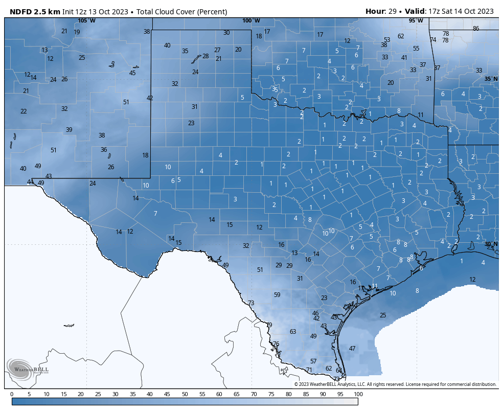
Per the NWS outlook, Texas looks mostly good. As you get into the Rio Grande Valley, there will be cloud cover, particularly between McAllen and Del Rio. There will likely be at least some cloud cover in Brownsville, San Antonio, and Corpus Christi. The Panhandle will also see clouds, as should southeastern New Mexico, though hopefully not a total overcast.
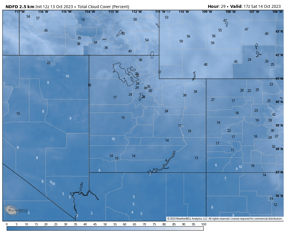
Utah will have at least some cloud cover in most spots, but it does not seem like enough to obscure the eclipse, especially near the path of total annularity. Coastal Oregon looks clouded in, with gradual improvement as you head east across the state and into Nevada, which should just have patchy clouds here or there.
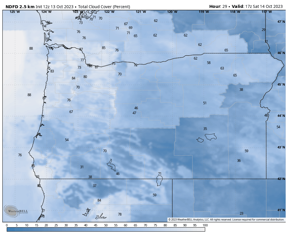
Overall, the only two places that I think will have real problems are coastal Oregon and portions of the Rio Grande Valley. Hopefully you’re able to see it where you are if in the path, and please remember to use eye protection!
Elsewhere, we should hopefully see the beginnings of calmer weather this weekend nationally after some heavy rain of 1 to 3 inches today for Chicago, Milwaukee, Madison, and Minneapolis. An inch or two will fall tomorrow in the Mid-Atlantic as well. More for you Monday!
Does 94L mean anything to Houston?
Hi, Matt J!
Space City Weather is an excellent source for Houston-centric weather. Eric and Matt always make note of any credible weather events likely to impact the Houston area over on that site.
As for 94L, Matt L specifically stated the following in today’s The Eyewall post:
“For now, any talk of 94L’s end game is speculative at best, but this will merit watching in the days ahead.”
I hope this helps!
Not to worry, either Matt or Eric already called the hurricane season over for the Gulf a couple of weeks ago.