In brief: Melissa will struggle for another day or so before it likely explodes into a major hurricane near Jamaica, yielding a lot of bad things. We are most troubled by the flooding potential in Haiti, eastern Cuba, and Jamaica. Whatever the case, this is going to be a destructive, very bad storm for those locations.
How Melissa should go from mess to might
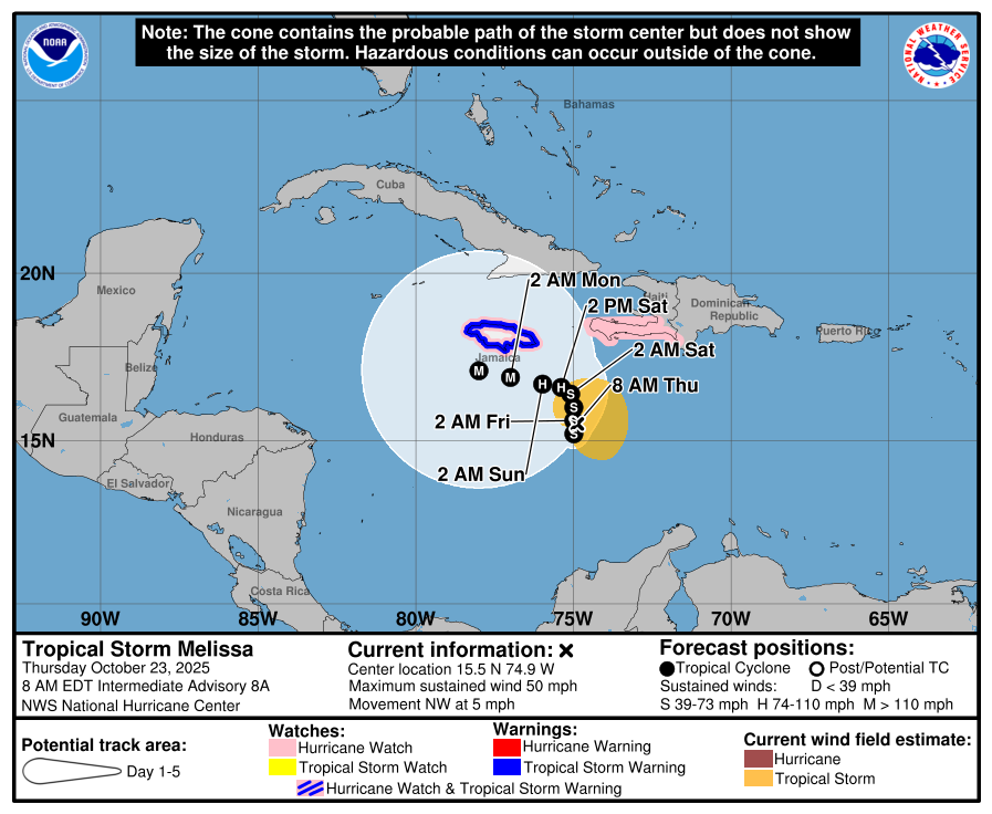
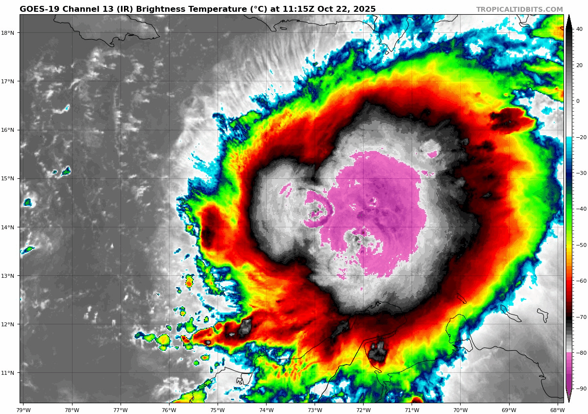
Tropical Storm Melissa continues to oscillate in intensity today, now down to 45 mph maximum sustained winds. We figured it would be a slog at first, and it is just that.

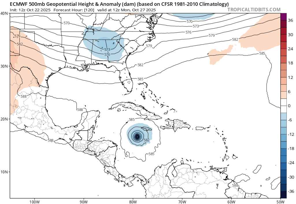
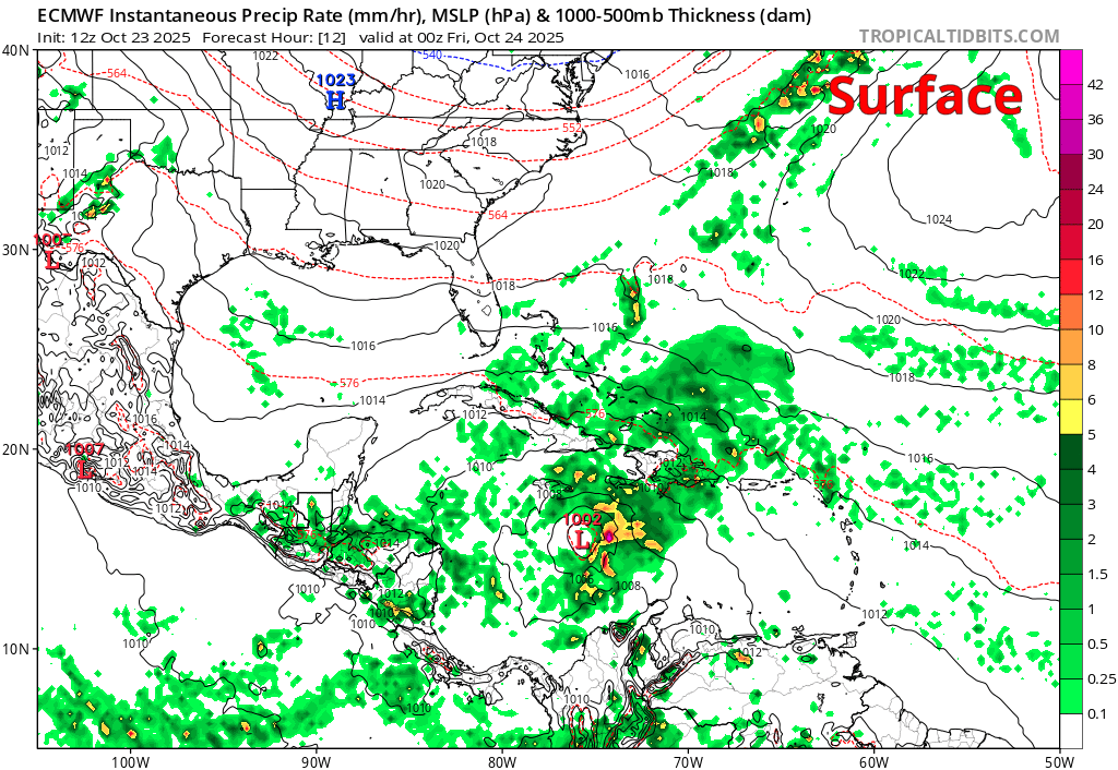
It is battling wind shear mightily at the moment, which is basically causing the storm to be tilted. The actual surface center is to the west of the thunderstorms, while the upper level center of the storm is located to the east of there. You can see on the animation below how the center of the system tilts with height from the surface to 20,000 feet up (500 mb level).
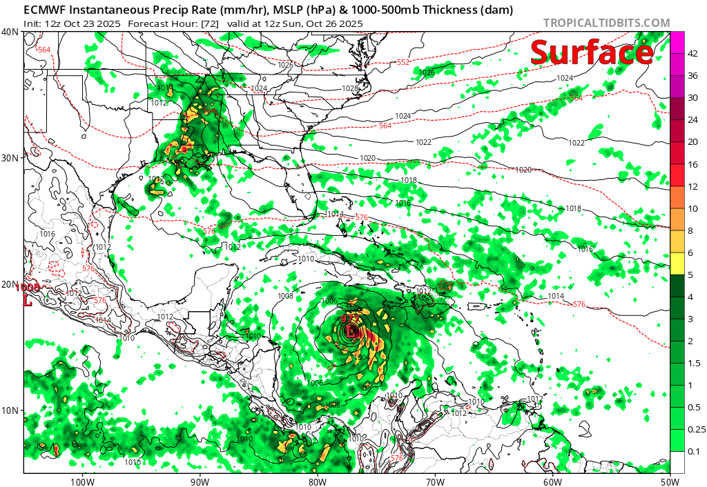
Strong wind shear will do that! Now, over the next 48 hours, that shear is going to diminish. This will allow the system to better vertically align. In fact, by Sunday, per the European model below, you can see how the surface, 5,000′ (850 mb), 10,000′ (700 mb), and 20,000′ (500 mb) centers are basically all atop each other rather than skewed to the east.
As Melissa vertically aligns, it will become stronger. And then the process will basically start a feedback loop, allowing Melissa to feast on a more pristine environment of low wind shear and incredibly warm water. The combination should allow for explicit rapid intensification of Melissa very near Jamaica. As this occurs, Melissa will become a powerful, extremely dangerous storm by Sunday or Monday.
How strong does Melissa get?
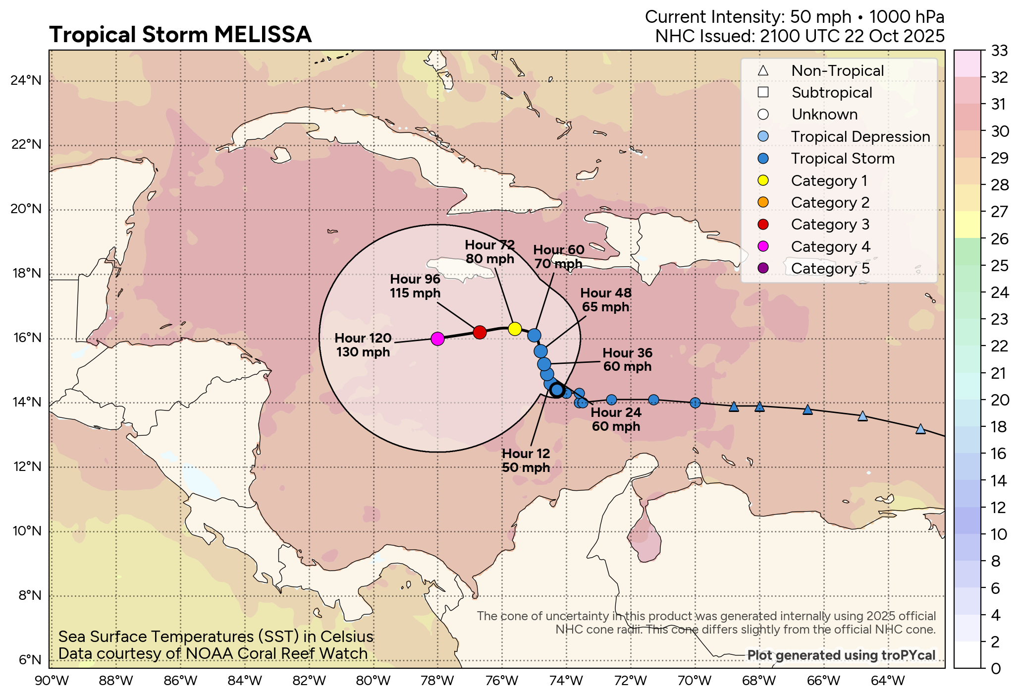
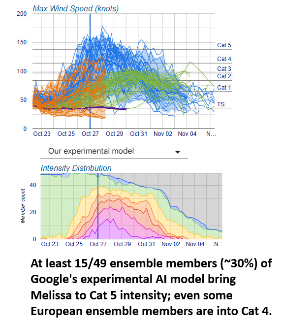
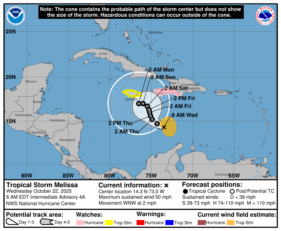
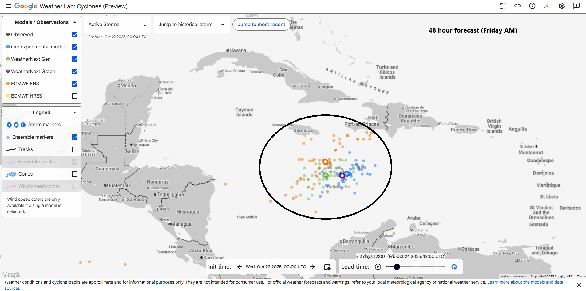
Much like the last few days, the sky is the limit with Melissa, as long as wind shear relaxes and it remains over water. With steering currents basically allowing Melissa to meander the next 18 to 36 hours, possibly northward, when they allow for a slow west drift late this weekend, it will depend on whether or not Melissa hugs the coast of Jamaica or remains offshore that will determine how strong it ultimately gets. Hurricane? Almost a guarantee. Major hurricane? Probably. Cat 4 or 5? Seems like a better than average risk. Consensus modeling puts it as a higher end category 3 storm, while Google Deep Mind and the HAFS model suite take it well into category 4 intensity. That’s where the NHC forecast sits right now, which makes a lot of sense given the environment.
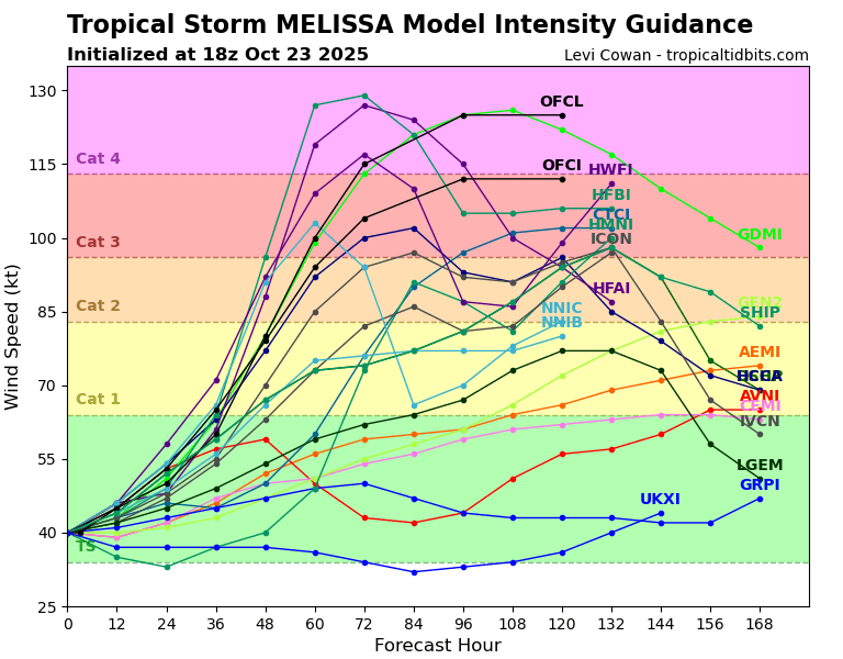
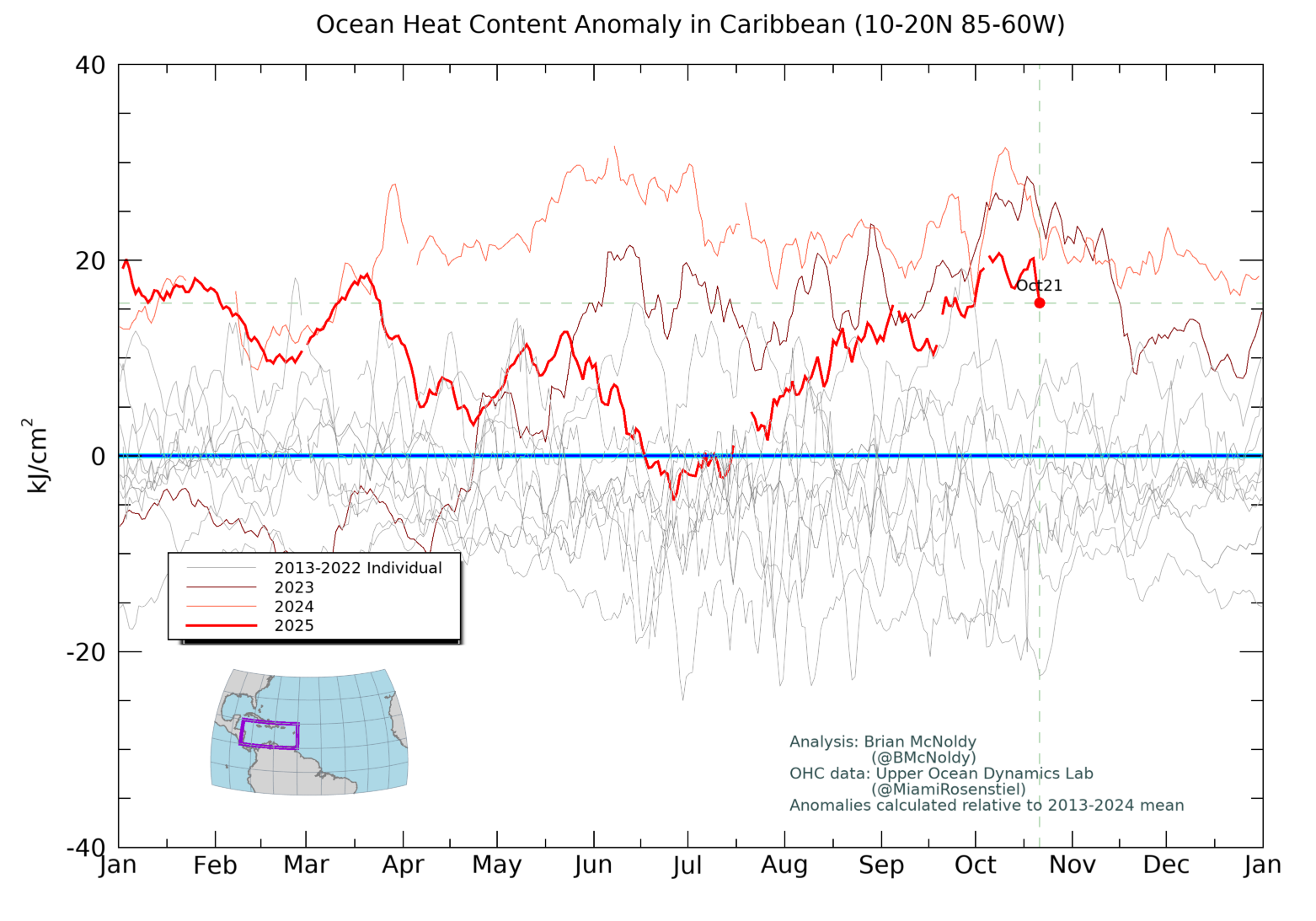
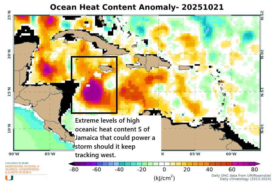
It appears that Melissa’s intensity will peak in the 72 to 120 hour period, while the storm is in the Caribbean near, south, or just southwest of Jamaica. This also places it near or over the highest oceanic heat content in the basin, meaning it will be ideally situated for high-end intensification. The sky remains the limit, barring land interaction.
Catching Melissa’s Drift
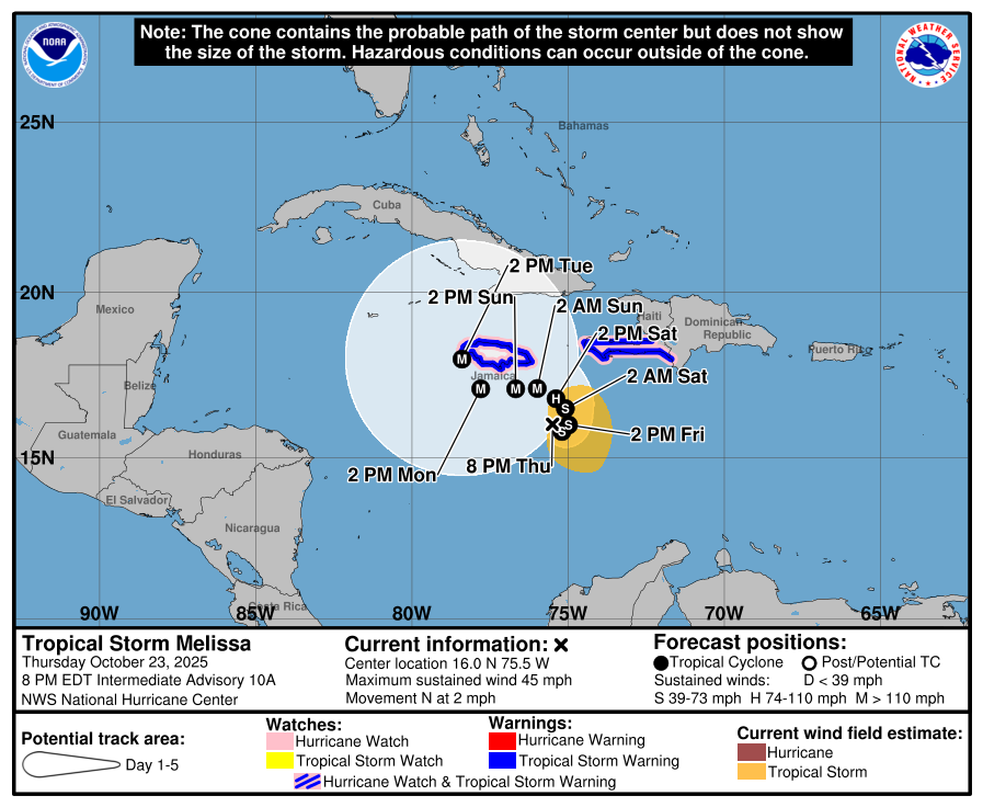
As Melissa drifts westward thanks to basically collapsed steering currents and high pressure to the north gently nudging it to the west, it will remain in rather close proximity to Jamaica, likely lashing the island with hurricane conditions for perhaps 2 full days or more. This reminds me a little of how Dorian stopped moving near Great Abaco and Grand Bahama Island in 2019 as a category 5 storm. The terrain in Jamaica means that the proximity to land will dictate things a little more, but the general idea is that you’re going to have a massive storm at or near peak intensity in very close proximity to land, in this case Jamaica.
Eventually, as a trough digs into the Eastern U.S., it will begin to try to capture Melissa allowing it to turn northward and track toward Cuba. However, while this process begins after Tuesday, it probably won’t accelerate out to sea until Thursday. So it may take another day and a half to get from west of Jamaica to Cuba itself.
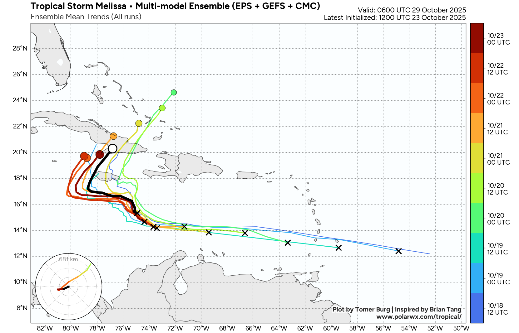
From there, Melissa will slowly exit, probably over the southeastern Bahamas and out to sea, hopefully closing the books on the 2025 hurricane season.
The flooding
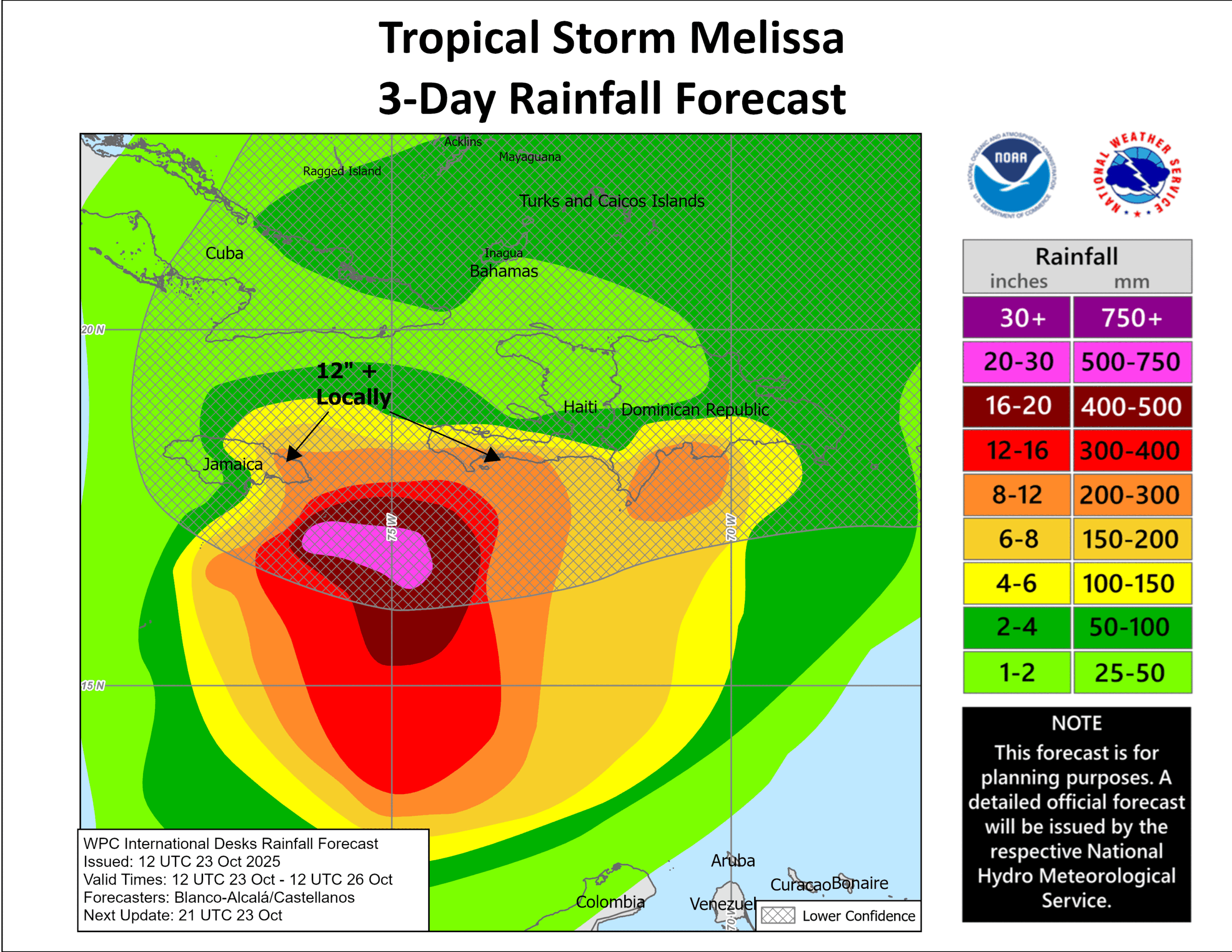
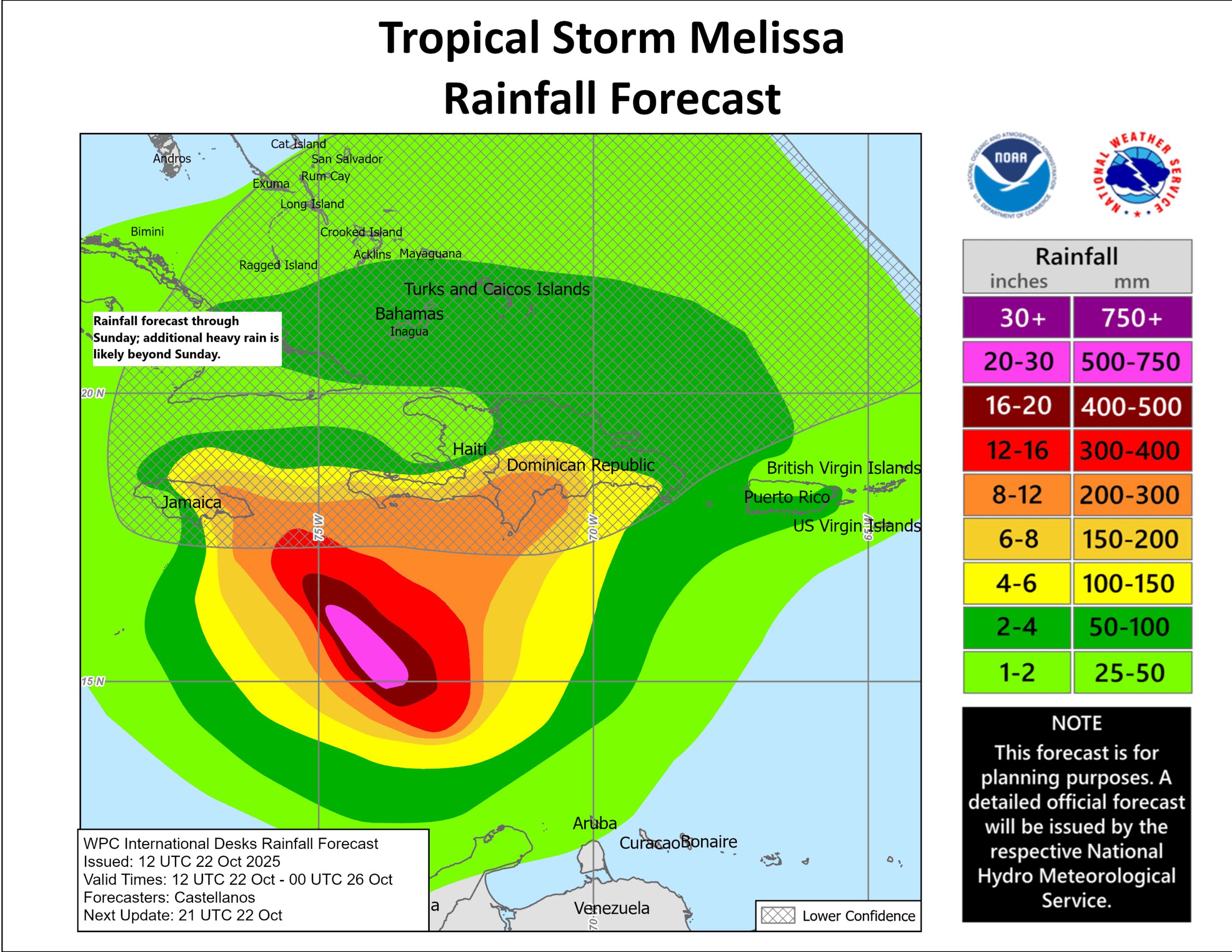
Melissa is going to be a terrible storm. There are just no two ways about this. It’s going to be hour after hour of lashing. Even if that’s not at major hurricane intensity on land in Jamaica, it will be powerful. And it will rain. A ton. I’ve shown the forecast for rain, but unfortunately because Melissa is staying at the Residence Inn and not the Holiday Inn Express, 72 hours doesn’t cover the entire forecast. Here’s a look at the forecast from today’s European model. Keep in mind that these totals will vary a bit, and the exact totals will depend on the exact track, but for Jamaica, this is absolutely horrid.

Unfortunately, it’s tough to argue that these totals can’t be achieved. The slow movement and rapid intensification should allow for this to occur. Additionally, heavy rain is likely in eastern Cuba and southwest Haiti.
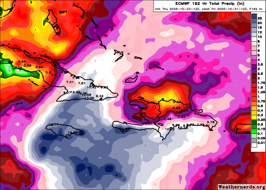
Perhaps 20 inches of rain could fall in those areas too. This seems increasingly likely to be a catastrophic rain and flooding event in addition to a very bad hurricane for Haiti, eastern Cuba, and Jamaica. Sometimes you just feel helpless when you look at things like this, knowing the message is clear, the uncertainty not terribly high, but the end result will still be terrible. Here’s hoping somehow it underperforms.
More tomorrow.