In brief: Tropical Storm Bertha may be nearing its peak before it begins a steady, if not quick weakening trend on approach to Louisiana. Bertha is expected to dissipate before reaching Texas. Impacts from Bertha will include high tides and some minor tidal flooding perhaps on the Mississippi and southeast Louisiana coasts, as well as locally heavy rain.
Big Bertha
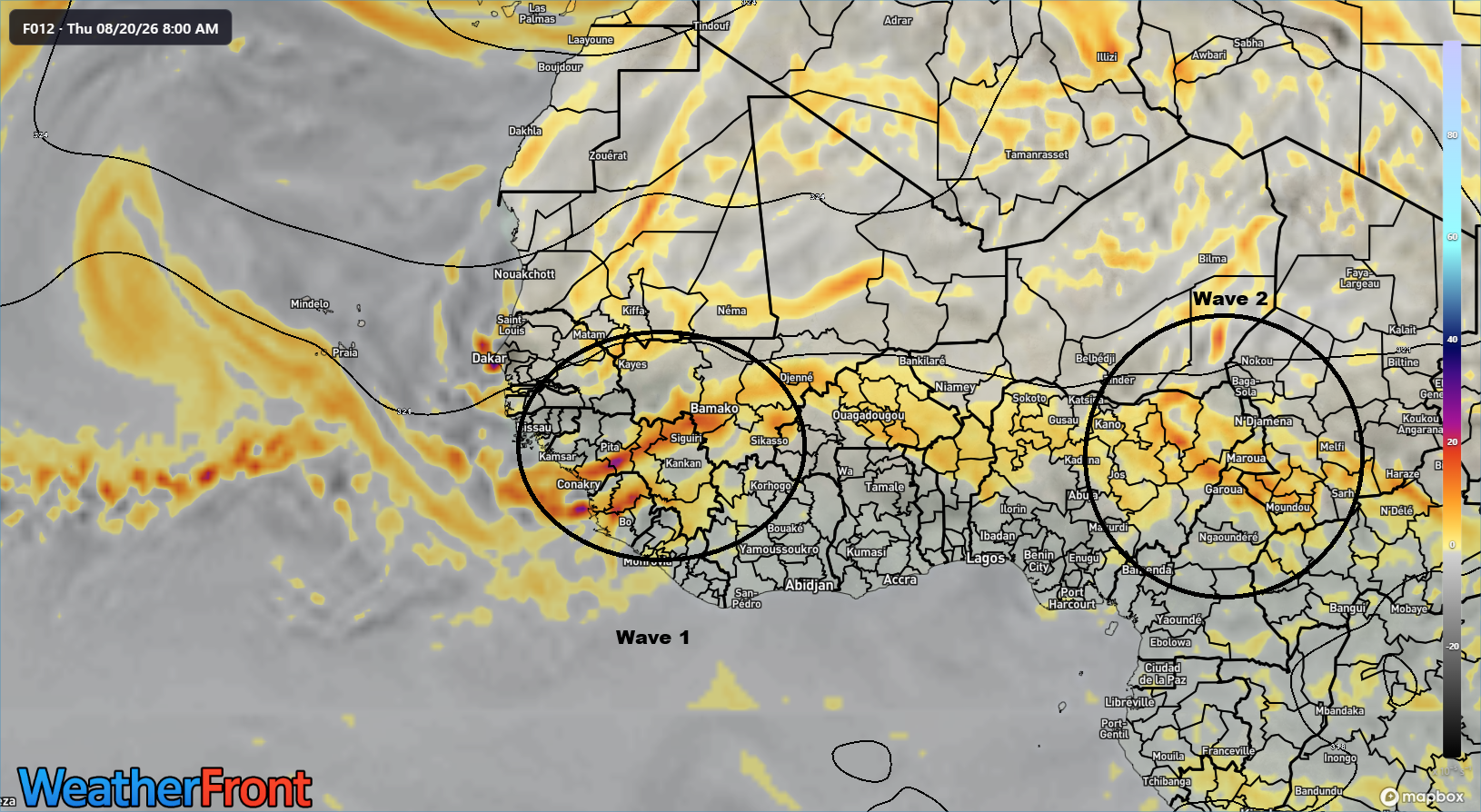
Ok, Bertha isn’t exactly big. But it’s a tropical storm. It’s more like a blob. Or a couple blobs. Or a creepy thing staring at you.
Bertha is frazzled but formidable over the Gulf waters. (WeatherFront)
Bertha is extremely reminiscent of another “B” storm in the Gulf from a few years back, Barry. Barry became a hurricane, or more like a halficane.
Barry in 2019 was a lot like Bertha. (NOAA)
Barry’s center was constantly north of all the thunderstorms. In Bertha’s case, it’s similar. Where’s the center?
(WeatherFront)
The center is visibly exposed north of the thunderstorms and located just south of Destin. The bulk of the wind with Bertha is located under the storms, especially south and east of the center. We are seeing 40 mph wind gusts near Cape San Blas east of Panama City and a 43 mph gust near St. Teresa and Bald Point State Park (which is a beautiful place to visit). So, Bertha’s doing the thing. Maximum sustained winds are around 60 mph, again offshore under the thunderstorms. Bertha is probably near its peak intensity this morning.
(NOAA/NHC)
Bertha is expected to track west northwest for a little while before shifting west and perhaps even west southwest over the immediate coast of Louisiana.
Bertha should be near peak intensity today, and we’re fairly confident of this for two reasons: Wind shear and dry air. Bertha’s going to get attacked on both sides in about 12 to 24 hours. On the eastern flank, northeasterly wind shear. On the western flank, dry air.
Use the slider to compare dry air and wind shear as forecast on Wednesday morning. (Tropical Tidbits)
The combination of these factors in conjunction with a storm that is already just barely holding it together coherently historically leads to rapid weakening. We hear a lot about rapid intensification during hurricane season, something we’ve seen happen more and more often in recent years. But rapid de-intensification may be the story here. Bertha should weaken to a depression by the time it gets west of New Orleans, and frankly, it may be lucky to even have an identity anymore by the time it gets to Lake Charles. There may some additional thunderstorms into western Louisiana or far southeast Texas on Thursday or Friday as the remnants pass through, but even that may be asking a lot.
The main impacts from Bertha to land will be in the form of rain and squally weather. The squalls will produce gusts to tropical storm intensity at times, primarily along the coast east of Vermilion Bay, Louisiana. The heaviest rain should fall in southeast Plaquemines Parish.
Rain totals over the next 5 days. (Pivotal Weather)
Additionally locally heavy rain may fall from Grand Isle west as well as near Mobile Bay. Additionally, waves and tides will increase some across the Gulf Coast, leading to perhaps a 2 to 4 foot peak storm surge in eastern Louisiana, as well as on the Mississippi coast.
(NHC NOAA)
Bottom line: Mostly nuisance impacts from Bertha are expected along the Gulf Coast, particularly in southeastern Louisiana.
No other tropical concerns in the Atlantic at this time.
In brief: TD 2 is a sloppy looking system in the Gulf, and while we should keep an eye on things, it does not appear as if this will deliver significant impacts to the Gulf Coast. We explain what’s at play here. We also take a look at a localized but notable flash flooding risk in New Jersey and NYC tomorrow.
First of all, thank you to all the new subscribers we’ve picked up in the last 24 hours. Thanks for joining us here. Our bread and butter is daily tropical weather discussions, but we also chime in on other significant weather as well. Eric is based in Houston, where I was for the last 14 years, and I am now based in southern New England. Together, we’ll keep you covered through hurricane season and beyond.
Let’s get down to business.
NHC forecast as of Monday morning. (NOAA/NHC)
Tropical Depression 2 formed yesterday in the eastern Gulf. Over the next couple days, it’s expected to drift westward, becoming a tropical storm, possibly as soon as today. The satellite image of TD 2 this morning is far from impressive.
(WeatherFront)
That’s basically a half-cyclone right now. That hasn’t stopped systems from becoming technically tropical or storms or hurricanes, but it does speak to limitations that they will face. In this case, both shear and dry air are going to play a major role in capping TD 2 at mid-tropical storm intensity at best I believe.
Mid-level moisture is limited with TD 2, and the system itself is surrounded by dry air on virtually all sides. (Tropical Tidbits)
If you’re looking for a beefier tropical system, you want to see a lot less dry air than the model above shows. So right away, TD 2 is going to have to deal with continued dry air. This is not something that will change much between now and the end of TD 2’s life cycle. Additionally, while TD 2 is over warm water and dealing with minimal wind shear right now, that’s going to pick up significantly in the coming days. It’s likely that the eastern side of the storm gets blasted by northeasterly wind shear tomorrow or Wednesday, which should further limit development.
(Tropical Tidbits)
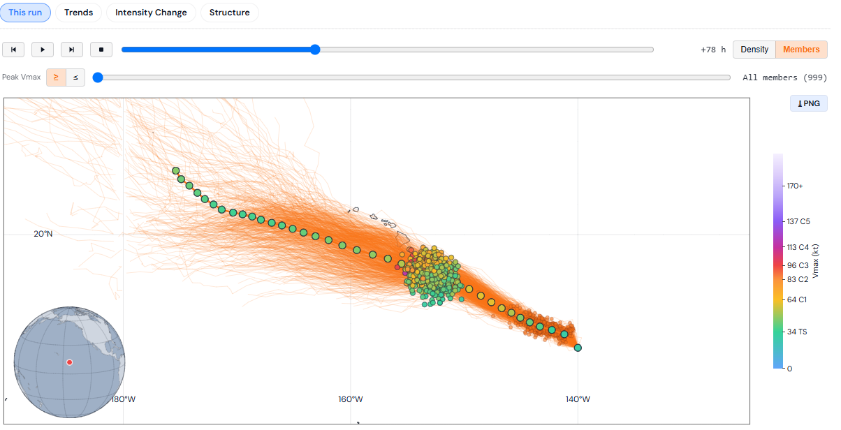
And the vast majority of tropical modeling, as well as Google Deep Mind’s 1,000 member forecast ensemble keep TD 2’s intensity at or below middle grade tropical storm levels. Interestingly, if you look at the various ensembles, you also see a lot of them “losing” Tropical Depression 2 before it gets to Texas.
Google Deep Mind’s storm tracks, showing most of them ending before the storm arrives in Acadiana. (Tomer Burg)
In other words, we are seeing the bulk of the modeling say that TD 2 is going to run its course before getting to Lafayette or Lake Charles. The 5 to 10 percent or so that survive west of Louisiana are the ones coming to Texas. So it may look as if the modeling is all pointed right at Texas, but in reality, that’s mainly saying the remnant is. And when you look at the NHC forecast at the top, you’ll notice the intensity is dropped to depression when it makes it to Texas. Frankly, that may be generous given what we see this morning. It may be that this system ends up arriving as a shell of itself in Texas.
So what will TD 2 do? Assuming it does indeed become a tropical storm by tomorrow, we would probably see a bit of gusty wind on the coast of the Florida Panhandle, along with rain today and tomorrow. Winds as I write this are not gusting much beyond 20 mph there, however. As the system tracks to the west and as the northeasterly wind shear kicks in, most of the rain from TD 2 will migrate over the open Gulf waters.
Total rainfall from the European model (Pivotal Weather)
You can see above how the bigger totals of 5 to 10 inches remain way offshore. The heaviest on land rain is likely to be today into tomorrow for the Florida Panhandle and perhaps in Plaquemines Parish, Louisiana, near where TD 2 will make a close pass Wednesday evening. Some localized flash flooding is possible, but overall this looks like a relatively gentle impact to most portions of the Gulf Coast.
There are still a handful of model ensemble members that track the system a little farther south, a scenario we discussed yesterday and still won’t completely take off the table. It’s becoming highly unlikely though. And even in those cases, it’s likely that the intensity of TD 2, or Bertha, would be capped by the aforementioned wind shear and dry air, and currently about 6 of the 1,000 Google Deep Mind ensemble members bring the storm to hurricane intensity. This was around 100 or so yesterday if I recall correctly.
So for the Florida Panhandle through Mobile, expect heavy rain and some locally gusty winds, perhaps to tropical storm force on the immediate coast. From Mobile through New Orleans, you’ll see some occasional downpours and perhaps breezy conditions but not much else. South of New Orleans through Acadiana could see some heavy rains midweek, along with breezy conditions. From Acadiana through Texas, impacts should be minimal and mostly confined to some hotter temperatures Wednesday as that northeast flow kicks in, as well as perhaps a slight chance of showers by Friday. We do not expect flooding concerns to renew in Texas.
That’s as of right this moment. Forecasts can and do change, and we encourage you to continue monitoring the forecast as the week progresses. But we do not expect a dramatic change in TD 2’s outlook right now.
Elsewhere, the Atlantic is quiet!
Northeast/Mid-Atlantic storms & flooding
Another round of storms and potential flooding returns to the East Coast tomorrow, and I am cautiously watching the corridor between Philly and New York City for flooding risks. The area is under a slight risk (level 2/4) for flash flooding, but that does not currently include New York City.
Flash flooding risks are slight (level 2/4) in the Mid-Atlantic tomorrow. (NOAA)
Some of the higher resolution model guidance is perking up about potential flash flooding north of I-195 in New Jersey. Flash flood guidance, or the amount of rain needed in 6 hours to trigger flash flooding is around 1 to 1.5 inches in urban northern New Jersey.
6 hour flash flood guidance in the Mid-Atlantic. (NOAA)
Depending on exactly how things set up tomorrow, it is possible that the flash flooding risk is a bit higher than currently presumed, particularly in the New York City metro area. Just something to pay attention to in that area.
In addition to flooding, there is an enhanced risk of severe weather, level 3/5 in areas west of I-95 tomorrow and a slight risk (2/5) elsewhere. Severe watches are likely on Tuesday as well.
In brief: Today we look at the increased development odds of Invest 91L, as well as the couple scenarios that are on the table. Interests along the Gulf Coast should monitor Invest 91L closely over the next couple days.
Editor’s Note: Invest 91L was reclassified as Tropical Depression 2 as our post was published.
(NOAA/NHC)
Let’s check out Invest 91L this morning.
Invest 91L looking modest in the eastern Gulf this morning. (WeatherFront)
Not terrible. Still not a tropical system, but we’re slowly getting there. The NHC odds have increased to 80 percent this morning.
(NOAA/NHC)
Modeling is getting a bit more aggressive with developing this into a formal entity. Of the 1,000 Google Deep Mind ensemble members, almost all 1,000 are now developing the system. Looking closer at the operational version of GDM, we can see a general track spread that either hugs or stays just south of the Gulf Coast.
Most operational GDM members keep 91L offshore, allowing it to develop into a moderate tropical storm. (Google Deep Mind)
When looking at the possible intensity of 91L, the vast majority of guidance, including about 75 percent of the 1,000 member ensemble keep this a tropical storm. Most tropical modeling aside from Google agrees on this as well.
Intensity forecasts from Google’s Deep Mind and from the other tropical models. (Google/Tropical Tidbits)
There are a couple GDM members that bring 91L up to hurricane intensity. And when you look at the European ensemble, we see this as well to a much more substantial extent.
The European physical ensemble is quite aggressive with tropical development from Invest 91L, with at least 20 percent of its members bringing it to a hurricane as it comes west. (Weathernerds.org)
It is worth noting that some changes were made to the European ensemble this past spring, so we’re kind of working with an unknown quantity, at least operationally right now. The AIFS ensemble is notably much, much weaker than the Euro physical. This feels like a bit too much of an outlier to me to take seriously right now, but obviously folks on the Texas and Louisiana coasts should keep watch on this.
In terms of the overall environment that Invest 91L, if you look at the operational European model (not the ensemble), you’ll see that generally, Invest 91L will be operating within a little cocoon of favorable moisture levels, but dry air is not far away, surrounding the cocoon on all sides.
Mid-level atmospheric moisture forecast for Tuesday (Tropical Tidbits)
How about wind shear? Well, there’s going to be a good bit of northerly or northeasterly shear as well in the Gulf. That should help hold it back some. But it may also allow it to track a little farther offshore, increasing its residence time over warmer water, which could allow for a little bump in potential intensity. The upper pattern does in fact offer that as a possibility, with strong high pressure over northern Texas, it could allow a farther south and west track to occur.
The upper pattern provides a good bit of uncertainty over the next few days in terms of how Invest 91L may track. (Tropical Tidbits)
So what’s the story here? I think we can expect gradual development over the next 36 hours from Invest 91L, possibly becoming a “potential tropical cyclone” by later today or Monday morning. The smart money right now would be on a mid-grade tropical storm tracking into Louisiana. However, there is a not so inconsequential minority solution that takes Invest 91L farther south and west, opening the doors to more of a Texas coast outcome, most likely south of Houston.
Bottom line: Gulf interests should be monitoring this system over the next couple days. We may post an update as early as later today. Stay tuned.
In brief: Odds of development in the northeast Gulf have increased a good bit since yesterday, however the likely intensity of any system still looks to remain low. We update the rain totals and potential impacts on this Saturday afternoon.
Odds of development are up to 40 percent in the northeast Gulf. (NOAA NHC)
I just want to check in this afternoon, as we have seen some changes in the broader evolution of the Gulf disturbance off the coast of Florida. First, the satellite loop shows what may seem like a pretty well-defined circulation.
(WeatherFront)
And there is, but the pressures are high, the winds are low, and the circulation is broad. So at this point, it’s not as if development is imminent. That being said, we’ve seen a big jump in development odds from the models since yesterday. What had been about 15 to 20 percent risk is now up to a 50 to 60 percent risk on Google’s Deep Mind 1,000 member ensemble.
Google Deep Mind’s 1,000 member ensemble is showing about 60 percent odds of development as the system drifts west just off the Gulf Coast. (TC Atlas)
What has not changed since yesterday is that the system, now dubbed Invest 91L is unlikely to gain much strength. At this point, most model guidance keeps this as a depression or low-end tropical storm. What does that mean? The wind and marine threats, while impactful should be mostly nuisance. At this point even the rain looks to be more nuisance than anything as the bulk of it is expected to remain offshore through Wednesday.
European AIFS ensemble total rainfall through Wednesday. (WeatherFront)
There may be some locally heavy downpours on the immediate Gulf Coast between Sarasota and New Orleans but overall the type of heavy, flooding rain would likely remain over the open Gulf waters.
Beyond midweek, the system is likely to basically fall apart or just nudge inland and dissipate, with some locally heavy rain perhaps in Louisiana or Mississippi as it does so. At this time, it does not appear to be a Texas threat.
Bottom line: Development chances are increasing today, but the ceiling for intensity on this system remains quite low, and the bulk of the rain is likely to fall over the open Gulf. Still, it’s the Gulf Coast in July. Check in with your local weather sources for any updates each day. We’ll keep you posted as well.