In brief: Invest 97L may end up being a beneficial rainmaker for parts of Louisiana and Texas over the next couple days, as it tries to develop before moving ashore on Tuesday near the Texas/Louisiana border. Meanwhile, Dolly’s chance at a second act seems minimal at this point, but it’s worth watching the pattern in the eastern Gulf in a little over a week.
Invest 97L to bring some rain to Texas and Louisiana
We’ll start closer to home today, with an area of possible development that felt like it sort of crept up out of nowhere after Friday morning. We have a disturbance now, Invest 97L, with about a 50 percent chance to develop over the next couple days.
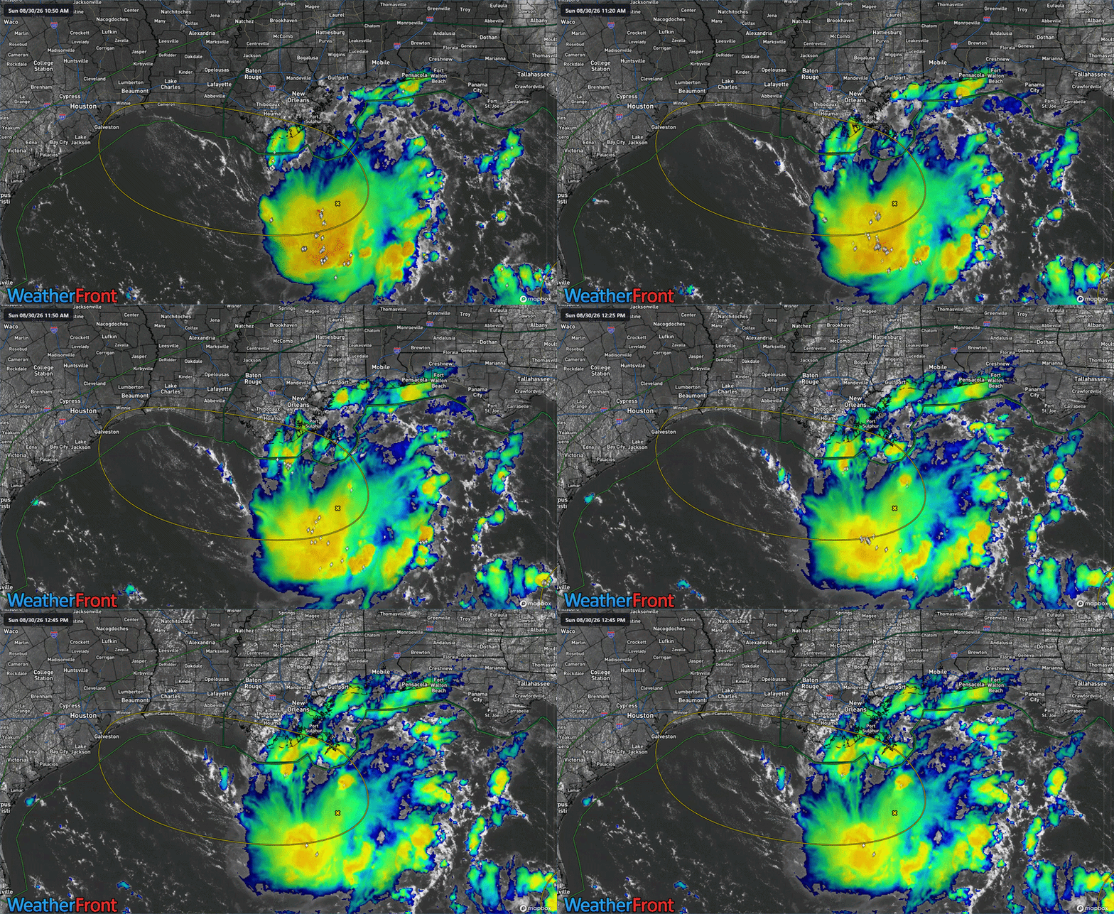
Overall, the system has a pretty good deal of thunderstorm activity with it, not terribly dissimilar to what we saw with Bertha a few weeks ago. Whatever the case, there have been worse looking systems this summer. The models are not especially bullish on further development of 97L. Google’s Deep Mind 1,000 member ensemble has about an 8 percent chance of development, while the operational model doesn’t develop it all. And indeed, while wind shear isn’t terribly hostile where it currently sits, it should pick up a little bit over the next day or so. Not a lot, but perhaps enough to stave off a depression? We’ll see.
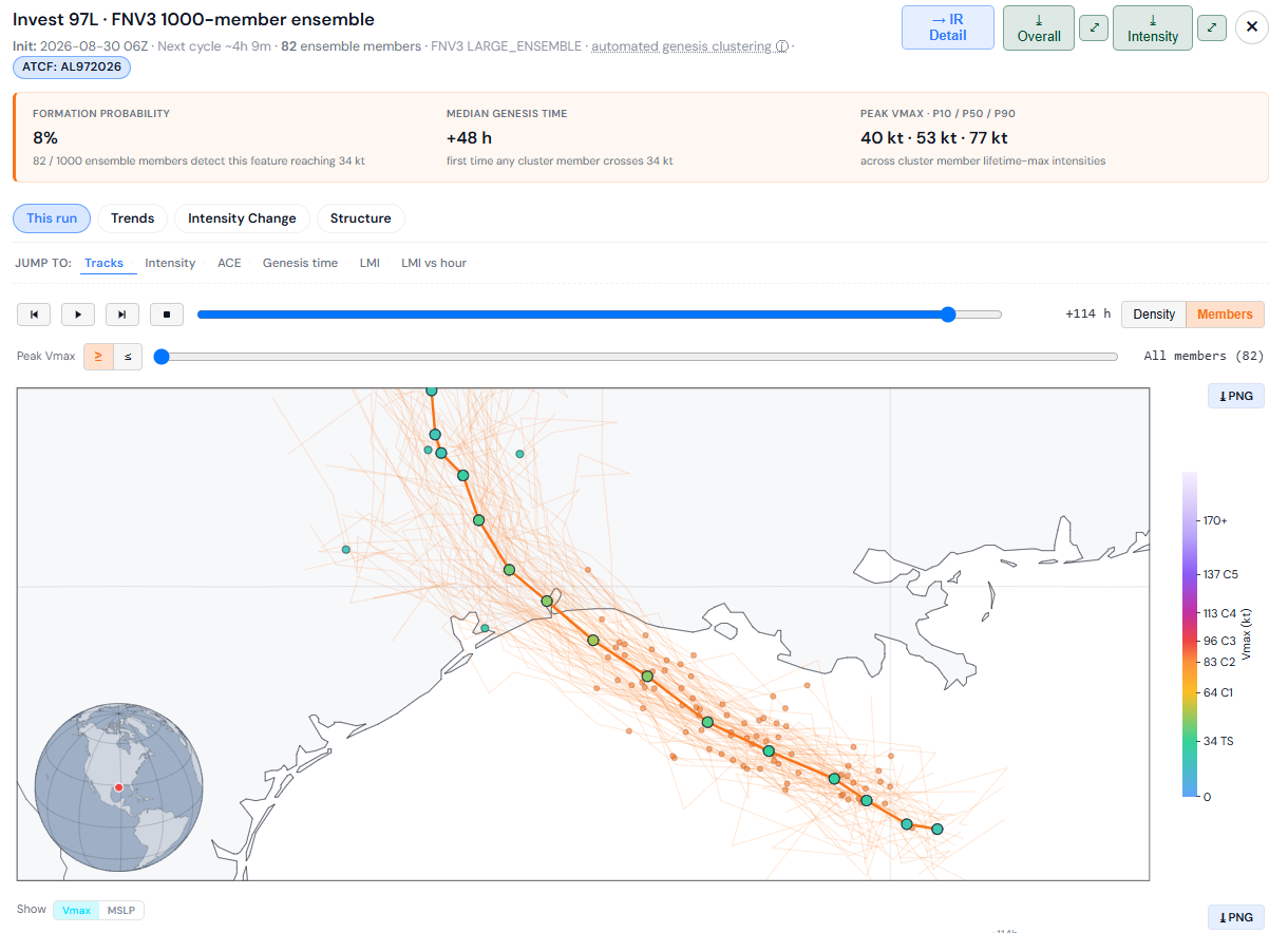
Either way, expect 97L to track generally west to northwest over the next couple days, bringing it ashore somewhere near Port Arthur or Sabine Pass by Tuesday. At this point, I would not expect much more than an open wave or a depression. And in fact, any rain from 97L would be most likely welcome in a region that has seen drought begin to really accelerate in the last month or so. But, if 97L can wrap itself up a little faster, over quite warm waters, sure we could end up with a tropical storm. The next name on the list is Edouard.
Once inland, 97L will probably get somewhat boxed in by high pressure to the east that’s going to try and build over top of it back to the west. I don’t think this will “trap” 97L over Texas, but it may act to slow it down a good bit. While this likely won’t lead to a major flooding issue, we could see some daily thunderstorms with heavy downpours possible. Modeling won’t do well capturing that right now, but I would not be shocked to see the rainfall totals shown below begin to inch upward a little over the next couple days between Dallas and Houston.
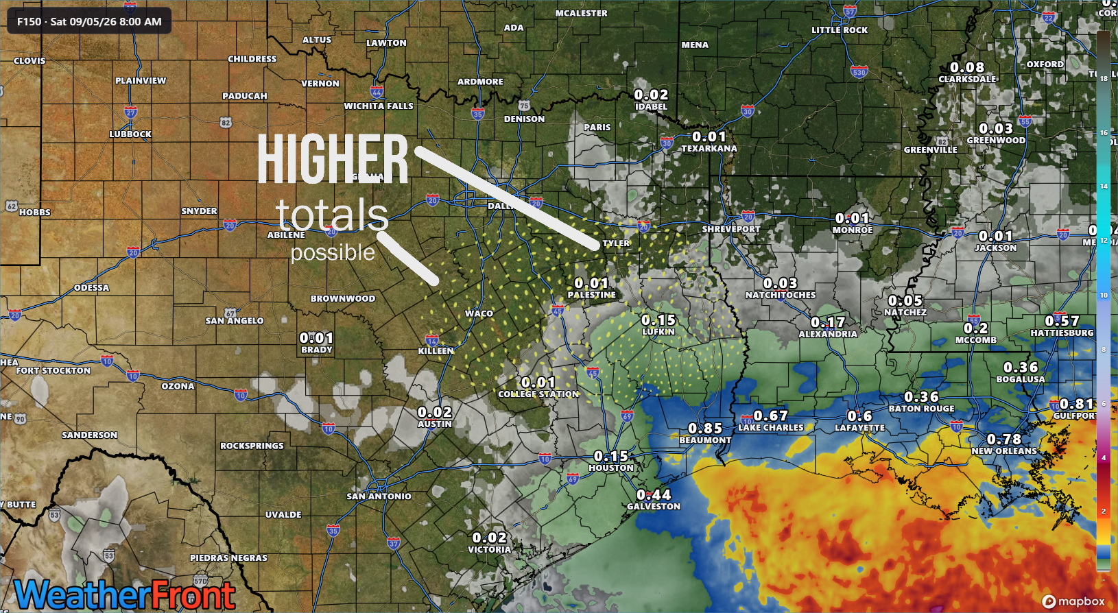
Bottom line with 97L: Worth keeping an eye on for Gulf Coast residents, especially near Beaumont, Port Arthur, and Cameron Parish, LA. Keep an eye on the rainfall forecast farther inland across Texas in case things should change.
Dolly second act chances?
Let’s check on Dolly’s remnants this afternoon.
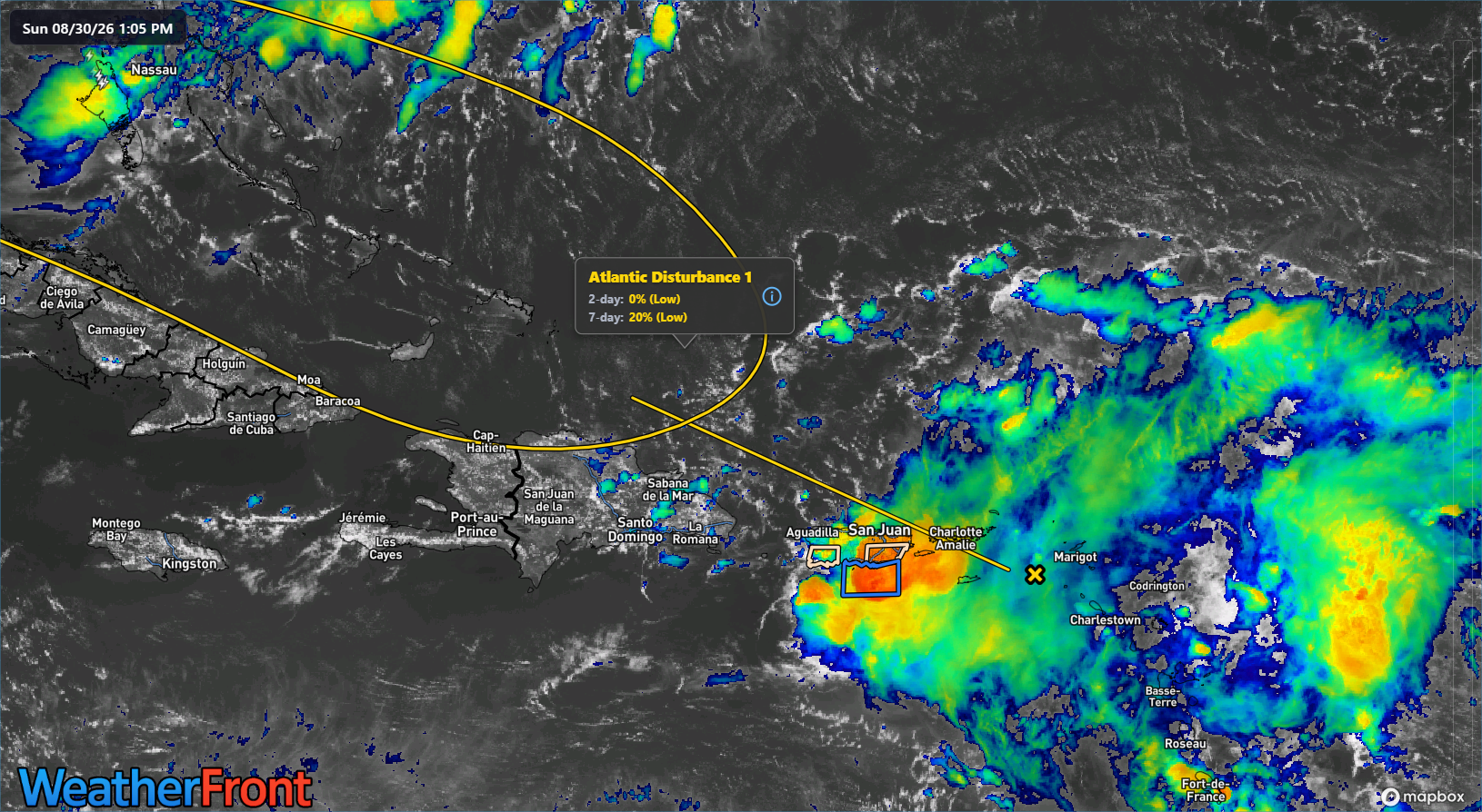
The good news is that rains are falling in the drought-stricken Caribbean. So that’s coming to pass. From here, Dolly’s road is bumpy but not necessarily enough to destroy it. By Thursday, whatever is left of Dolly should be near Cuba and the Bahamas. I would assume it does not look a whole lot different at that time.
From there we embark on a bit of a choose your own adventure with this one. Some models draw it into the Gulf with some further development before crossing Florida and hooking back out to sea. Others keep it subdued without much development. Right now, the camps seem split with the AI modeling very subdued on any future organization and the European model a little more aggressive. There are some other models trying to put something else in the eastern Gulf around the time that Dolly gets there it seems as well. Most modeling takes that across the Florida Peninsula and out to sea.
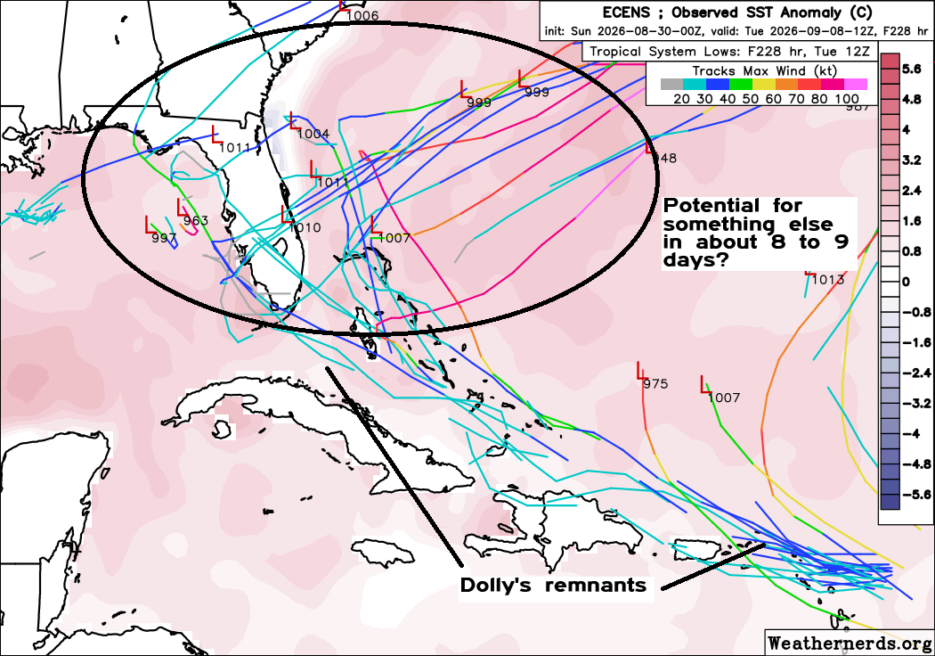
So, this is just kind of sloppy right now, and there’s not much signal to draw out of this noise. What’s it mean? It means we should probably continue to keep track of both Dolly’s remnants and the potential for development in the eastern Gulf in about 8 to 10 days from now. But at this point, there’s no real reason to worry or get worked up.
Beyond that, the tropics are mostly subdued for the time being. But as is the case heading into the peak two to three weeks of the season now, you do want to keep track of each system, even the little ones.