In brief: Tropical Storm Dolly has a limited amount of time left before it likely dissipates, bringing just some remnant rain to the islands. Beyond that, it seems unlikely we’ll get an encore out of Dolly in the Gulf — but there’s at least some reason not to write it off completely.
Tropical Storm Dolly officially formed yesterday out of Invest 96L in the Atlantic, a well-timed storm name for the fourth system of the season. Much like the previous 3 this year, Dolly is not going to hold it together for very long.
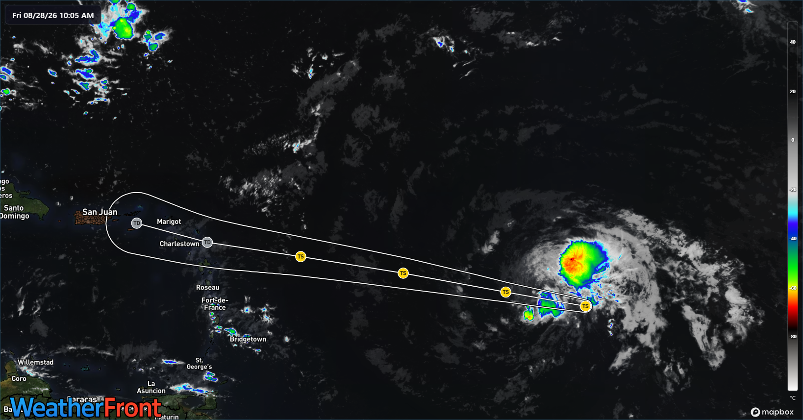
The storm currently sits well east of the Lesser Antilles. Over the next couple days, Dolly will rapidly move west northwest toward the islands, but simultaneously wind shear is going to increase, dry air is not going to improve things, and the forward motion will continue fast. The combination of these factors puts a very strong cap on Dolly’s potential intensity. In fact, in most cases, model guidance degenerates Dolly to an open wave
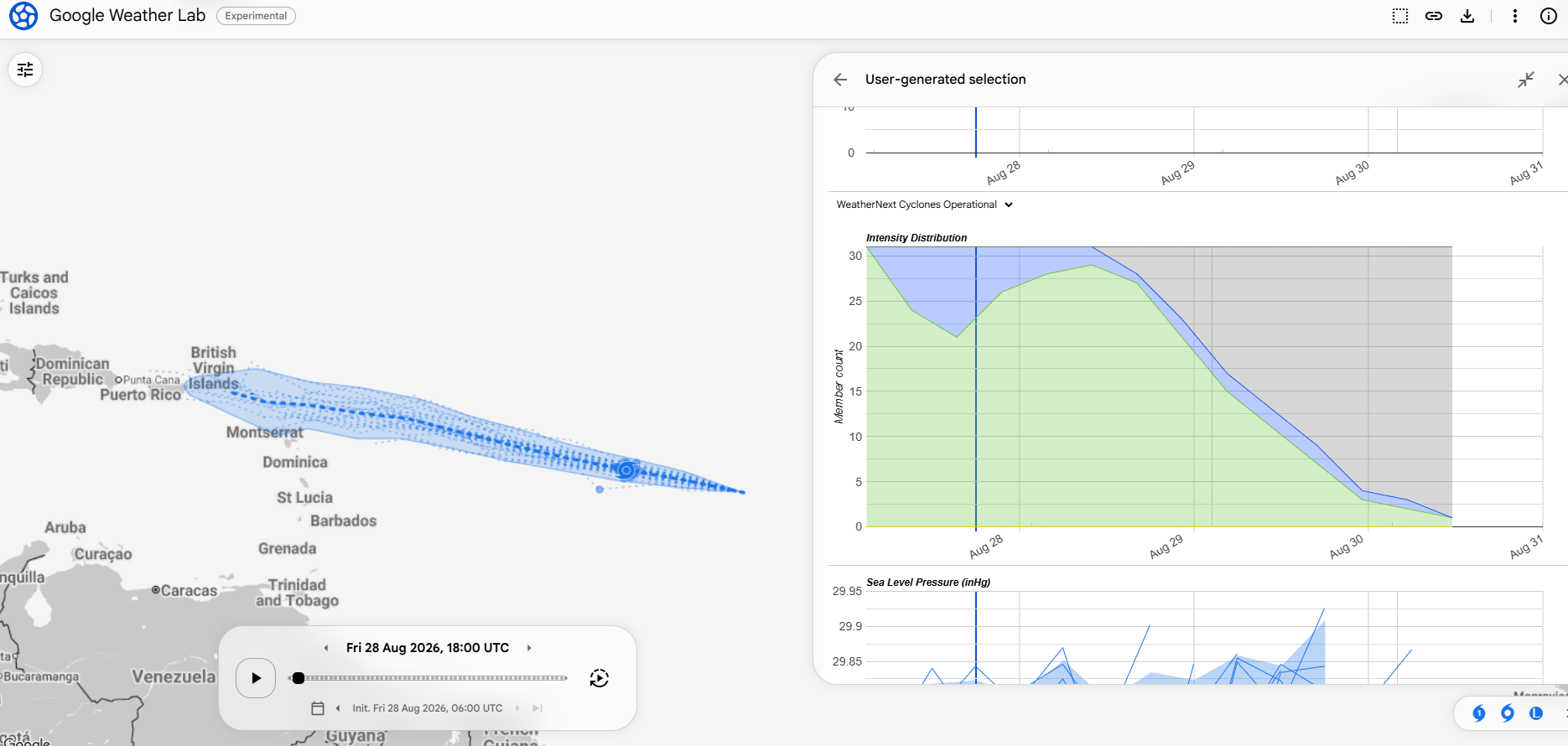
The Google Deep Mind operational model drops the percentage of ensemble members showing Dolly as a coherent system from 100% today to about 10% by Sunday evening.
So at this point, any impacts in the Caribbean should be limited to rain. And this is actually good news. Almost half of Puerto Rico is currently sitting in extreme drought.
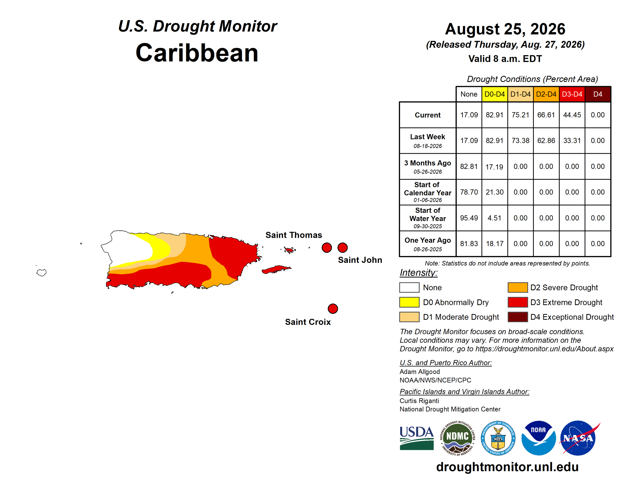
Thanks in part to the strong El Niño, much of the Caribbean is dealing with drought right now. So any rain is welcome. How much rain will we see in these areas? Hopefully a solid 1 to 2 inches falls from this. Usually in drought, the risk is that the forecast comes in lighter than expected.
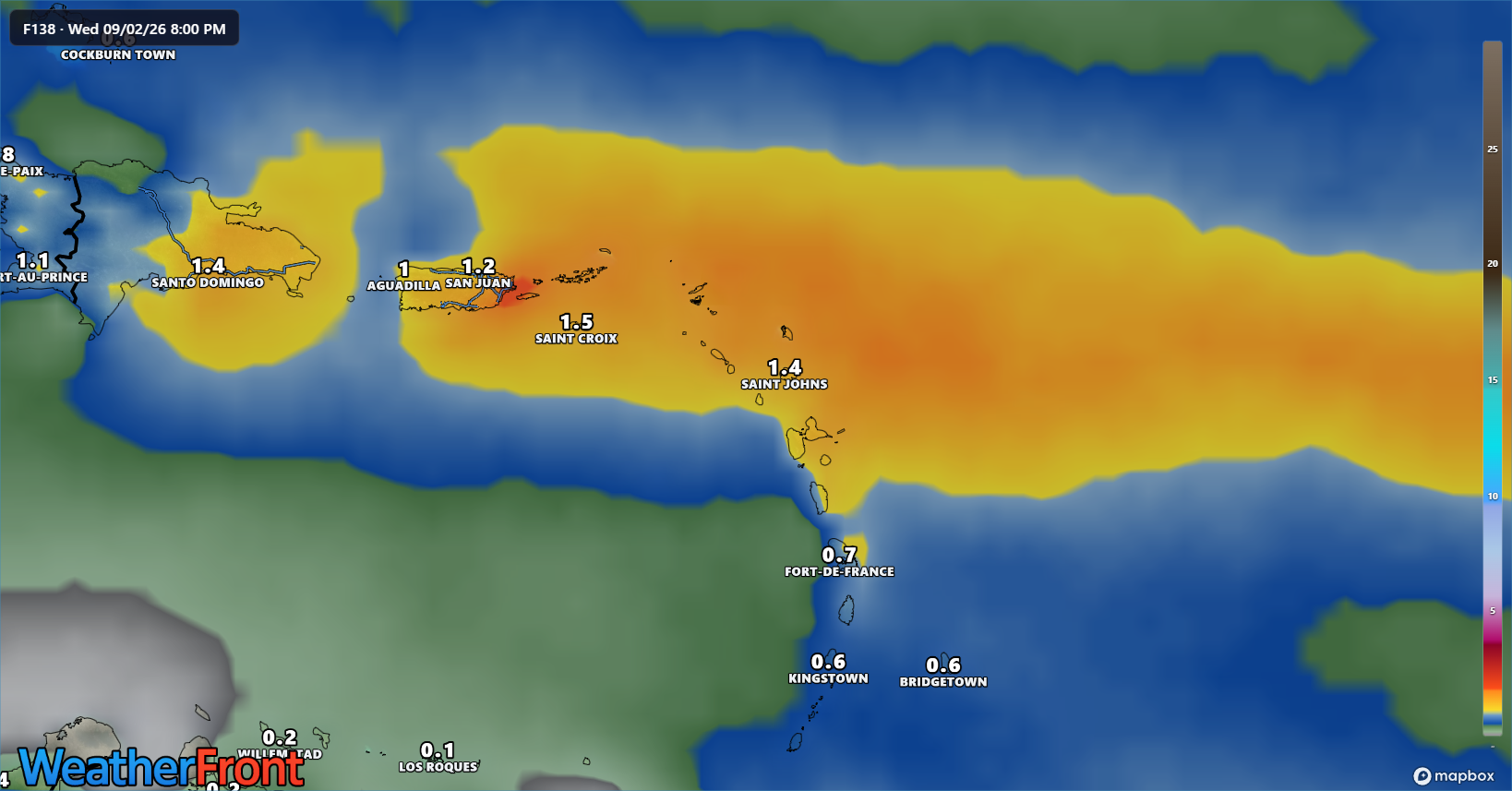
Either way, once in the Caribbean, it seems likely that any remnants of Dolly will be further hampered by shear and land interaction.
The question beyond midweek focuses heavily on what conditions Dolly’s remnants are in once near the Gulf or Florida. If Dolly has some lingering thunderstorms sticking with it, once near the Bahamas or Florida or Gulf, perhaps Dolly may have a chance to organize a little again. If Dolly is ripped up good, then it would be unlikely to do much of anything. Basically, while it seems highly unlikely any remnant of Dolly would do anything once near the Gulf, it’s one of those things you just never feel good totally writing off this time of year. So, let’s see how things trend through the weekend. And let’s hope some parts of the Caribbean can get some welcome rains.