In brief: Invest 96L is holding its own in the Atlantic, and in fact that’s probably all we’re going to get out of it for the next several days. About a week from now, the story could get a bit more interesting, so we explain why and the things to watch in the days ahead.
Invest 96L
With 95L out of the picture now, we can focus solely on the main wave, Invest 96L in the eastern Atlantic.
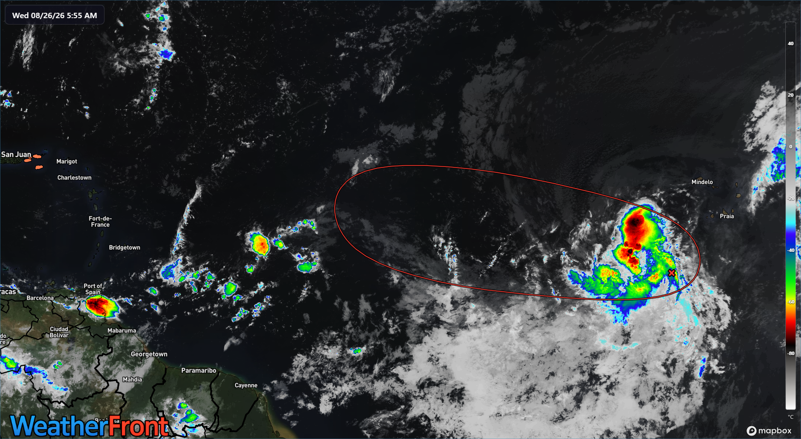
The disturbance is not really progressing forward toward development but not exactly falling apart either. It’s just like one of us, working 9 to 5 and holding it together one day at a time. Both shear and dry air are at levels keeping it capped but also not exactly destroying it either. And realistically, this is probably where we’re going to be for a few days. Wind shear doesn’t look totally prohibitive, but it’s going to be present near the system for its entire trek across the Atlantic. Dry air doesn’t look totally prohibitive, but it’s going to be present near the system for its entire trek across the Atlantic.
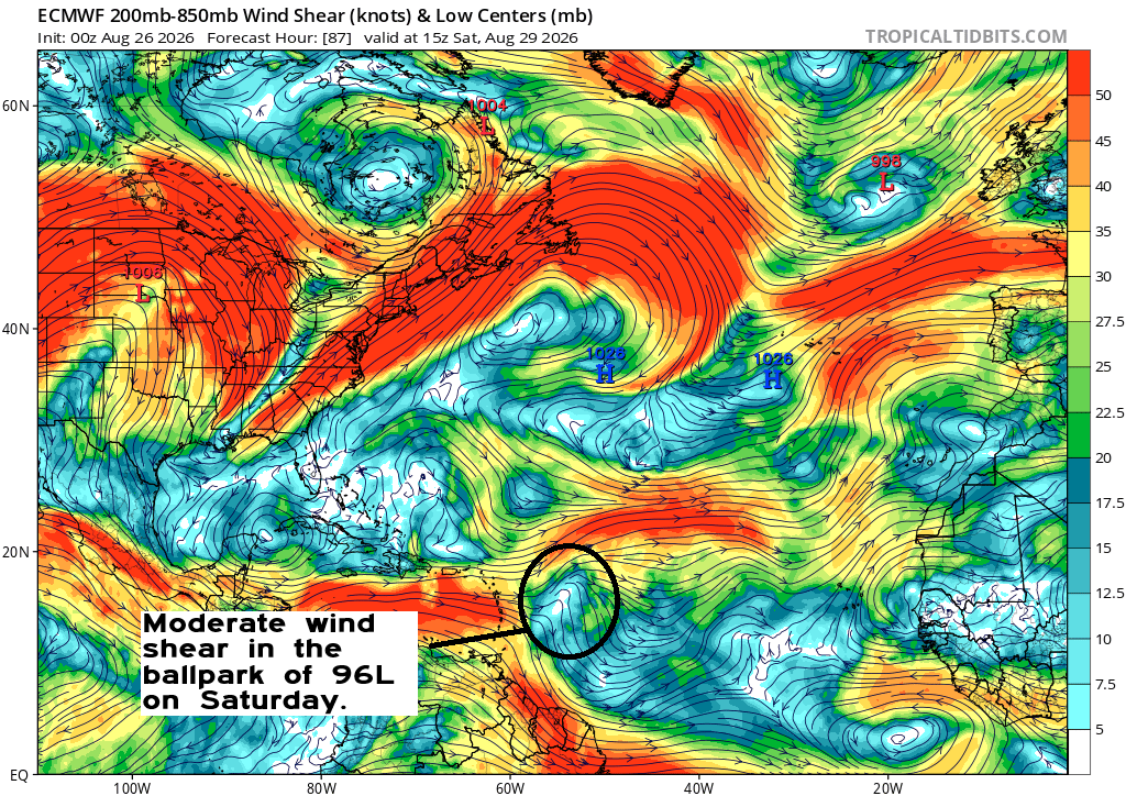
A 70 percent probability of development feels a bit generous at this point, but truthfully, you could probably make a case anywhere from 10 to 80 percent with this one right now and it would be logical. Despite the high odds of development, I think it’s important to note that at least over the next 4 to 5 days, intensification seems highly unlikely. Could you get a depression or weak tropical storm? Sure. Would it get any worse than that through the weekend? No.
Our next real meaningful waypoint with 96L will be in about a week. At that point, we would expect Invest 96L, whatever degree of organization it is in to be located somewhere between the northern Caribbean and just east of the Bahamas.
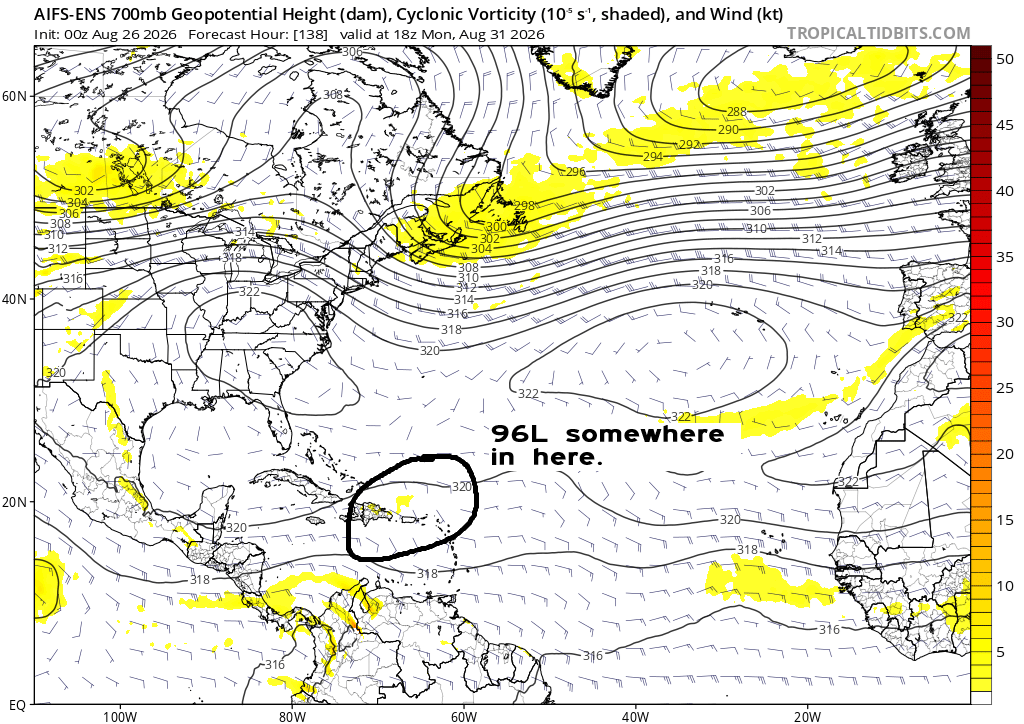
It’s at that point that modeling gets a little funkier with things. The overarching pattern next week should feature a pretty broad area of high pressure in the upper atmosphere from the Desert Southwest into the Southeast and Mid-Atlantic. Well to the northeast of 96L at that time should be a trough in the North Atlantic. I would anticipate (at least looking right now at things) that both 96L and the trough will not be strong enough to link up and quickly usher the disturbance out to sea. So what may end up happening here is that 96L kind of sits off the Bahamas. From here it becomes a little more challenging to answer where it goes, but I would think that the overall pattern would support a bit of a turn north and eventually out to sea. It’s also an open question to wonder what sort of environment 96L will be in at that point.
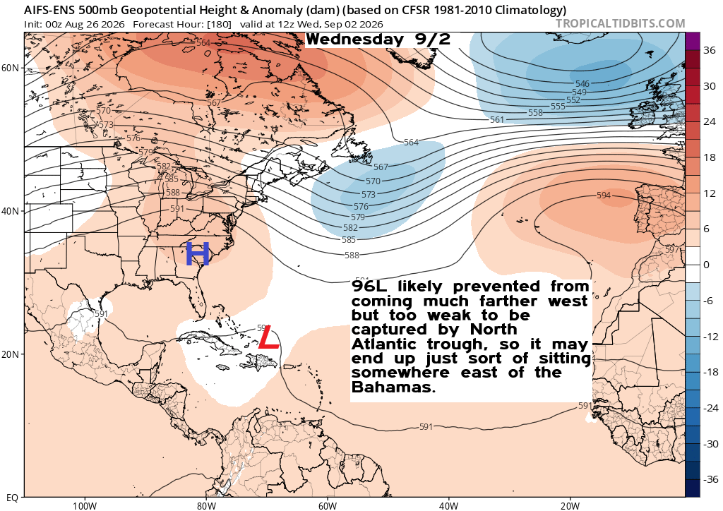
I would assume that shear would be a good bit lower in the Southwest Atlantic at that time, but I’m not sure dry air or general weak instability that’s been hampering the basin won’t still be an issue.
So, that’s where we stand: Low risk of any meaningful development through about Monday or so. Then, the story gets a little more interesting but not nearly at a point where it’s concerning. If anything, model support over even the last 12 hours has dipped somewhat. Just something to watch. The good news is this is the only game in town right now, and there’s no sign of anything else meaningful in the pipeline at this point. More to come!