In brief: Invests 95L and 96L have our attention in the Atlantic, though 95 is no threat to anyone, and 96 probably isn’t a threat either. That said, we take a deeper look at 96L and its future over the next week or so.
Watching the Atlantic right now is like putting a towel back in the drier and discovering it’s still damp. It’s not boring like watching paint dry. It’s just kind of frustrating. Are we going to get there? I mean, no one will complain if we don’t. But at this point, every disturbance that makes a go of it over the Atlantic thinks they’re evil Anakin Skywalker. “I’m a big, bad tropical wave. You want to stop me?”

Of course, it didn’t exactly end well for Anakin, and it probably won’t end well for most of these disturbances. But the question is if they stir something up in the interim.
Invest 95L
The disturbance east of Bermuda looked like it wanted to have a go at times. But thus far it has fallen short.
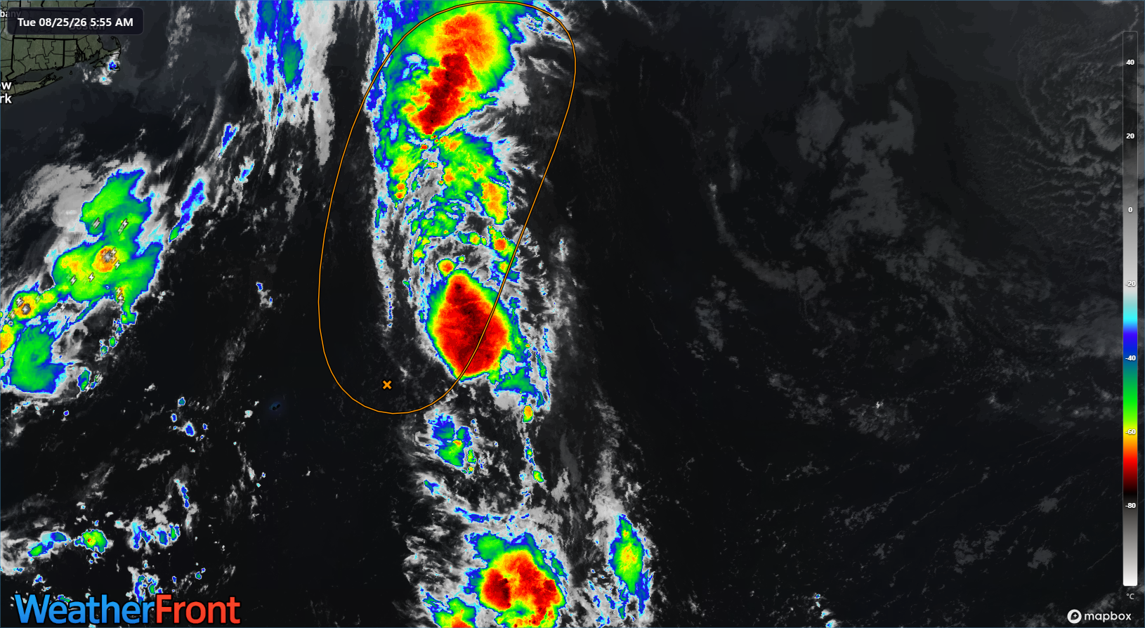
Will it do it today? I’m doubtful. It has about 12 to 18 hours left to do something before it runs out of runway. And at this point, it just looks too strung out to be able to consolidate enough.
Invest 96L
Newly minted Invest 96L is the one we’re most interested in at this point.
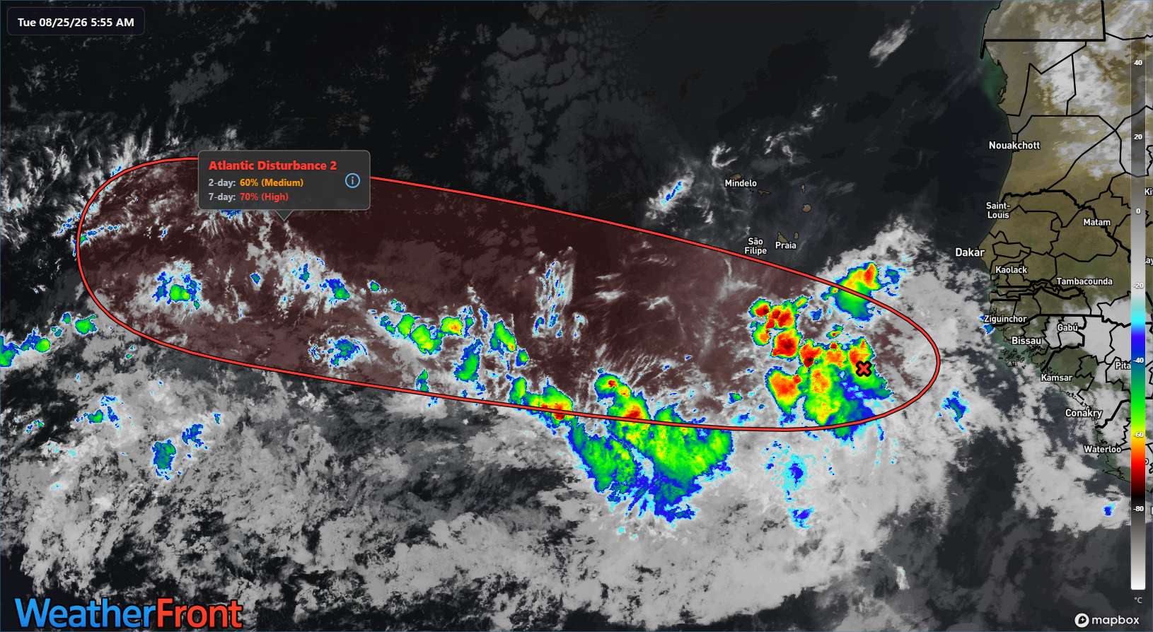
Looking at it on satellite, it’s still just a seedling of a tropical wave this morning. And over the next couple days, it will gradually try to organize itself. It currently sits in a relatively modest shear environment, though there is a bit of drier air nearby. So by no means will this organize swiftly.
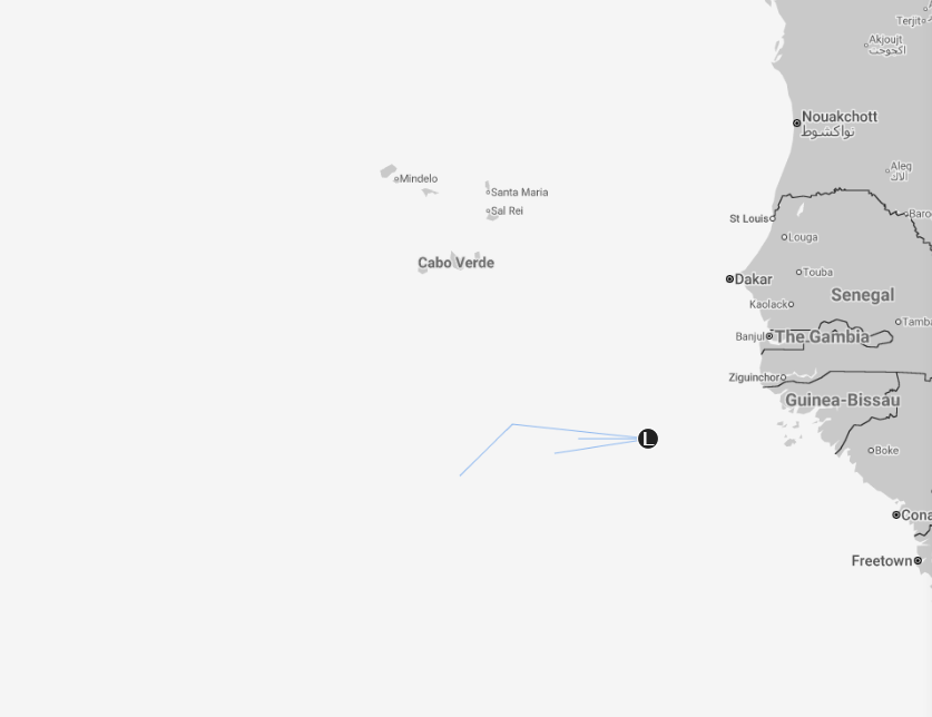
Models have mostly held their positions since yesterday. It does seem like the European model’s AIFS is a little less enthused today. And Google’s Deep Mind operational ensemble is totally uninterested. The tropical models are a little bit more bulled up but even they’re quite mixed. On the whole, we’re basically in the same spot we were 24 hours ago, so I won’t belabor the point. Odds of development around 60 to 70 percent, though generous aren’t unreasonable. But we aren’t anywhere over that right now.
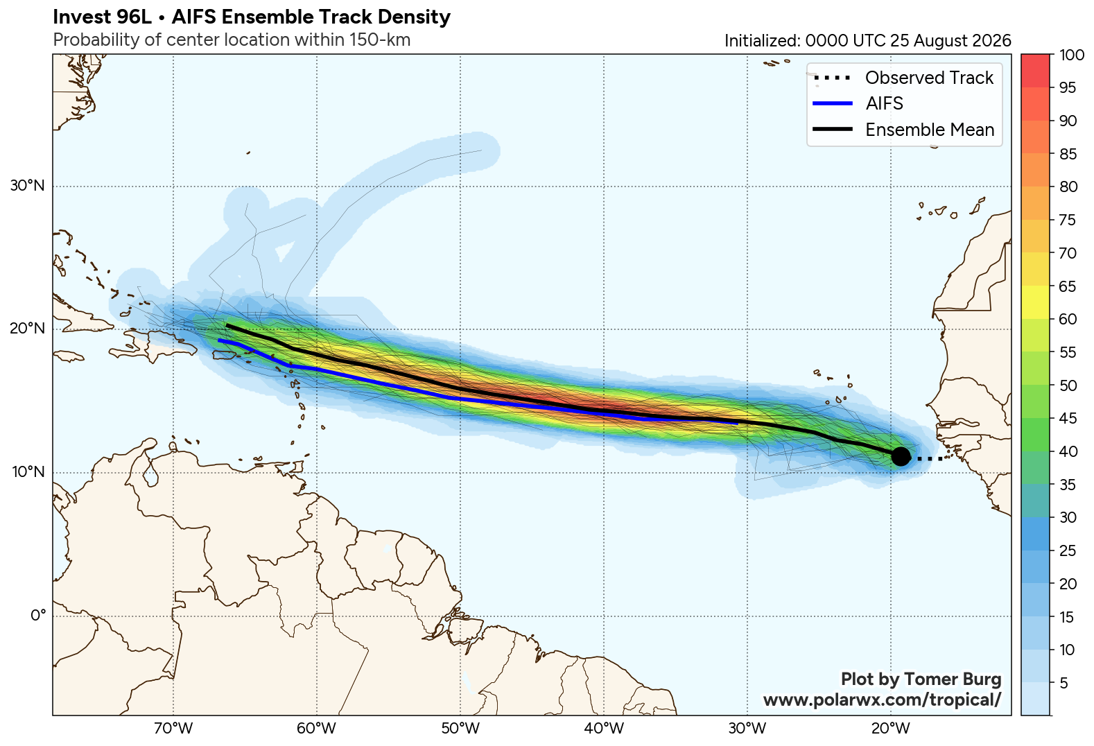
In terms of the future track of 96L, be it as a remnant tropical wave or as a nascent system, its future will initially be dictated by the Bermuda high, which will build west across the Atlantic as 96L moves west, keeping on a westerly or west-northwesterly course through at least Saturday or Sunday.
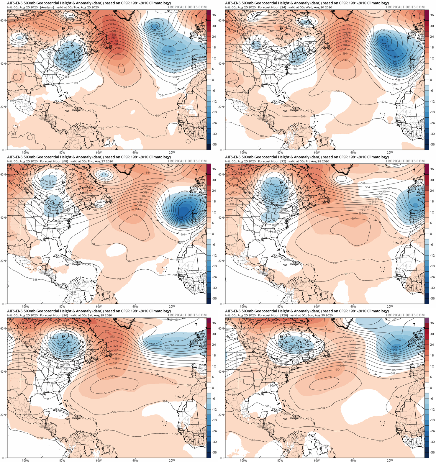
Where is the Bermuda high? Look at the big 597 bullseye over the open Atlantic. Thereafter, if 96L is weak, it may end up buried in the Caribbean, likely left to perish or track closer to the Antilles and Puerto Rico, where it still would face an uphill battle. If 96L is moderate, it would likely “feel” an expected weakening Bermuda high after Sunday (just after this model loop ends) and turn northwest and north fairly quickly, likely heading out into the open Atlantic. Neither scenario should get anyone too worked up right now, but we’ll keep an eye on things through the week and see how it all progresses. It’s late August. You never take anything for granted this time of year.
Beyond 96L
Anything else? Nothing specific at this time. There is model noise, as there always is this time of year, even in strong El Niño events. But I can’t really point to any specific disturbance beyond Invest 96L to home in on right now.
I suppose if you want to look for some intrigue, the Pacific is where you’d go. The NHC has seven disturbances on the board, be they active or in the outlook. The area with a 90% chance of development may be the most intriguing.
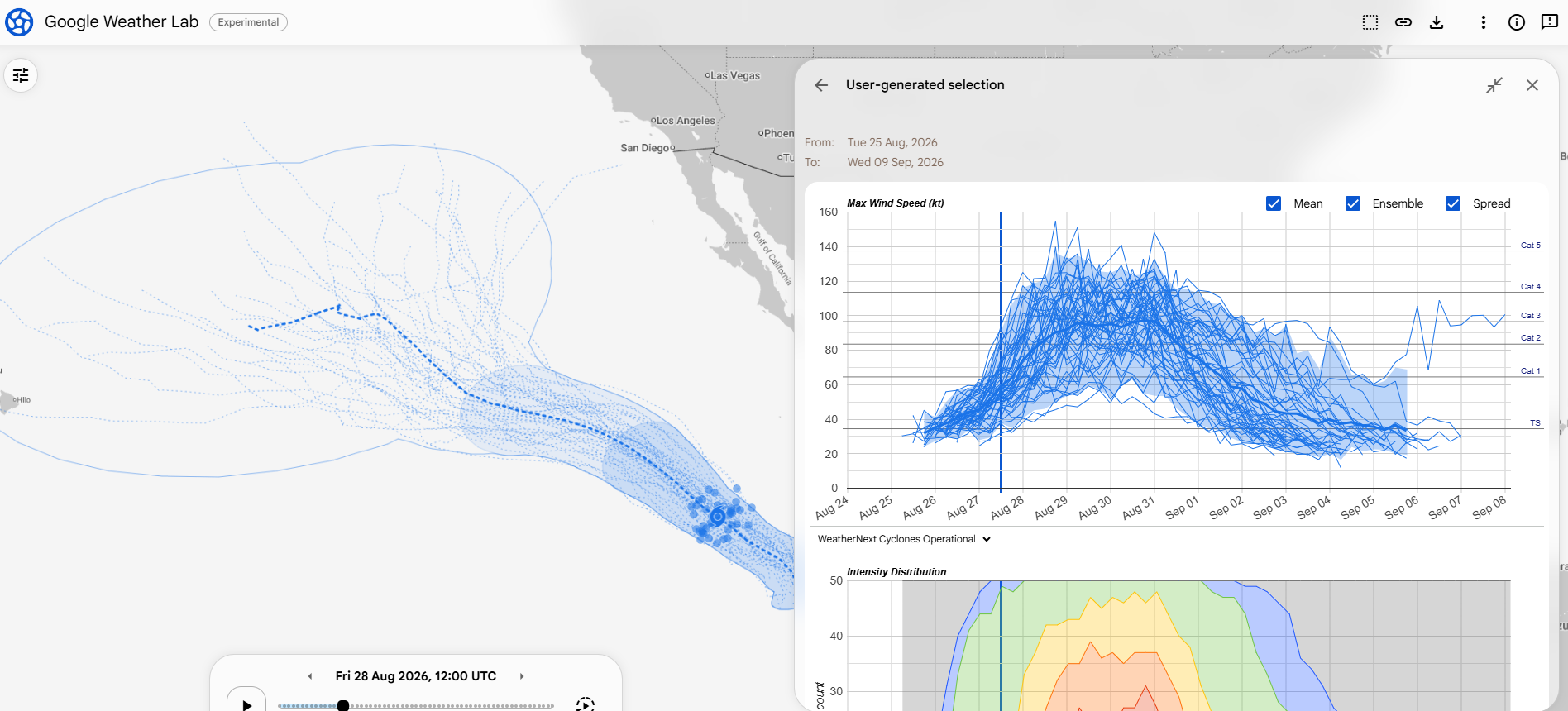
While most modeling kicks it west across the Pacific, there is a small subset that does try to lift this northward in time. If that happens, we could see some remnant moisture end up in the Southwest. That would not necessarily be a bad thing, as the monsoon has been fairly disappointing in many areas so far this year. But I would not exactly get my hopes up yet in the desert.