In brief: The Atlantic tropics are getting a little busier, but at present none of the potential systems are a concern for land. Meanwhile, the Desert Southwest is going to be at the center of a heat wave this week, which means some extreme temperatures and continued high wildfire danger.
Tropics: Busier but within the realm of what’s typical for August
We’ll start in the Atlantic today. We’ve got two areas highlighted by the National Hurricane Center.
Let’s start closer to the U.S.
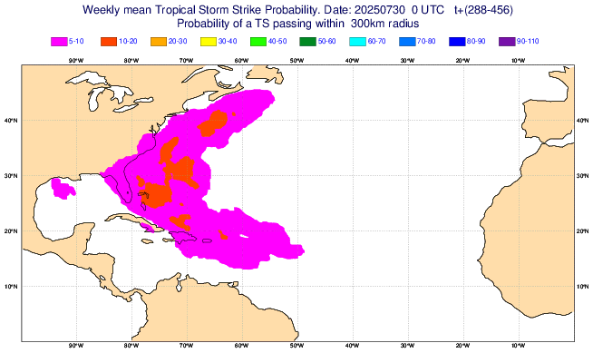
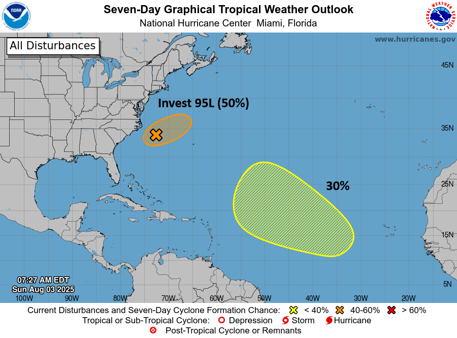
Invest 95L
The disturbance we had thought might be of most interest through next week is trying to get its act together off the Carolinas. Invest 95L is attempting to look the part this morning.
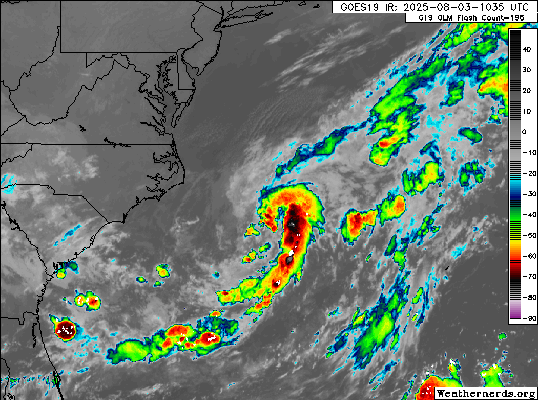
Invest 95L is expected to pretty steadily work east-northeast and out to sea. Modeling is in good agreement that this will exit stage right quickly.
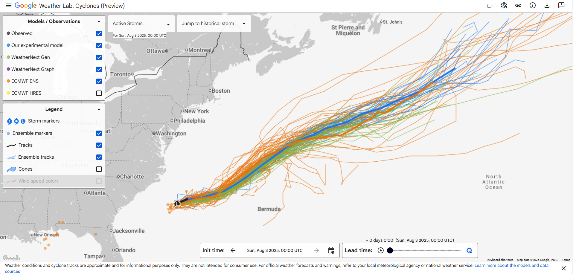
Conditions for development should become rather hostile over the next couple days, so this will probably succumb to environmental conditions eventually as it moves out to sea. Bottom line: Decent chance to develop; no threat to land.
Broad 30% area of interest
Looking out farther into the Atlantic today, a very large 30% area has been drawn that covers almost the entire central Atlantic. There’s not a whole lot doing out there at the moment, but it appears that a wave will exit Africa and may begin to attempt to develop by mid to late week. When we look at the European model ensemble picture, we can see that the majority of the 51 ensemble members are doing something out there by later this week, but since they can’t exactly resolve where that might occur, the area of possible interest is rather sprawling.

The overall pattern in the Atlantic this week will feature a pretty broad “weakness” in the subtropical ridge east of Bermuda. This should allow for any sort of developing storm to exit. A weaker, disorganized wave may just plod along west northwest.
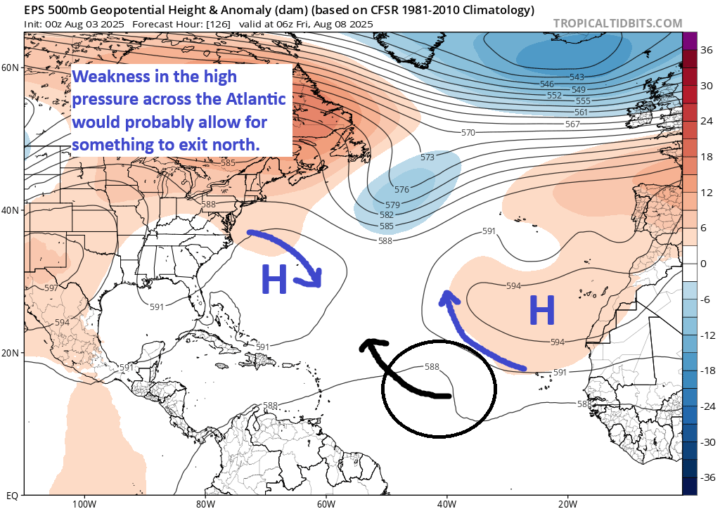
You never like to overthink these things too much, so it seems pretty simple. That said, if the forecast weakness ends up stronger or less impactful than predicted today, that could change the overall profile of risk with this wave. For now, it’s probably not a concern for land, but it’s probably also a good idea to monitor its progress later this week.
Behind that, there’s no real defined risk that I can pick up on over the next 2 weeks, but it’s the time of year to keep watching, as I’m sure something will materialize at some point. For now though, the takeaway is that the Atlantic is becoming more active but within the bounds of what’s normal for this time of year.
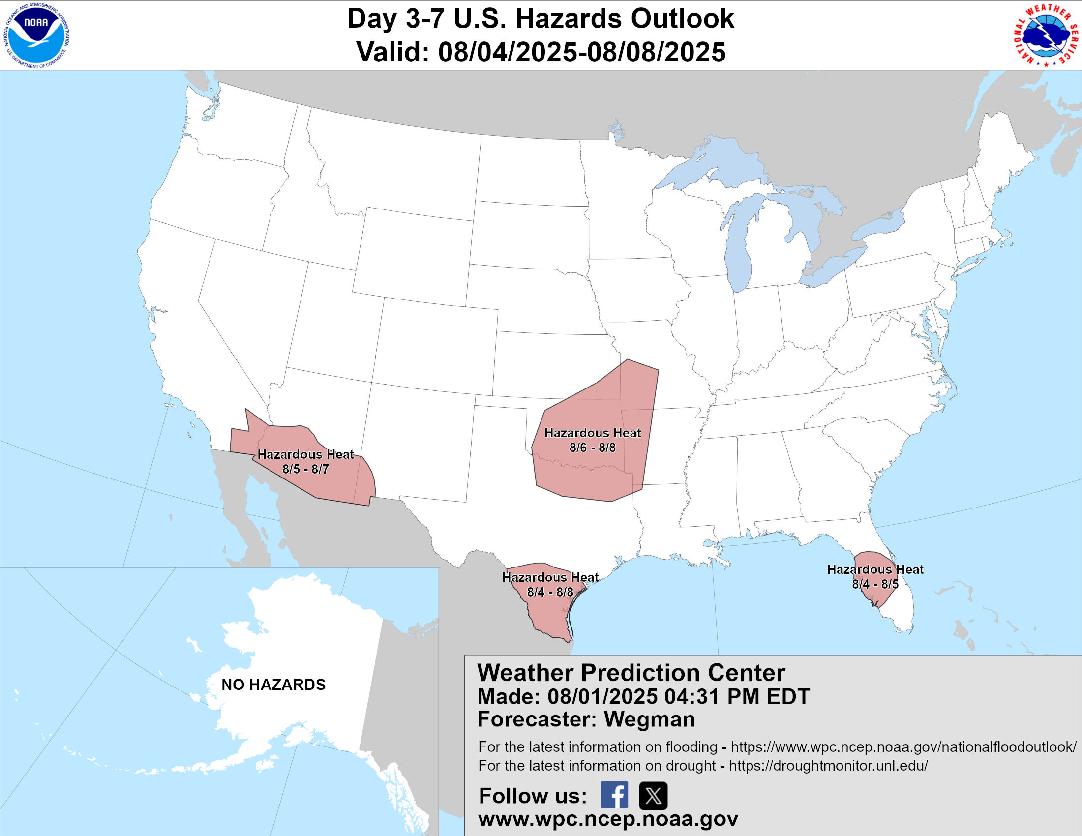
A Desert Southwest heat wave
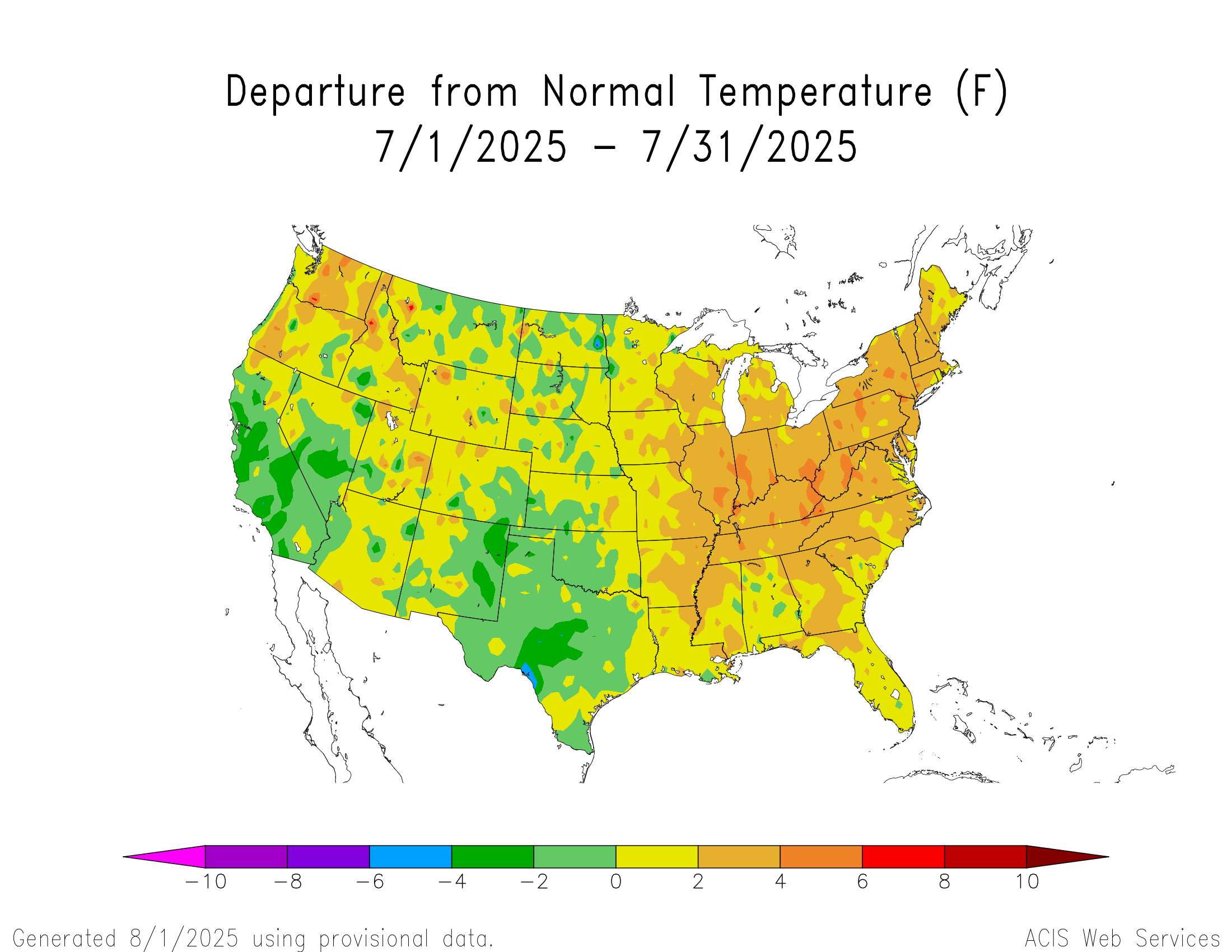
The weather pattern has calmed a bit lately, with more moderate temperatures a bit less in the way of extreme rain and such. That said, it does look like the heat is going to crank up this week. When you’re talking about possible temperature records in the Desert Southwest, you know it’s hot. High pressure is going to flex its muscles in that region this week, and in fact, the percentage of European ensemble members showing an all-time record strong upper level high pressure system is well up over 50 to 75 percent this coming week (Wednesday).
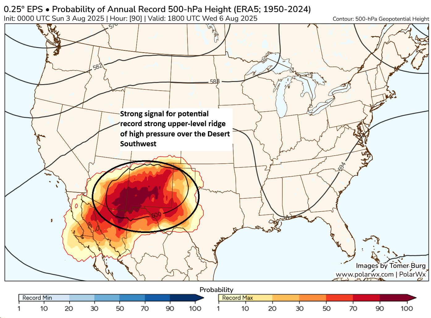
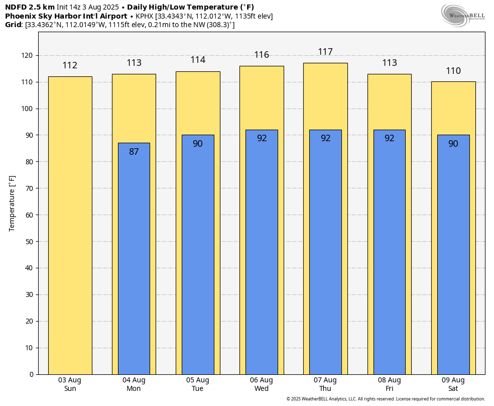
That doesn’t guarantee that we’ll see a record, but it sure suggests that whatever this is is going to be extreme. In fact, we’re already seeing numerous record highs or near record highs being forecast in the Desert. Phoenix is expected to hit 117° on Thursday, which would break a daily record by 5 degrees and match the all-time August record high temperature last set in late August 2023.
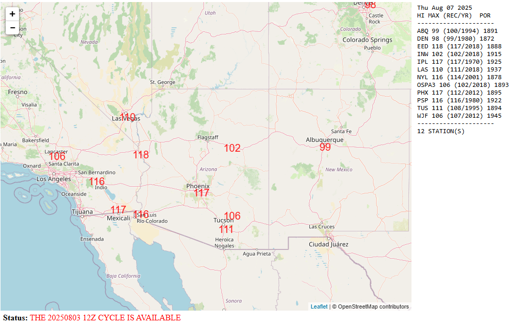
The 111° is Tucson is only one degree shy of the August record as well.
We may see more than one record fall this week in Phoenix and Tucson.
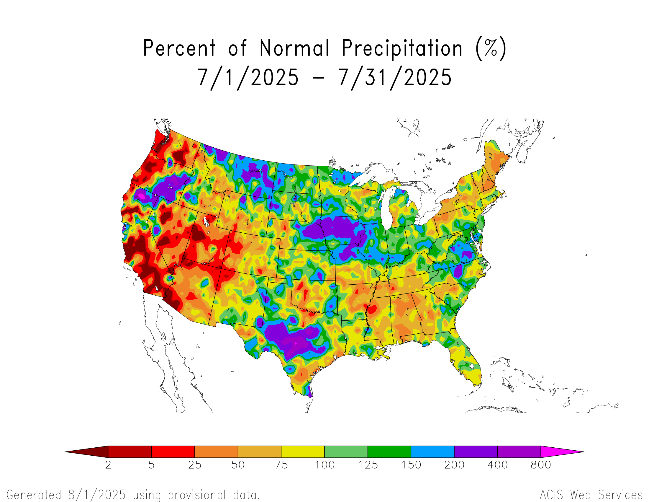
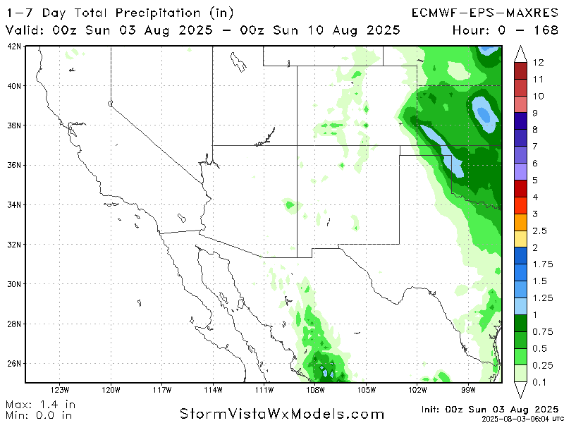
Broadly, the Southwest will also experience multiple days of records threatened. More importantly, it looks dry this week with most moisture limited. Any rain will be limited to the Plains or perhaps deep into Mexico.
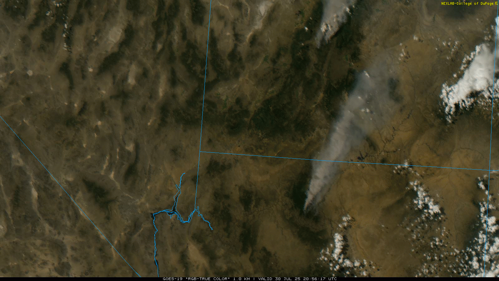
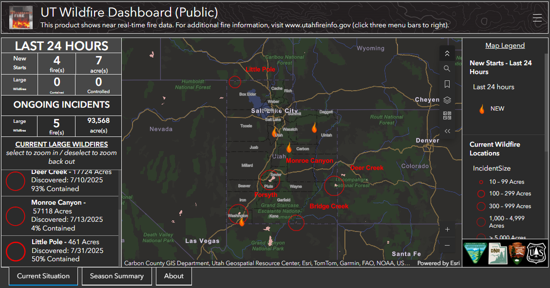
This will likely lead to continuing wildfire concerns, and critical fire danger is forecast for Utah tomorrow and Tuesday. Red Flag Warnings are already posted for both days.
Conditions may be a little less extreme in Arizona for wildfires, but it’s possible that Red Flag Warnings are hoisted there too this week. Either way, the West is already a bit of a tinderbox, and this week will do nothing to help that situation.