In brief: Neither Invest 94L or a potential disturbance in the Gulf are expected to develop this week. Locally heavy rains have fallen in Missouri and Illinois leading to numerous instances of flash flooding. Building heat will make it feel pretty uncomfortable this week across much of the Midwest and South.
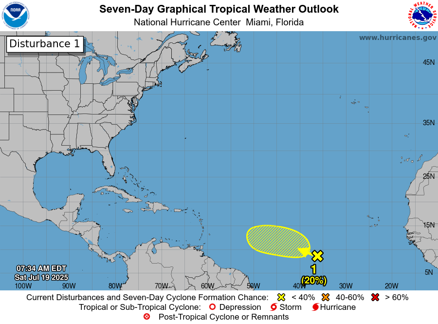
Invest 94L
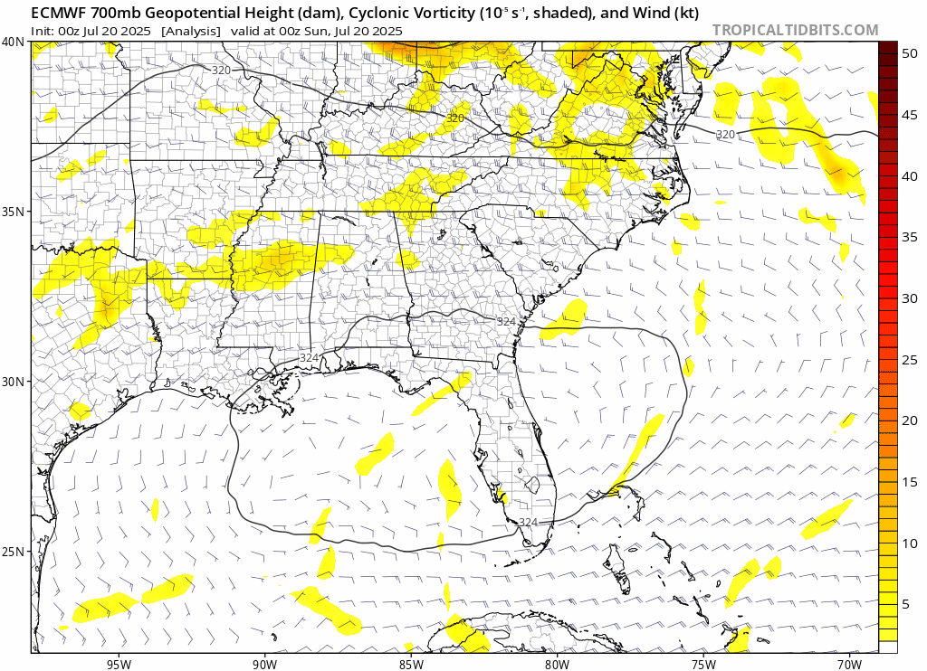
We start out in the Atlantic today, where the tropical wave we’ve been watching is now tagged as Invest 94L. Nothing has changed here, and we expect little to no development out of this feature as it approaches the Lesser Antilles.
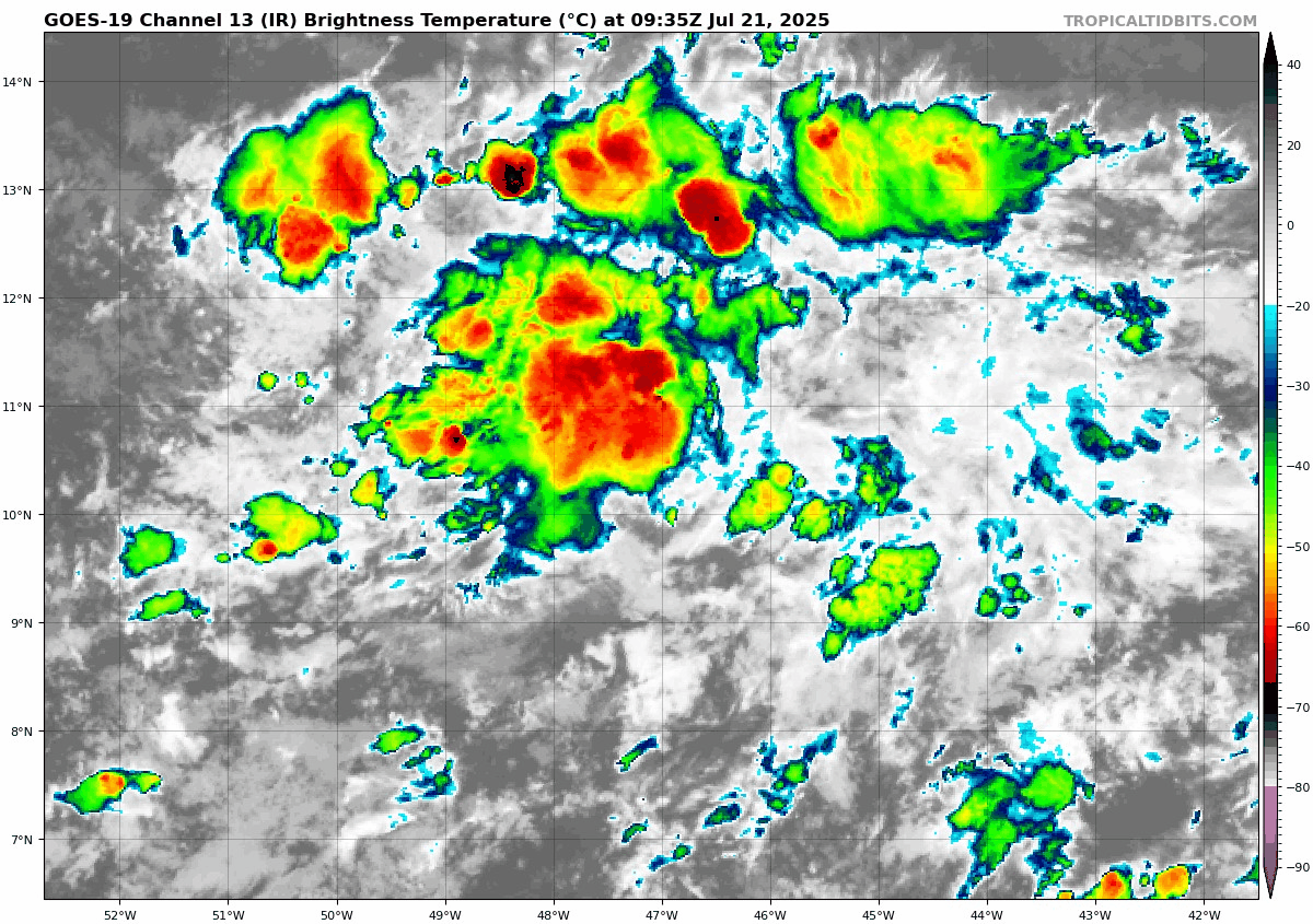
Modeling is in really good agreement that this will plow through the northern Windward Islands, move into the Caribbean, and fall apart. Perhaps we’ll see some added rain and thunderstorm chances in the islands as this moves in, but aside from that, no real impacts are expected out of 94L at this time.
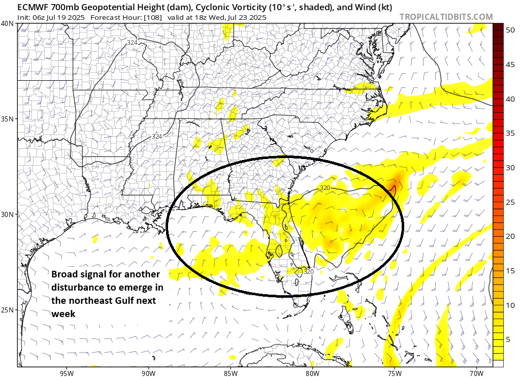
Gulf disturbance
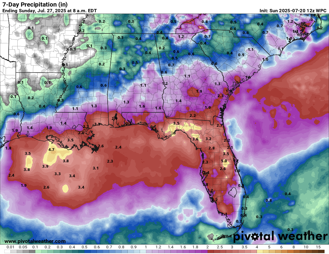
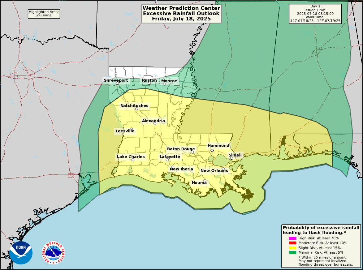
Modeling continues to show a redux of last week’s Invest 93L in the Gulf later this week. A fairly disorganized disturbance will emerge in the Gulf probably on Wednesday and track west. I think this one will enter the Gulf a bit farther south than 93L did, which should allow it to track more toward Texas than Louisiana. Wind shear doesn’t look horrendous, but it will be present. More importantly, the building heat wave north of this disturbance and hot, dry weather in Texas will likely surround this thing with dry air that should limit any development risk.
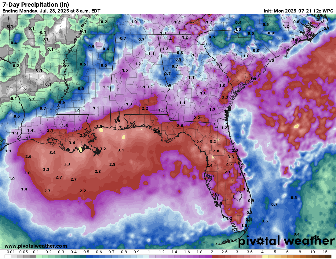
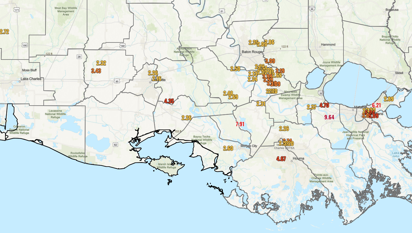
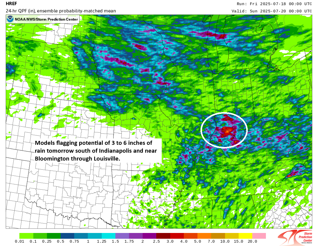
Rainfall will be the primary calling card of this disturbance. Look for locally heavy rain again this week from Florida across the Gulf Coast into Louisiana. The heavier rains may extend a little farther west into parts of Texas by the weekend as well, but major flooding issues are not currently expected.
Overall, odds of any organization are quite low (no models showing anything of note), and again rainfall will be the primary thing to watch here.
Currently, there are no other items of interest in the Atlantic.
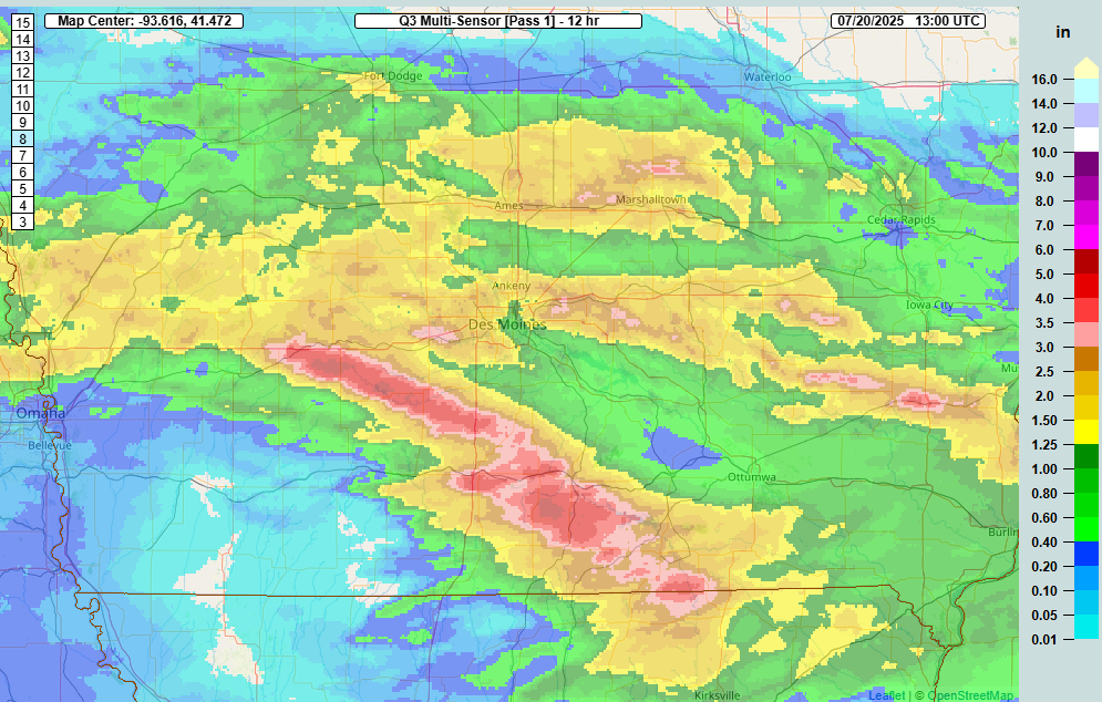
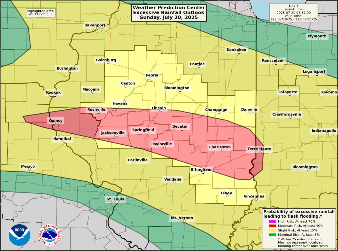
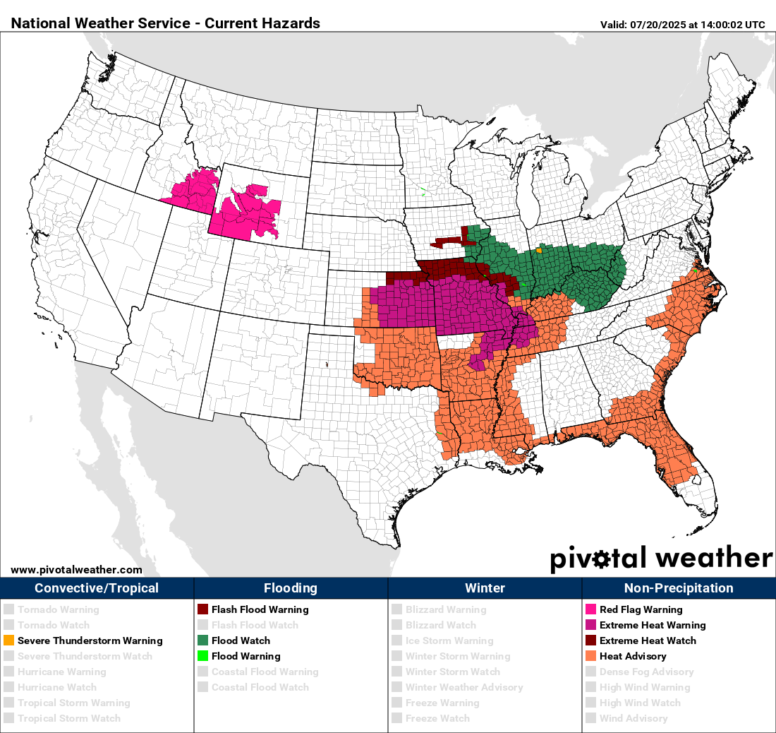
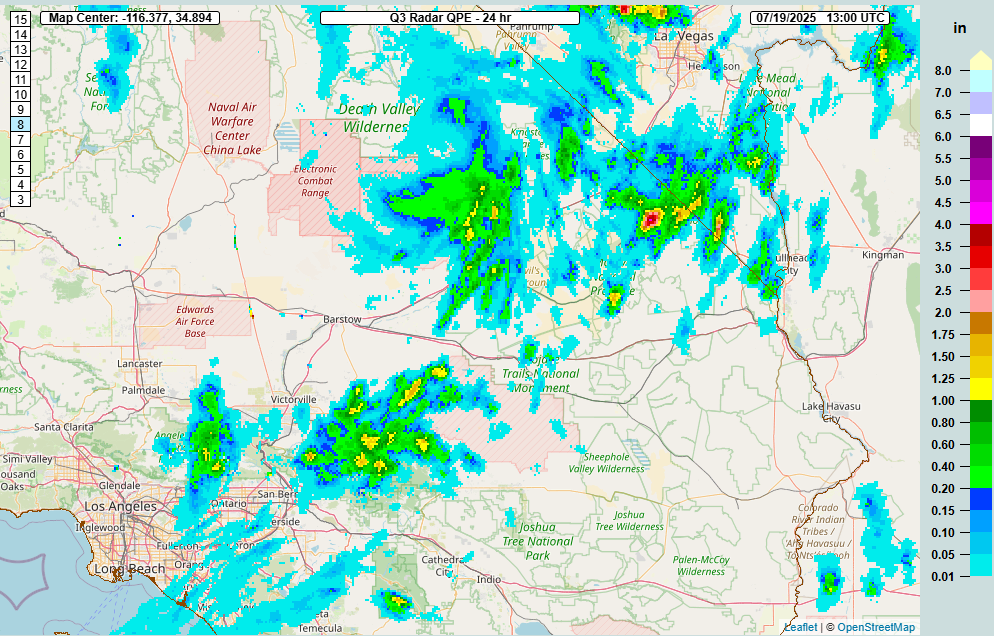
Illinois/Missouri flooding
We almost got through yesterday without a flash flood emergency, but one was issued for Fayette County, Illinois just after 11 PM CT on Sunday. That area saw an estimated 7 to 9 inches of rain yesterday from periods of heavy rainfall.
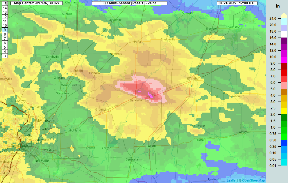
Additional heavy rain led to multiple serious flash flooding reports across parts of Missouri, especially just northwest of St. Louis. Flash flood warnings continue in this area this morning. Flooding along the Kaskaskia River at Vandalia, IL is ongoing, and it may approach moderate levels before cresting.
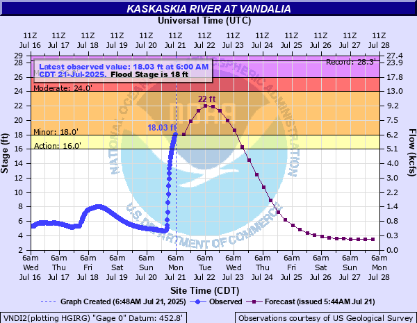
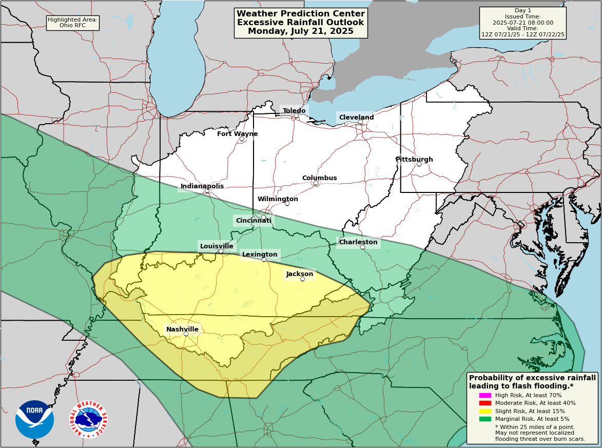
Some rivers in this region have risen 5 to 10 feet or more in the last 24 hours. The heavy rain risk should shift south and east today, with more risk focused into Kentucky.
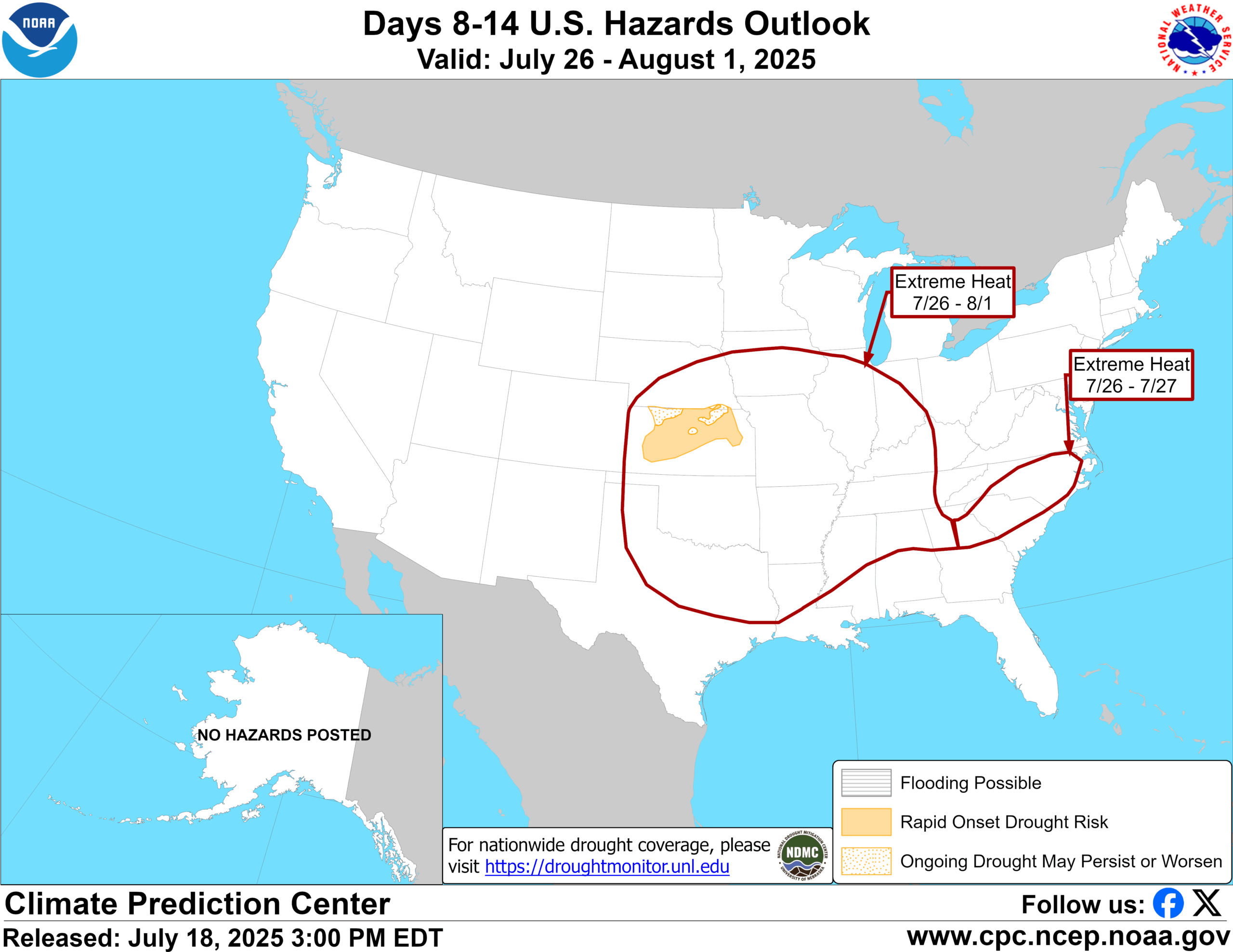
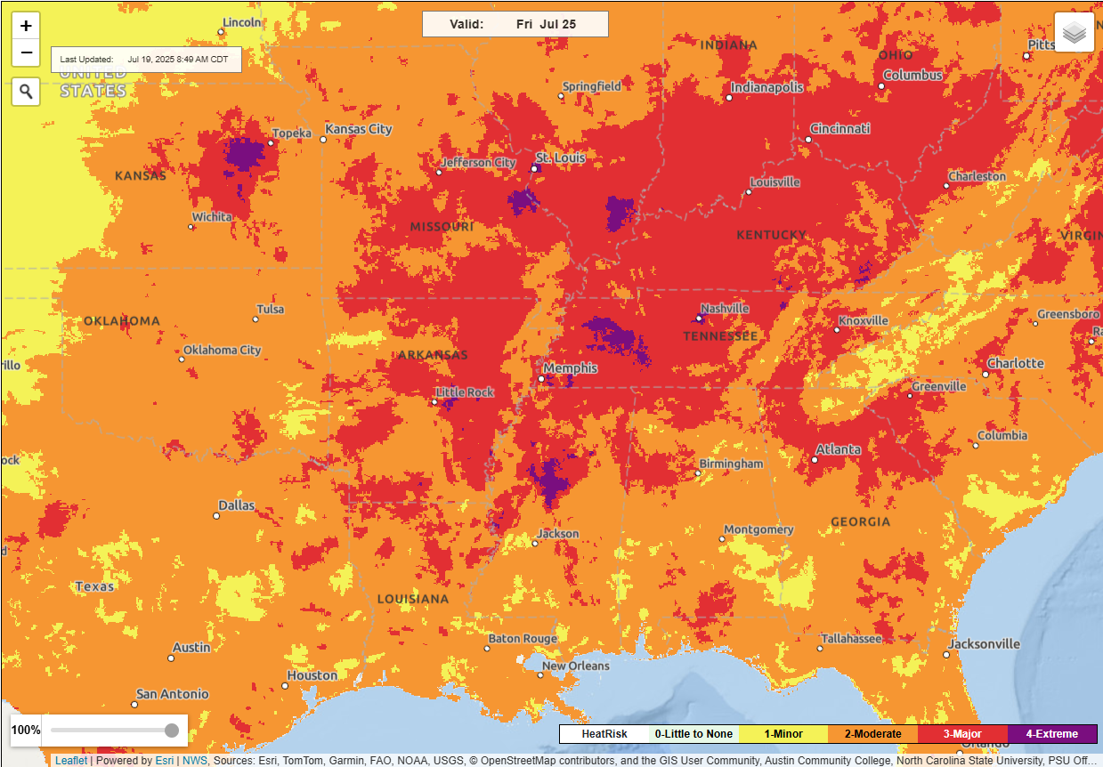
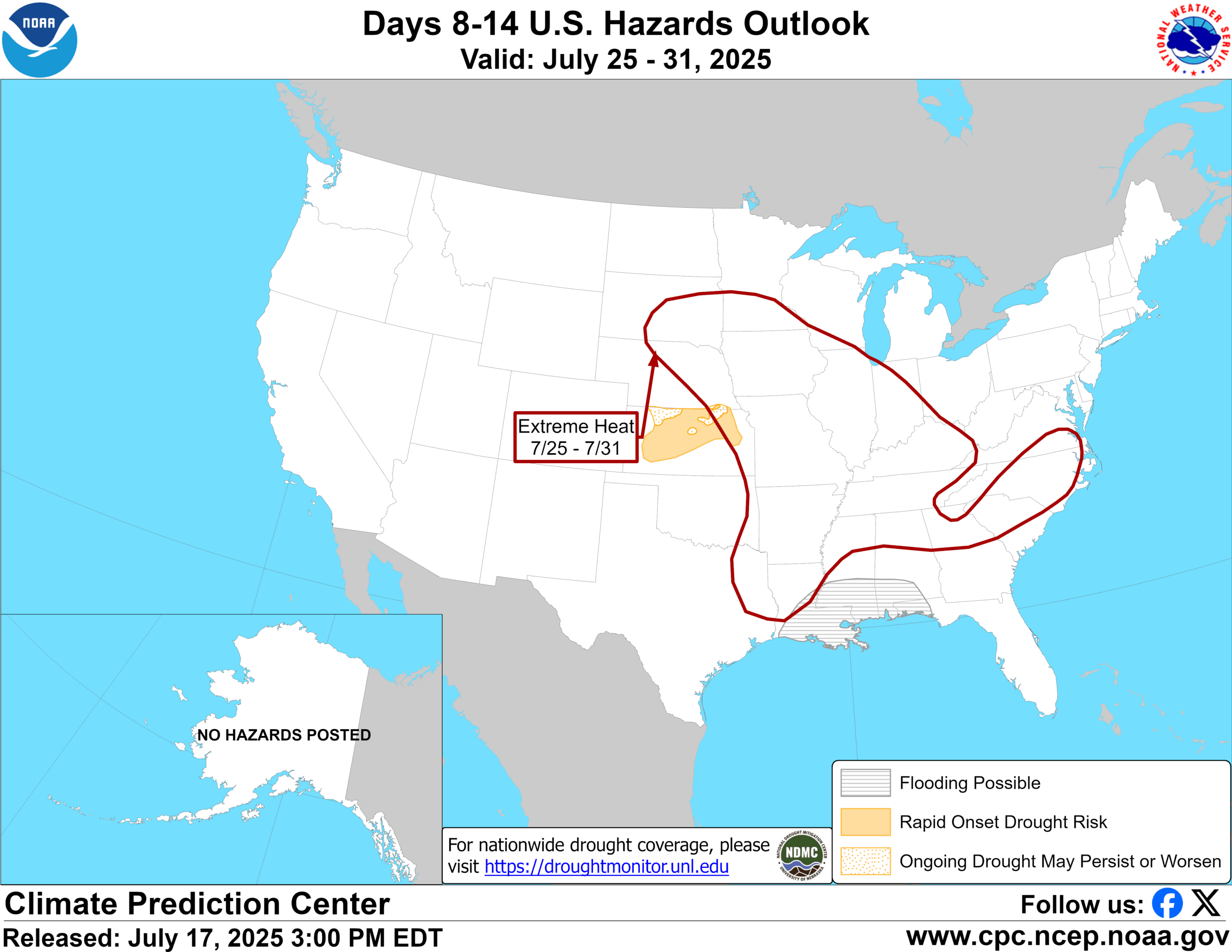
Heat wave
Meanwhile, if it’s not water falling from the sky, it’s water vapor in the atmosphere, and the combination of heat and humidity looks rather stout this week across the Mississippi Valley.

Widespread high and isolated pockets of “extreme” heat risk per the National Weather Service are expected by Wednesday across the Mississippi Valley and South. Very few record temperatures are currently forecast, but the combination heat and humidity will make it feel pretty rough through the week. More heat is on the way for next week too. More to come.