(9:45 CT Monday Update): We will see PTC classified at the top of the hour. We will have a post before 11 AM CT.
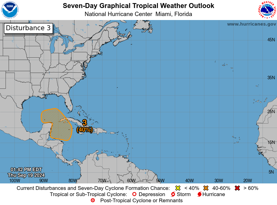
(2 PM CT Update): The disturbance we are going to be tracking is now known as Invest 97L, and there will likely be a bunch of additional data available to us later today.
Headlines
- Confidence is increasing in the formation of a tropical system in the southeastern Gulf of Mexico this week
- Current conditions in the eastern Gulf of Mexico support the possible development of a powerful hurricane by Thursday or Friday
- While confidence in a forecast track is rising, residents of the Gulf coast from southeastern Louisiana all the way to Fort Meyers, Florida should pay heed
- Given the uncertainty of timing, Florida could start to see impacts in as few as four days from this system
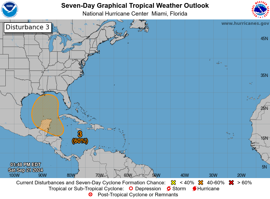
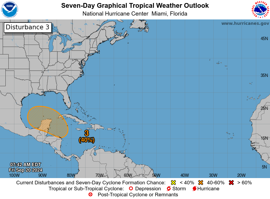
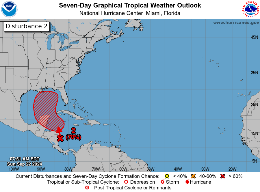
System status
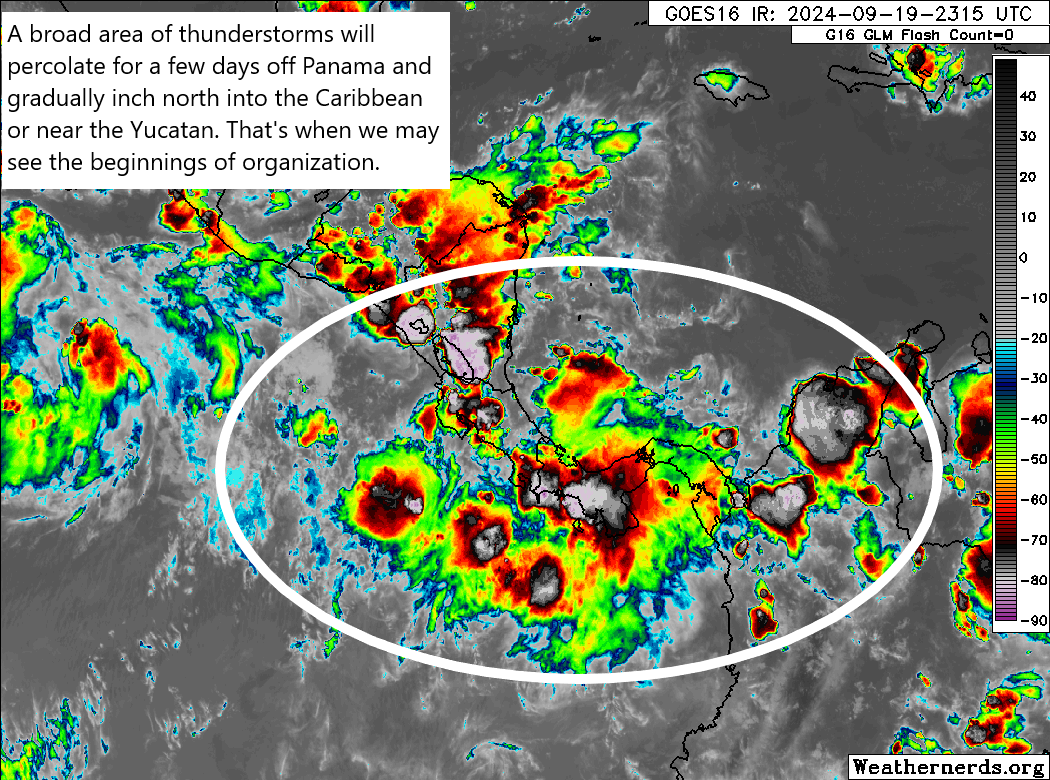
We’ve been talking about the potential for a tropical storm to form in the northwest Caribbean Sea for days, and for the time being there’s still not much to look at on satellite. We’re still seeing disorganized showers and thunderstorms in the western Caribbean Sea, in the vicinity of Nicaragua. However, what has changed is that the models we trust the most are now pointing to a more or less similar outcome over the coming week. That is, we expect a tropical system to develop, and then move into the southeastern Gulf of Mexico by around Wednesday. And after that? Well, that’s what the rest of this post will discuss.
Track of this storm
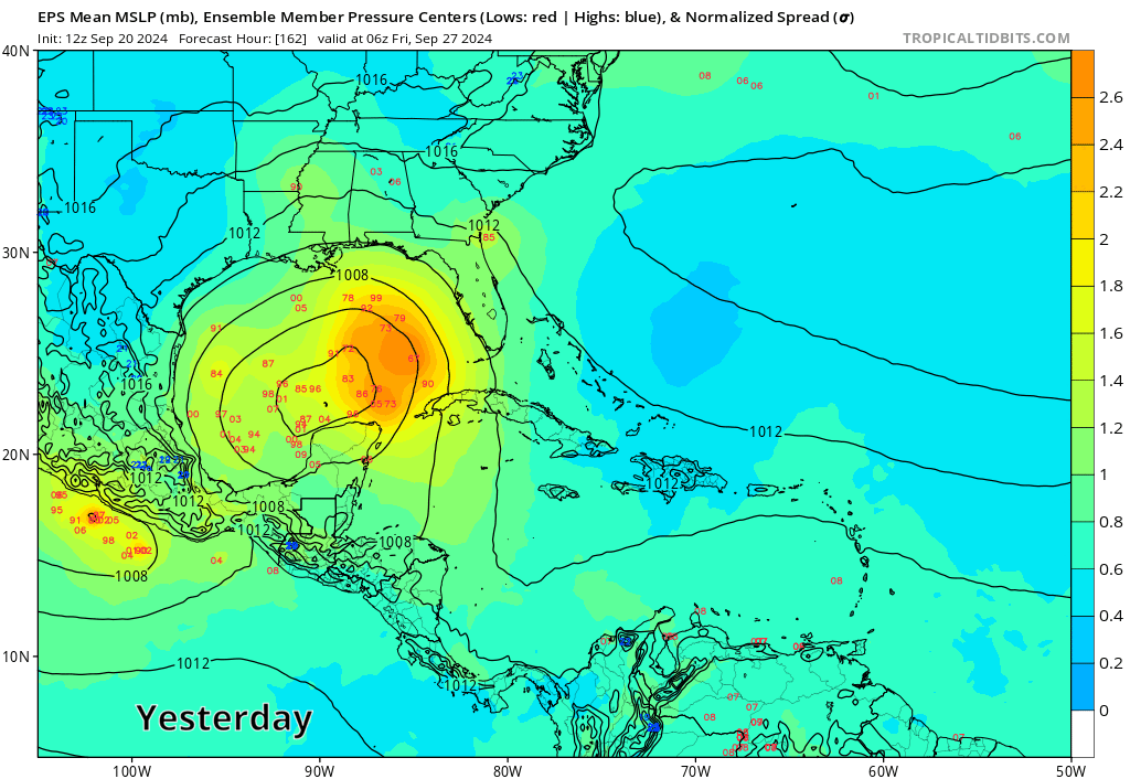
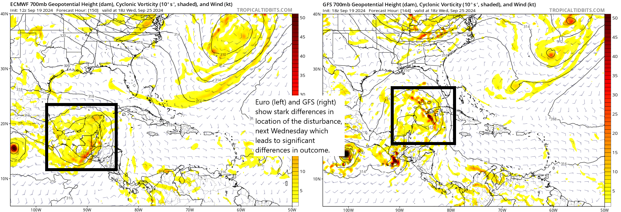
All of our major model guidance now suggests that a tropical system will start to become better organized by Tuesday or Wednesday, with a center of low pressure forming near Cancun, Mexico, or the western tip of the island of Cuba. There is still some discrepancy in the timing and intensity, but we can have pretty high confidence in this outcome.
The timing of this does matter, as a more rapidly developing storm would likely ultimately track further to the east, which is to say toward the west coast of Florida; and a slower developing system has a better chance of going more due north, ultimately making landfall somewhere between the Louisiana delta and Florida panhandle.
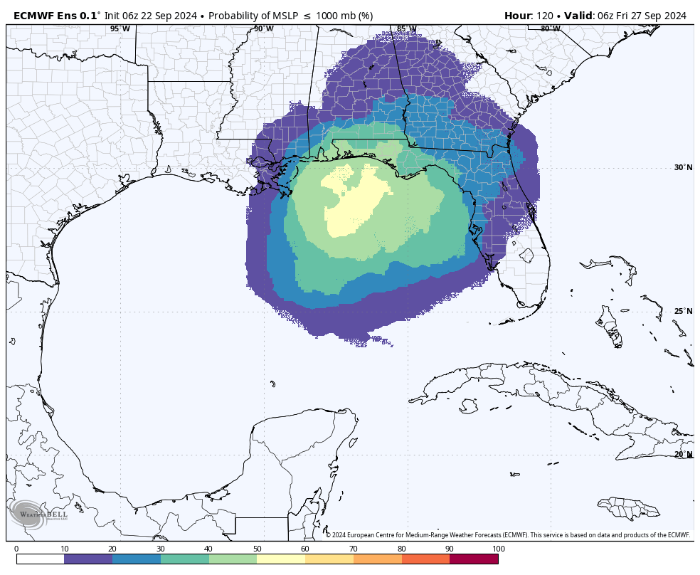
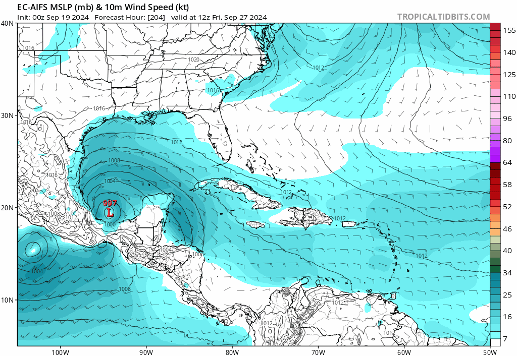
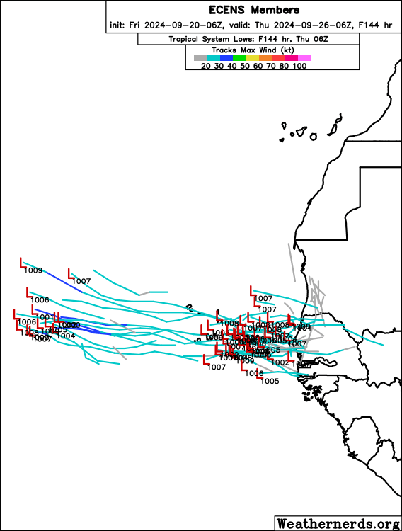
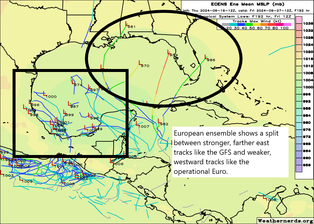
If we look at the 06z run of the European ensemble model above, we can get a sense of the most likely locations where the center of this storm could go. Note that this forecast indicates a potential landfall on Friday, but depending on the forward speed of this system, we cannot rule out a tropical storm or hurricane reaching the coast as early as Thursday.
The other global model ensembles are not dissimilar to the European model shown above. Our best high resolution, operational models are starting to coalesce around a landfall somewhere between Destin, Florida, and Cedar Key, Florida. However given that a center of circulation has not formed, overall confidence in where precisely this storm will go about five days from now is necessarily low.
The most important message I want to leave readers with today is that residents of the Gulf coast from southeastern Louisiana all the way to Fort Meyers, Florida, should be keeping tabs on this system over the next couple of days.
As a space guy, I’m also watching closely for impacts to NASA’s Crew-9 launch from Cape Canaveral, Florida, presently scheduled for Thursday afternoon.
What about its intensity?
Forecasting the intensity of a tropical system, of course, often more dicey than a track forecast. Because the storm has not been designated an “area of investigation,” or Invest, we do not have access to a suite of tropical-based models that are used to forecast intensity. So far the global models have been all over the place, ranging from tropical storms to a fairly powerful hurricane. However, these models typically do a poor job with intensity.
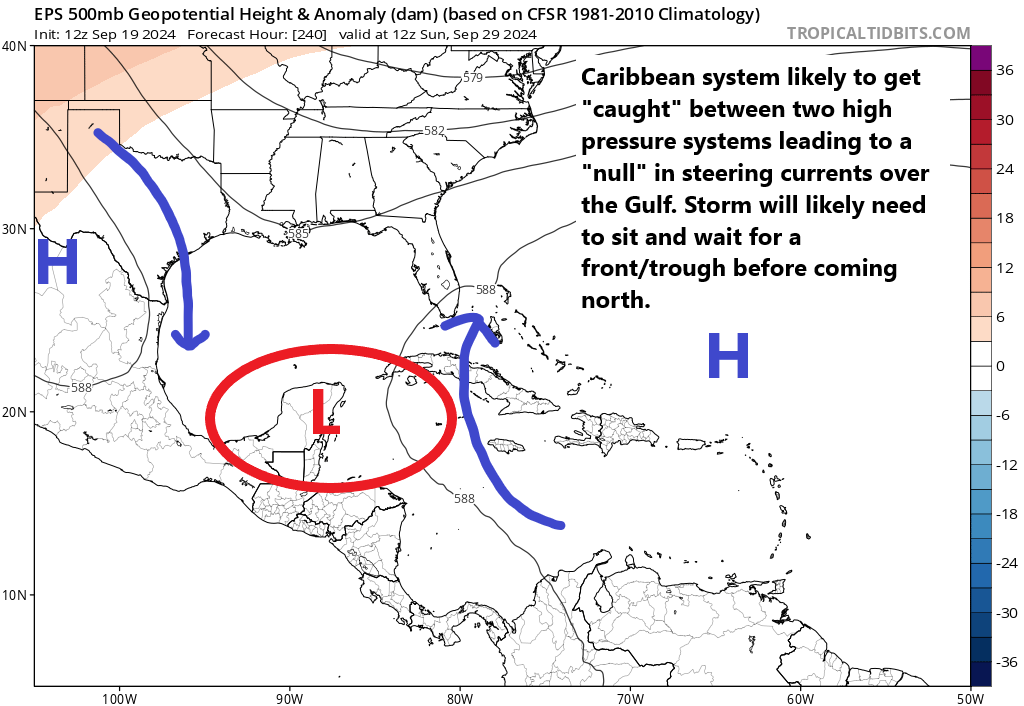
From a big picture standpoint, what concerns us here at The Eyewall is that there are no obvious things to slow this storm down. If it does start to develop a low pressure center by around Tuesday or Wednesday, then it would have two full days over the Eastern Gulf of Mexico to intensify, and if conditions are right that offers plenty of time to blow up into a powerful hurricane.
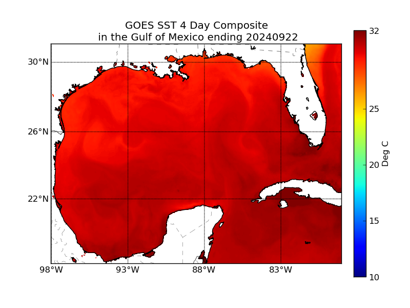
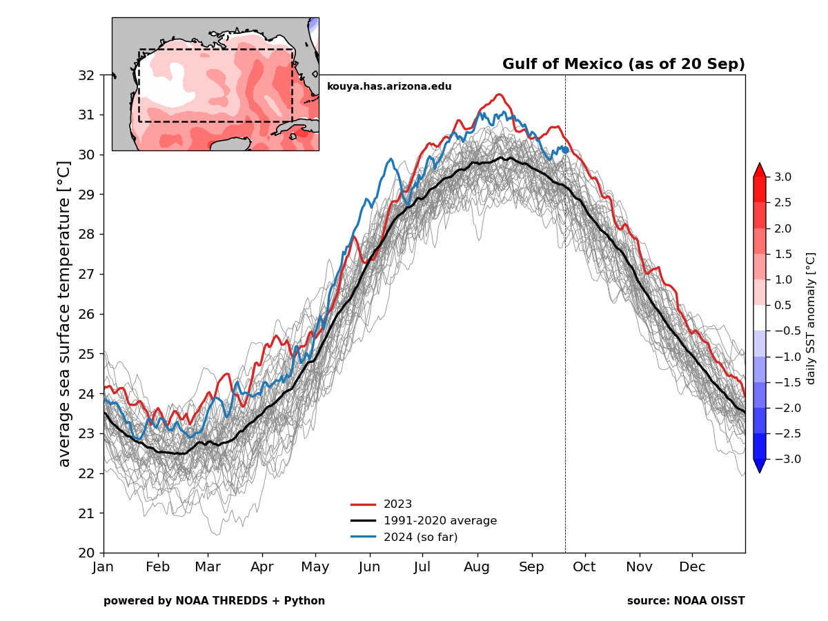
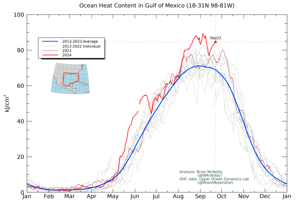
The sea surface temperatures in the vicinity of where this system should track are incredibly warm. This is partly because it is late September, and partly because of the background signal of climate change that has pushed oceanic temperatures, generally, to record highs. In addition, when we look at conditions beneath the surface, oceanic heat content is very high. This means that, as a storm churns north across the Gulf of Mexico, it will not necessarily be bringing cooler water to the surface. Deep oceanic heat is often a precursor to rapid intensification.
Wind shear has been fairly high over the eastern Gulf of Mexico over the last several days, but this shear level is now trending lower. And if this pattern continues as expected, the environment for storm formation and strengthening should be neutral in terms of wind shear, if not even favorable. So we cannot really count on shear for assistance.
Perhaps dry air, particularly on the western flank of the storm, may play a role in inhibiting some development. However, when we stack up the extremely warm surface temperatures in the eastern Gulf of Mexico, and the shear environment, I have to believe that a hurricane is likely to form before landfall late this week. This is another reason for residents of the northern Gulf of Mexico and Florida to keep a close tab on things.
Some final thoughts
It’s still too early to say too much about impacts from this system. However, storm surge, wind damage, and inland flooding from rainfall are all on the table. Where these occur, of course, remains highly dependent upon the track.
Given the current trends, it is unlikely that we see a named storm develop before Tuesday or Wednesday. Waiting for a named storm, therefore, will not leave much time for preparation. Again, this is why we’re advising residents to keep a close eye on things over the next couple of days.