Good Monday morning! It’s still snowing in the Sierra. Let’s start your week off right with a look at what’s happening weather-wise.
Headlines
- Periods of snow continue in the Sierra, with recovery proceeding slowly. Blizzard warnings are discontinued and replaced with winter storm warnings, with more manageable snow expected this week.
- Heavy rain will fall on the Southeast via two systems, one tomorrow and another around Friday.
- Severe weather risks are outlined in the South for Thursday and Friday in particular.
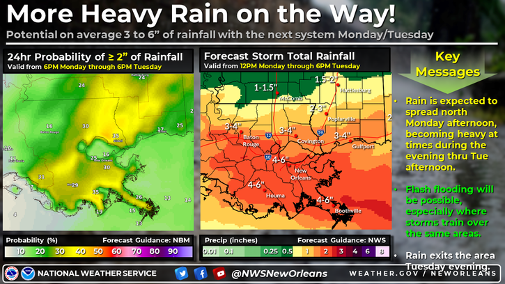
- A more localized risk of excessive rain and flooding exists in New Orleans and Southeast Louisiana today and tomorrow.
Sierra slammed
The snow continues in the Sierra today, though the blizzard warnings of the weekend have been dropped. Now, winter storm warnings are in effect into Wednesday morning. Moderate winter storm impacts are expected to continue today and tomorrow in the northern Sierra in particular.
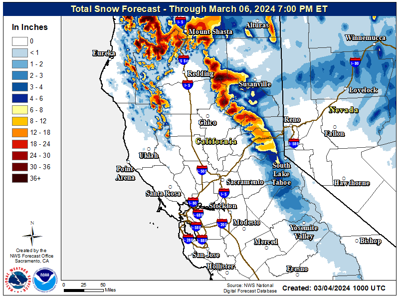
In terms of what has fallen. According to their websites at about 4 AM PT this morning, Heavenly has seen nearly 70 inches, Homewood has close to 90 inches at the summit, and Northstar is at 70 inches. Most snow reports have not been updated since yesterday morning. I would expect to see another batch released later today.
We will also get another update on the Sierra snowpack today or tomorrow, which should show the central and northern Sierra at or above average I would assume. The southern Sierra did fairly well too, but they were also running a bigger deficit, so we’ll see if they can jump past normal.
Videos have been circulating on social media showing a bunch of vehicles stuck in the Sierra. I-80 is still closed between Colfax, CA and the Nevada state line this morning. Snow “sluffs” (or loose snow on the top of the snowpack that produces a less intense avalanche) also occurred on US-50 yesterday, closing the road. If you’re like me, you’ve also been watching SoCal, in particular Big Bear Lake and the eagle cam. It’s been a rough few days for them, especially with the wind. There have been But apparently, eagle chicks are expected any day now, hopefully in better weather conditions.
Southeast soaking and late week severe weather risks
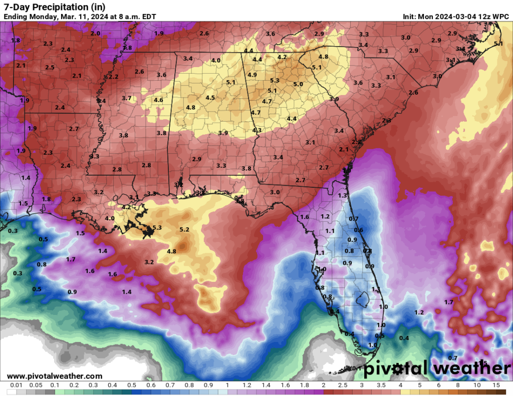
Rain is en route to the Southeast this week, with one round tomorrow into Wednesday and another one coming Friday into Saturday. There will be a healthy amount of rainfall piling up, with totals in excess of 5 inches possible by the weekend for parts of Alabama, Georgia, and South Carolina.
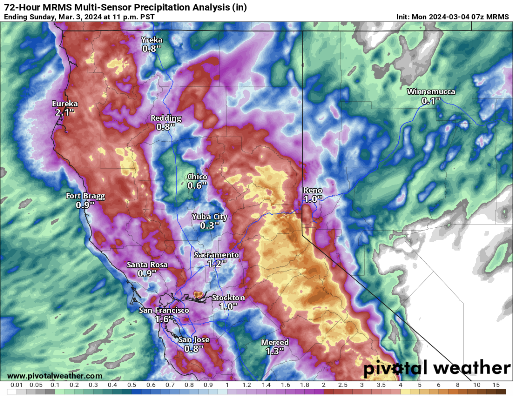
Additionally, southeast Louisiana is in a little bit of a higher risk for heavy rainfall today and tomorrow. A slight risk (level 2/4) for excessive rainfall is posted with localized totals in excess of 6 inches possible in that area.
Will these storms come with any severe weather? As of right now, there are some marginal risks outlined by the Storm Prediction Center through Wednesday, but nothing beyond that. However, days 4 and 5 (Thursday and Friday) are now highlighted with 15 percent severe risks, the equivalent of at least a slight risk (level 2 of 5). More importantly, the Storm Prediction Center typically refrains from handing out risks on days 4 through 7 unless they’re convicted. In this particular case, model agreement is pretty solid on potential severe weather from East Texas into the Deep South on Thursday into Friday.
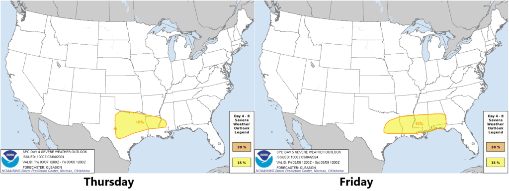
The severe threat may expand into Georgia or the Carolinas on Saturday, but as the SPC notes in their discussion this morning, there is a fair bit of model disagreement on enough details to keep a formal risk out of their forecast. We’ll see how this evolves through the week.