In brief: Our 2025 Atlantic hurricane season recap concludes with part 3, taking us from the delicate ballet between Humberto and Imelda through the season finale with Melissa.
Part one of the season synopsis can be found here.
Part two of the season synopsis can be found here.
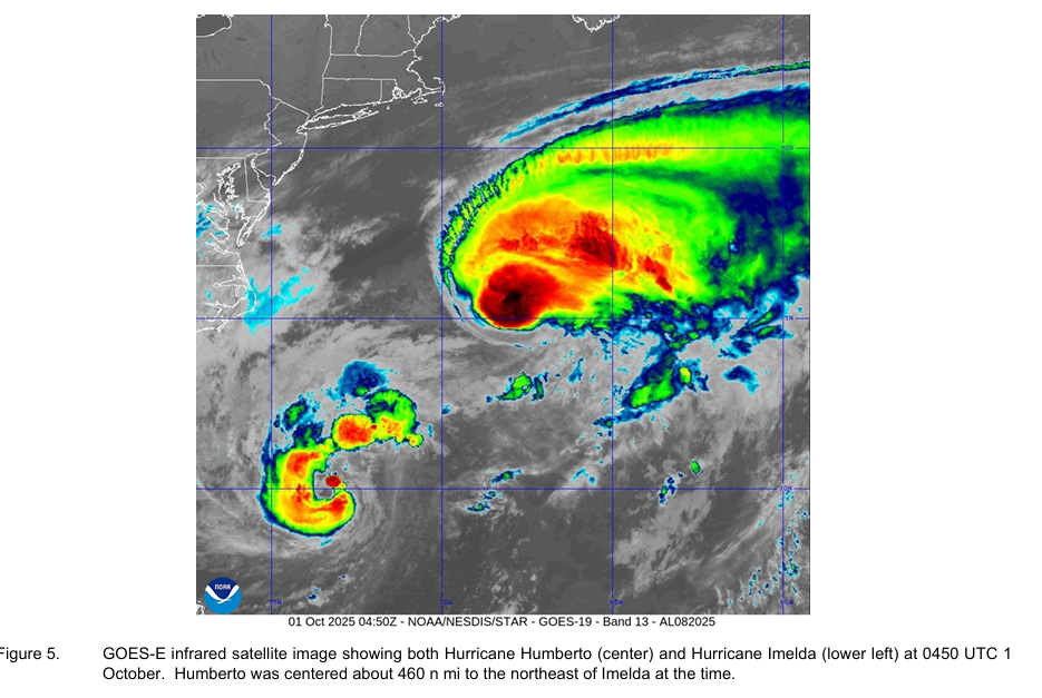
Hurricane Humberto (September 24-October 1) & Hurricane Imelda (September 28-October 2)
It would be tough to separate out Humberto and Imelda, as they were both quite literally intertwined with one another during their life cycles.
Humberto
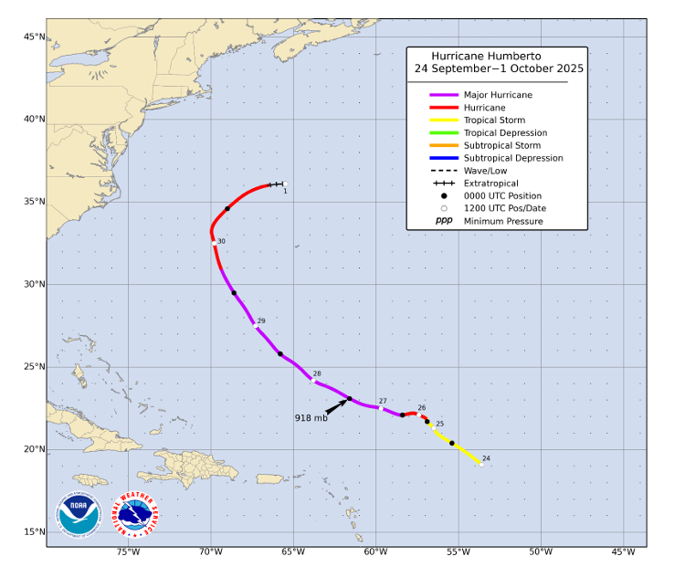
Humberto’s life cycle began on September 24th, forming as a tropical storm in the morning. Even early on, it was apparent that Imelda and Humberto may interact with one another at some point during their life cycle.
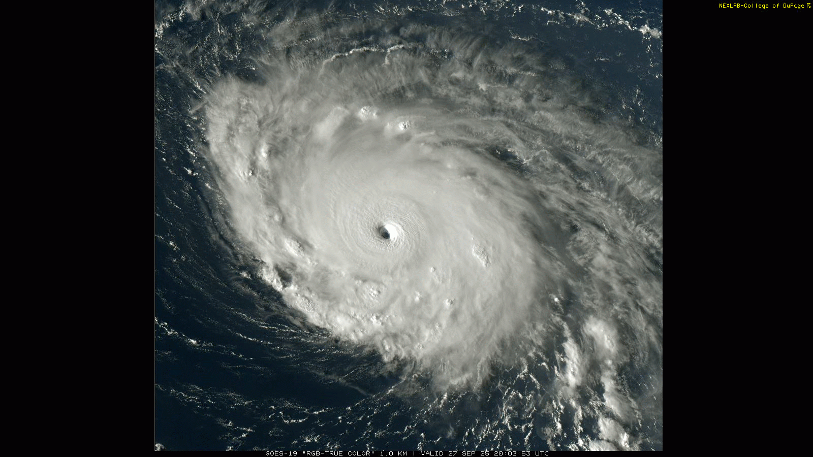
About 36 hours after forming, Humberto had become a formidable tropical storm with 70 mph winds. Humberto basically stalled out for about a day and maintained intensity before slowly resuming its track. Once it did this, Humberto exploded, tapping into abnormally warm ocean temperatures and revving up from a strong tropical storm to a category 5 hurricane in less than 2 days. The Atlantic subtropics were near record warm for that time of year, meaning Humberto had copious amounts of warm water to feast on. Humberto reached peak intensity on September 27th, settling in around 160 mph for maximum sustained winds.
Shortly after peaking as a category 5, Humberto underwent an eyewall replacement cycle and began to slowly weaken on the 28th. It dropped to 140 mph before stabilizing and restrengthening to 145 mph on the 29th. After that, Humberto began to weaken quickly. 24 hours after going back up to 145 mph, Humberto had weakened to 80 mph. Humberto turned north, northeast, and east, merging into an upper-level trough and associated cold front by September 30th.
The GFS and Google Deep Mind’s ensemble performed well during this storm for track, and Google’s Deep Mind, along with consensus aids and the HWRF did well on intensity. The HWRF will often do well with high intensity hurricanes, as it tends to perform best in environments where storms have significant intensification potential.
Imelda
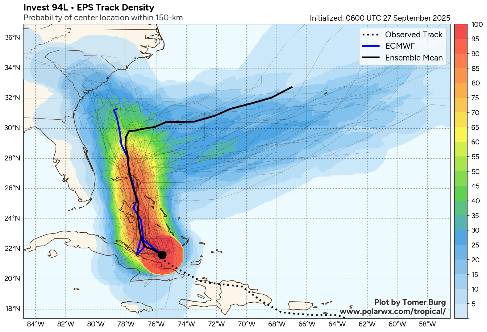
Now, Imelda was a much different animal. Imelda sprung to life officially on the evening of September 27th. Advisories for a potential tropical cyclone had been issued prior to that point given the likelihood of development and proximity to land. By the following afternoon, Imelda got its name. Imelda struck Great Abaco Island in the Bahamas on the morning of the 29th with maximum sustained winds of 50 mph. From there, Imelda drifted northward, eventually strengthening into a hurricane on the 30th. It slowed down then as Humberto passed to the east, then picked up speed again, peaking in intensity on October 1st, with winds just above 90 mph. That evening it passed immediately south of Bermuda, impacting the island with strong winds and heavy rain. By the next day, Imelda had become extratropical. Imelda eventually got absorbed into the same general system that absorbed Humberto about 5 days previously by October 3rd or 4th.
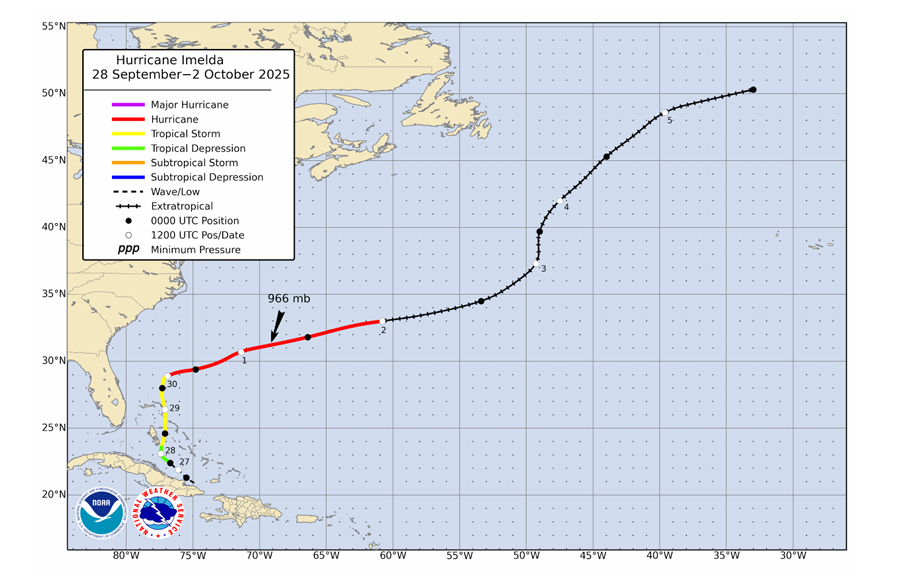
While Imelda and Humberto didn’t directly interact with one another, Humberto’s influence had a big impact on Imelda’s final track. It also had a big impact on the model guidance forecasting Imelda and how close it would approach the Carolinas and Southeast. Thus, track forecasting suffered a bit during this storm across the board. NHC track forecasting errors still managed to beat the 5-year average between hours 36 and 60. Google Deep Mind’s model did very well overall in terms of track once again. So did the UKMET, which was part of a group of solutions that took Imelda farther east, not right up against the U.S. East Coast.
Intensity forecasts were generally not as difficult, and the NHC outperformed most model guidance and the 5-year average here. Winds on Bermuda gusted as high as 86 mph. Imelda dumped over 20 inches of rain in parts of eastern Cuba while a tropical wave as well. Imelda was a good case study in being cautious about being too aggressive with forecasts before a storm even develops.
Tropical Storm Jerry (October 7-11)
Jerry formed from a tropical wave about 4 days after it exited Africa on October 3rd.
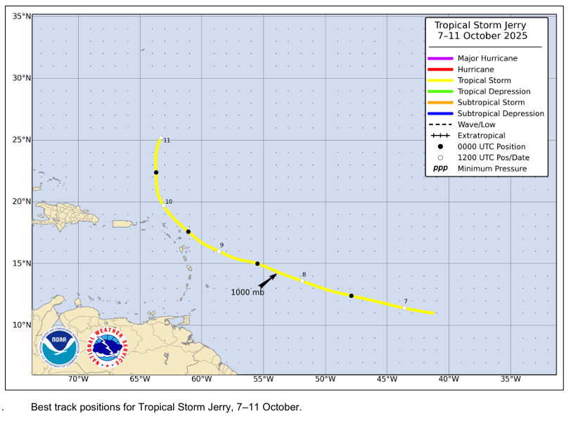
The wave associated with Jerry booked it west until it developed on the 7th, immediately becoming a tropical storm. Because of Jerry’s forward speed and some wind shear and dry air, it just never was able to get off the ground, despite some aggressive model forecasts at the time. Jerry peaked on the 8th with 65 mph maximum sustained winds and a surface pressure of only 1000 mb. Though Jerry missed the islands to the northeast, the storm still managed to kill one person in Guadeloupe and cause some significant flooding there and in Antigua. As much as 5 to 9 inches of rain fell in some of those islands with wind gusts as high as 67 mph in Guadeloupe. The NHC track forecast for Jerry was outstanding, while the intensity forecast was too strong, owing to the aggressive model guidance early on.
Subtropical Storm Karen (October 9-10)
Karen was a relatively unmemorable storm with the very noteworthy exception of being the farthest north a tropical storm or subtropical storm has formed on record.
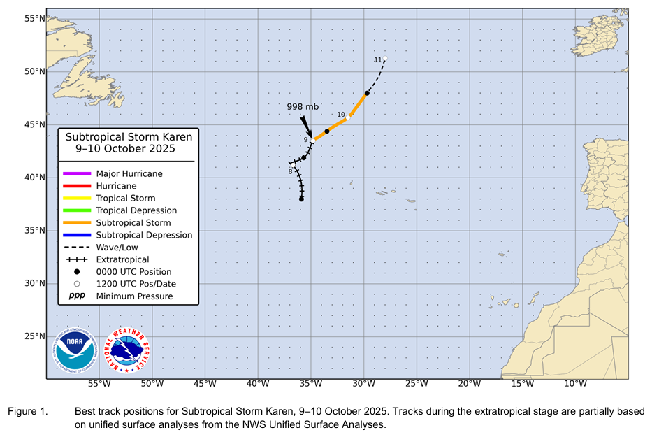
While many storms have tracked into that part of the ocean, none have had their origin occur that far to the north. As a subtropical entity, Karen only had maximum sustained winds of 45 mph, though it was stronger prior to undergoing tropical transition. Rather than regurgitate the technicalities involved in determining why Karen was a subtropical storm and how it came to be, I encourage you to check out the NHC’s post storm analysis on Karen here.
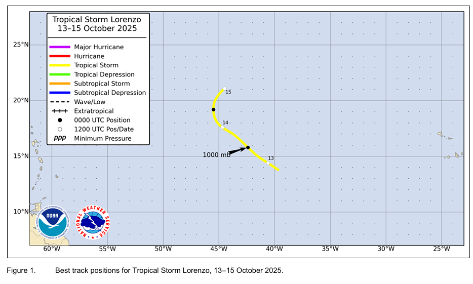
Tropical Storm Lorenzo (October 13-15)
Not much to say about Lorenzo. It formed from a tropical wave in the open Atlantic and never really got off the ground, lasting just a short time before dissipating.
Hurricane Melissa (October 21-31)
The worst of the season saved itself for last. 2025 ended with Hurricane Melissa, an absolute monster of a storm that shattered records. It tied (Allen 1980) for the strongest hurricane on record in the Atlantic Basin with 190 mph maximum sustained winds. Maximum sustained winds at landfall of 185 mph tied Dorian in 2019 and the Labor Day 1935 storm for strongest landfall on record in the Atlantic. The 892 mb minimum central pressure was only beaten out by Wilma in 2005 (882 mb) and Gilbert in 1988 (888 mb) for deepest tropical cyclone in the Atlantic. A dropsonde observation from a hurricane hunter mission into Melissa measured an instantaneous wind speed of 219 kts (252 mph), which is the highest wind speed ever measured globally by that type of equipment.
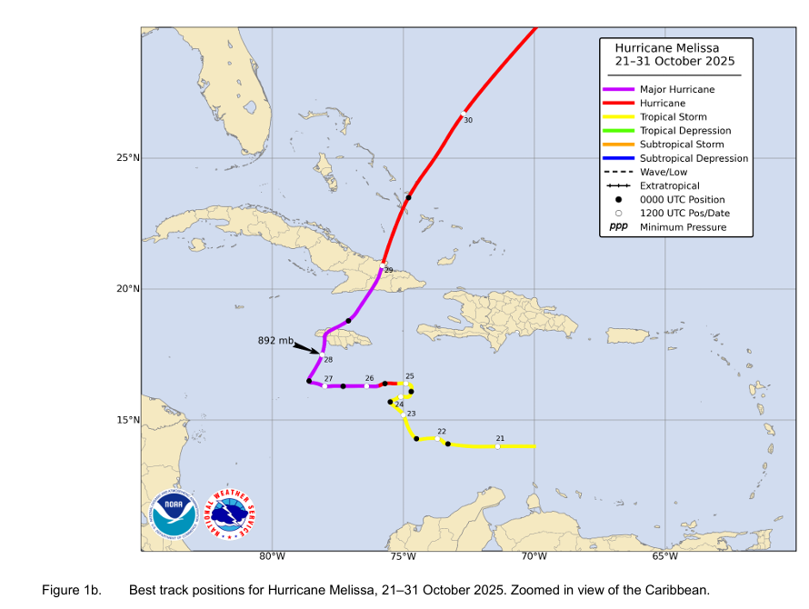
Melissa was captured in the models well in advance of development as a potential threat, noted prior to October 13th. It was tough to take it super seriously initially, as modeling had been flagging that area for many days prior to Melissa being a thought. It was really around October 17th or so when things got pretty serious looking. And it only escalated from there.
Much ink has been spilled on Melissa over the last several months, as it relates to preparedness, communication, climate change, you name it. There’s no real sense in going off the deep end here with things, but I strongly encourage you to read the NHC’s report in full, as it contains a multitude of valuable information, imagery, and insight. I will just note that forecast-wise this was a tremendous success for the National Hurricane Center, which beat virtually every model at almost every lead time on both track and intensity. The exceptions were a few models that beat NHC on day 5 intensity errors and Google Deep Mind, which had a slightly better track forecast across the board. Google’s model was a revelation this past hurricane season, and there will be high expectations for its performance in 2026.
I’ll end it with some editorial comments. It’s a testament to Jamaica’s preparedness and resilience that the total death toll from this storm (officially) still lags 100 people. There was some commentary from folks in Jamaica on social media lambasting some meteorologists for overhyping the storm. And when you think about that, it’s almost laughable to think that you could possibly overhype one of the largest storms in modern history. But Jamaicans are not ill-prepared for hurricanes, and there was an element of patronization in some of the posts and comments ahead of Melissa that because Jamaica is a Caribbean nation it must not be ready to handle a storm. Quite frankly, while not as excessive as some others, I was guilty of expressing some serious concern of the impending doom variety rather than the healthy concern one should have when a category 5 storm is looming. None of this is to minimize that this was a legitimate catastrophe for the country. It caused over $8 billion in damage after all. But the air of condescension was evident. We could all learn some lessons from Jamaica for how to prepare and harden our communities for hurricanes.
2025 would have been a footnote in the history of Atlantic hurricanes for the most part had Melissa not occurred. It’s a sobering reminder that even in relatively quiet seasons, bad storms can happen. This is why we advocate preparing every hurricane season as if it is “the one.”