In brief: A quick Monday table setter to discuss severe weather today, flooding concerns that are coming up, and an early season heat wave on the East Coast. Eastern Pacific hurricane season is also officially underway.
Tropical concerns: None.
Eastern Pacific hurricane season began on Friday, and it looks quiet for the time being. Nothing on the Atlantic side to get us stirred up either. Look for part 3 of our 2025 Atlantic season in review on Wednesday.
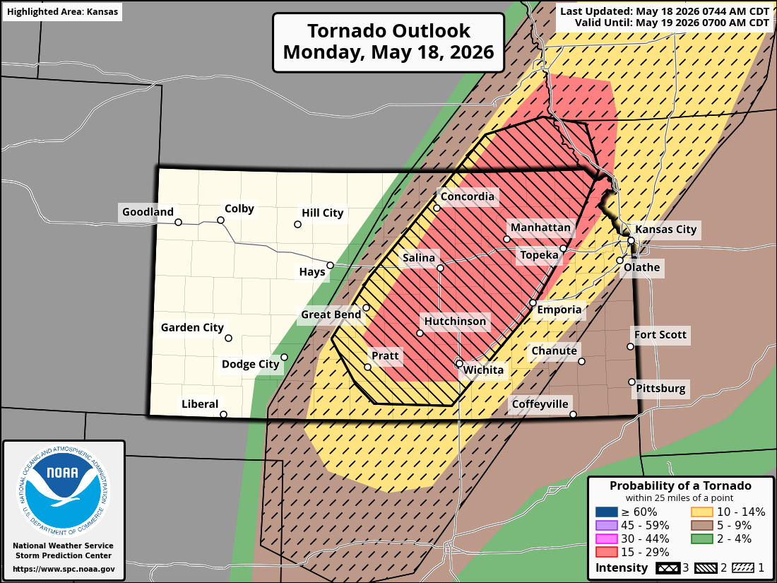
Severe weather concerns: Moderate risk today Kansas/SE Nebraska
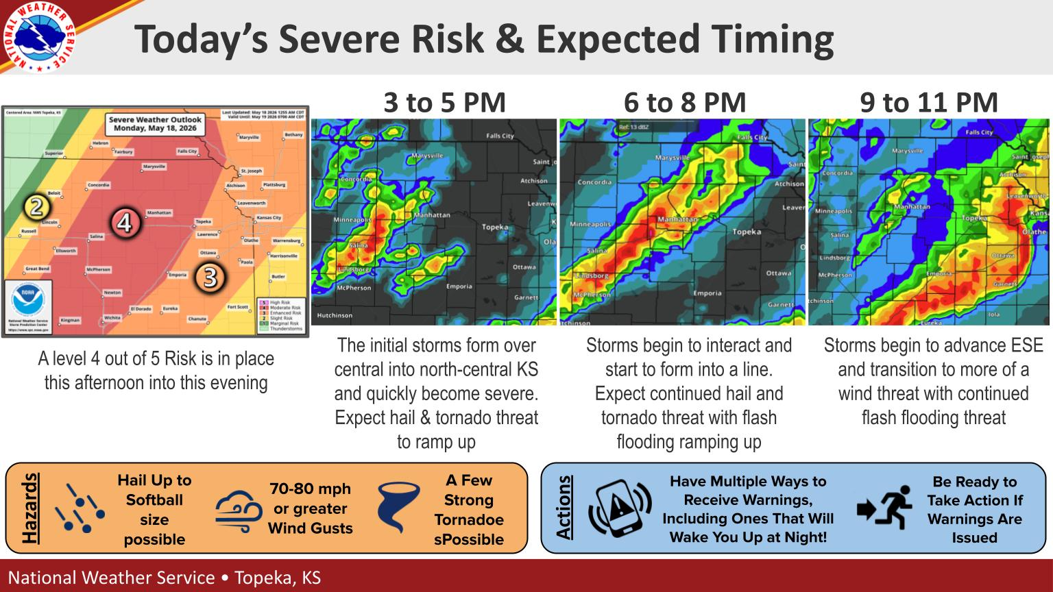
A moderate risk (level 4/5) is in place today for much of central and northeast Kansas, as well as southeast Nebraska. The risk today is for significant hail and strong tornadoes in this area.
Storms should develop later this afternoon and advance east across Iowa and Missouri. Much of those areas are in enhanced (3/5) and slight (2/5) risk as well. So there is substantial risk for damaging thunderstorms today and tonight in these regions.
Storms will advance south and east tomorrow where a very broad slight risk (2/5) is in place from Upstate New York into Texas.
Flooding concerns: Central U.S., including Texas
Storms today will cause localized flash flooding from Kansas into Iowa and Minnesota but also a bullseye in Missouri. In these areas a “slight” risk (2/4) is in place for excessive rainfall and flooding, except a moderate risk (3/4) in Missouri.
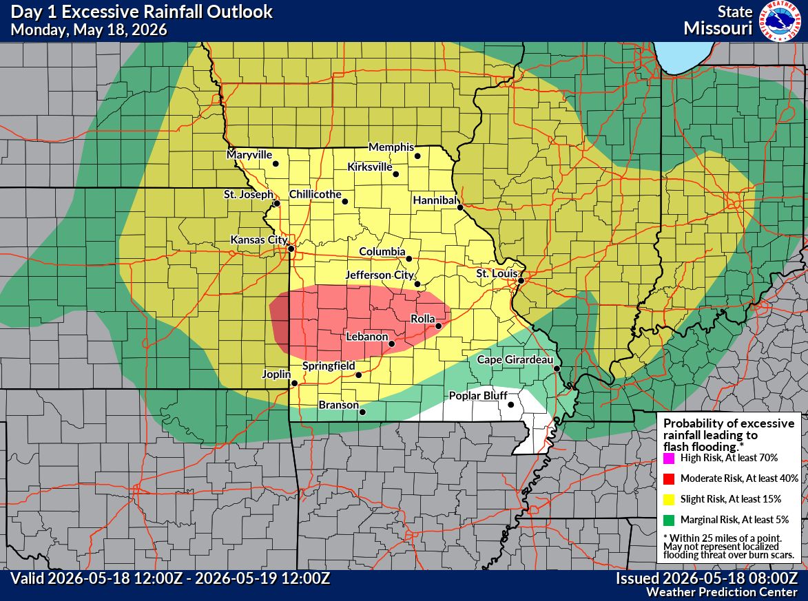
Flood watches are posted in this area.
As that system exits to the east, the setup over the Central U.S., from about Texas into the Ohio Valley and Southeast is going to favor continuous moisture coming in off the Pacific, Gulf of Mexico, and Caribbean Sea. This will lead to repeated rounds of rain and thunderstorms beginning tomorrow and continuing probably into next week in these areas. Rainfall totals will probably add up to 4 to 8 inches over a broad area in that 7 to 10 day period.
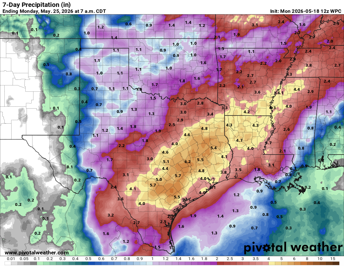
In localized spots, we could see some flash flooding concerns ramp up, including portions of Louisiana and the Houston area in Texas. We could also see some larger rivers begin to flood as well. We’ll be monitoring the rain chances for Houston closely at Space City Weather. But this looks like a major, prolonged and drought-busting rain event across the South and Ohio Valley. We will likely have more to come on this either here or at Space City Weather.
One other additional note: Corpus Christi has been in the news a lot lately because of the potentially devastating water shortage issues in that area. While this will not end those concerns at all, 1 to 4 inches of rain would help a lot in the near-term. Most models show this as a plausible outcome, though the heavier rains will be focused northeast of there. Hopefully with a developing El Niño, the rains will occur more frequently, though flooding concerns may emerge more frequently too.
Heat concerns: Northeast Corridor
Not necessarily out of the ordinary, but an early season heat wave is going to impact parts of the Northeast Corridor, especially between New York City and Richmond, Virginia the next couple days. Yesterday was a taste of things with 89 degrees recorded in New York, Philadelphia, and Washington. Today and tomorrow should be worse. Forecast highs are in the mid-90s for DC and Philly today and tomorrow and perhaps mid-90s into New York and Boston tomorrow.
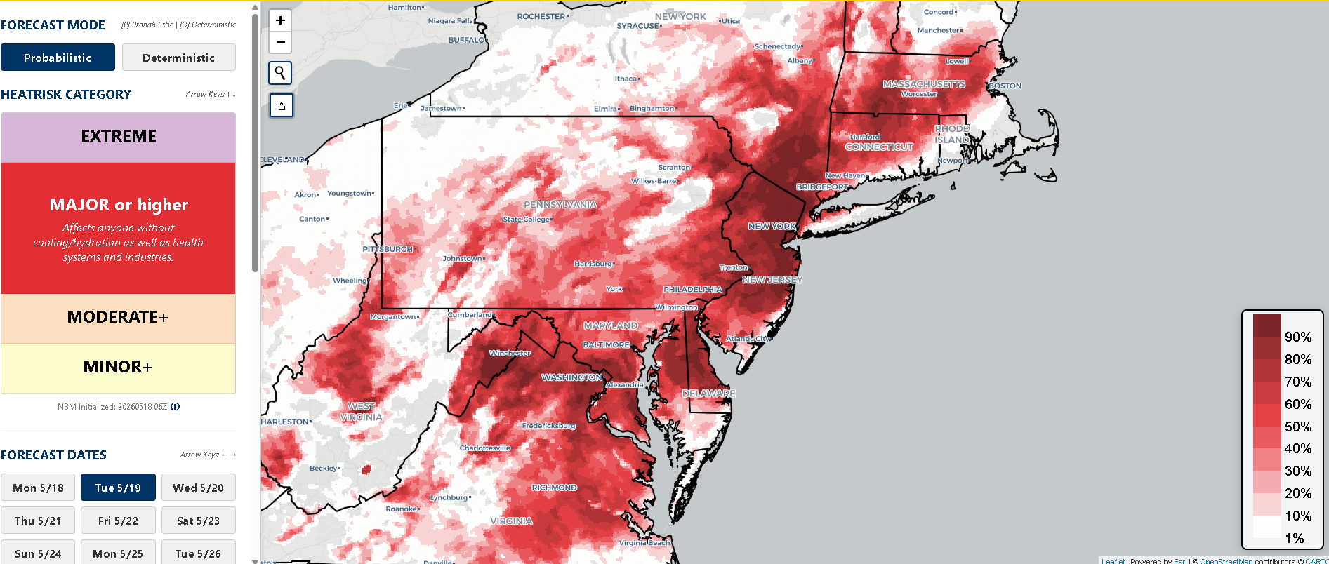
Tuesday should be the hotter of the two days overall, and the NWS heat risk map above shows pretty high probabilities of “major” risk (level 3/4) over a broad area. Heat should end on Wednesday evening with a cold front slamming through the region.