In brief: We’ll be keeping a casual eye on the Gulf late next week or weekend as the potential does exist for some low-end development. However, it’s by no means close to a certainty at this time.
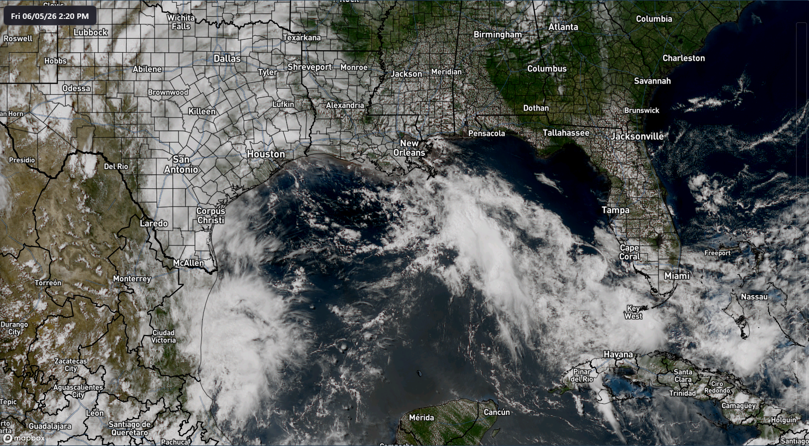
So far this season, including back into May, we’ve seen some hints in the models of potential Gulf development. Yes, the usual suspects have done their usual things. But also, there’s been at least some legitimacy to the overall pattern being unsettled and stormy. One need only look at a satellite image of the Gulf today to see that.
Over the next few days, we’ll see things start to ease up a little in the Gulf before we get a little bit more intrigue later next week. Around Thursday or Friday, we begin to see the outlines of some cyclonic flow around the Yucatan. It appears that this may be the beginnings of a Central American Gyre (CAG) pattern. This is historically a common pathway to get development in the Gulf or near Mexico in June.
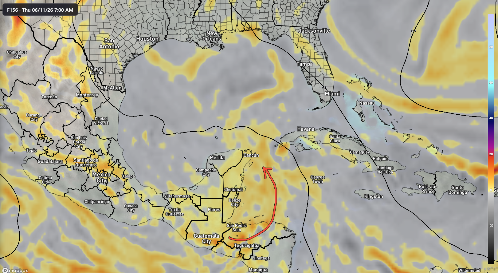
If this happens, you would start watching the Gulf around next weekend. Is there actual model support for a system? Not entirely. I mean, there is, but it’s not exactly stellar at this point. Google’s AI model is very, very lukewarm on any development. The European AIFS ensemble is also fairly lukewarm on things. The classic European ensemble is a little more excited about things (shown here), but even this is like 20% of ensemble members only. And the European ensemble does tend to have a somewhat overly aggressive genesis forecast with these things in my experience.

Also keep in mind, this time of year, it’s most likely that if something does develop, it would be sloppy, poorly organized, and quite moisture-laden. That means heavy rain would be more of a concern than any sort of wind or surge aspects. At this point, it’s a curiosity worth following into next week to see what happens but nothing anyone needs to get too worked up over.
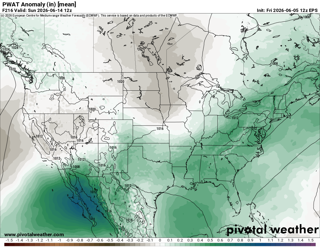
Indeed, there is a *lot* of moisture on the board around next weekend, with Sunday the 14th looking like it has above normal moisture up and down the East Coast and into the Gulf and Texas. So at the least, we’re looking for rain chances.
More to come on all this.
Elsewhere, we’re in good shape with no concerns. Tropical Storm Amanda in the Pacific is no threat to land. A new disturbance is likely to form into a system currently off the coast of Zihuatanejo, Mexico. That could eventually make landfall, but as of now, models are mixed on exactly what that looks like.
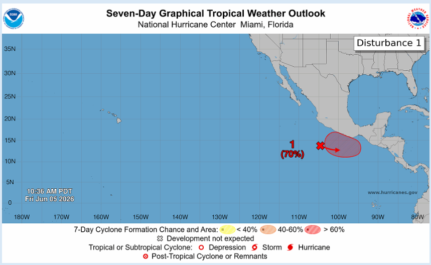
Another disturbance south of this one may drift into Central America, possibly briefly developing. We expect the East Pacific to be fairly active this season, so this may just be the beginning for that basin.