In brief: Invest 92L in the Atlantic is struggling to organize and it likely is en route to eventually dying off in the Caribbean. Behind 92L, another system has some development chances as well heading toward next week. And in Hawaii, folks should continue monitoring Invest 93C, which should become a depression or storm today or tomorrow, approaching Hawaii this weekend as a tropical storm or perhaps lower-end hurricane.
A sorta busyish Atlantic
We are now up to about an 80 percent chance of development in the Atlantic today from the tropical wave we’ve been watching. It’s been tagged as Invest 92L as well, so we get more things to watch on it as it moves. Satellite tells you that this system is not exactly crushing it this morning.
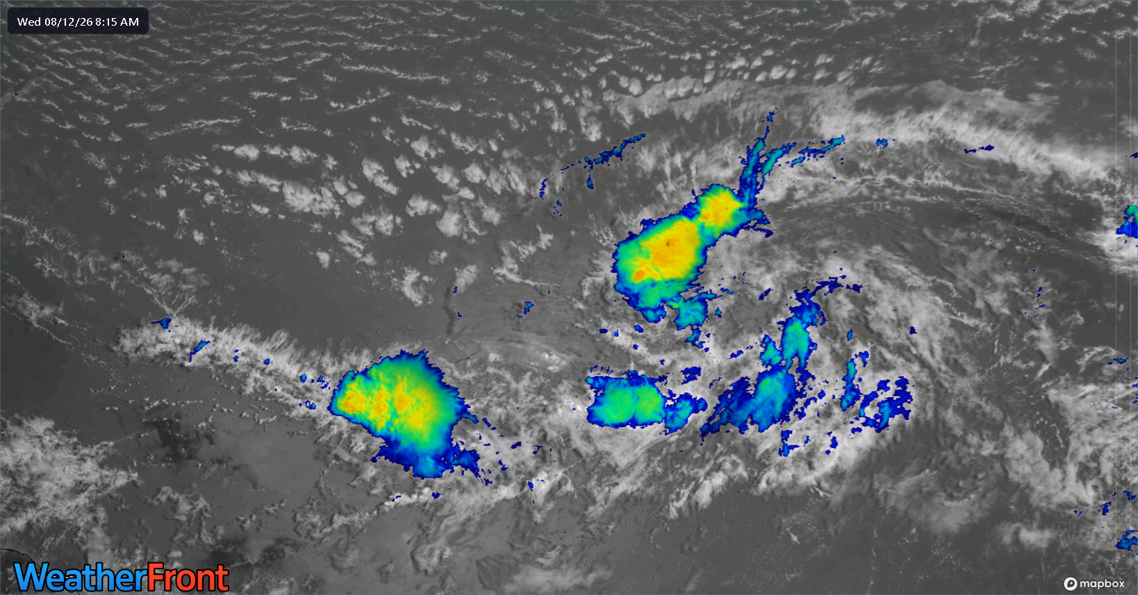
Despite the lack of meaningful storms, there is a definitive “twist” to the disturbance right now, so it’s getting somewhere.
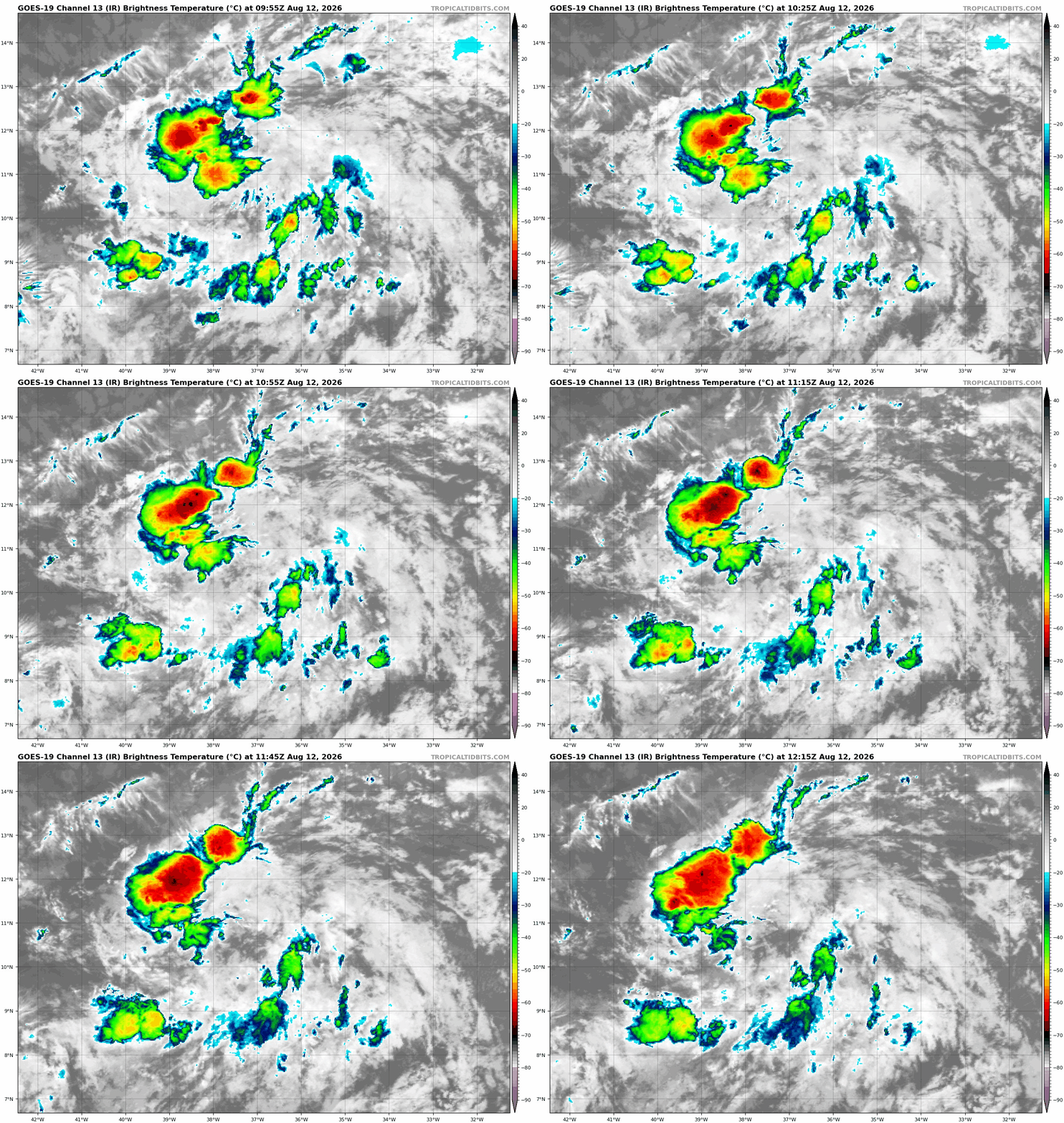
I would expect we see a depression out of this within a day or so.
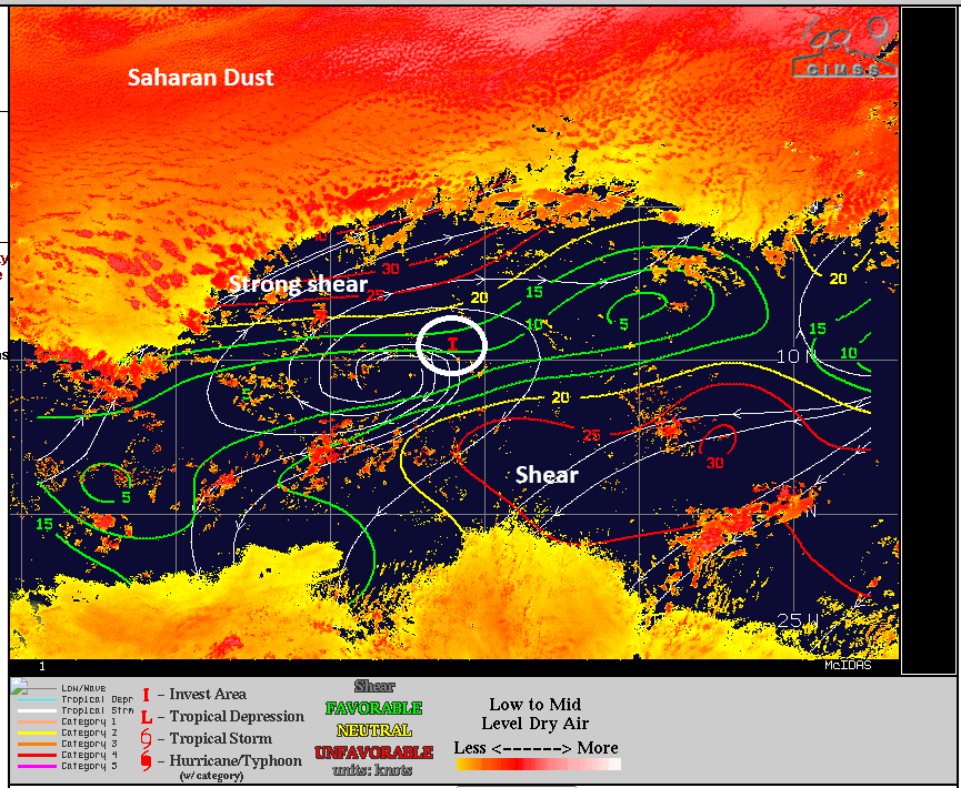
The environment surrounding Invest 92L is not exactly ideal. While the system itself is somewhat cocooned in a small area, it has to deal with significant wind shear just north and on the southeast flank, as well as oodles of Saharan dust immediately north. Basically, there is going to be a functional limit on this system’s intensity because even if it does grow, it will immediately “feel” the shear and dry air more aggressively.
So what does that mean going forward? Well, Invest 92L, whatever it is, should be approaching the Lesser Antilles in about 3 to 4 days. As it gets there, it will have a couple choices. Either go north out to sea through a weakness in high pressure in the Atlantic, or continue west into the gauntlet that is the highly sheared Caribbean.
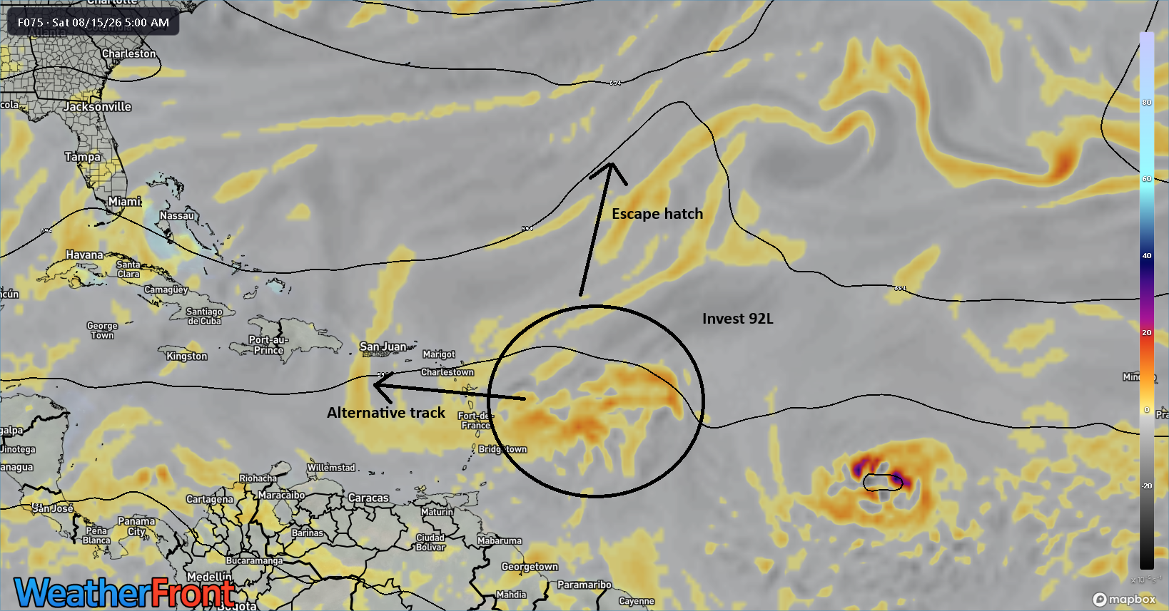
When dealing with tropics, we usually have a rule that goes “weaker west.” In other words, if 92L struggles, it will likely just keeping plodding west into the Caribbean. At that point, it would almost certainly succumb to wind shear, and that’d be that. If 92L can get a modest organization together, it would be more apt to “feel” the weakness in between the areas of high pressure in the Atlantic, the escape hatch if you will. In that case, it would likely turn north and probably end up heading out to sea. I think the smart money is to the west into the Caribbean.
Note, behind 92L is another tropical wave. You can see it on that Euro model depiction above. This one is currently flagged with 30% development odds. At this point, modeling seems to be very mixed on the future of this system. The AIFS and Euro are a little more excited, whereas Google’s modeling (both operational and the 1,000 member ensemble) are lukewarm.
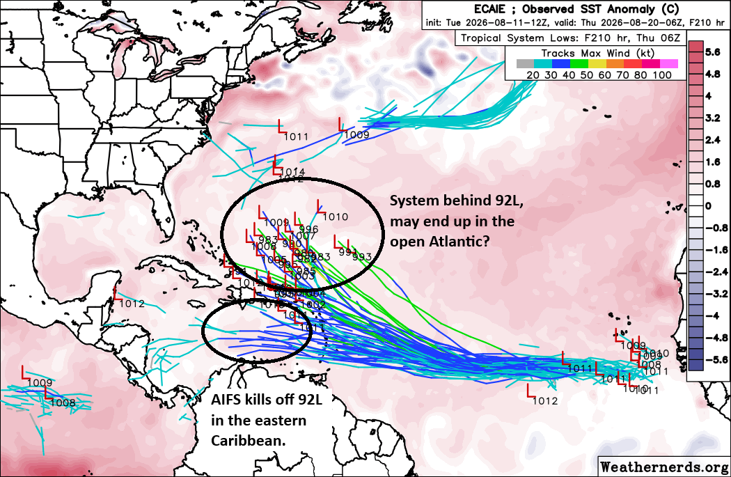
The AIFS ensemble is above, and if you live on the East Coast, you’re probably looking at that and saying, “Um.” But the reality is a.) I’m not sure we even get to this point yet. And b.) This assumes the next wave even develops at all. The overall pattern is supportive of keeping any storm tracking north into the Atlantic out at sea, so if I live on the coast, I wouldn’t be sweating either of these waves right now. We’ll keep you posted.
There’s another system in the far north Atlantic that is not a threat to land, but we could see a throwaway depression or “C” storm before it dissipates.
Hawaii risks?
Shifting into the Pacific, we continue to track Invest 93C. Odds of development of this system remain high, but admittedly, it has been sluggish to really get going. This is decent news for Hawaii.
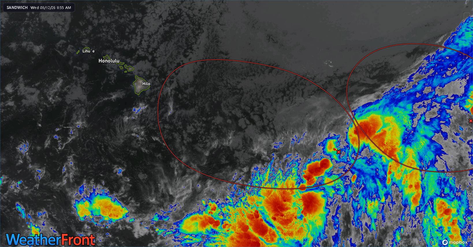
What to make of this? Well, the system itself is trying to get organized near that little red “x” on the image above. It looks close to maybe becoming a depression, so we’ll see we get that today. We are about 4 days out from Hawaii impacts. Over the last couple days, the upper end intensity of this disturbance seems to have faded a bit in the modeling. It is having to fight off a good deal of shear, but that should ease up in the next couple days. Likely, we see a depression, then tropical storm by tomorrow or Friday. As it approaches Hawaii this weekend, we should expect some degree of heavy rain, flash flooding, and gusty, possibly damaging winds on some of the islands. There’s still ample uncertainty on the exact track and intensity, so specifics are tough to nail down.
Another potential risk is wildfire ahead of the storm as winds increase and humidity drops. This will be something to also monitor in the next couple days as this system organizes and approaches.