In brief: Hurricane Isaias is a category 2 storm this evening, with the forecast basically on track as expected. Landfall will occur tomorrow night, likely between Mobile and Fort Walton Beach, FL as a formidable hurricane. We discuss the latest. We also take a look at the West, where the Desert will be impacted by two (2) remnant tropical storms over the next week.
I don’t want to bury the Isaias coverage here, so scroll through for some thoughts on Tropical Storm Rachel’s Southwest U.S. impact.
Isaias
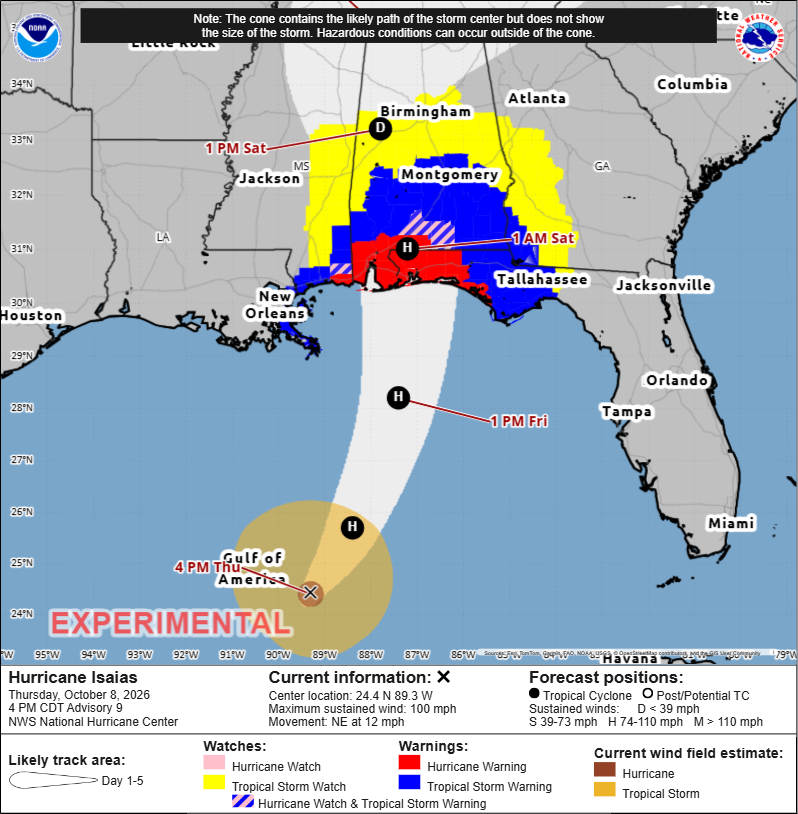
Hurricane Isaias has been fascinating to watch today. It started off looking ok. Then, we saw some “under the hood” elements that suggested it was gearing up to intensify. Its satellite presentation actually degraded a bit this afternoon, and after about 3 PM ET, we have seen what appears to be steady intensification ongoing.
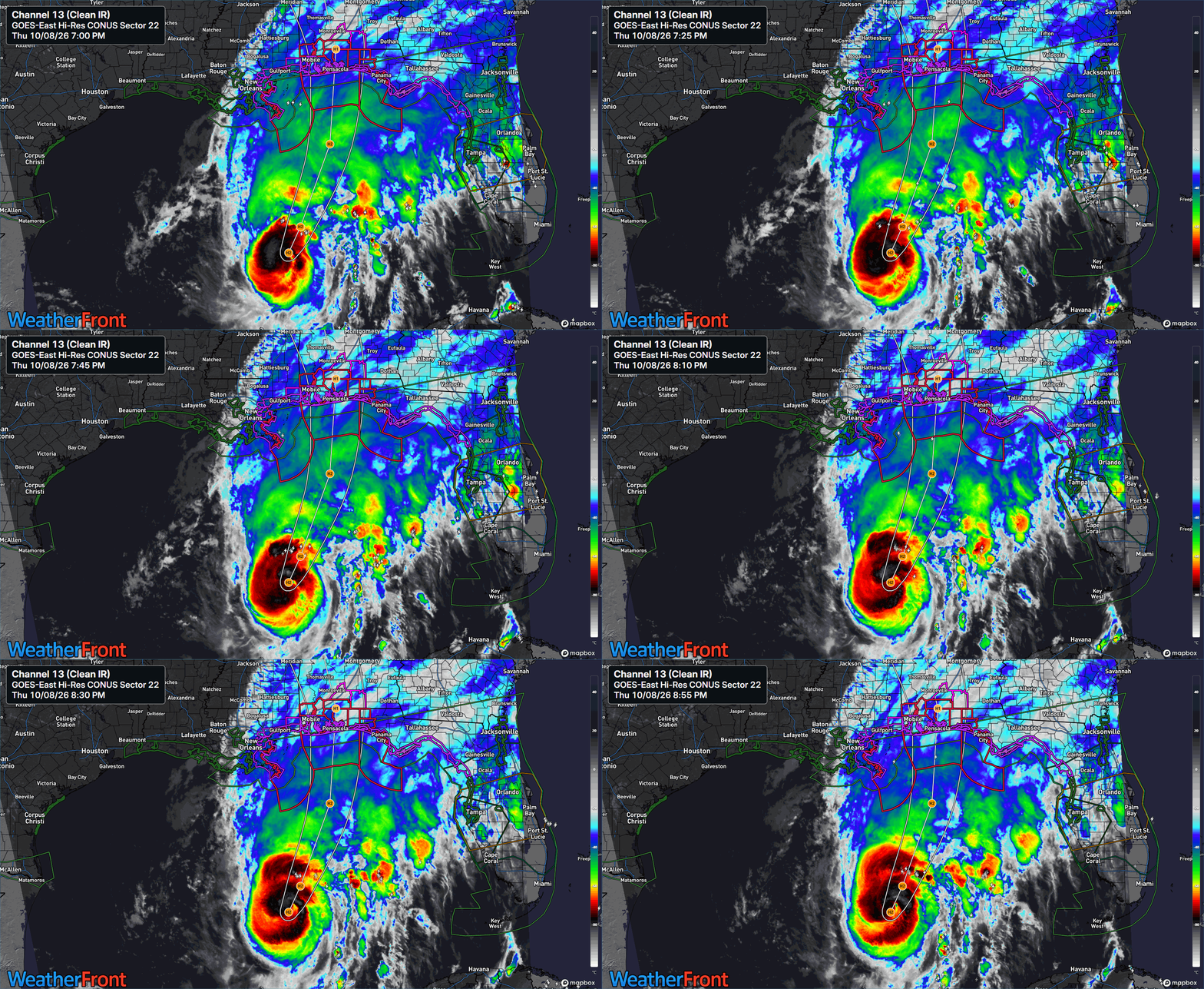
Deep thunderstorms started to pop on the western eyewall and then began to wrap around and expand into the evening, and as of this writing, Isaias looks like a reasonably healthy hurricane, despite enduring about 25 knots of wind shear near the center. Be thankful for this wind shear because without it, Isaias would be on the way to elite hurricane status I think. It’s sitting over water temperatures that are over 2 degrees Celsius warmer than normal, which is surely helping, and it’s also passing near the healthiest ocean heat content in the Gulf of Mexico.
Isaias may be able to fight the intense shear around it off for another 18 hours or so. The center appears to be somewhat incubated from the worst of the shear. By tomorrow afternoon or evening, it may become too much to hold off, and Isaias will begin to shed some intensity in the few hours before landfall. Notably, over 95 percent of Google’s 1,000 member ensemble brings Isaias over 115 mph tonight or tomorrow. This model has been absolutely steadfast and resolute in suggesting that Isaias would make a run at major hurricane intensity over the open Gulf before weakening on approach.
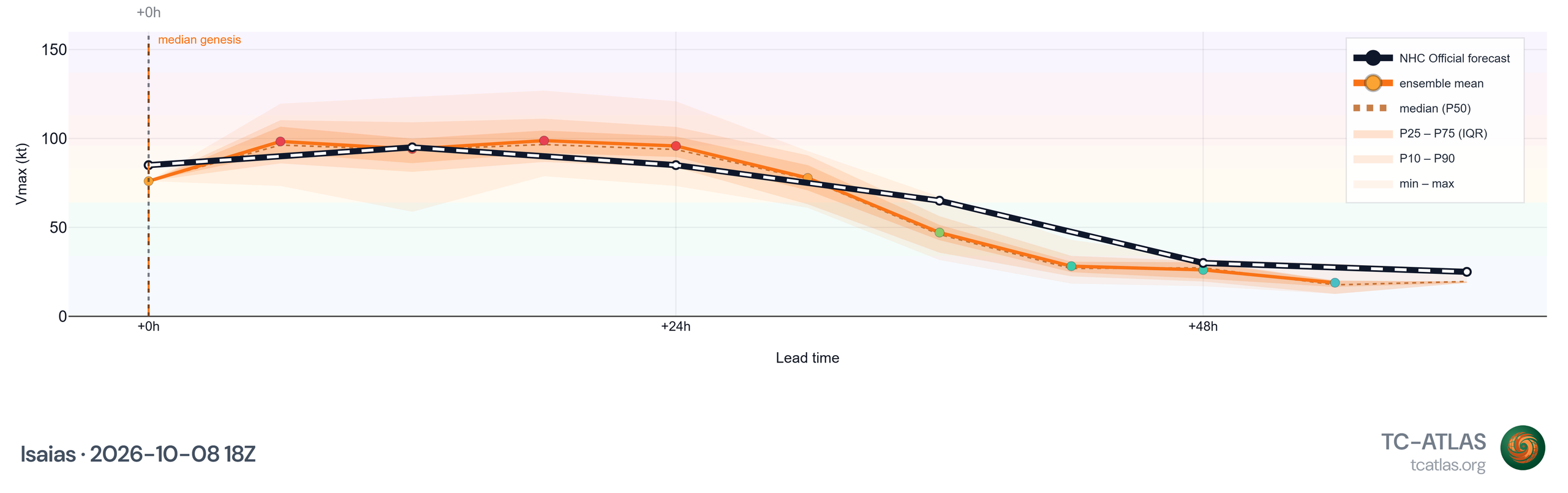
So what does this mean for the folks in the path of the storm? It means you need to prepare for a significant hurricane impact. Even if Isaias does weaken some before landfall, it may not appreciably change the surge and wind outcomes on the immediate coast. It may also allow for the wind field to expand farther north and east, so the inland areas under tropical storm watches and warnings will also need to assume there will be power outages and the like as the storm presses inland. Charge your phones tomorrow and tomorrow night.
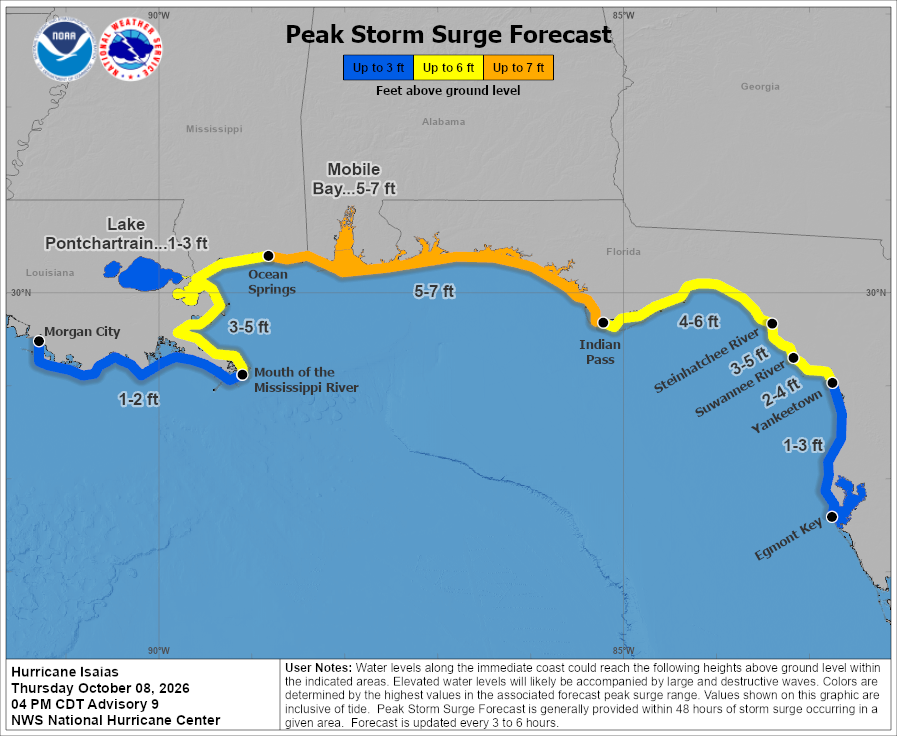
Notably, the surge forecast has pretty much held since yesterday, with a 5 to 7 foot peak surge expected, especially near and east of where the center comes in. I would be most concerned about surge in the western Florida Panhandle right now and watch it cautiously around Mobile Bay. Tides will run up elsewhere along the Gulf Coast, as far west as Louisiana and as far east as the Nature Coast.
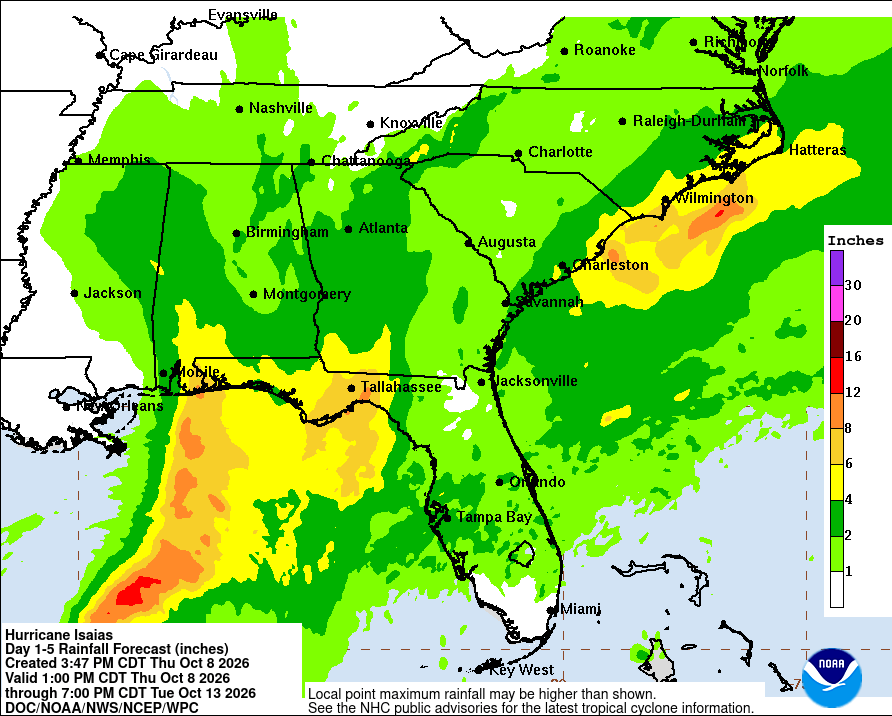
Rainfall continues to be mostly an asterisk on this storm. I don’t want to minimize rainfall at all. As someone who spent 14 years in Houston, boy do I know. While there will be instances of flash flooding likely all over the Southeast, these should hopefully not be the worst you’ve seen in recent years and hopefully mostly scattered or isolated in nature. Still, respect the water.
The other element is severe weather. As the wind field expands in a high shear environment, Isaias is likely to spawn tornadoes. This seems most likely in the pocket east of where the center comes in, potentially well east across Florida and southern Georgia.
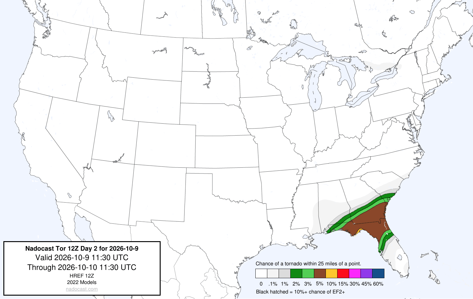
Based on what I’m seeing on some of the other modeling, this tracks, and I would watch for isolated tornadoes in these areas tomorrow night and/or Saturday morning. There may also be a secondary area that shows up north of here on Saturday evening closer to coastal South Carolina. As Isaias weakens through the day Saturday, aside from those areas, the threats and hazards from the storm will diminish.
So, the bottom line with Isaias is that not much has changed. A hurricane will make landfall, probably somewhere between Mobile and Fort Walton Beach, FL tomorrow night. While it will probably be weakening on approach, it will likely come in as a formidable hurricane with an expanding wind field, meaning storm surge and winds near the coast, as well as inland will be impactful. The threat of severe weather and isolated tornadoes will also potentially be impactful in North Florida and southeast Georgia.
More in the morning.
Pacific Tropical Storms Rachel & Simon
Let’s shift from the Gulf into the Pacific, where Tropical Storm Rachel is this evening.
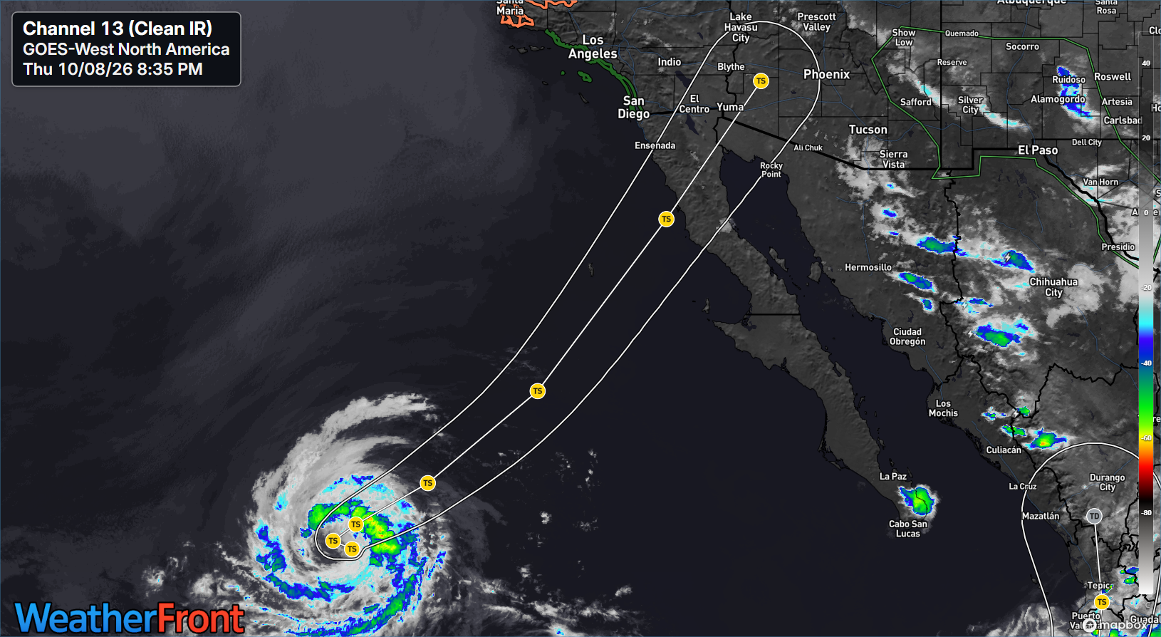
Modeling has Rachel coming ashore late Saturday somewhere between northern Baja and San Diego. While Rachel will be weakening, it will likely still have some degree of tropical storm force winds with it as it moves ashore, meaning that strong winds interacting with the terrain of northwest Mexico and/or California and Arizona will produce locally powerful wind gusts.
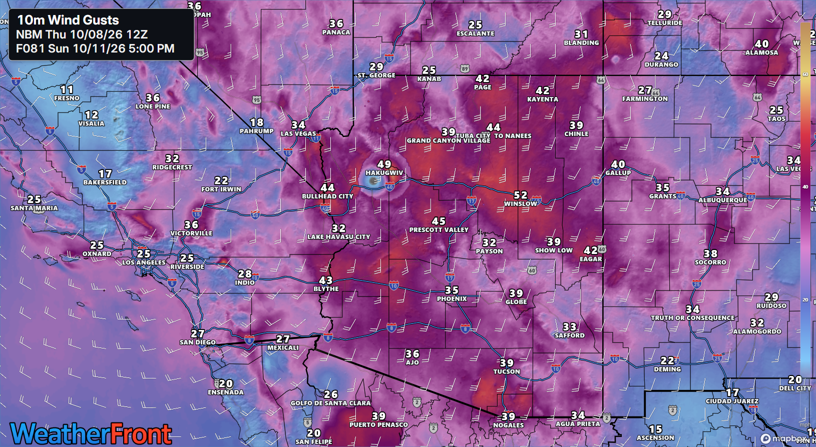
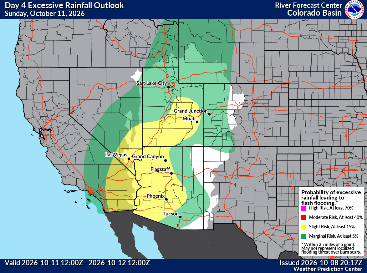
In addition to the wind gusts (and some coastal flooding and rough surf in California), locally heavy rain may occur in parts of the Southwest. Not only that, the remnants of what should become Hurricane Simon in central Mexico will also push into the Southwest next week, likely leading to another round of heavier rain. The heaviest rain from Rachel Sunday and Monday will occur in Arizona and Utah. The heaviest rain from Simon later next week will occur in New Mexico and Colorado (and parts of west Texas).
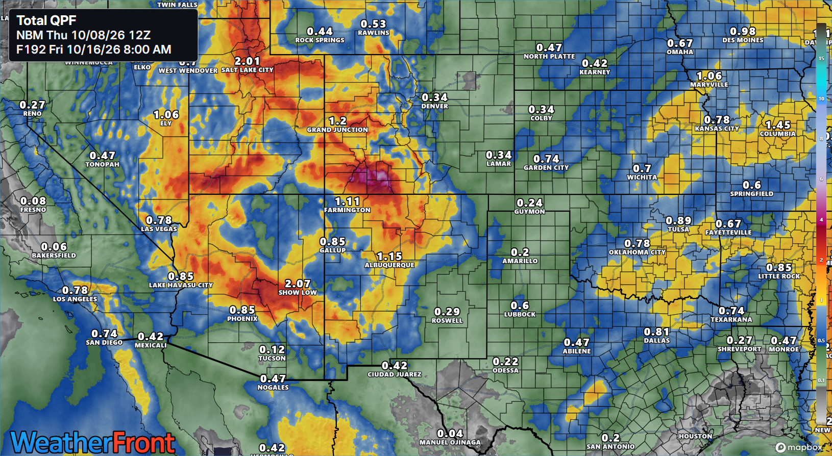
Areas of flash flooding risk should begin to pop up with Rachel this weekend and Simon next week.
It has been quite busy across the Pacific this year.