In brief: In this update on Hurricane Isaias we provide the latest information on the track and intensity forecast, as well as look at impacts, which could range broadly across a few southeastern US states.
Isaias status
As of 11 am ET on Thursday, Hurricane Isaias has reached sustained winds of 85 mph, and its central pressure continues to fall, now dropping to 975 mb. The storm is starting to accelerate, and is now moving to the east-northeast at 10 mph. It also appears to be in the middle of turning toward the north. So what happens next?
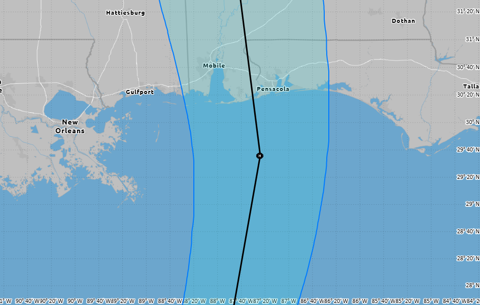
Where Isaias will go
By now our confidence in Isaias’ track is fairly high over the next few days. Observations are starting to closely match predictions, and the major uncertainty is whether there are any wobbles in the center’s position. Isaias should approach the northern Gulf coast on Friday evening, a little more than a day from now. Its landfalling position will likely be somewhere near Mobile, Ala., or Pensacola, Fla. From there the storm should accelerate to the north, likely tracking near Tuscaloosa, Ala., during the mid-morning hours on Saturday. This forward motion will be helpful in mitigating some of the worst inland flooding, but could bring damaging wind gusts to a larger area.
How strong Isaias will get
This is a trickier proposition. The storm is, and will continue to move over, some exceptionally warm water during the next 24 hours. Given the hurricane’s falling central pressure and sea surface temperatures, one would anticipate rapid intensification. However wind shear is not zero, and should really start to increase 12 to 24 hours from now as the storm gets closer to the northern Gulf coast. The National Hurricane Center predicts Isaias to reach 110 mph in sustained winds by Friday morning, before weaking a bit prior to landfall on Friday night. This is a reasonable forecast, but subject to some uncertainty. Isaias could be a bit weaker than this at landfall as the wind shear looks to be pretty stout.
What about impacts?
We are going to see the usual hits from Isaias in terms of hurricane threats: storm surge, wind damage, and inland rainfall. None of these look to be pleasant, of course, but absent the aforementioned shear they could definitely be worse.
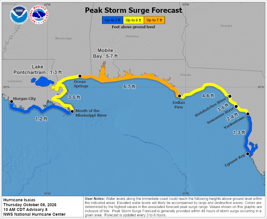
Storm surge is obviously dependent upon the landfalling location, and the area of maximum surge (5 to 7 feet) could shift a little to the west or east as a result.
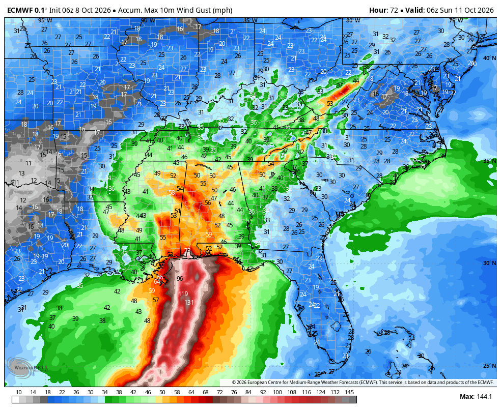
Much of Alabama and eastern Mississippi could end up seeing wind gusts of 50 to 60 mph from Isaias as it moves in on Friday night, into Saturday morning. This is likely enough wind to cause some widespread power line issues.
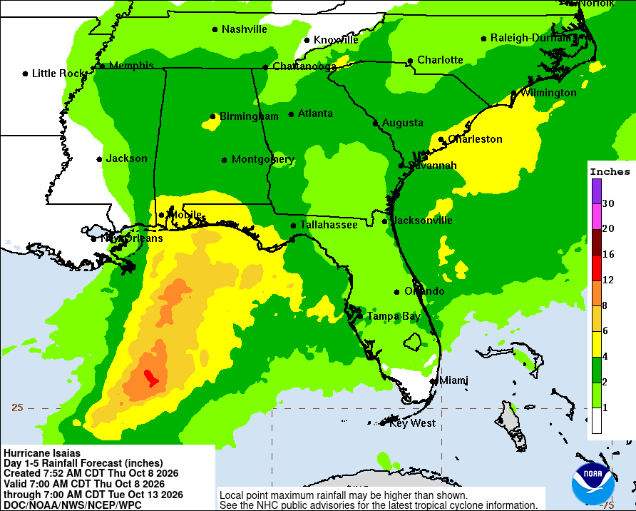
Inland rains from Isaias will be mitigated to some extent by its forward movement. Most of these totals should be manageable.
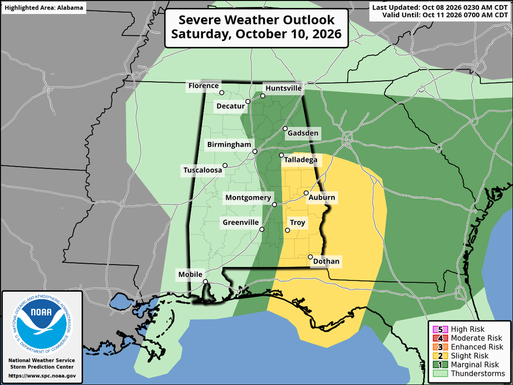
Due to the shear environment surrounding Isaias some of its strongest thunderstorms could occur well east of the system over Alabama, Georgia and northern Florida on Friday night and Saturday.