In brief: The Atlantic tropics remain noisy but not exactly substantive. Invests 92L and 94L are both expected to attempt to develop but likely struggle. Meanwhile, Hawaii should prepare for a tropical storm impact this weekend.
Atlantic side of business
In yesterday’s post we noted that, “there’s another system in the far north Atlantic that is not a threat to land, but we could see a throwaway depression or “C” storm before it dissipates.” Indeed, if you blinked, you may have missed that Tropical Storm Cristobal formed yesterday, and is on the way to dissipating today.

It appears as a “naked swirl,” or something more out of Cinnabon’s test kitchen. I’m just saying. Cristobal has thus far matched Arthur in ACE, which is to say less than 1, which is to say, basically a rounding error in a typical season. But weak storms count too, so there you have it.
Invest 92L
Meanwhile, south of Cristobal in the Atlantic Main Development Region (MDR) remains Invest 92L, a somewhat healthier looking tropical disturbance today.
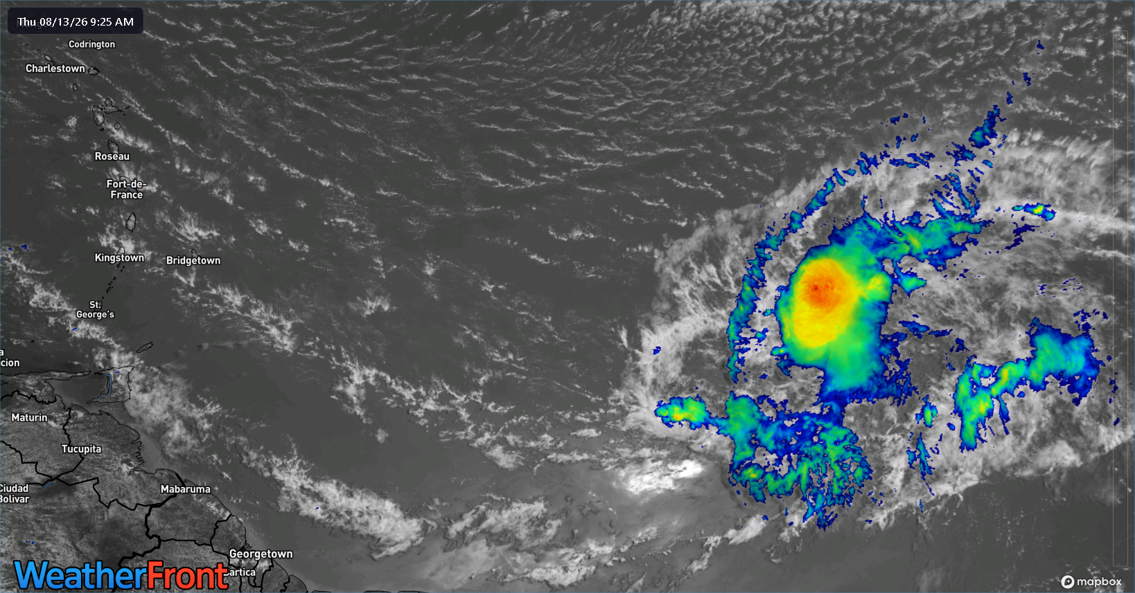
92L isn’t exactly well organized but it’s better than it looked 24 hours ago. Models remain sort of split on whether or not this gets to a point if it actually develops, but given the look this morning, my hunch is that it will find a way. Still, wind shear is currently an issue, especially just north of the disturbance. And models are in decent agreement that it’s unlikely to pass much farther along than tropical depression status, keeping it generally poorly organized. This should allow for a due west track into the Caribbean, where doom awaits 92L’s future.

For the islands, this looks like a bit of a rainmaker but not much beyond that. Once in the Caribbean, it will be greeted by another shot of 20 to 30 knots of wind shear to the face, which should shred it apart. At this point, we don’t really expect any remnant to track as it continues west, so for the Gulf and western Caribbean, this is probably nothing to be worried about. We’ll obviously let you know if that changes.
Invest 94L
To the east of 92L is our latest Invest, 94L. While 94L looks less impressive than 92L this morning, it is carrying some thunderstorms, and it may be more apt to develop, as 92L has helped “seed” the lane in front of 94L with added moisture. It, too will have ample wind shear to fend off, however. The Atlantic is not for the weary of tropical systems right now. If 94L can survive that with some structure in tact, it may have a better long-term prognosis than its partner to the west.
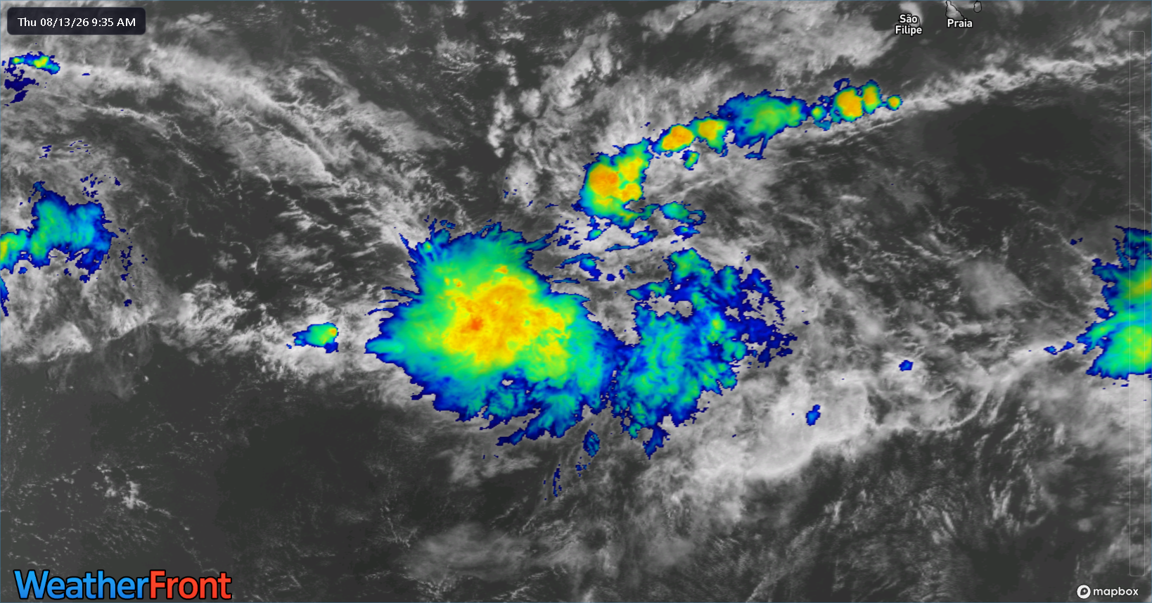
Assuming it survives, it may begin to develop a bit more east of the islands. Otherwise, it is likely to meet a somewhat similar fate to Invest 92L. If it does develop, it will likely hook northwest and north into the open Atlantic. Currently, about 20 percent of reasonably decent ensemble members do this. And within the tropical models, the majority keep 94L below tropical storm intensity.
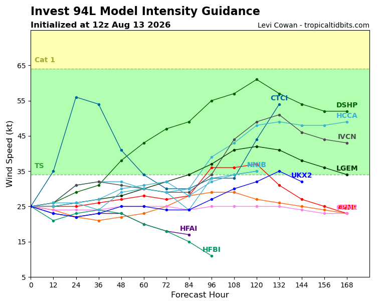
Conditions appear hostile overall, but it’s possible we sneak a depression out of this perhaps.
Right now, we just aren’t seeing the setup required to generate meaningful, higher end tropical activity. This is what was expected this summer, and it appears that’s what we’re getting.
Pacific potential
A good news/bad news type situation setting up for Hawaii. The good news is that it does not appear that Invest 93C, which has been reclassified as Potential Tropical Cyclone One-C is going to be a big time hurricane as it passes Hawaii. The bad news is that we do expect tropical storm impacts in Hawaii by this weekend.
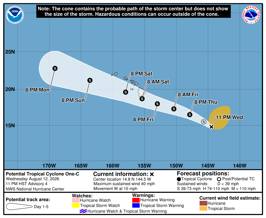
The system is struggling to organize initially because of its sprawling nature. Over the next day or so, we should see it begin to consolidate around a formal center and slowly organize. Modeling is in decent agreement in a track near or just south of the Big Island, as well as slow, steady intensification. This should allow for a moderate tropical storm to track near Hawaii on Saturday. We should see tropical storm watches issued later today.
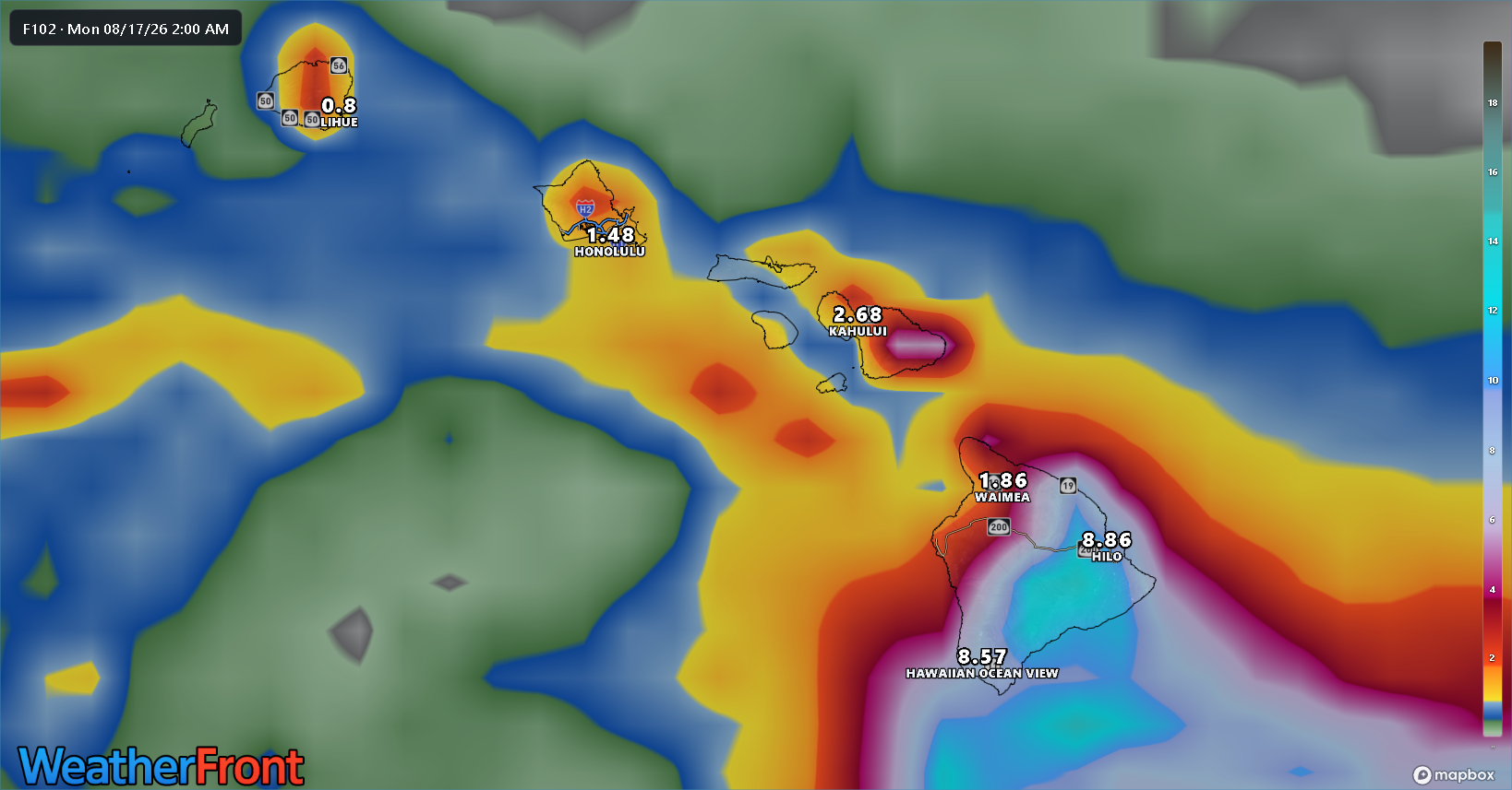
The European model has a track fairly close to the NHC’s track right now, just south of the Big Island. This allows for 10 inches or more of rain on the east and southeast facing slopes, with downwind rain shadowing lowering amounts to an inch or so on the northwest edge of the island. A similar story on Maui. These amounts may change in the coming days as the storm track and organization is finalized. This will increase the risk of flooding and mudslides on the Big Island this weekend.
Obviously, winds will be a concern too and will be honed in on as we get a bit closer. Some wind speeds could be enough to cause some damage in localized parts of the islands pending terrain effects. And fire weather may tick up as a concern tomorrow ahead of the storm. Interests in Hawaii should find local sources and follow them and heed the advice of local officials ahead of this storm.