In brief: We continue to track development potential in the Atlantic over the next week or so, and things remain fairly unimpressive (though plausible). In the Pacific, a system passing close to Hawaii by the weekend is a distinct possibility, and we have an update with the latest.
Atlantic MDR system
Looking at satellite this evening, and the primary disturbance we’re watching in the Atlantic looks half decent.
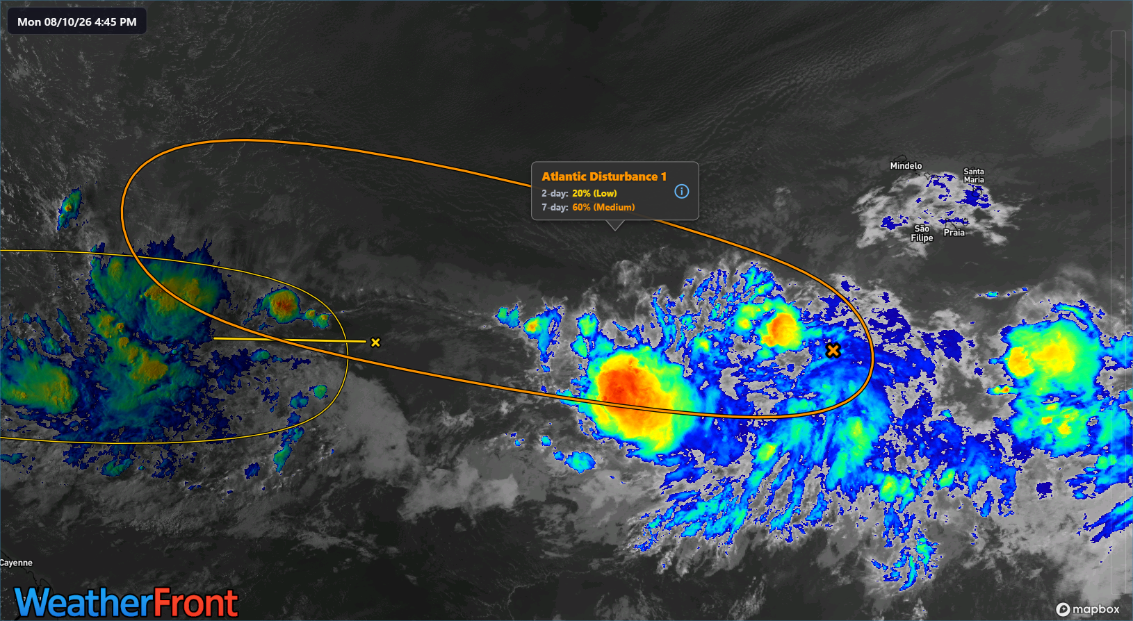
We haven’t seen it hit “invest” classification yet, but I imagine we are not too far off. Over the next couple days, this disturbance will have mostly modest conditions to work with. There’s some shear, some dry air. Nothing is perfect here. But it may be enough to allow the system to try to slowly organize.
Since yesterday, we have seen some weather modeling get a little more bullish on potential development from this disturbance. Google Deep Mind’s model in particular has moved to about 25 percent odds of development here.
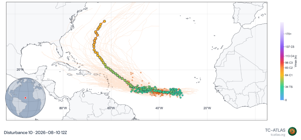
That’s a bit under the NHC’s 60 percent odds right now, but it’s still a decent signal when combined with the also relatively bullish AIFS and European model. As noted above, any development here is likely to be sluggish. The system is likely to have to battle some degree of wind shear into the rest of this week and weekend. In addition, it’s probably going to be surrounded by dry air and Saharan dust, or at least close enough in proximity to it that it acts against development. Overall, there’s no reason to believe that over the next 3 to 5 days at least this thing gets anywhere noteworthy with intensity. Hence, we are of the mindset of slow development.
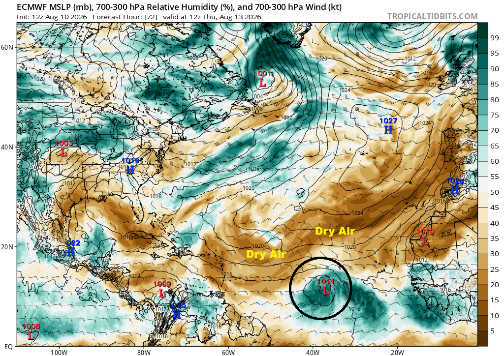
Once it gets closer to the islands, maybe it can shake some of the drier air off, but I’m not convinced just yet. Still, if you live in or are visiting the Lesser Antilles, it probably makes sense to keep some casual tabs on what this system does through the week. However at this time, it still does not appear that we’ll have much of a menace on our hands. Farther out in time, I’m not sure we can say much coherently about this system, short of it is unlikely to be a big storm. More to come, of course.
Other Atlantic disturbances
The National Hurricane Center has modest odds on two other areas. The 10 percent one in the central Atlantic will likely fall prey to shear and dry air soon. The 10 percent one in the northern Atlantic is unlikely to do anything either. Onward.
Hawaii & Invest 93C
Well, to Hawaii now, and Invest 93C. This one looks a little frazzled today.
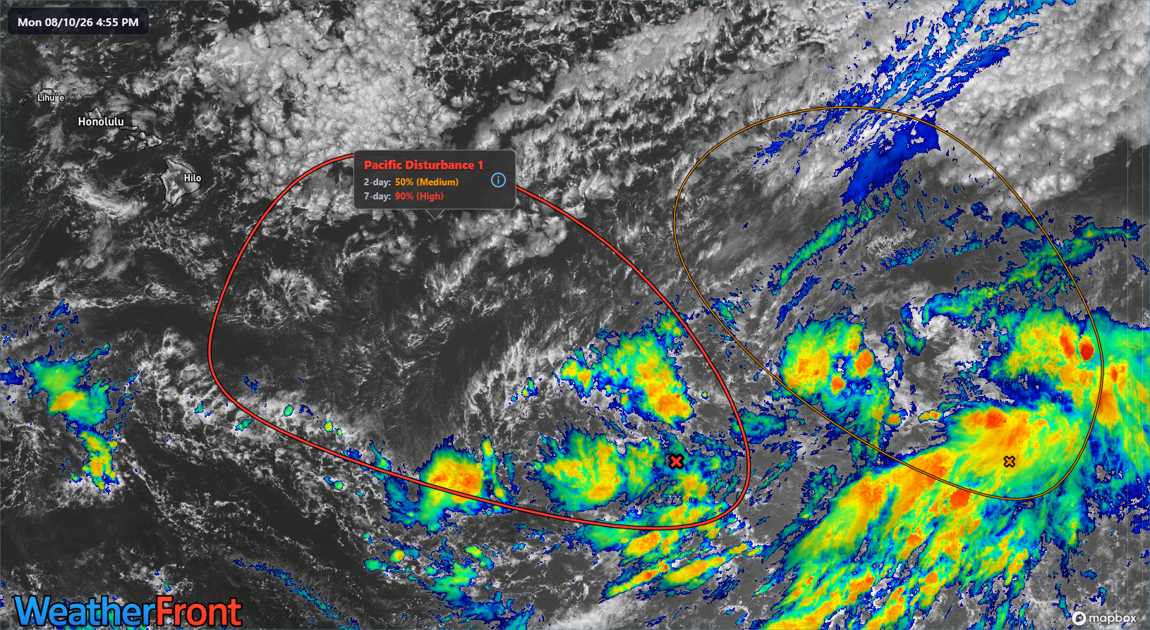
That said, we don’t really expect development for another 12 to 24 hours or so. Look for this to gradually become more coherently put together by tomorrow. From there, two things have changed since yesterday. First, the track has shifted slightly farther north, now bringing more of the Big Island into the forecast envelope (especially if you look at Google Deep Mind’s model).
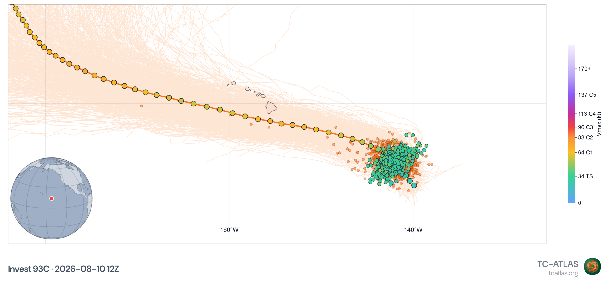
Second, the max forecast intensity has dropped off some. Fewer models and ensemble members bring this to a major hurricane now. After 75% or more yesterday, we now have about 35 percent today. While that’s a rather large move, it’s still a noteworthy, healthy minority of members and a solution that should be taken seriously. Basically, interests in Hawaii should be monitoring Invest 93C very closely. Impacts are possible as early as later Friday or Saturday.