In brief: A pair of disturbances in the Atlantic are highlighted for development risk over the next week or so, however neither look particularly menacing. Generally, below average activity should continue in the basin. A potentially potent storm in the Central Pacific may develop and pass just south of Hawaii later this week as well.
Atlantic picking up a bit
Back on Friday we talked about the potential for development in the Atlantic’s Main Development region as a wave pushed off the African coast. Well, as of today, the National Hurricane Center is identifying two areas to watch for development.
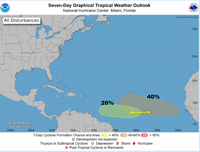
The front running disturbance is the one we discussed back on Friday. This one looks mediocre at best today, at least in terms of being organized.
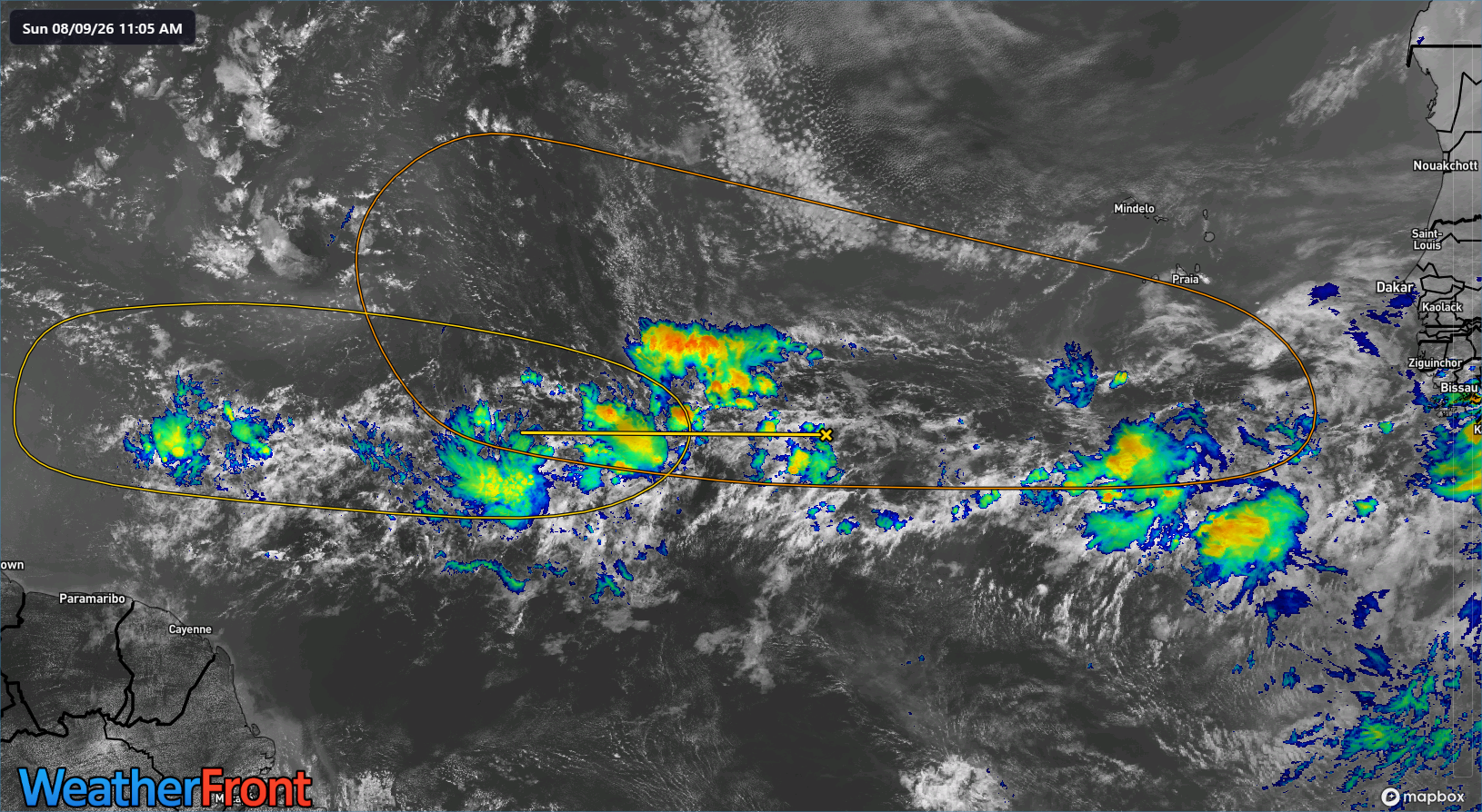
To be honest, modeling also looks mediocre here, with roughly 0 to 10 percent of ensemble members across the board between the Euro, Euro AIFS, and Google Deep Mind showing development over the next 3 days. Generally speaking, this wave is also heading into an area with a lot of shear and dust, so the 20% odds by the NHC may be a bit generous here.
Now, the wave behind it has a little more support. While only about 10 to 20 percent of Google Deep Mind members develop this one, a fair number of Euro and AIFS ensemble members do develop it eventually. As we noted on Friday, it seems likely that any development here is likely to have a pretty low ceiling. That still holds true. The western Atlantic is not exactly super hospitable for tropical activity right now. This is more or less August being August above all else. Wind shear remains fairly strong in the western Atlantic and Caribbean.
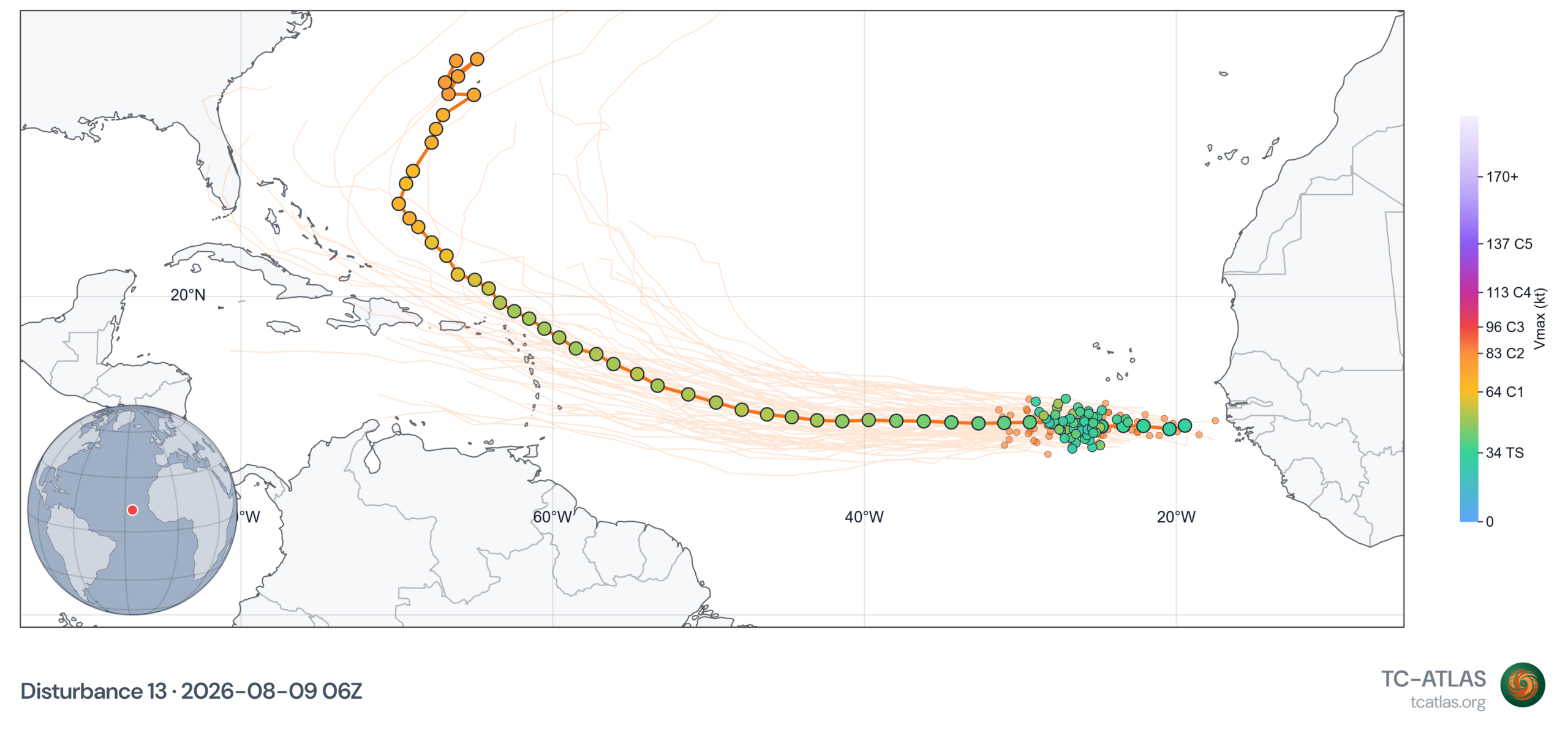
Note that while the intensity on the 1,000-member Google Deep Mind ensemble increases as the storm turns northward, the number of members falls to single digits, meaning roughly 1 percent of members do this; highly unlikely.
I could foresee two likely outcomes from this wave. The first would be if it follows the Euro/AIFS logic of development, where it becomes coherent in 3 to 4 days or so. In that case, the system would be more likely to split the gap between high pressure in the Atlantic and probably curve out to sea. The second outcome is an incoherent tropical wave that makes it to the Caribbean and just gets sheared apart. Neither outcome is particularly menacing. At this point, I would say that the islands of the Caribbean should monitor the progress of this disturbance over the next week or so, however it remains highly unlikely that a severe system would impact the region at this time. Elsewhere, check back in a couple days from now and see where we are.
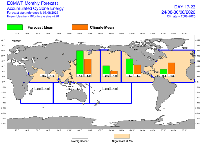
Other than these two systems on the board, the next thing to watch may be another deep Atlantic wave sometime the week of August 17th, which again looks minimally impressive in modeling at this time. Notably, if you look at the European subseasonal forecast from Saturday into the week of August 24th (and August 31st for that matter), Atlantic activity is expected to be below 50% of normal. This indicates to me that we are unlikely to see any significant burst of Atlantic activity the rest of this month. El Niño dominance over the basin is likely to persist.
Central Pacific and Hawaii
One area to watch that we don’t normally cover much in depth, however, is Hawaii. You can see that week 3 activity is running around 2 to 3x normal. Multiple models are pretty bullish on the disturbance out there right now, Invest 93C.
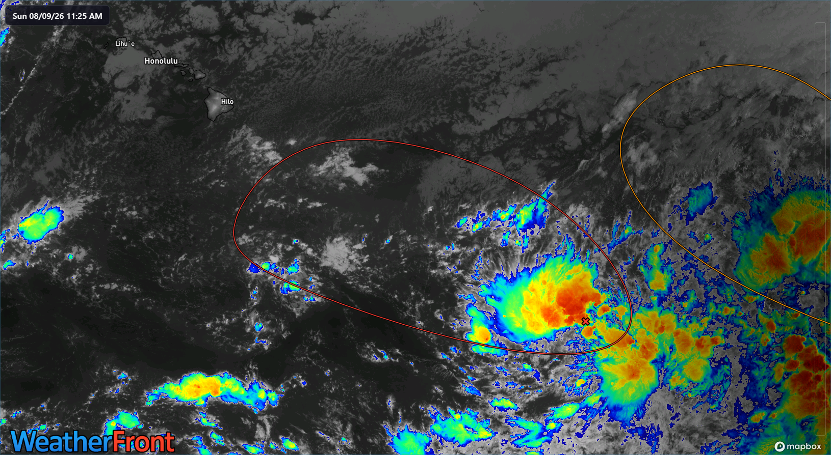
At this point, virtually all modeling keeps this south of Hawaii, but it likely is a system to keep an eye on over the next week or so, as the northern fringe of the forecast envelope just grazes the Big Island. Fringe impacts, such as gusty winds and rough surf would be likely to impact the islands eventually.
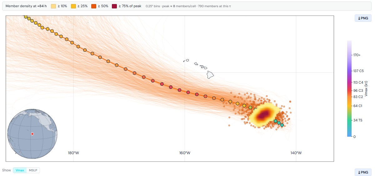
Google Deep Mind’s ensemble is quite bullish on fairly rapid intensification of 93C, with over 75 percent of members bringing this to major hurricane status (115 mph or greater). We’ll keep tabs here too.