In brief: We have our first tropics themed forecast post of the season today, as heavy rainfall in the Southeast may also have some lower-end tropical entanglement to watch. We also discuss the coverage plan for the season and some other weatherly tidbits.
The Eyewall in 2026
Happy Wednesday. We’re getting closer to hurricane season, which is usually when the pace of our posts increases! My apologies to your inbox. Anyway, our plan for this coming season is much like it has been the last few seasons of The Eyewall: We will post every day or two and more frequently when storms are threatening. There may be times where we have to take a few extra days off, as we’re both navigating life! But as always, all of our posts will be public facing and freely available, and we will keep comments open to all this season. We will continue to post both on Substack and The Eyewall’s website, so readers can pick the source best for them. We certainly would love for you to subscribe to our Substack, as it is our way of being able to send out emailed posts en masse and also offers a way to support our work. Paying members support our work for all, but we will hopefully put at least something together unique for you as well at some point later this year, be it a live chat, AMA, or something else. Your support and generosity are greatly appreciated. With my eventual relocation from Houston to the Northeast, I will also probably be including a few more Northeast Corridor related nuggets in here too.
Severe Weather: Not entirely dormant
We’re actually likely heading into a period of somewhat calmer conditions over the coming days, as severe weather risks focus mostly on localized areas from time to time.
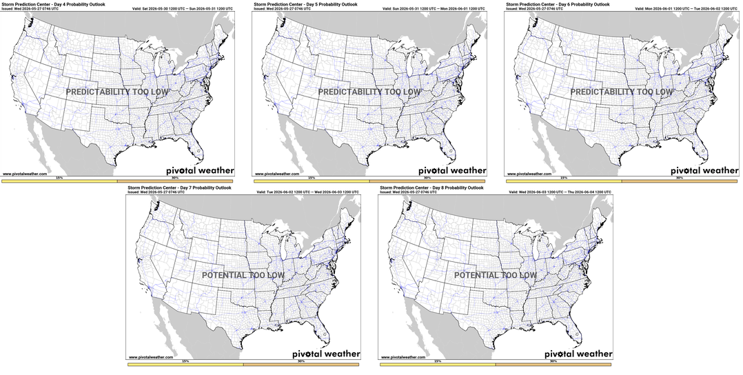
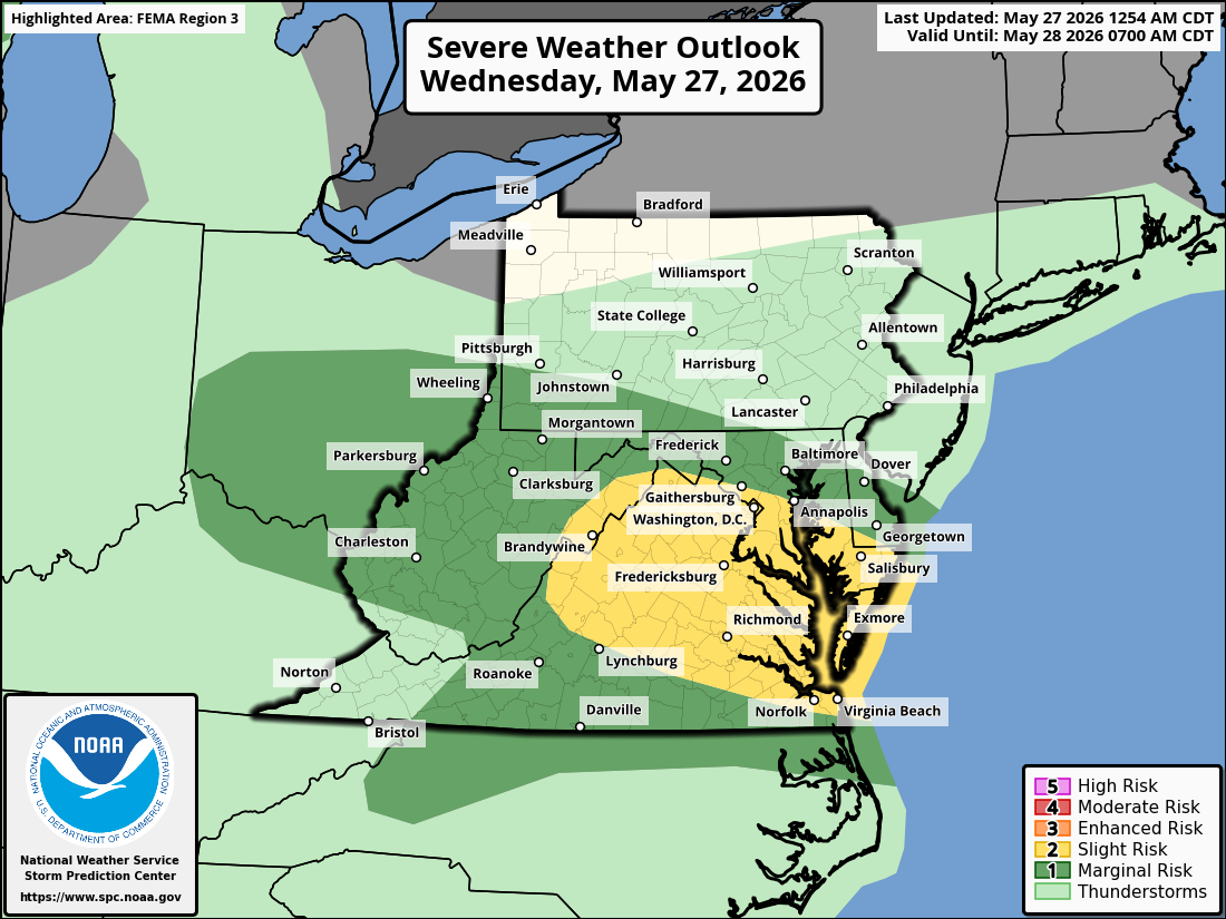
Again, that’s not to say severe weather won’t happen. It probably will. It’s May, and we’re heading into June. However, any sort of large scale, significant or long-duration events don’t seem likely to crop up anytime soon. It will be stormy in spots, however, including today in the Mid-Atlantic where a slight risk (level 2/5) is in place.
Flooding chances: Watching the Southeast
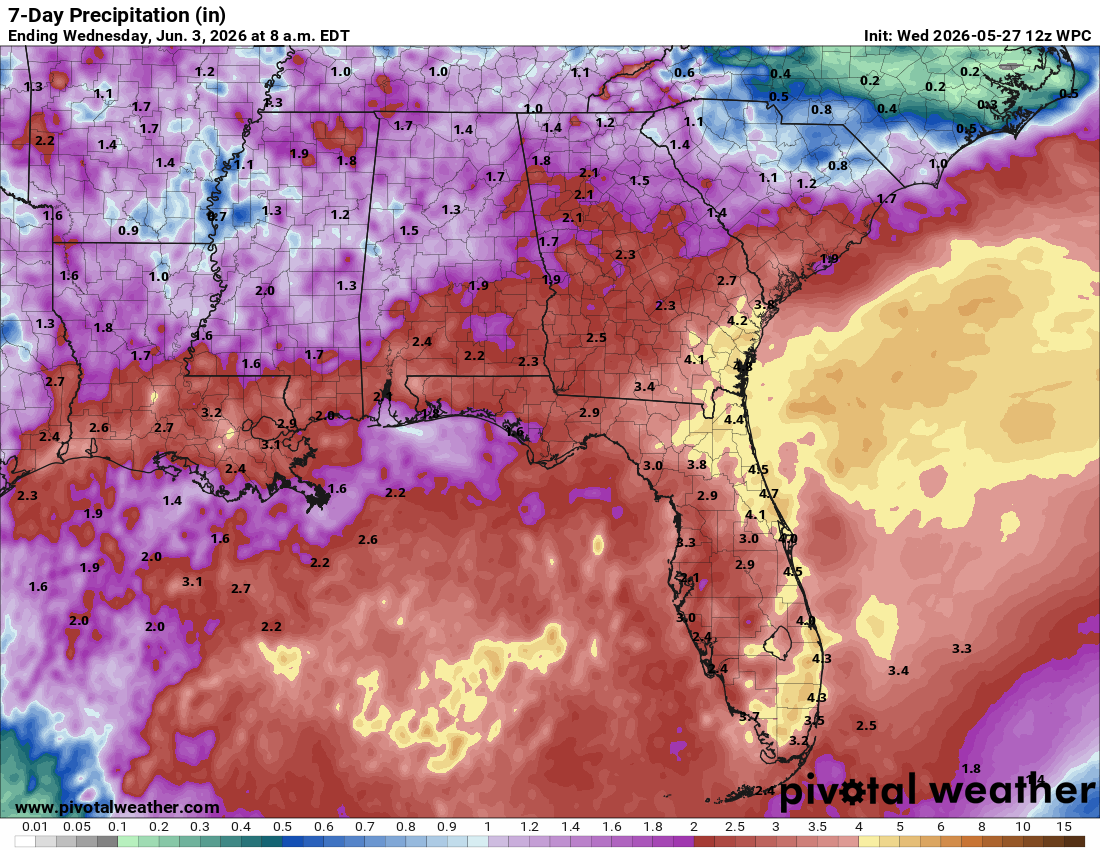
And that dovetails into our flooding conversation. It does look quite wet over the next 7 to 10 days or so in the South.
Texas has seen a good deal of rain over the last 7 to 10 days, and while storms will continue to pester the state at times, the better chances will probably shift into the Panhandle and New Mexico as we go into next week. We’ll probably have to start watching some of the burn scars in New Mexico for flash flooding potential.
However, the Southeast is where the focus will now be for the most heavy rain and flooding potential. Precip over the next 2 weeks is expected to average well above normal in Florida and along the eastern Gulf Coast.
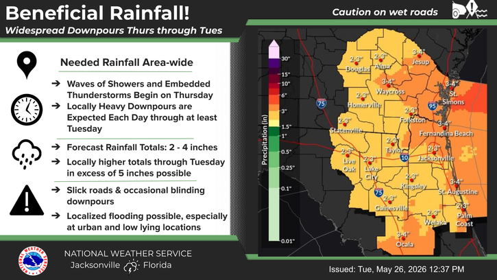
While these areas have been dry, obviously when you start talking about isolated pockets of 4 to 8 inches of rain, even over a 10-to-14-day period, that’s a lot and can lead to flooding risk.
Tropics: Something weak in the Gulf stirring in early June? If you squint.
And that dovetails into our tropics conversation. Hurricane season begins on Monday, if you were not aware. We don’t currently see any real threats at this point. That said, within this funnel of moisture aimed at Florida and the Southeast and Gulf Coast, we may begin to see the risk of a disturbance forming by accident in the Gulf.
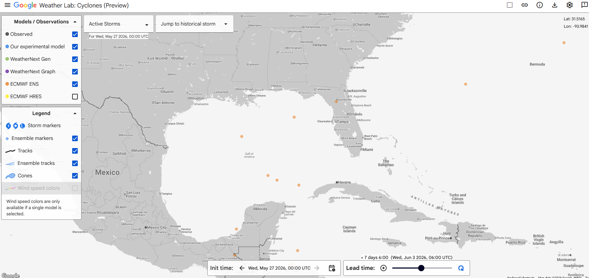
What does that mean? We’re heading into June, so we’re not talking about anything aesthetically pleasing or textbook here. Early season systems tend to be weak and sloppy but moisture laden. And they often form in the Gulf. With all this moisture being directed south to north across the Gulf, there will inevitably be a disturbance or two in the flow. When that happens, you may briefly open a window for tropical development. Right now, odds favor that *not* happening, but I just want to plant the seed, a.) because again, to emphasize, early season systems are not usually strong and b.) this is definitely a high moisture pattern capable of producing flooding.
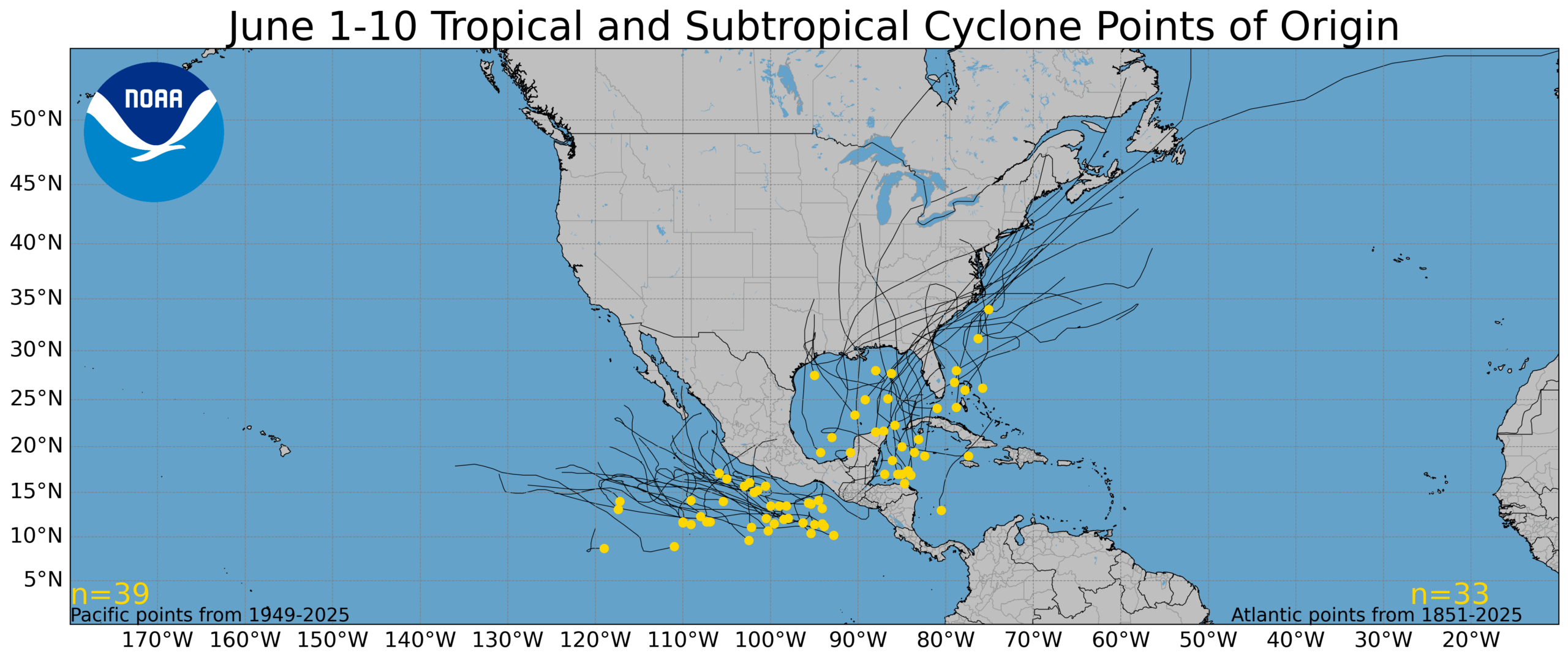
When could this happen? Later next week or weekend. Based on the map from the European ensemble shown near the top of this section, that seems to be the timeframe we may be looking at. Notably, AI modeling, both from the European Centre and from Google show nothing really.
What should happen, regardless, is a pickup in early season activity in the Eastern Pacific, however. Models hint at some activity there.

So, do you need to worry about a Gulf system? No, but you should be monitoring rainfall forecasts over the next 10 days in Florida and along the eastern Gulf Coast. More to come!