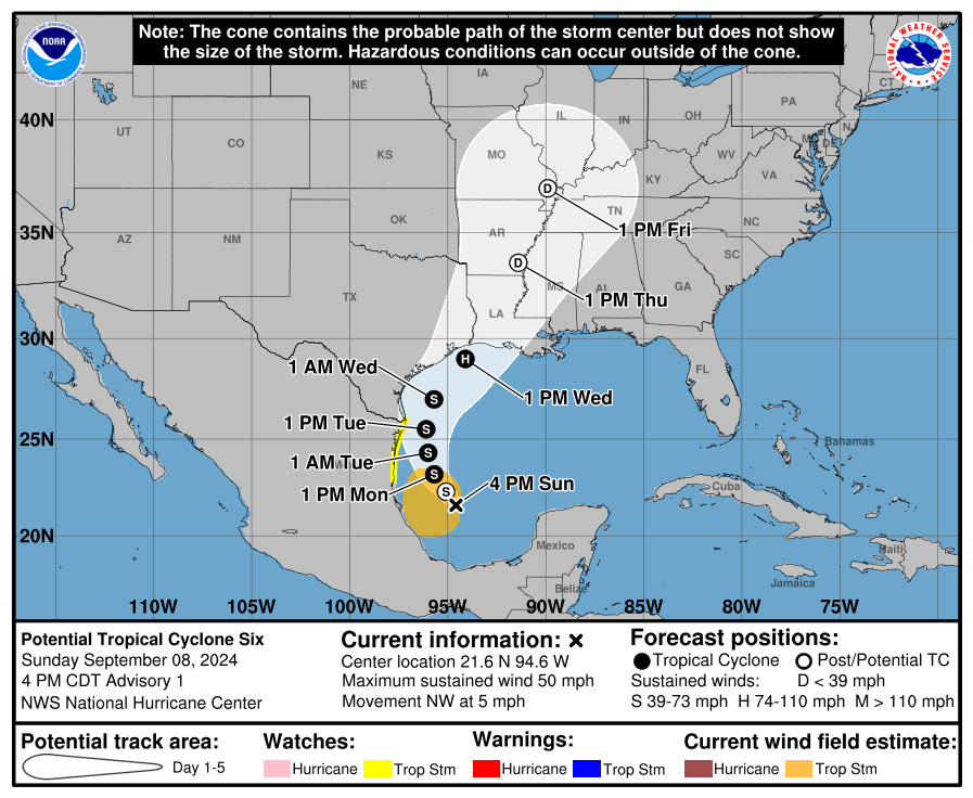
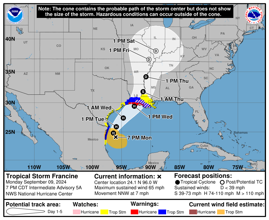
8:15 AM Tuesday Update: We will have more later this morning. Francine is still a tropical storm with 65 mph winds. The revised forecast cone and track is shown here:
While Francine is contending with dry air, it remains likely to intensify today into a category 1 or 2 hurricane before coming ashore just past peak in central Louisiana. Impacts have not changed significantly since last night, but we’ll revisit everything later this morning.
Headlines
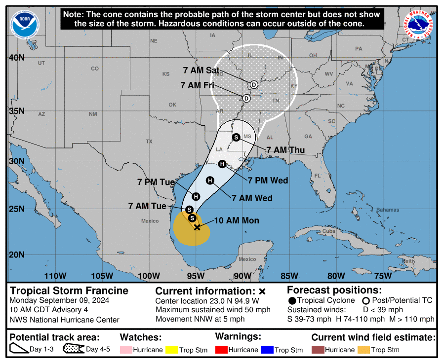
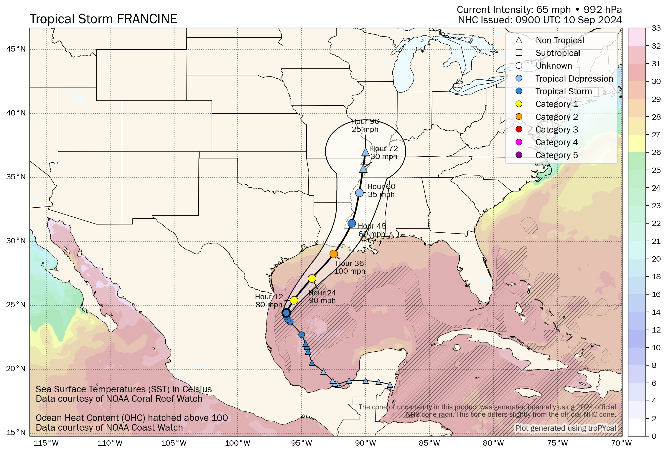
- Francine continues to strengthen this evening, and it is expected to eventually intensify into a category 2 hurricane sometime later tomorrow or early Wednesday before leveling off just before landfall Wednesday afternoon.
- Landfall continues to point toward or just west of Vermilion Bay with only slight adjustments since earlier today.
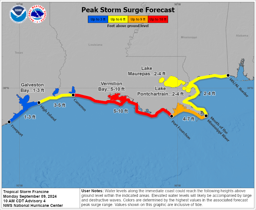
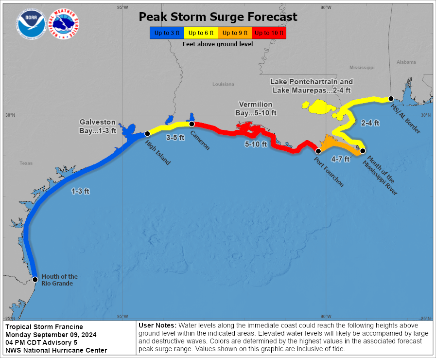
- The surge forecast is mostly unchanged with 5-10 feet at peak on the Gulf Coast of central and eastern Louisiana and 2 to 4 feet on Lake Pontchartrain in New Orleans.
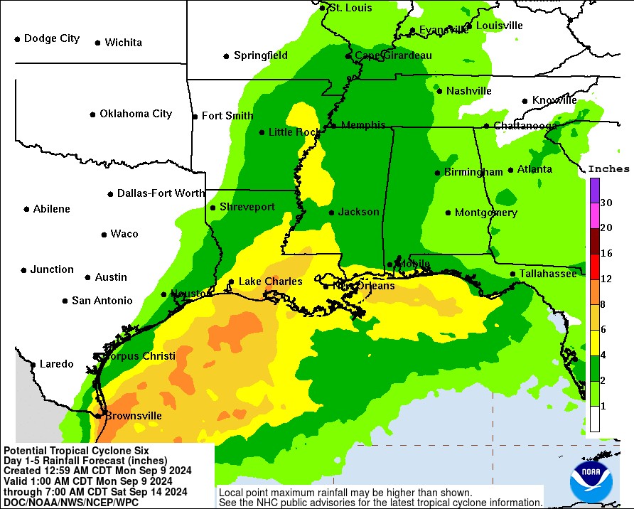
- Widespread flash flooding in Louisiana and parts of Mississippi is likely as Francine moves inland.
- A localized flash flooding risk exists in the lower Rio Grande Valley this evening and Tuesday morning as Francine passes offshore.
Francine now
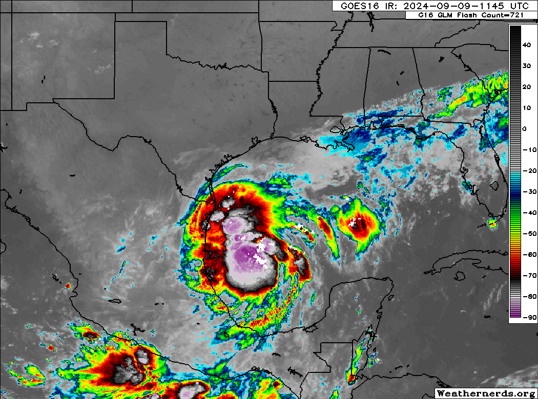
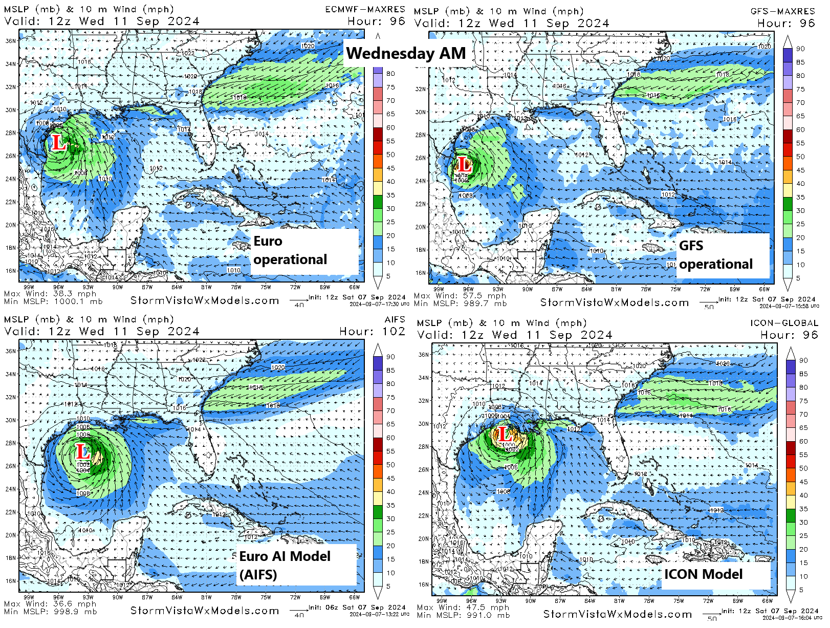
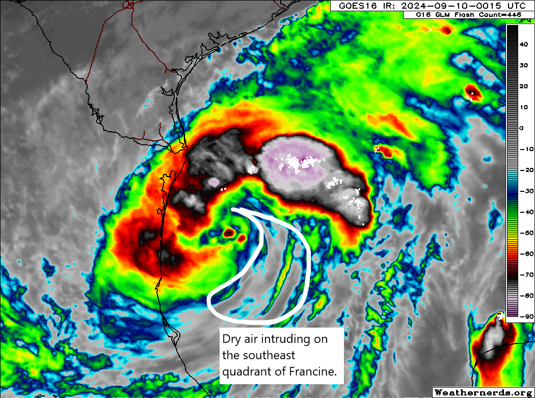
Francine is wrapping up considerably this evening as it begins to approach hurricane intensity. One slight issue Francine is contending with is some dry air that it wrapped in on the southeast side. Could that help cap the potential for rapid intensification into a high-end Cat 1 or Cat 2 hurricane? Perhaps, but at this point it’s just something to watch in the near term and will likely disappear come morning.
Otherwise, Francine is behaving as expected, on the upswing.
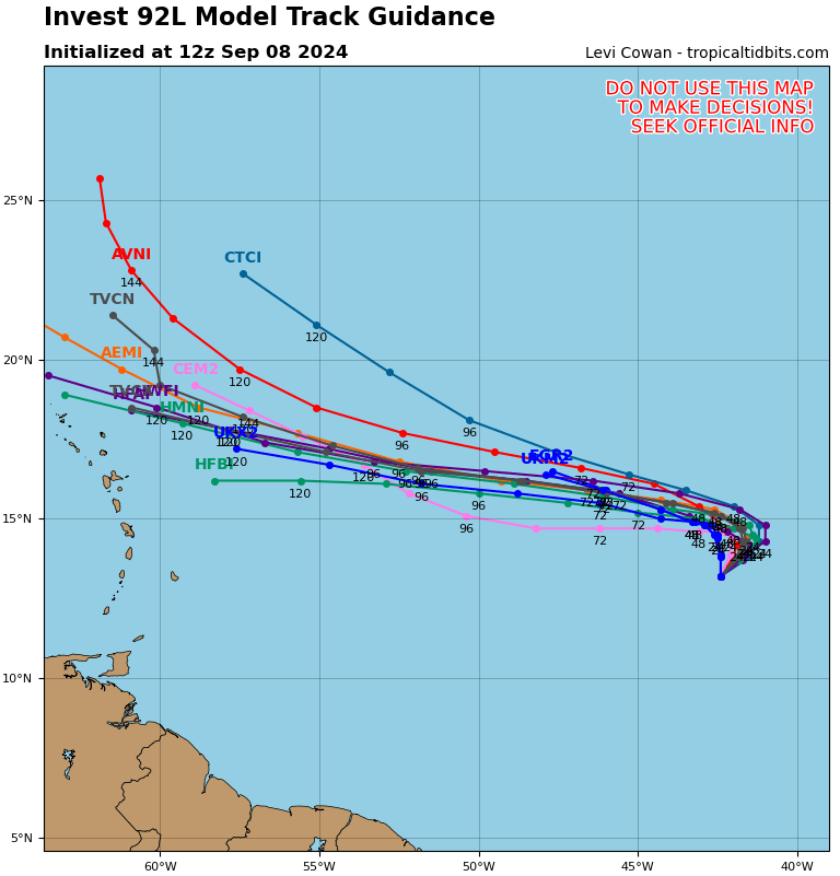
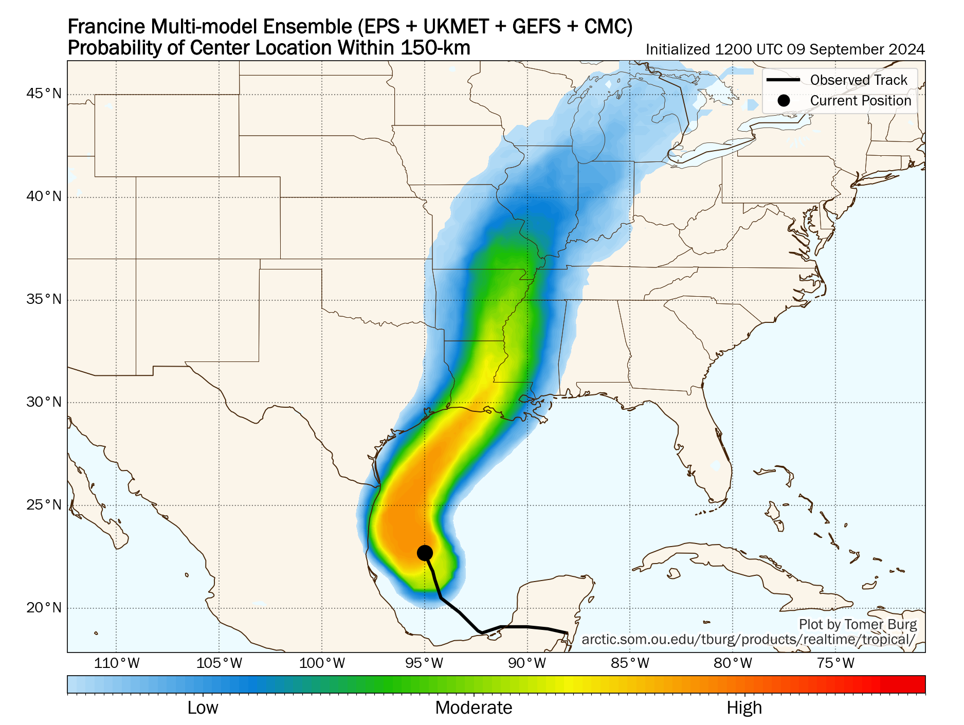
Francine track
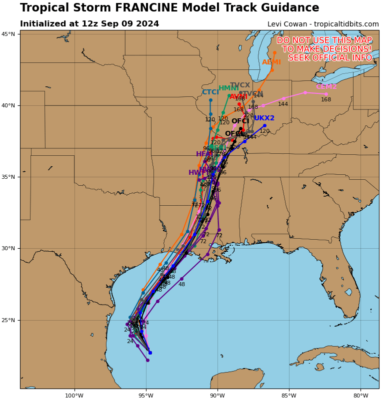
The track has nudged just a bit to the west through the day today. If we saw it coming ashore on the western side of Vermilion Bay this afternoon, we’re perhaps looking at landfall just immediately west of Vermilion Bay with tonight’s forecast update. In general, this shouldn’t mean a whole heck of a lot from an impacts standpoint, and for all intents and purposes, Francine is on a collision course with central Louisiana/Acadiana/Atchafalaya Basin on Wednesday. Landfall continues to have sped up a bit and now looks to be Wednesday afternoon.
Francine intensity
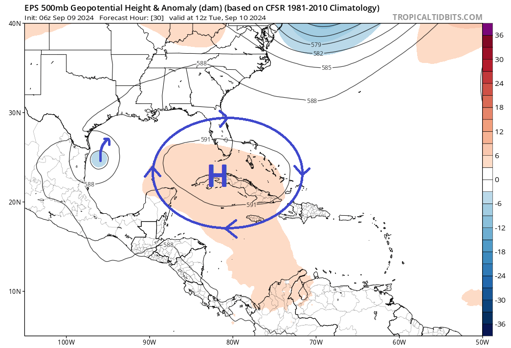
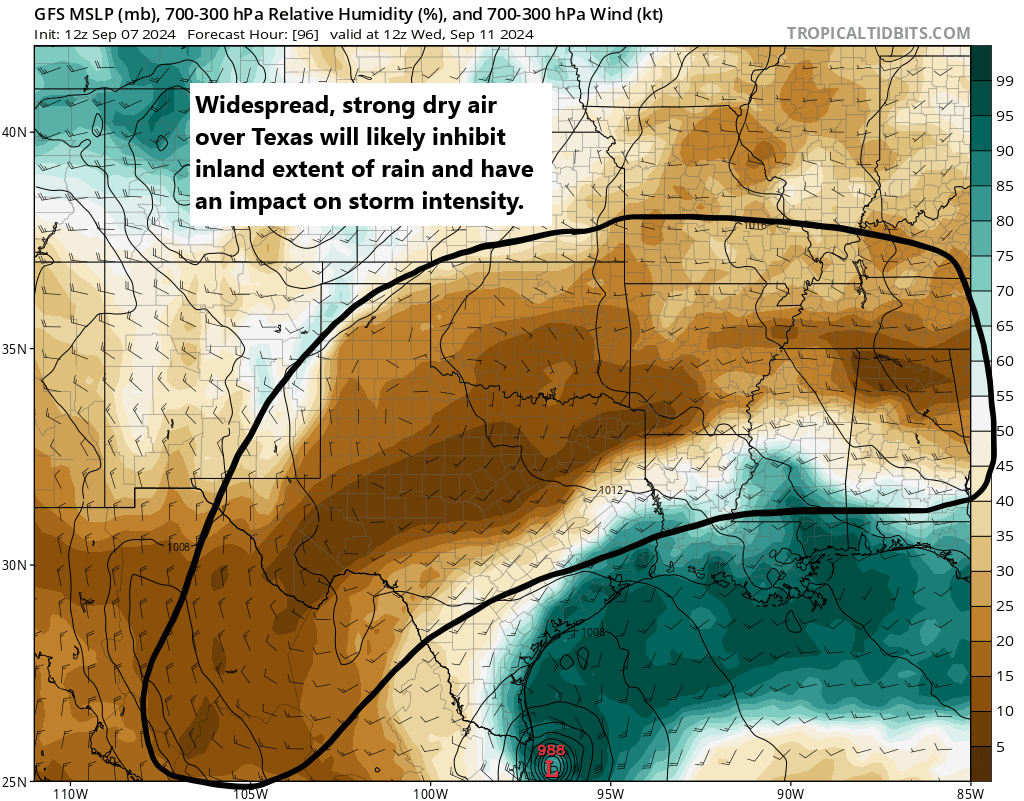
This continues to be a challenging intensity forecast. The dry air gives me a little pause, but in general, we expect Francine to rev up to a category 2 storm tomorrow. Could it go stronger? I suppose, but time, land, and shear are challenges it will face that probably keeps that potential low.
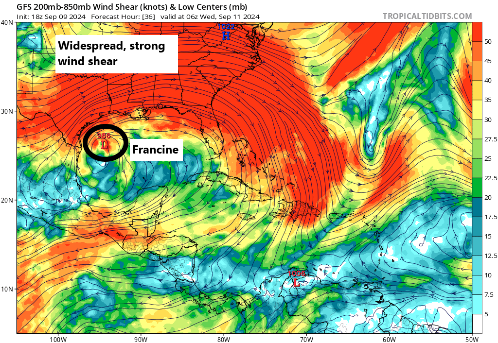
Let’s talk shear for a minute. Recall that in general, wind shear tends to act against hurricane intensification. Francine will have little shear to contend with for the next 24-30 hours or so. But then it’s going to run into a wall of shear on the Gulf Coast. This should allow Francine to peak in intensity offshore and make landfall as a stable or slightly past peak hurricane. This will still cause significant hurricane impacts, but it may shave a little off the top in terms of how bad it could be. That’s good news. It may also allow Francine’s winds to wind down quickly over land as it tracks into Mississippi.
Bottom line: A past-peak category 2 hurricane is expected to make landfall near or just west of Vermilion Bay Wednesday afternoon.
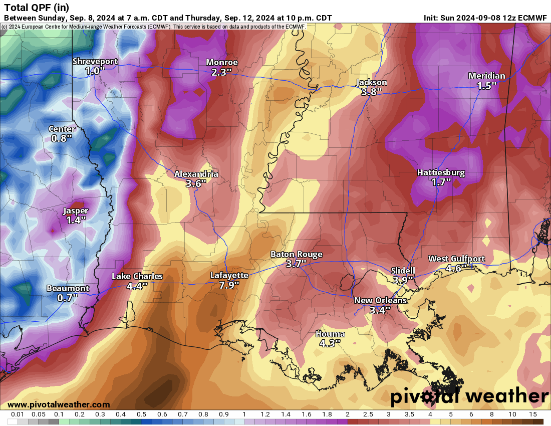
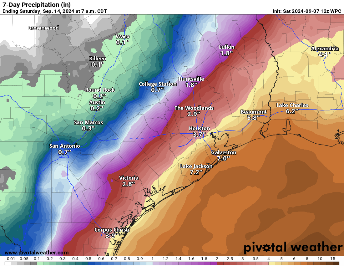
Francine rainfall
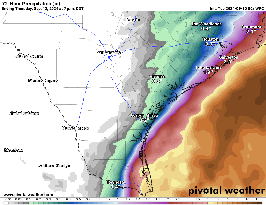
The overall thinking with rainfall has not changed much today. We may have seen a slight decline in total rainfall as Francine’s forecast has accelerated and sped up.
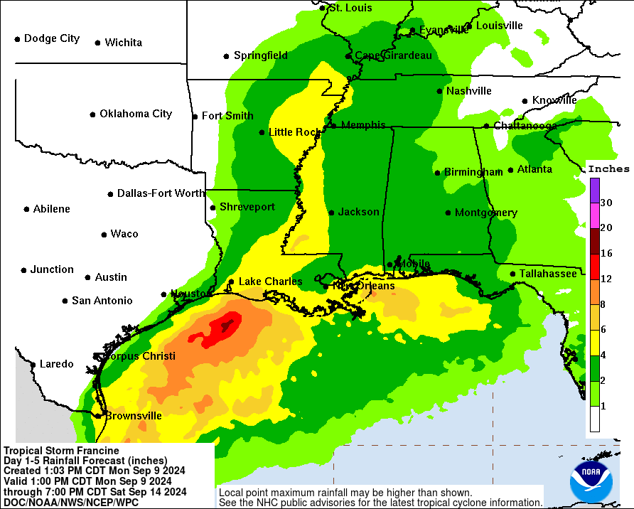
Francine will be capable of flash flooding over a broad area from Louisiana into Mississippi.
Francine surge
The storm surge forecast has changed little from earlier today, and we still expect a maximum surge of 5 to 10 feet across coastal parishes between Cameron and Port Fourchon.
Other notes with Francine
I just want to dial up a few other notes on Francine this evening.
Houston: For our Houston readers, a complete update on Francine is on our companion site, Space City Weather. Find it here.
Brownsville: As Francine still has a touch more longitude to “gain” this evening, heavy rain will begin to push into the lower Rio Grande Valley, primarily near and east of Brownsville through South Padre Island and Boca Chica. We could see as much as 6 to 10 inches in spots in this area. While there is likely to be a *very* sharp cutoff between little rain and hefty rain, it will likely be close to the southeast corner of South Texas.
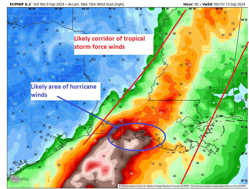
Max forecast wind gusts: Here’s a quick summary of the maximum forecast wind gusts from local National Weather Service forecasts in a few of the larger cities in or near Francine’s path as of 7 PM CT Monday. These are subject to change:
Houston: 25 mph
Galveston: 45 mph
Beaumont: 28 mph
Port Arthur: 38 mph
Lake Charles: 43 mph
Lafayette: 69 mph
Baton Rouge: 85 mph
Port Fourchon: 39 mph
New Orleans: 32 mph
Gulfport: 38 mph
Natchez: 44 mph
Vicksburg: 36 mph
Jackson, MS: 57 mph
Our next post will be later tomorrow morning, but we will update the top of this post with any significant changes that may be occurring.