In brief: Hurricane Melissa has weakened to become a Category 2 hurricane after emerging off of Cuba on Wednesday morning. We take a first look at Jamaican impacts from the storm, and the threats facing the Bahamas, Bermuda, and Atlantic Canada.
Status of Melissa
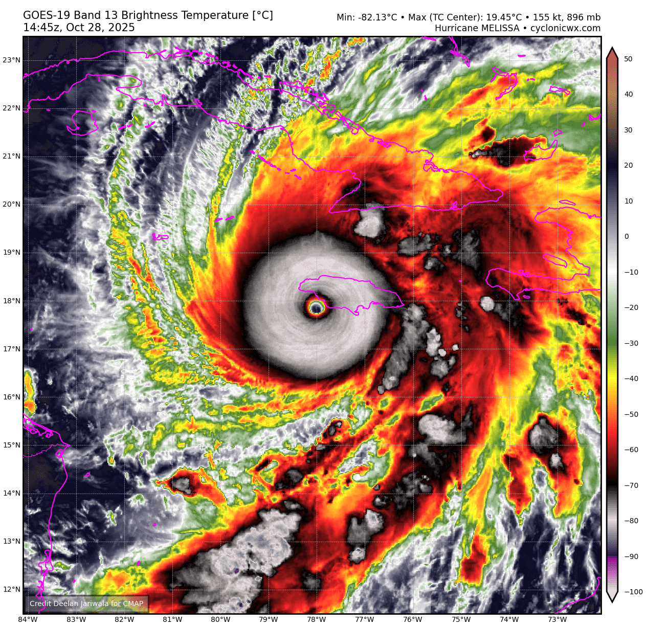
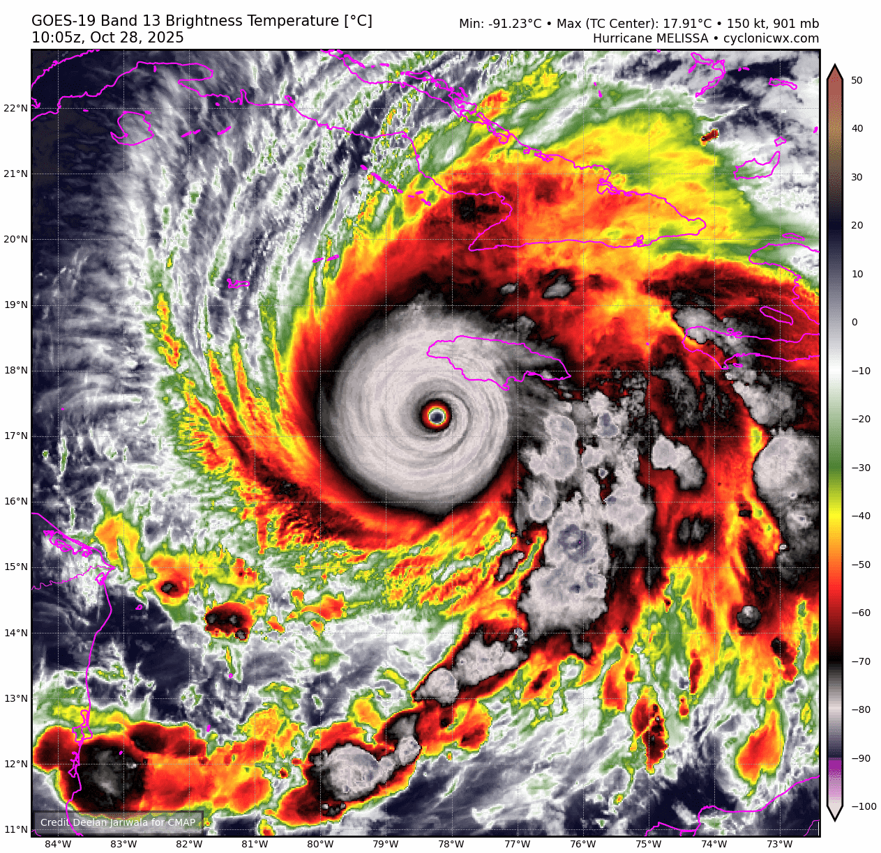
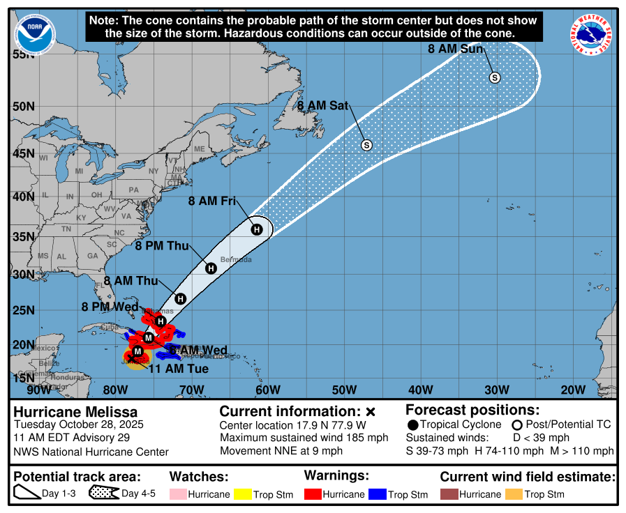
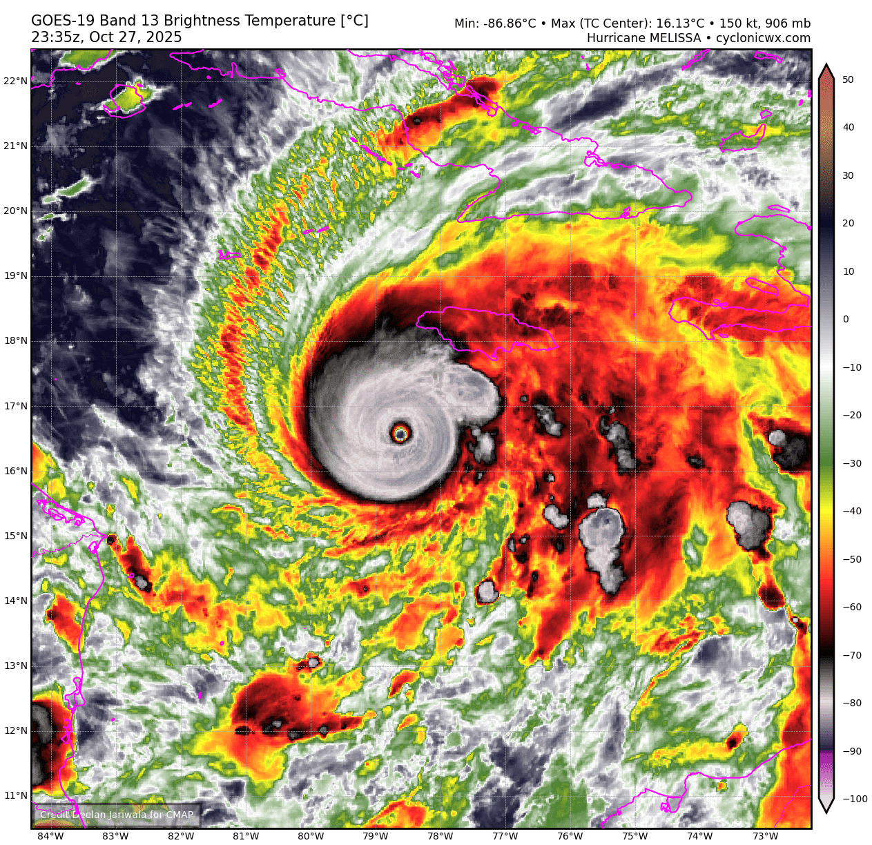
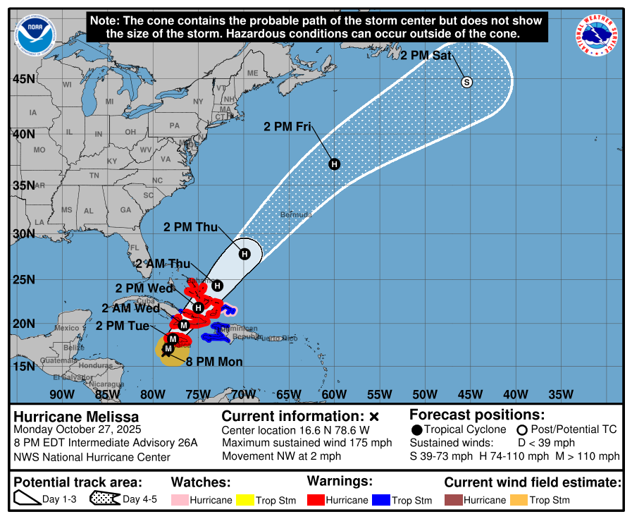
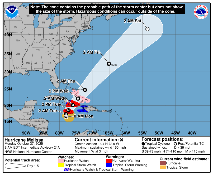
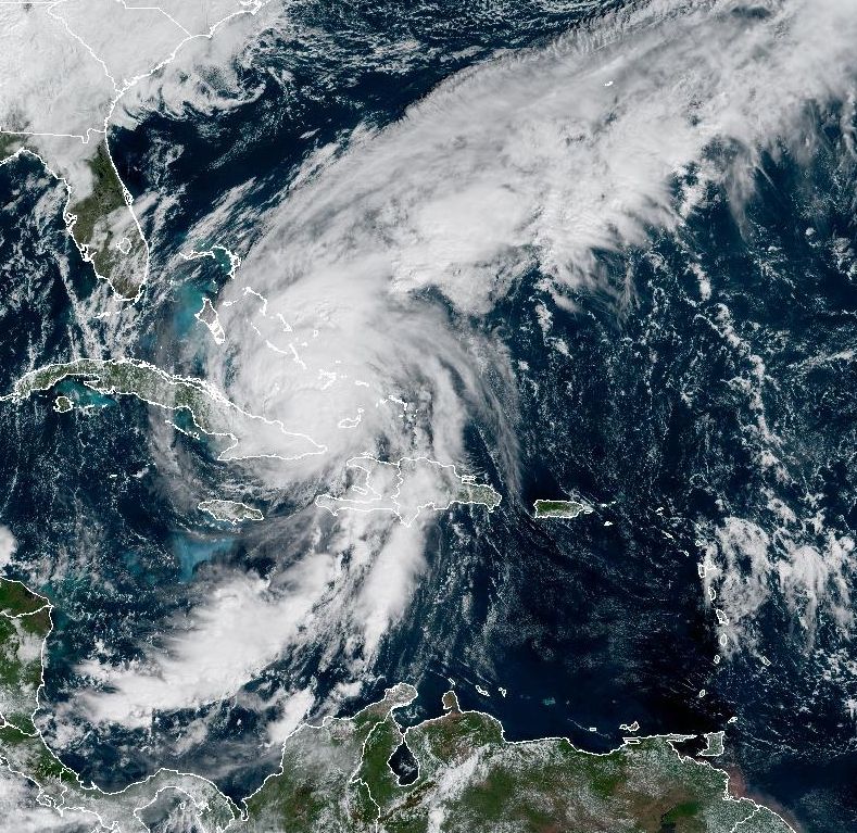
As of 11 am ET on Wednesday, Hurricane Melissa remains a Category 2 hurricane, now with 100 mph sustained winds. Melissa has begun to accelerate to the northeast in response to an upper level low pressure system. It is now moving at 14 mph, and will likely continue to speed up. Melissa may hold this intensity for another day or so before weakening further.
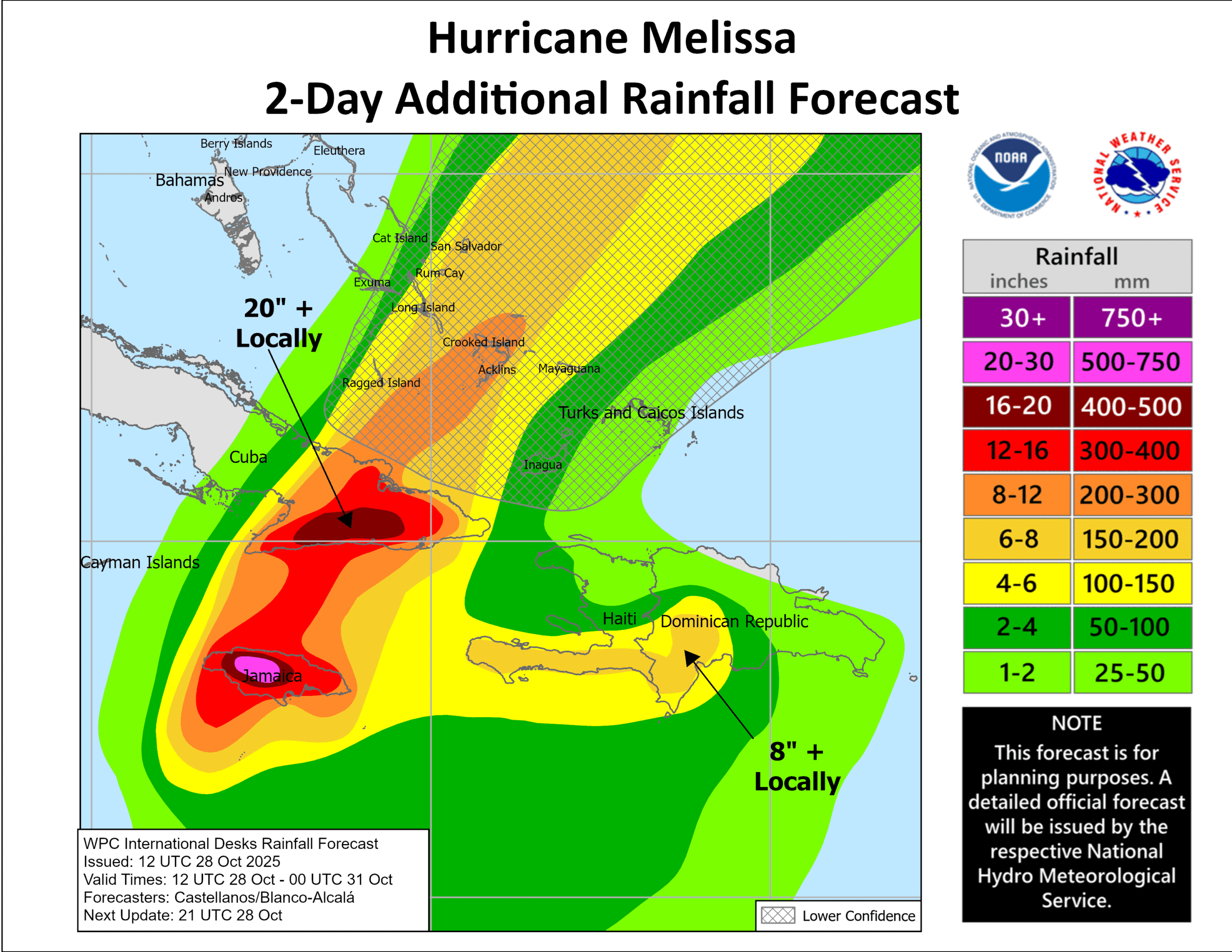
Impacts in Jamaica
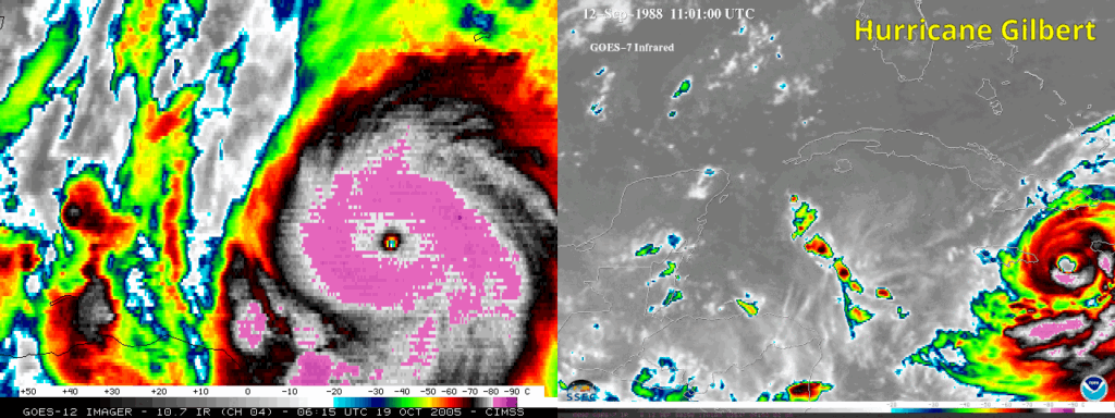
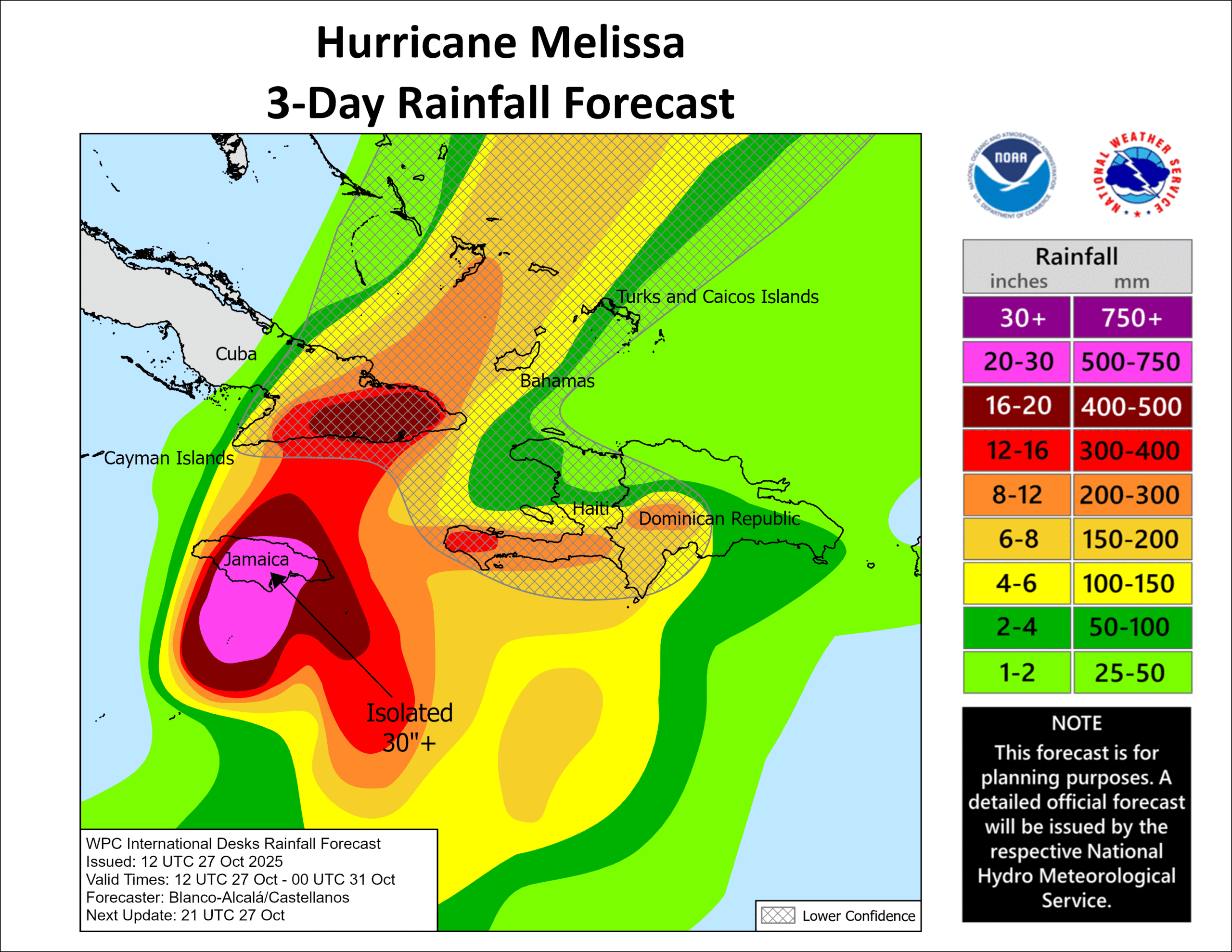
Recovery operations are beginning in Jamaica, where Melissa hit hard on Tuesday. It is tied with the Labor Day Hurricane of 1935 as the most powerful hurricane to strike a landmass in the Atlantic Basin, which includes the United States, Mexico, Central America, and the Caribbean islands. One small bit of good news is that the storm’s core was fairly compact, so the extent of Melissa’s strongest winds was not massive. As a result the most populous part of Jamaica, including Kingston, was comparatively spared.
The same cannot be said for the western half of the island nation. There were no immediate reports of deaths, but loss and damage assessments were only beginning on Wednesday morning. Dana Morris Dixon, Jamaica’s information minister, said power was knocked out to 70 percent of the country. “I know so many people have said they cannot reach their families in western Jamaica. That’s because of damage to the telecoms infrastructure,” Morris Dixon adding that it “looks really, really difficult” in many parts of the island and the images coming in are “devastating.”
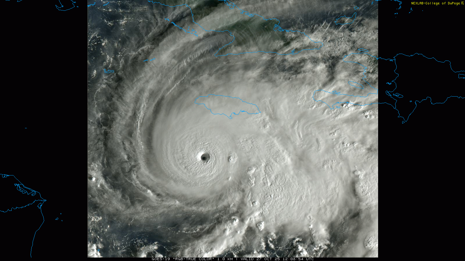
Melissa is just now emerging from the eastern half of Cuba, and it is too early to determine impacts there.
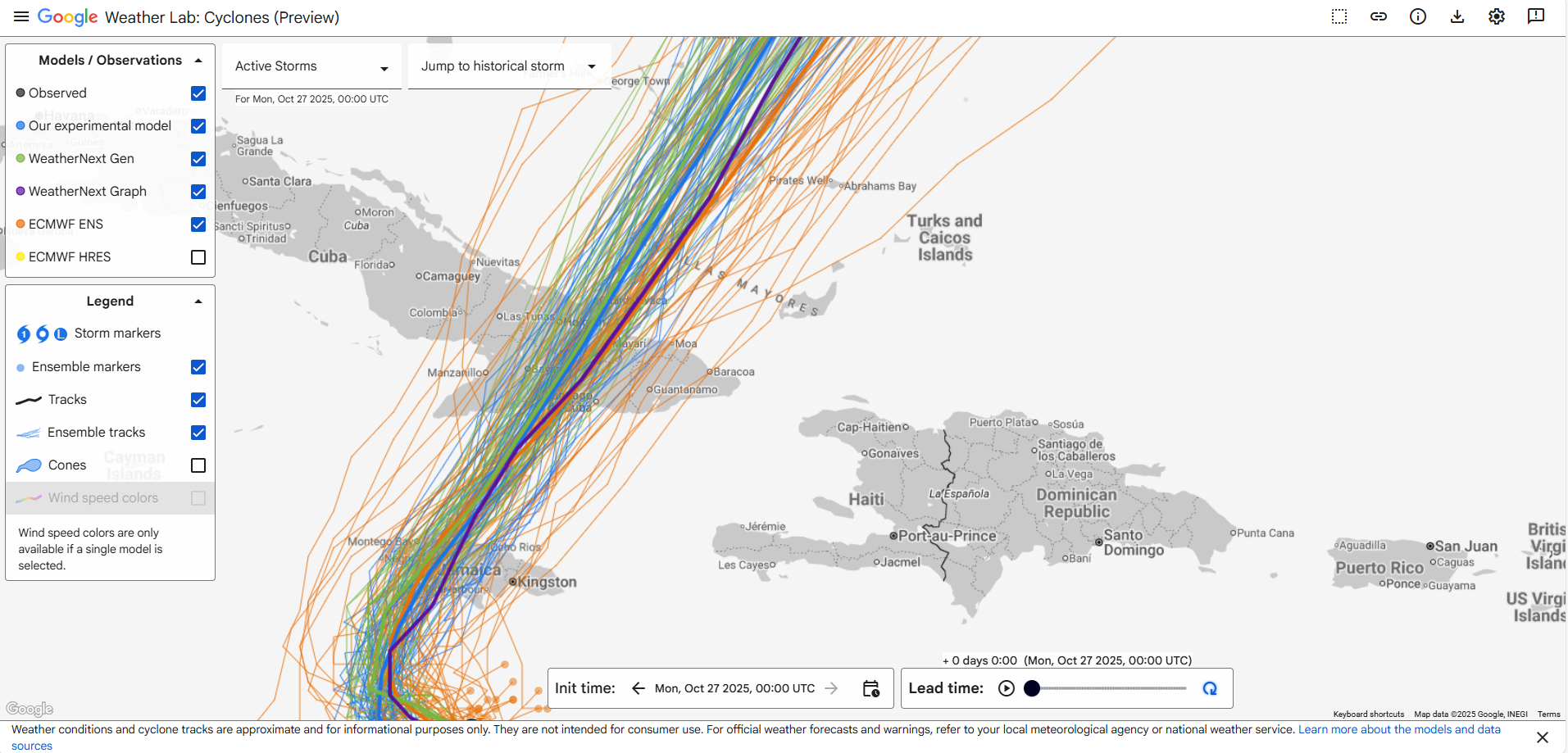
Melissa from here on out
Melissa remains a powerful hurricane and will cross the Bahamas today. The storm’s path will miss the larger islands, passing to the southeast of Nassau. However, several of the smaller Bahamaian islands will sustain a direct strike from Melissa as it maintains Category 2 strength. Damaging winds and storm surge are the biggest threat.
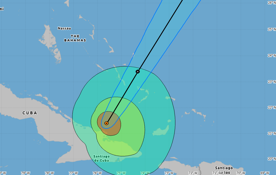
As the storm accelerates to the northeast it will near, but likely just miss Bermuda on Thursday night. It likely will be still be a Category 1 or Category 2 hurricane at that time. Some of our better track forecasts have been edging a little westward in this time frame, and if this trend continues it would keep the center of Melissa offshore, sparing Bermuda from worst-case impacts.
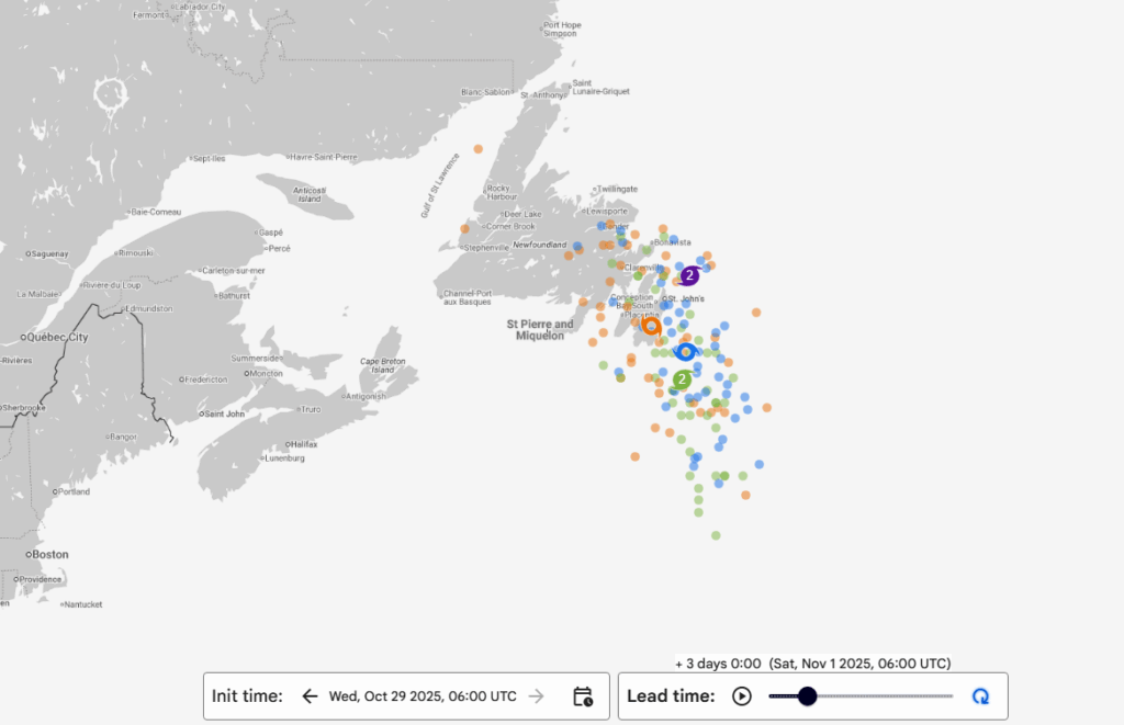
By later on Friday or early Saturday, a weakening Melissa will likely impact Newfoundland, Canada. By this time it may have begun a transition to an extra-tropical storm, but it will still pack a wallop in terms of waves and winds.
Anything coming after?
The tropics will be quiet in Melissa’s wake. The only watch point I have for you this morning is the southern Caribbean Sea, where something may eventually spin out of the Central American gyre, a broad area of low pressure that is typically present through November. We cannot point to any specific threats, but we’ll keep an eye on it for you.