In brief: Tampa reached an all-time high temperature record yesterday. The Atlantic tropics, while busier, still lack a lot of organized risks. And a destructive wind event is possible later today and tonight, primarily in South Dakota and Minnesota.
Torching Tampa
We start today in Tampa, where it hit 100 degrees on Sunday. While that may seem like a relatively pedestrian number, it happens to be the hottest temperature recorded in that city since records began in the 1890s.

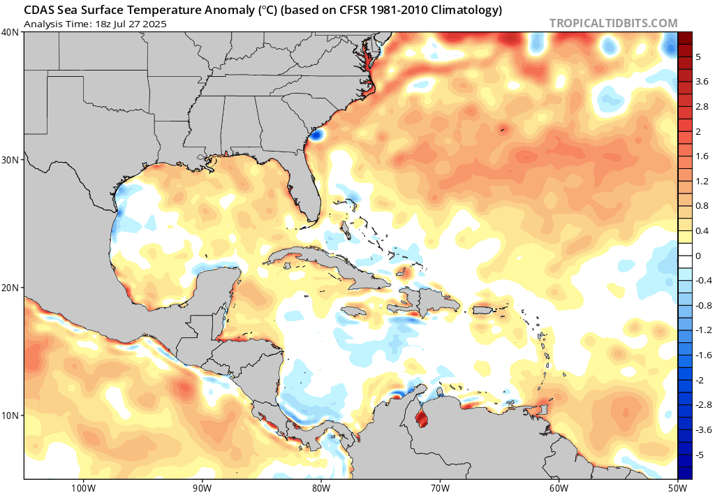
Even 99 degrees has only been reached two times, the 2020 instance noted above and back on June 5, 1985. Notably, only four of the 25 hottest days on record in Tampa have occurred in July or August. Typically, you have a sea breeze or thunderstorms or humidity that’s too high to allow for such heat. Yesterday, the area was under the influence of an abnormally strong ridge of high pressure over the Gulf, as well as a very abnormal offshore directed wind at the time of peak heating. The combination allowed for temperatures to surge at a time of relatively low humidity. It’s a very localized nuance, but we’d be lying if we didn’t also note that it’s certainly symptomatic of a warming Gulf as well.
Tampa has set or tied 107 record highs and 150 record warm low temperatures since 2020. That’s not a typo. Their records go back to 1890 and 30 to 40 percent of their warm records have been met in less than 6 years. That’s remarkable.
The forecast high today is a more tolerable 97° for Tampa.
A slightly busier Atlantic
Taking a snapshot of the Atlantic basin this morning, it looks a bit more interesting than we’ve seen lately. First, we have a pretty healthy-looking area of thunderstorms north of the Caribbean islands. This is associated with a tropical wave in the area. There is very, very little model support for anything here, despite how it looks this morning. High pressure should serve to inhibit any sort of organization.
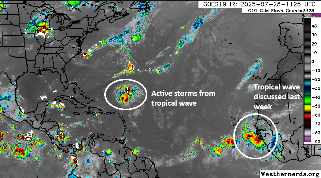
Secondly, we have the tropical wave that we discussed a bit last week that’s now emerging off Africa. This one still has a puncher’s chance of doing something as it comes westward through the week. Will it actually get anywhere? I don’t know; model support has continuously slipped for this one since last week. At least through Friday, en-route to the islands, there should be a very minimal chance of development.
After Friday, the picture gets a little more complex. Some modeling lifts this area more to the northwest at the same time that thunderstorms roll off the Southeast coast. The result? Something. If you look at the different ensembles, both from AI-derived models and traditional physics-based models, you see a sloppy mess off the Southeast coast in about 8 days.
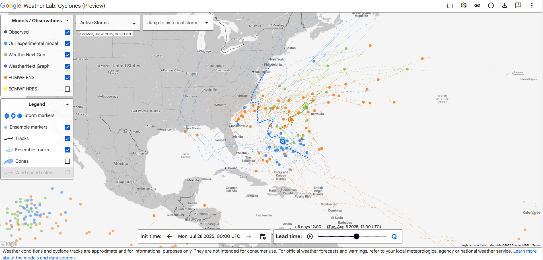
I really like Google’s tool here because it gives you a good initial overview of what is percolating. Looking into this further from other models, I get the sense that there’s a signal here, but exactly what that signal is (some hybrid subtropical sloppy system, a more formal tropical entity, or something else) remains to be seen. Also, it seems that support right now favors an out to sea outcome ultimately, but again, we’re 8 days out from something that hasn’t formed yet. But I think we pretty clearly have our next area to watch, even if it isn’t a terribly serious concern.
You may have noticed on the Google plot above action in the Pacific. Indeed, it is busy out there now, with Tropical Storm Iona (expected to become a hurricane south of Hawaii) and 3 other areas to watch.
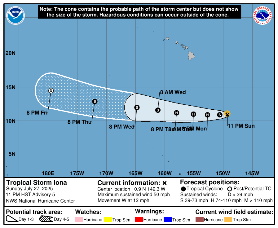
No impacts for Hawaii are expected at this time.
South Dakota & Minnesota with potent severe weather risk today
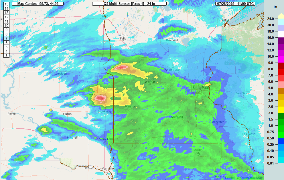
Flash flooding impacted the Reno area yesterday evening. Severe storms with heavy rain ripped across Minnesota yesterday, with rain totals of 4 to 8 inches in parts of southwest Minnesota. Eastern South Dakota was also smacked by heavy rainfall and a tornado near Watertown.
The focus today is less on flooding and more on severe weather. There’s a fairly strong signal for a powerful line of thunderstorms to develop in the Dakotas later and rocket eastward across South Dakota and into Minnesota. The Storm Prediction Center is already qualifying this setup as a “derecho is likely.” A moderate risk (4/5) has been issued for portions of South Dakota and Minnesota. For those new to derecho, it is a long-lived area of thunderstorms that produces significant wind damage over hundreds of miles.
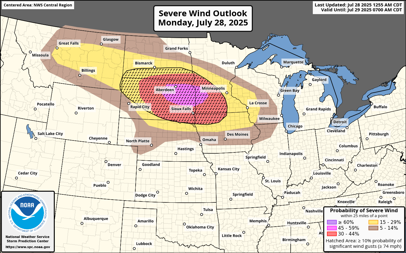
Storms should develop through the day in western North and South Dakota. As they come east later this afternoon and this evening, they will likely intensify into significant wind producers, along with isolated tornadoes. The highest-end risk for destructive winds appears to be from eastern South Dakota into southwest Minnesota. However, it is possible that these storms will hold together and bring significant wind damage concerns to eastern Minnesota too, including the Twin Cities later tonight. Storms should finally begin to weaken once in Wisconsin.
Bottom line: A destructive wind event is a good possibility tonight in a good chunk of South Dakota and southern Minnesota, possibly extending into northern Iowa.