Today, we want to offer up a quick update on next week’s severe weather chances, as well as a look at prolonged winter weather in the Upper Midwest and Northern Plains.
Headlines
- Severe weather risk Sunday and Monday looks somewhat limited and confined to the Southern Plains and perhaps the Mid-South or Deep South.
- Two winter storms will bring snow to the Upper Midwest and Northern Plains; one tomorrow and the other with the Sunday/Monday storm.
Just how serious is early next week’s severe weather risk?
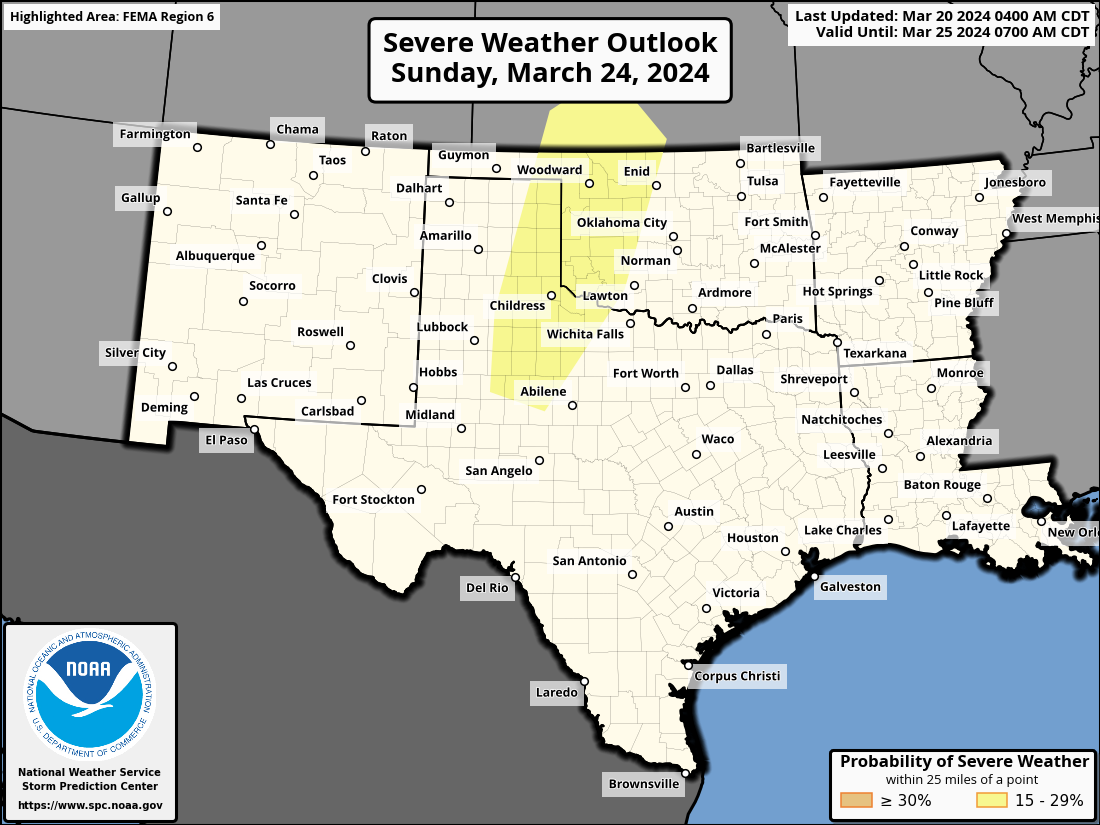
Next week continues to look like a slightly more active one across the country, with some severe weather possible. The Sunday/Monday timeframe in particular has stood out for awhile now for that potential. And indeed, the Storm Prediction Center has now highlighted portions of Texas, Oklahoma, and Kansas for severe weather risk on Sunday.
One of the reasons to argue against significant, widespread severe weather early next week is tomorrow and Friday’s storm that travels along the Gulf Coast and amplifies off the Southeast coast. That system emerges off the Southeast coast on Saturday morning before amplifying a bit over the weekend and meandering just offshore of the Mid-Atlantic and Southeast.
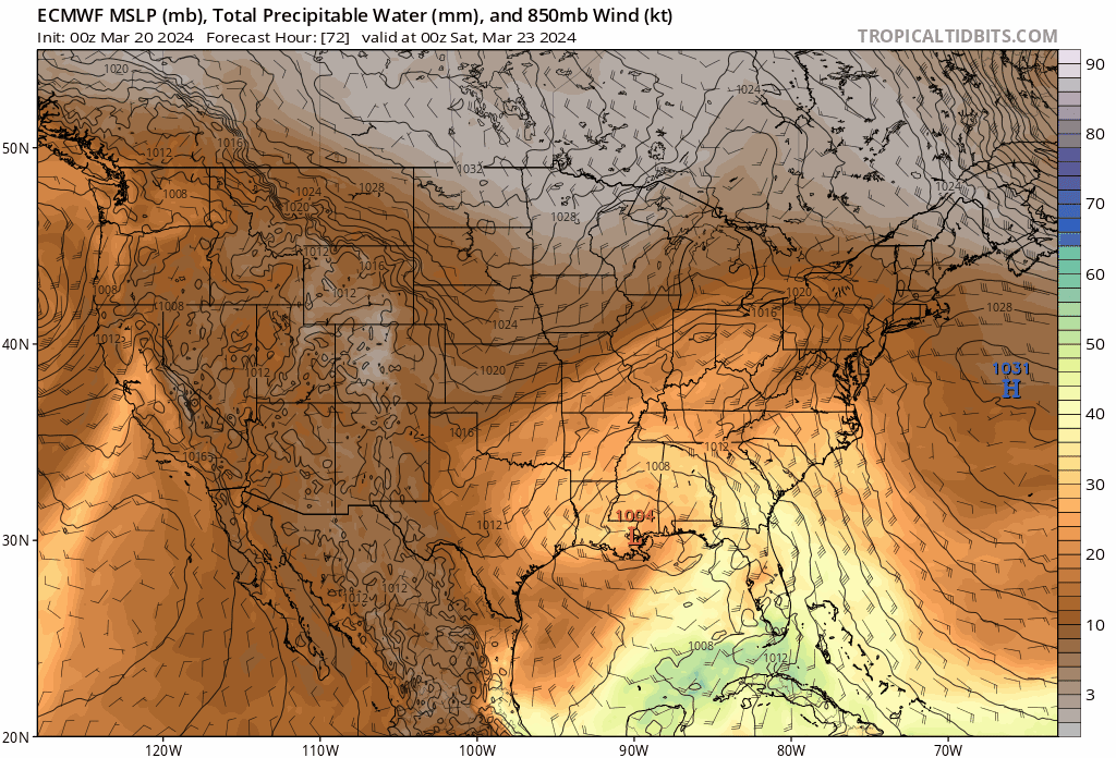
From the animation above, you can see that the shaded values representing precipitable water in the atmosphere, or how much available moisture there is expected to be is blunted somewhat by dry air on the backside of the storm off the East Coast. So despite a vigorous storm forming in the Lee of the Rockies, it still may not be enough to really push the needle up in terms of moisture, or what would otherwise be a pretty serious severe weather pattern.
All that said, given the intensity of the storm emerging off the Rockies, there should still be enough for a severe threat, just perhaps more localized and/or suppressed than we would otherwise see. For now, the Storm Prediction Center continues to advertise predictability as “too low” for Monday. We’ll continue to watch, but the Southern Plains seem most prone to it right now for Sunday, with some migration eastward to the Mid-South or Deep South on Monday.
Making up for lost winter in the Upper Midwest and Northern Plains
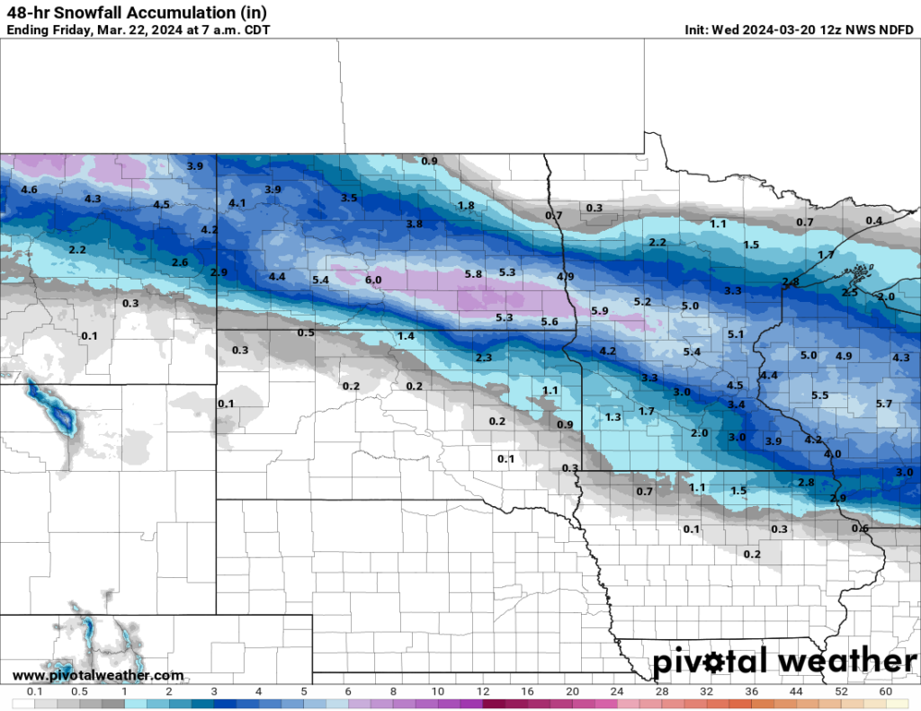
The Northern Plains saw a rather benign winter this year. The 13.5 inches of snow in Bismarck for December through February was in the lower third of winters historically. It was worse in Minneapolis, which saw their 9th least snowy winter period, with only 11.1 inches of snow from December 1-February 29th. For Bismarck, they’ve only had a bit over an inch of snow this month. Minneapolis has seen a trace of snow. But we’re going to make up some ground over the next couple days. The first storm arrives tomorrow evening, bringing a general 3 to 6 inches with higher amounts from northeast Montana into Wisconsin.
A second storm, the same one that will help bring some severe weather to the South will deliver another round of snow to the North. This one may be a bit more potent. A wide swath of 6 to 8 inches of snow is possible in the same general areas with this one Sunday into Monday. This storm could even linger into Tuesday in spots. The trick with this storm will be how much mixing with rain or sleet we see in those areas. That could cut down totals a bit for the Twin Cities. But there will likely be an axis of heavier snowfall that could occur in western Minnesota or eastern South Dakota.
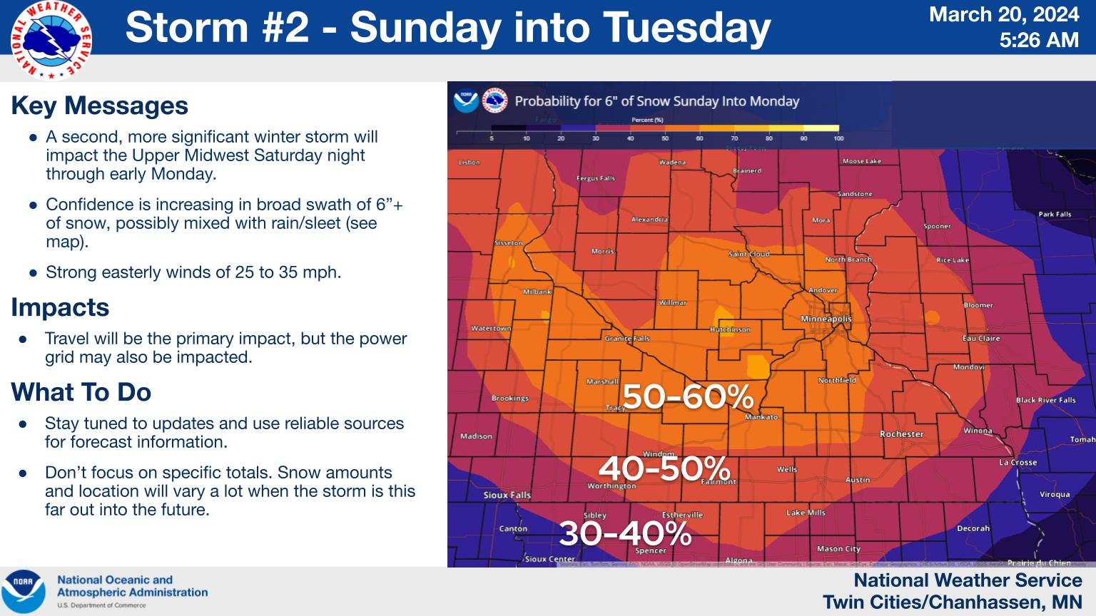
Whatever the case, a storm with more snow for the Twin Cities and the heaviest snow west and southwest of there is likely Sunday into Monday. One disappointing aspect of this storm is that as you roll into Canada, the snow forecast drops off a good bit.
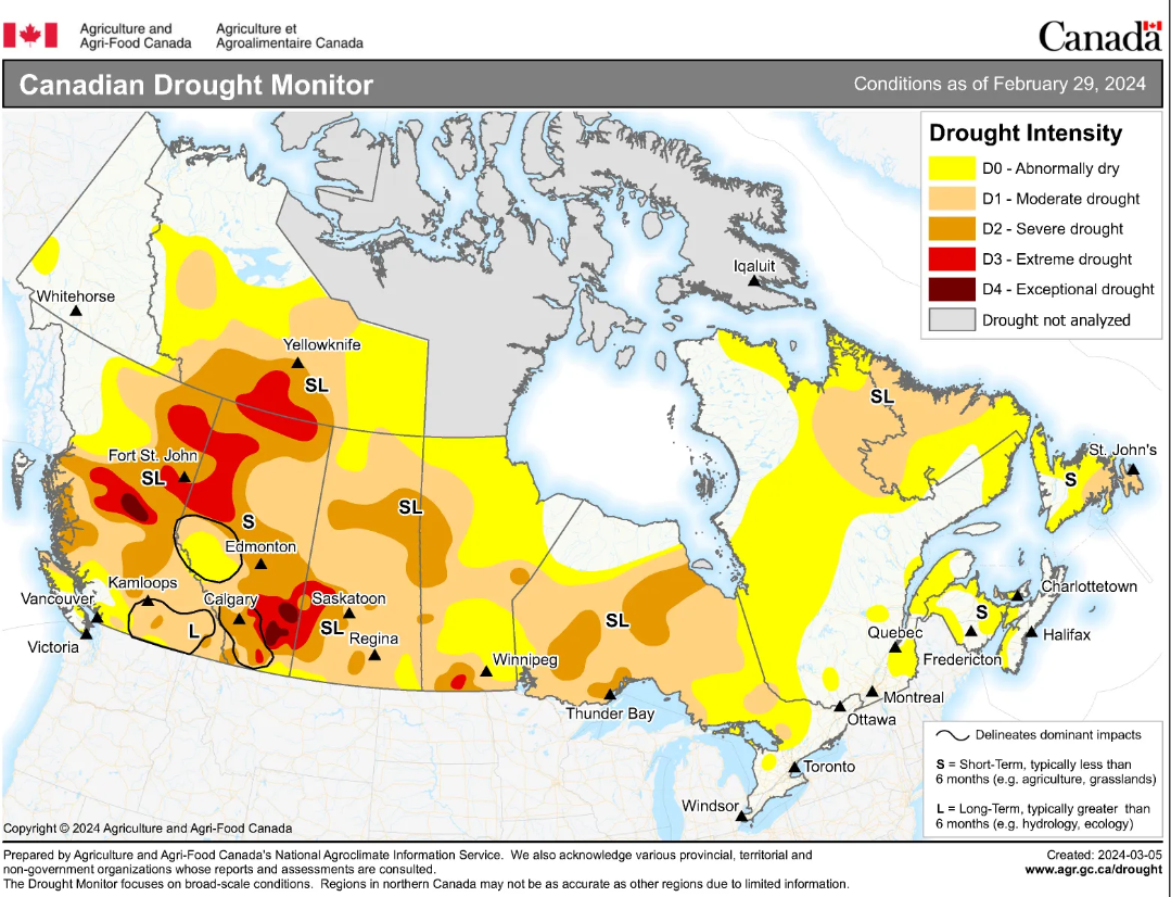
They desperately need moisture up there, particularly after last year’s catastrophic wildfire season. Unfortunately, these storms will do little to help the areas most in need.