One sentence summary
Today’s post offers a quick summary of this weekend’s Northeast storm and focuses on a significant flooding risk with Tuesday’s storm focused on New Jersey.
Weekend winter storm: A wind-whipped pop of snow in the interior Northeast
Rain, snow, and wind will move into the Northeast and Mid-Atlantic today with the much discussed weekend winter storm.

In terms of snow, look for anywhere from 6 to 12 inches in Central Pennsylvania (mainly north and west of Harrisburg) into the Poconos and northwest New Jersey. About 8 to 12 inches is expected for Central New York into the Capital Region and Hudson Valley. Higher amounts are possible in the Hudson Valley and likely in the Catskills, where as much as 18 inches may fall in spots. Most of northern Connecticut into Massachusetts, southern Vermont, and southern New Hampshire should see 6 to 12 inches. Higher amounts up to 18 inches are possible in southeast New Hampshire, extreme southern Maine, and portions of interior eastern Massachusetts.
For the major I-95 cities, Boston should see 6 to 8 inches, Providence 4 to 6 inches, New York City 1 to 2 inches or less, and Philly through DC less than an inch.
In addition to snow, ice is going to be an issue for portions of western Virginia and portions of West Virginia.
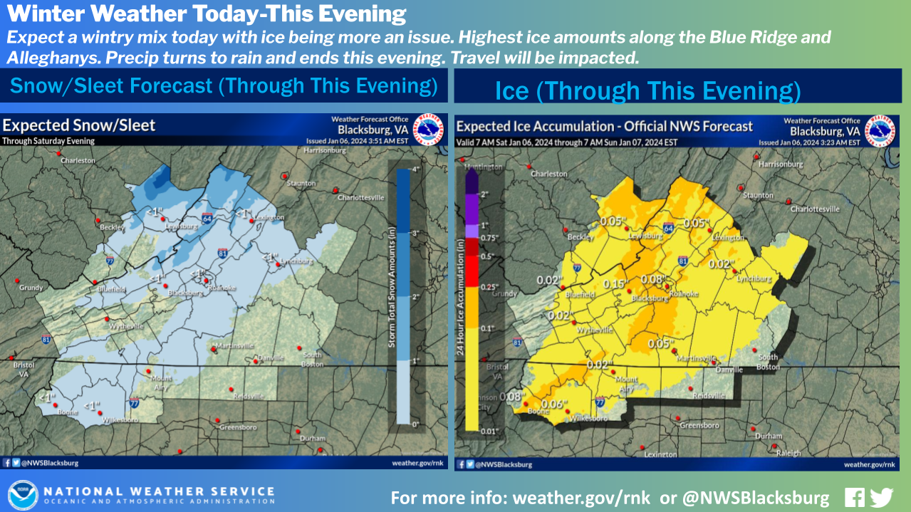
Though we don’t foresee major icing, any ice can impact travel, so the I-81 corridor probably should be avoided today.
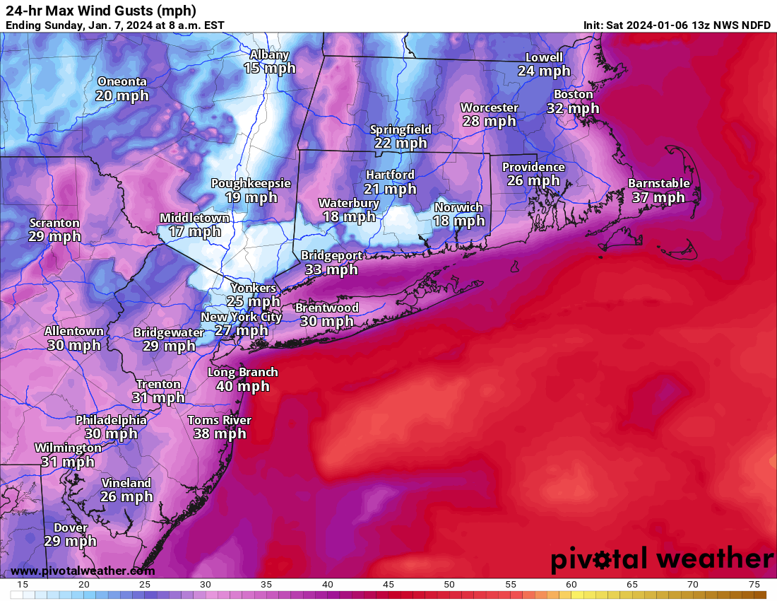
Gusty winds will also impact the Northeast and Mid-Atlantic today, with 40 mph or stronger gusts possible on the coast.
Last but not least, a slight risk of severe storms is in place in southwest Florida from Sarasota through Naples this morning.
Next Tuesday’s storm: Focus on New Jersey flooding risks
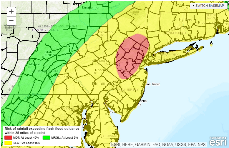
The second storm continues to come into focus some more. We’ve got numerous issues to face with this one, particularly gusty wind over a wide swath of the Eastern U.S., heavy snow from the Central Plains into the Midwest and Great Lakes, and the potential for flooding rains in parts of the East, with northern New Jersey being of particular concern.
We will talk more about the snow and wind later today or tomorrow, but I want to focus on the flooding risk in New Jersey right now, partially because it’s of concern, but also because I’m from New Jersey. The Weather Prediction Center already has the northwest part of the state in a Moderate risk for excessive rainfall and flooding, which is their highest category 4 days out.
We talk about snow totals during winter storms a lot, but we don’t always talk about how much moisture is actually contained within the snowpack, or what we typically call the snow water equivalent. If you melted the snow, how much water would you get? Between the rain and snowfall this weekend, much of New Jersey will see an inch or a bit more of liquid equivalent. This comes on the heels of the last 30 days which has seen anywhere from 150 to 300 percent of normal precipitation in New Jersey. It’s been wet, now we’re adding more water, as well as some snow which is likely going to melt as next week’s storm hits. Basically, you have the recipe for significant river flooding in much of the northern half of the state.
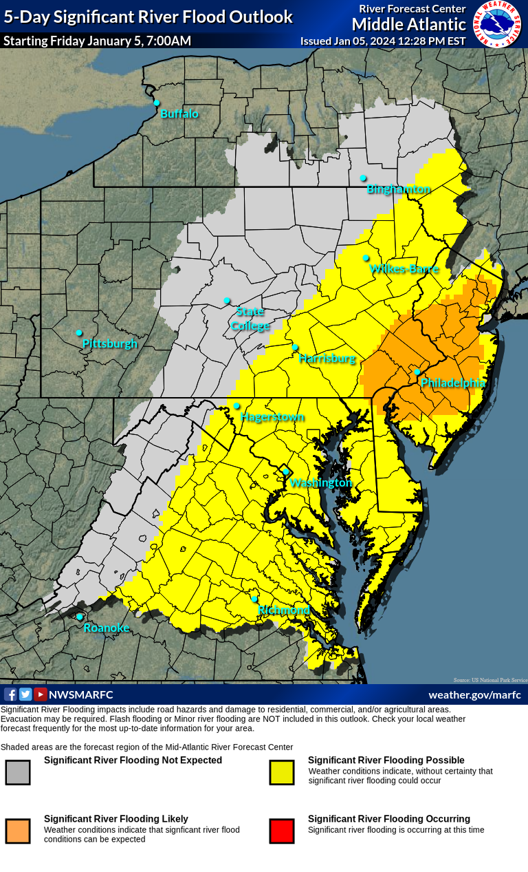
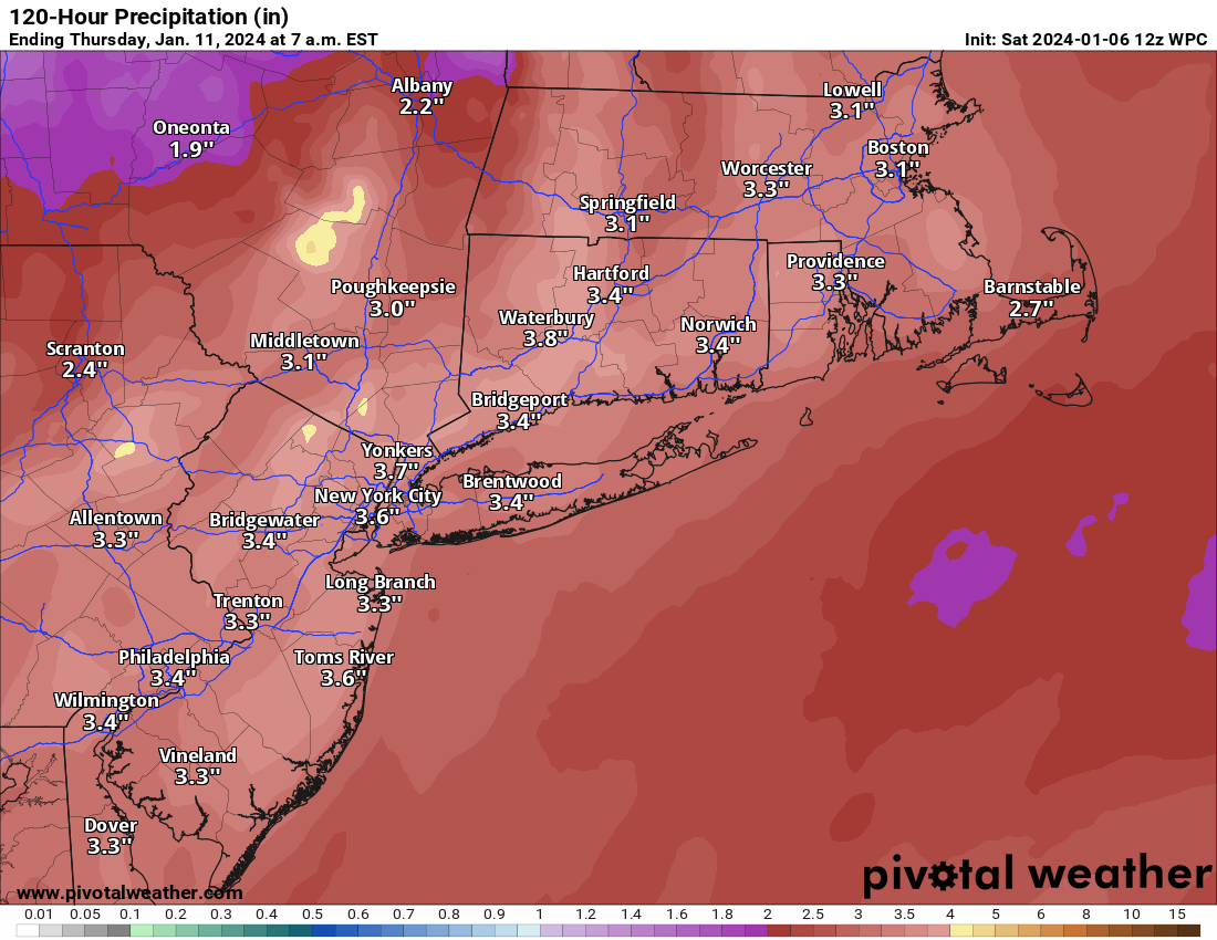
How much rain are we expecting? Between now and through Tuesday’s storm, portions of New Jersey, eastern Pennsylvania and southern New York could see in excess of 4 inches of total water.
One of the problems that highlights why New Jersey is especially vulnerable is that you will be seeing 1 inch of liquid basically already sitting on the ground with another 2 to 3 inches falling from the sky between the snowmelt and rain. This is going to send a lot of water quickly into the system, and again, that’s a recipe for flooding.
So, while the talk with this upcoming Tuesday storm is likely going to focus a lot on snow and wind and broadly heavy rain and cold to follow, folks in northern New Jersey in particular need to follow this forecast closely due to the very acute flooding risk.
Another storm is possible next weekend which could further exacerbate problems. But we’ll take this one at a time.
Ty for helping us to learn about snow/water amounts – lots of Northern weather physics that I’m unfamiliar with.
Wishing everyone in NJ to stay dry, warm & safe 🌬 💕