One sentence summary
This evening’s post offers an update on what to expect with a major Eastern U.S. storm into Tuesday, as well as some comments on more storms to come.
Major Eastern U.S. storm hitting through Tuesday
Back on Saturday we talked about the flooding risk specific to New Jersey due to snowmelt, saturated ground, and 2-3 inches of additional rain tomorrow. That risk has been refined today to include eastern Pennsylvania, DC, Maryland, northern Virginia, and portions of southern New York and Connecticut.
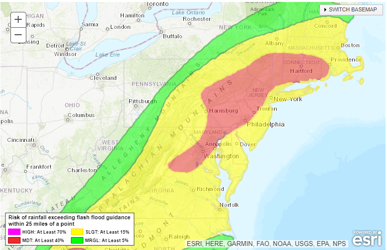
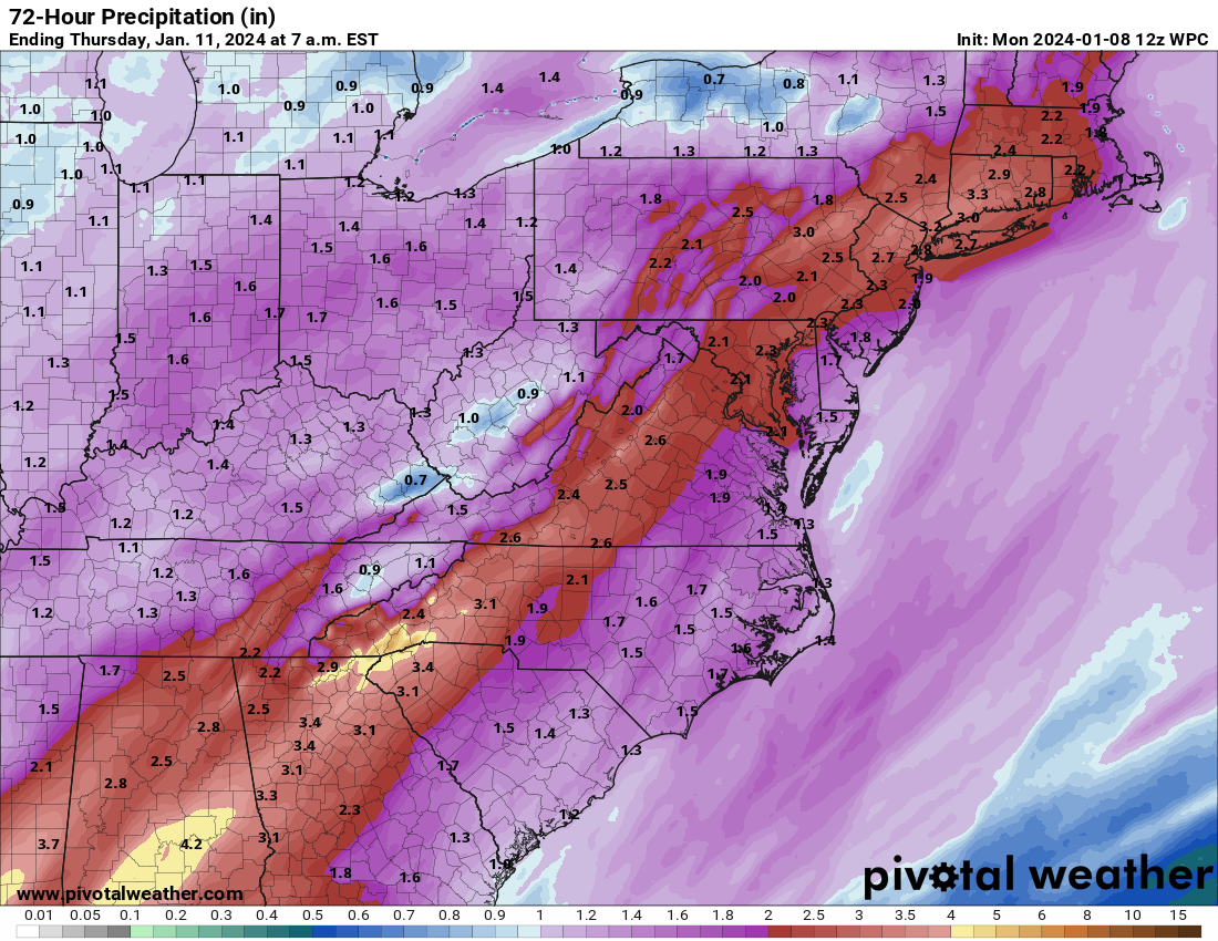
Total rainfall will be on the order of 1 to 3 inches in this region, which is plenty of water to produce flash and river flooding. Flood Watches are up from southern New England into Virginia, and tomorrow should be a very active day.
There are a ton of other elements to this storm. Let’s walk through them.
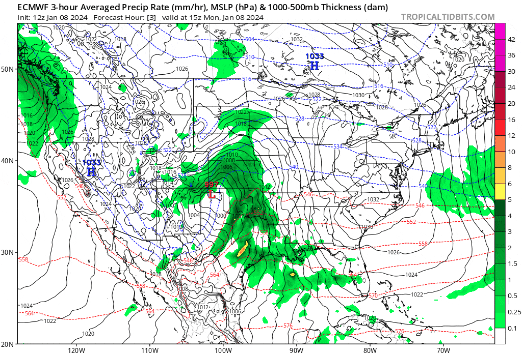
Severe weather: Tonight looks to be a very active severe weather night in the Deep South and along the Gulf Coast east of Texas. An enhanced risk is in effect for this region (level 3/5), and tornadoes are a distinct possibility. That severe risk will continue into the southeast tomorrow with an enhanced risk from north Florida into southern Georgia, and eastern South & North Carolina.
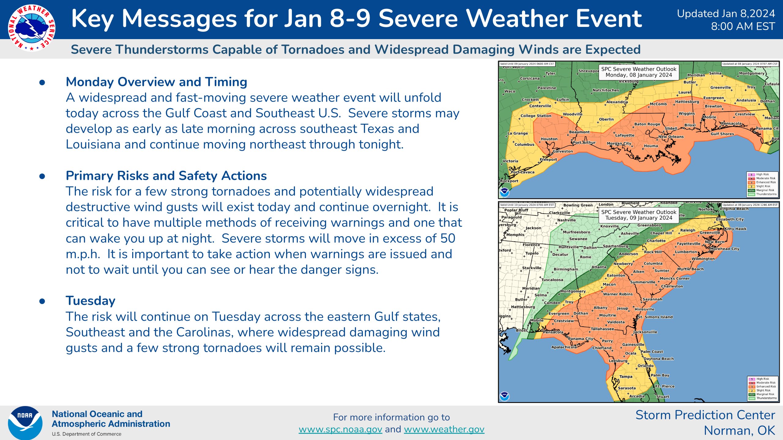
Again, strong winds and tornadoes are possible in these areas.
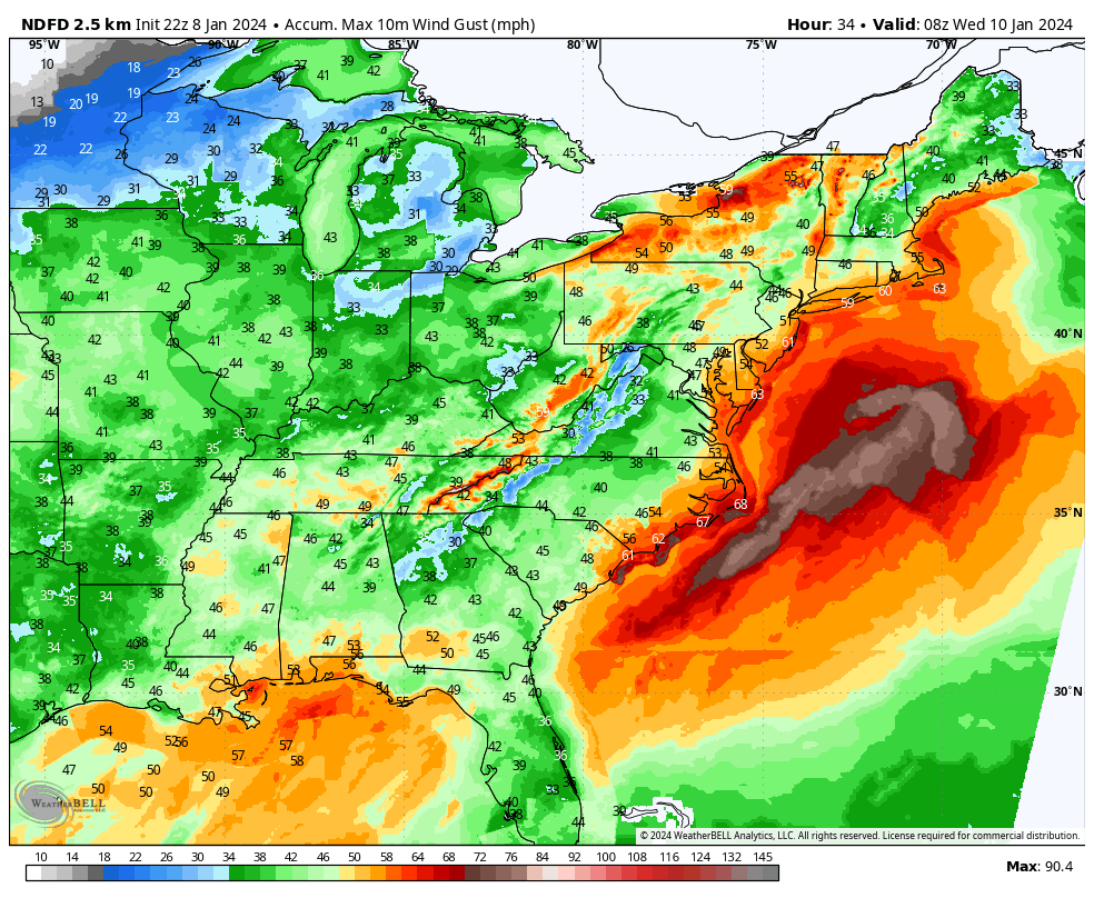
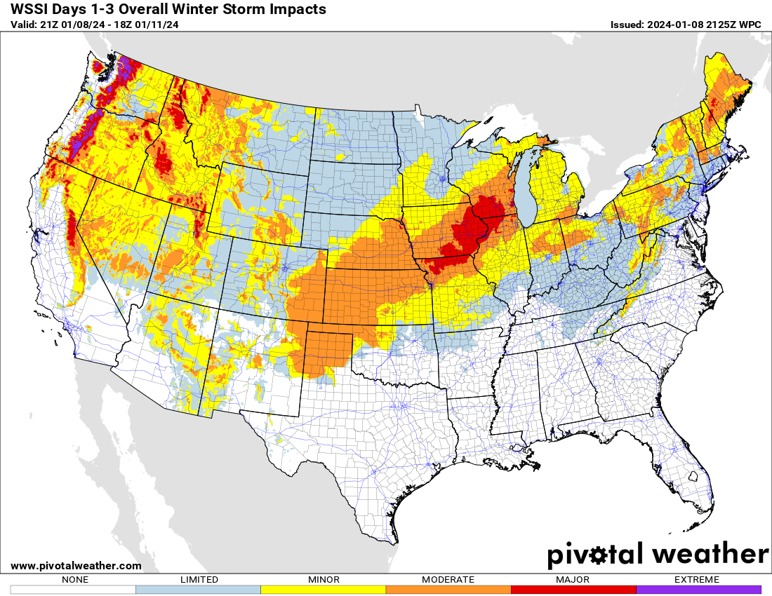
Wind gusts: Widespread wind gusts in excess of 40-50 mph are possible, if not likely across the Plains, Midwest, Southeast, and East tonight into tomorrow. Coastal New England, Long Island, and the Mid-Atlantic could see 60+ mph winds. This will be an exceptionally potent and widespread wind storm across the eastern half of the country, and there will likely be numerous power outages.
Snow: A major snowstorm will occur on the northwest flank on this storm, with anywhere from 6 to 12 inches or even more across northern Missouri, Iowa, northern Illinois, and southern Wisconsin.
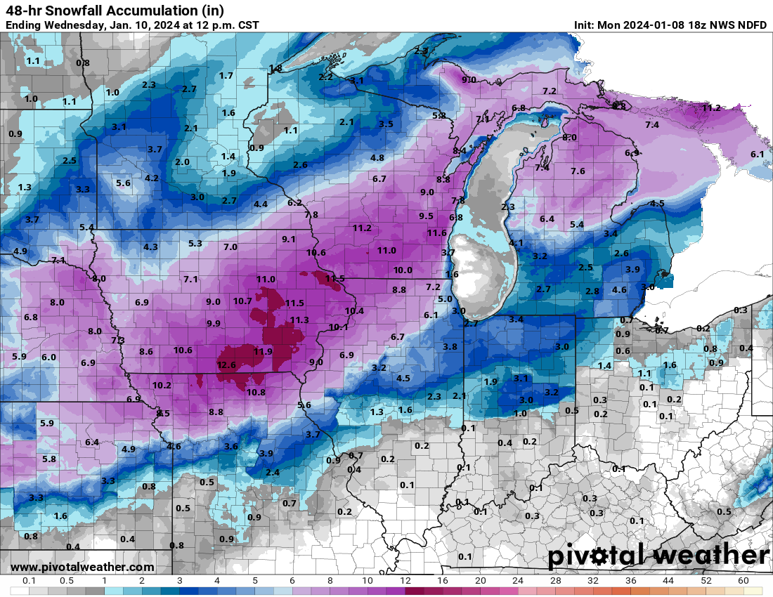
The combination of snow and wind will produce blizzard conditions from northeast New Mexico into Kansas, with near-blizzard conditions at times northeast of there.
But wait, there’s more!
At least two more major storms are queued up in the pipeline. The next one will take a track similar to slightly farther east than the current storm. Expect more wind, more snow, more flooding rain, and more severe weather risk on Friday into Saturday.
The subsequent storm will arrive Monday or Tuesday next week, and this one may take a farther east track, meaning we’ll watch for snow chances to creep eastward. But it could also produce more flooding and more wind in the East. Additional total liquid of 2 to 4 inchers more is almost certainly going to exacerbate flooding concerns in the Mid-Atlantic and Northeast. More to come on these.
Is it possible to extend your mapping and commentary to include Atlantic Canada?
Noted! I know we picked up a bunch of followers in that neck of the woods during all the storms this past summer. We’ll try to highlight some stuff there when we can!