We got so many emails in response to our post on Monday, so thank you for everyone’s interest. We are going to work on some solutions for sponsorship or support and get back to those of you who replied as soon as we can. Thank you!
Headlines
- Quiet persists into midweek next week.
- The GFS model is bullish on a possible system next weekend in the Gulf.
- Digging into model data seems to suggest that a weak, sloppy system or just a disorganized plume of moisture is most likely in the central or eastern Gulf toward Florida late next week or weekend.
Quiet through early next week
So, just to kick things off with some clarity, there are no systems expected over the next week. Everything looks quiet through at least midweek next week.
Eyeing up the southwest Caribbean & Gulf next weekend
What’s showing up?
One common theme of June with tropical weather is the GFS operational model getting overly excited about potential development in the Gulf or Caribbean. It is a known model bias. It happens every year, and if we had a dollar for every GFS model run that showed a system that never happened, we’d be able to buy quite a few pizzas. All that to say that it’s at it again today.
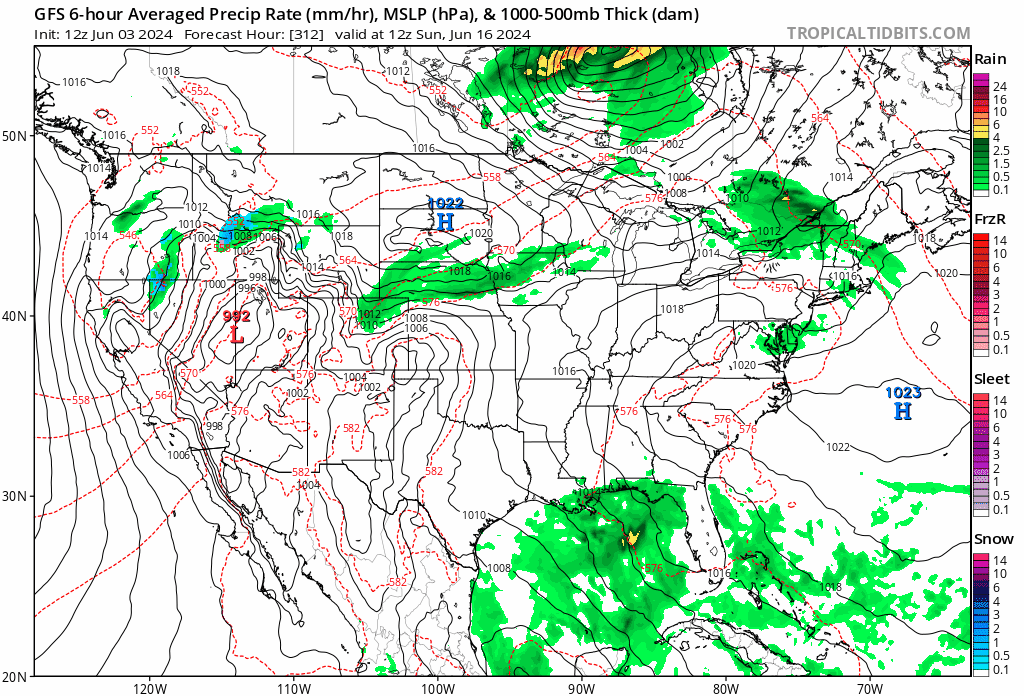
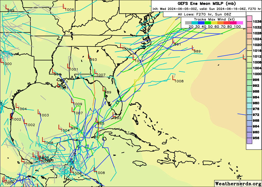
We’ve seen several runs now of the GFS showing a storm around next weekend in the Gulf or near Florida. In June, the first question I’d ask when I see this is whether or not there is any ensemble support for such an outcome. Recall, these operational models are one-run/one-solution outcomes. Ensembles are when tweaks are made to the initialization of the model and it gets run 30 to 50 different times, producing more of a spread in outcomes. This offers a more realistic view of what the outcome of a pattern may be. When we look at the GFS ensemble, we see a number of ensemble members producing something in the Gulf or near Florida.
Bear in mind that none of these are major storms. June storms, even with really warm water are likely to struggle because of wind shear. It’s still early. It is also why we tell people that there is no real correlation between how much activity there is in June and what we see over the peak of the season in August through October.
We have some ensemble support in the GFS, so the next question is whether or not we have European model support. We don’t. None of the 51 European ensemble members show anything meaningful.
What’s most likely?
While we have the GFS showing a system and the Euro showing nothing much, let’s look closer at how much precipitation the ensemble models show between June 11 and 17.
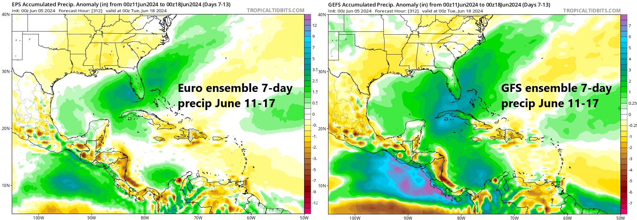
Interestingly, but not surprisingly given what we know, both models are in agreement on above normal rainfall between June 11th and 17th over the central and eastern Gulf and Florida in particular.
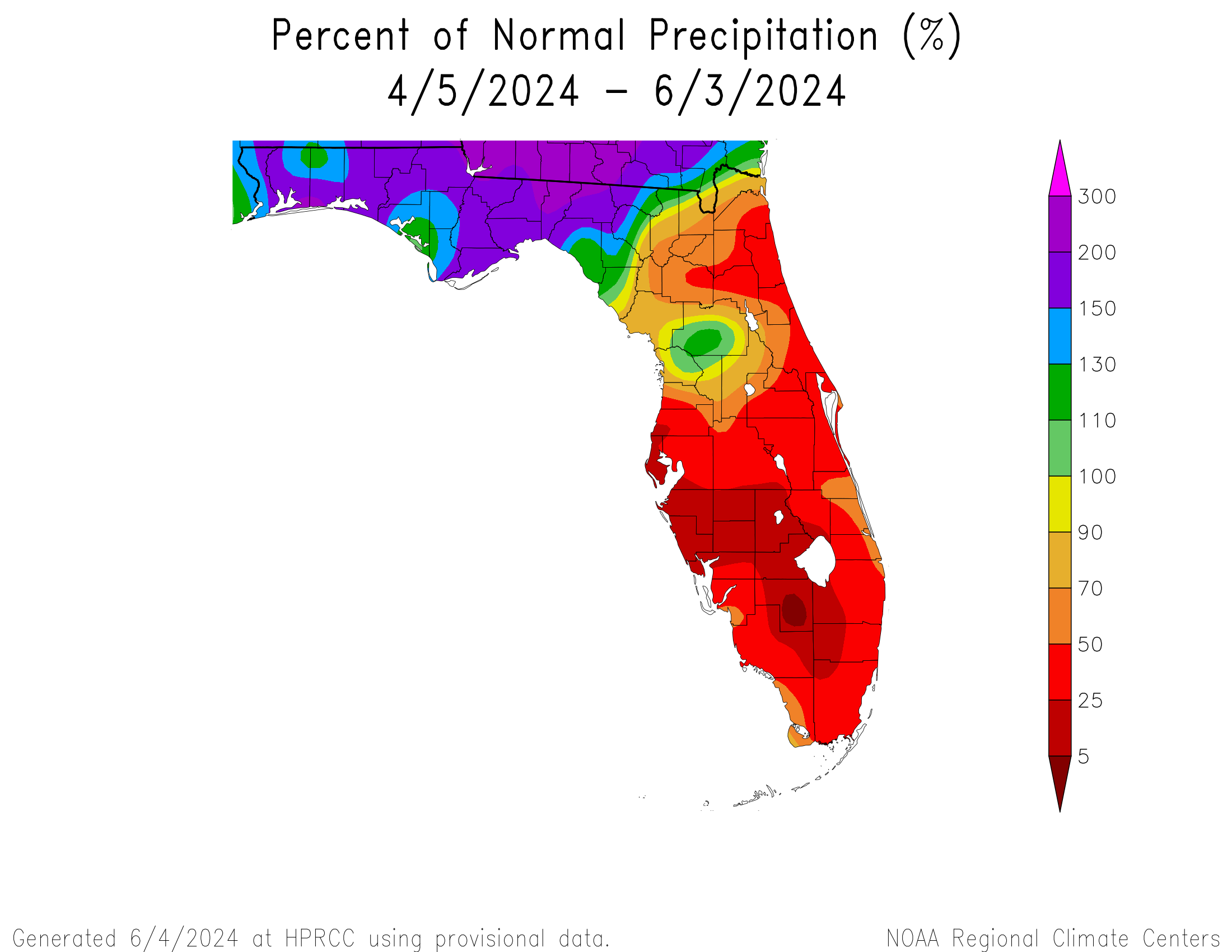
Between what the models show and what we know about early to mid-June in the Gulf, it would be plausible to expect either a disjointed “plume” of moisture lifting north and northeast across the Gulf next weekend. Or, less likely but not improbable, a sloppy, marginally organized tropical storm moving in that same direction. Either way, Florida has been in a dry stretch lately, with developing drought, so any rain would probably be more welcome than anything.
Whatever becomes of this potential next weekend, it seems this area in the southwest Caribbean or southern Gulf may be one to continue to at least keep tabs on deeper into June. We will continue to watch!
I appreciate the work that you folks do and were you to decide you need to have a subscription or donation model I for one would sign up and pay up.
What does the yellow over Texas in the ensemble mean of precipitation suggest?
Drier than normal weather for next weekend/early the week of the 17th.
You mention some quirks of the GFS model here such as the June bias. This kind of background detail about your process here is something I love about the articles on this site so far. Have you done, or have you considered doing a background piece – not necessarily on any individual system – but to educate about the various models and how you weigh their predictions?
It’s something I’d like to do if time eventually allows. I want the piece to be done right, not just done to be done. 🙂 But it’s a very good idea I’ve definitely given thought to. Thanks for the kind words!